Alderstead Heath

Wood, Forest in Surrey Reigate and Banstead

England

Alderstead Heath

Old Milestone, A23, Brighton Road, Outside No. 99 The milestone is located 120m North of the junction with Church Lane, on the East side of the road in the pavement with back to boundary wall. Parish of Reigate (Reigate and Barnstead District). Cast iron post, Reigate iron casting design, erected by Croydon & Reigate turnpike trust in the 19th century.

Inscription reads:-  16 / FROM / WESTMINSTER / BRIDGE / 35 / TO / BRIGHTON  : :  35 / FROM / BRIGHTON / 16 / TO / WESTMINSTER / BRIDGE  : : PARISH / OF / MERSTHAM

Milestone Society National ID: SY_LBT16
Old Milestone, A23, Brighton Road, Outside No. 99 Credit: Janet Dowding

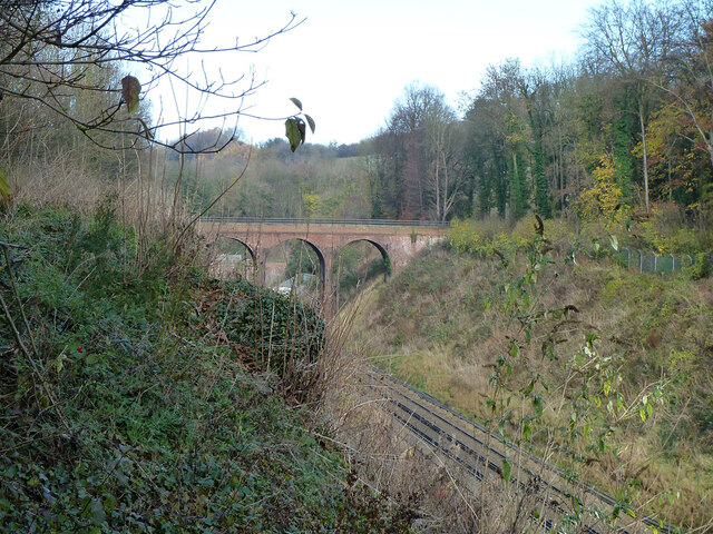
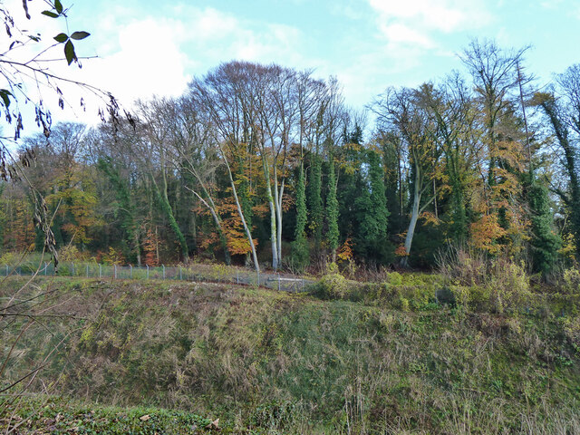
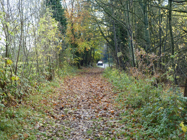
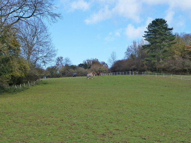
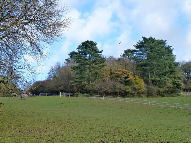
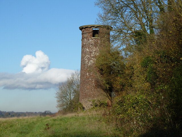
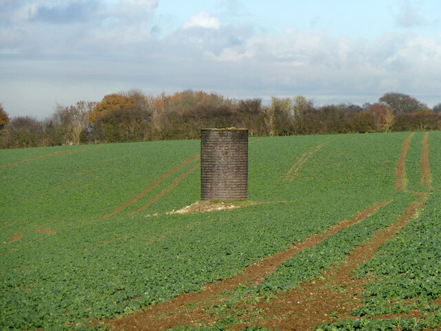
Alderstead Heath, located in Surrey, England, is a picturesque woodland area that offers visitors a tranquil escape from the hustle and bustle of city life. Covering an area of approximately 100 acres, this heathland is a popular destination for nature lovers and outdoor enthusiasts.

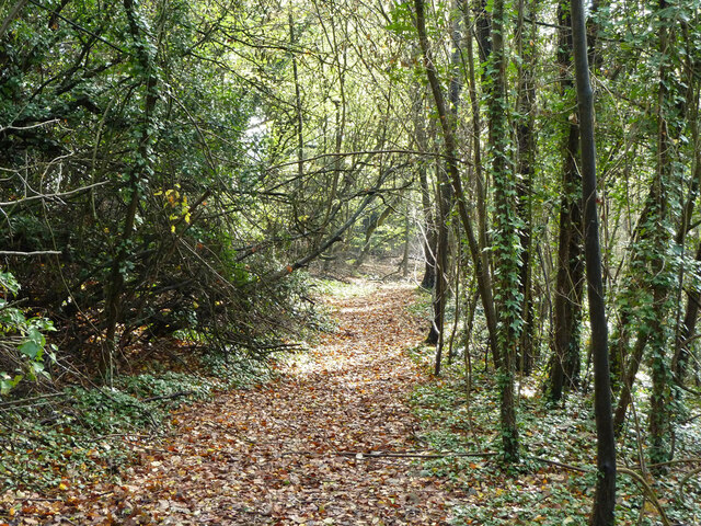
The heath is characterized by an abundance of alder trees, which give the area its name. These trees create a dense and diverse forest, providing shelter and habitat for numerous species of flora and fauna. The woodland is also home to a variety of wildflowers, including bluebells and orchids, which paint the forest floor with vibrant colors during the spring and summer months.

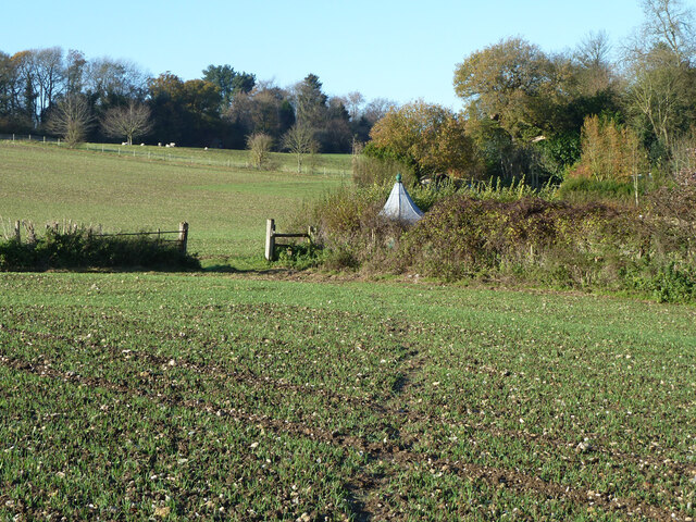
Visitors to Alderstead Heath can explore the numerous walking trails that wind their way through the forest, offering breathtaking views of the surrounding countryside. These trails cater to all abilities, from gentle strolls to more challenging hikes, allowing visitors to tailor their experience to their preferences.

The heath also provides a haven for wildlife, with many species making their home in the woodland. Birdwatchers can spot a variety of avian species, including woodpeckers, owls, and warblers. Small mammals such as rabbits, squirrels, and foxes can also be spotted in the area.

Alderstead Heath is not only a haven for nature enthusiasts but also a popular spot for picnics and family outings. The peaceful surroundings and well-maintained facilities make it an ideal location for a day of outdoor recreation.

Overall, Alderstead Heath offers a beautiful and serene woodland experience, with its diverse flora and fauna, scenic walking trails, and tranquil atmosphere. Whether you are seeking a peaceful retreat or an opportunity to connect with nature, this Surrey gem is sure to delight visitors of all ages.

If you have any feedback on the listing, please let us know in the comments section below.

Alderstead Heath Images

Images are sourced within 2km of 51.282502/-0.13520629 or Grid Reference TQ3055. Thanks to Geograph Open Source API. All images are credited.

Old Milestone, A23, Brighton Road, Outside No. 99 The milestone is located 120m North of the junction with Church Lane, on the East side of the road in the pavement with back to boundary wall. Parish of Reigate (Reigate and Barnstead District). Cast iron post, Reigate iron casting design, erected by Croydon & Reigate turnpike trust in the 19th century.

Inscription reads:-  16 / FROM / WESTMINSTER / BRIDGE / 35 / TO / BRIGHTON  : :  35 / FROM / BRIGHTON / 16 / TO / WESTMINSTER / BRIDGE  : : PARISH / OF / MERSTHAM

Milestone Society National ID: SY_LBT16
Old Milestone, A23, Brighton Road, Outside No. 99
The milestone is located 120m North of the junction with Church Lane, on the East side of the road in the pavement with back to boundary wall. Parish of Reigate (Reigate and Barnstead District). Cast iron post, Reigate iron casting design, erected by Croydon & Reigate turnpike trust in the 19th century. Inscription reads:- 16 / FROM / WESTMINSTER / BRIDGE / 35 / TO / BRIGHTON : : 35 / FROM / BRIGHTON / 16 / TO / WESTMINSTER / BRIDGE : : PARISH / OF / MERSTHAM Milestone Society National ID: SY_LBT16
Netherne-on-the-Hill : water tower Former water tower built as part of the former Netherne Mental Hospital. History of the site at this <span class="nowrap"><a title="https://www.thetimechamber.co.uk/beta/sites/asylums/surrey-country-asylum-netherne-hospital" rel="nofollow ugc noopener" href="https://www.thetimechamber.co.uk/beta/sites/asylums/surrey-country-asylum-netherne-hospital">Link</a><img style="margin-left:2px;" alt="External link" title="External link - shift click to open in new window" src="https://s1.geograph.org.uk/img/external.png" width="10" height="10"/></span>. Architect: George Thomas Hine
Netherne-on-the-Hill : water tower
Former water tower built as part of the former Netherne Mental Hospital. History of the site at this LinkExternal link. Architect: George Thomas Hine
Netherne-on-the-Hill : detail, water-tower Former water tower built as part of the former Netherne Mental Hospital. History of the site at this <span class="nowrap"><a title="https://www.thetimechamber.co.uk/beta/sites/asylums/surrey-country-asylum-netherne-hospital" rel="nofollow ugc noopener" href="https://www.thetimechamber.co.uk/beta/sites/asylums/surrey-country-asylum-netherne-hospital">Link</a><img style="margin-left:2px;" alt="External link" title="External link - shift click to open in new window" src="https://s1.geograph.org.uk/img/external.png" width="10" height="10"/></span>. Architect: George Thomas Hine
Netherne-on-the-Hill : detail, water-tower
Former water tower built as part of the former Netherne Mental Hospital. History of the site at this LinkExternal link. Architect: George Thomas Hine
Merstham church St. Katherine's is a grade II*(star) listed building, oldest parts 13th century.
Merstham church
St. Katherine's is a grade II*(star) listed building, oldest parts 13th century.
Way out to A23 from Merstham churchyard Also public footpath Reigate 87, used by the North Downs Way. The badly out of plumb wall is interesting, it looks like a rotational landslip down to the right that has afterwards been relevelled, oddly apart from the wall.
Way out to A23 from Merstham churchyard
Also public footpath Reigate 87, used by the North Downs Way. The badly out of plumb wall is interesting, it looks like a rotational landslip down to the right that has afterwards been relevelled, oddly apart from the wall.
Graveyard, Merstham Across the road from the churchyard, a narrow strip between the A23 and the railway.
Graveyard, Merstham
Across the road from the churchyard, a narrow strip between the A23 and the railway.
Graveyard, Merstham Across the road from the churchyard, a narrow strip between the A23 and the railway.
Graveyard, Merstham
Across the road from the churchyard, a narrow strip between the A23 and the railway.
Jolliffe Road bridge Over the Brighton Line via Redhill. Merstham Tunnel is beyond.
Jolliffe Road bridge
Over the Brighton Line via Redhill. Merstham Tunnel is beyond.
Woodland east of railway cutting, Merstham Looking from the graveyard here across the cutting leading up to Merstham Tunnel. The wood has largely developed on spoil from the Greystone Limeworks as was.
Woodland east of railway cutting, Merstham
Looking from the graveyard here across the cutting leading up to Merstham Tunnel. The wood has largely developed on spoil from the Greystone Limeworks as was.
Graveyard, Merstham Across the road from the churchyard, a narrow strip between the A23 and the railway.
Graveyard, Merstham
Across the road from the churchyard, a narrow strip between the A23 and the railway.
Bridleway Reigate 97, Merstham This is the course, or very near to it, of the Croydon Merstham and Godstone Railway, looking towards its terminus at Quarry Dean (it never got to Godstone).
Bridleway Reigate 97, Merstham
This is the course, or very near to it, of the Croydon Merstham and Godstone Railway, looking towards its terminus at Quarry Dean (it never got to Godstone).
Field with horses Above and between Merstham Tunnel (left) and Quarry Tunnel (right). Concealed in the woodland are ventilation shafts for the tunnels.
Field with horses
Above and between Merstham Tunnel (left) and Quarry Tunnel (right). Concealed in the woodland are ventilation shafts for the tunnels.
Trees on Quarry Tunnel spoil The shaft remains for ventilation, somewhere in the trees. The Quarry Tunnel on the Redhill avoiding line was opened in 1899.
Trees on Quarry Tunnel spoil
The shaft remains for ventilation, somewhere in the trees. The Quarry Tunnel on the Redhill avoiding line was opened in 1899.
Footpath Reigate 100 Starting over the boundary as Banstead 614, this runs from Netherne Lane to Shepherd's Hill.
Footpath Reigate 100
Starting over the boundary as Banstead 614, this runs from Netherne Lane to Shepherd's Hill.
Merstham Tunnel observatory This was built as a surveying platform to facilitate the setting out of the railway tunnel and its construction shafts. The Engineer's report to the board of the London and Brighton Railway dated 8th August 1838 has "The observatory will be completed in a few days, when the tunnel shafts will be immediately set out." The tunnel opened in 1841. Its air vents are quite unlike this tower, much squatter - see <a href="https://www.geograph.org.uk/photo/5032250">TQ2854 : Merstham Tunnel air shaft</a>.
Merstham Tunnel observatory
This was built as a surveying platform to facilitate the setting out of the railway tunnel and its construction shafts. The Engineer's report to the board of the London and Brighton Railway dated 8th August 1838 has "The observatory will be completed in a few days, when the tunnel shafts will be immediately set out." The tunnel opened in 1841. Its air vents are quite unlike this tower, much squatter - see TQ2854 : Merstham Tunnel air shaft.
Quarry Tunnel ventilation shaft 4 Quarry Tunnel was opened in 1899, 58 years after the parallel Merstham Tunnel. From above, the shafts are easily distinguishable, The Quarry ones are tall and unfenced, the Merstham squat, and presumably for that reason, fenced in, with thickets grown up inside the fence - see <a href="https://www.geograph.org.uk/photo/5032275">TQ2955 : Shaft 4, Quarry Tunnel</a>.
Quarry Tunnel ventilation shaft 4
Quarry Tunnel was opened in 1899, 58 years after the parallel Merstham Tunnel. From above, the shafts are easily distinguishable, The Quarry ones are tall and unfenced, the Merstham squat, and presumably for that reason, fenced in, with thickets grown up inside the fence - see TQ2955 : Shaft 4, Quarry Tunnel.
Stored crash barriers, M23 On the never completed extension northwards of the M23, concrete (?) interlocking sections to be used during road works.
Stored crash barriers, M23
On the never completed extension northwards of the M23, concrete (?) interlocking sections to be used during road works.
Footpath Reigate 86 A muddy route in November, from Church Hill, Merstham to Harps Oak Lane.
Footpath Reigate 86
A muddy route in November, from Church Hill, Merstham to Harps Oak Lane.
Show me another place!

Alderstead Heath is located at Grid Ref: TQ3055 (Lat: 51.282502, Lng: -0.13520629)

Administrative County: Surrey

District: Reigate and Banstead

Police Authority: Surrey

What 3 Words

///sits.woes.hedge. Near Caterham, Surrey

Related Wikis

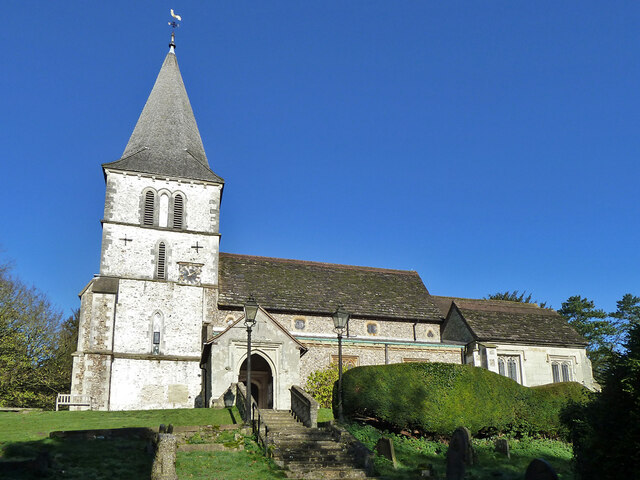
Church of St Peter and St Paul, Chaldon

The Church of Saints Peter and Paul at Chaldon, Surrey, is a Church of England parish church in the Diocese of Southwark. The building was begun before...

Netherne Hospital

Netherne Hospital, formerly The Surrey County Asylum at Netherne or Netherne Asylum was a psychiatric hospital in Hooley, Surrey in the United Kingdom...

Netherne-on-the-Hill

Netherne-on-the-Hill is a village in Surrey, England, occupying a plateau once home to Netherne Hospital. The village is across a narrow valley from Hooley...
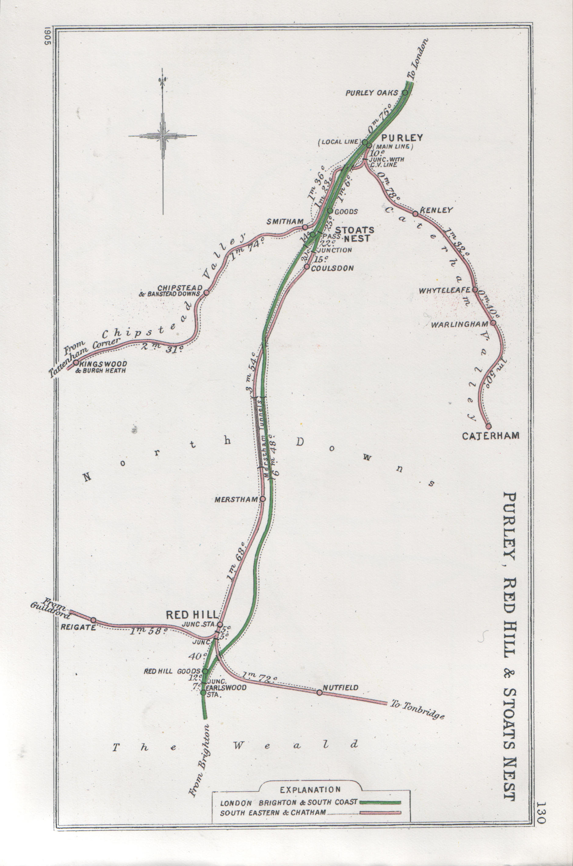
Merstham tunnels

The Merstham and Quarry tunnels are two neighbouring railway tunnels on the Brighton Main Line between Merstham and Coulsdon (formerly Stoats Nest) in...

Chaldon

Chaldon is a village and civil parish in the Tandridge District of Surrey, England. The village is situated high on the North Downs, immediately west of...

Coulsdon Town F.C.

Coulsdon Town Football Club was a football club based in Coulsdon, Greater London, England. == History == The club was established in 1968 as Reedham Park...

Happy Valley Park

Happy Valley Park is a public park in Coulsdon in the London Borough of Croydon. It is owned and managed by Croydon Council. Located in the Green Belt...

Merstham railway station

Merstham railway station is in Merstham, Surrey, England. It is on the Brighton Main Line, 20 miles 59 chains (33.4 km) measured from London Charing Cross...

Nearby Amenities

Located within 500m of 51.282502,-0.13520629
Bus Stop
Alderstead Heath
Naptan AtcoCode: 40004409203A
Naptan Bearing: E
Naptan BusStopType: CUS
Naptan CommonName: Alderstead Heath
Naptan Indicator: adj
Naptan Landmark: Alderstead Heath
Naptan NaptanCode: surgpagw
Naptan Street: Dean Lane
Naptan Verified: no
Public Transport: platform
Source: naptan_import
Wheelchair: no
Lat/Long: 51.2803101/-0.1379648
Bus Stop
Alderstead Heath
Naptan AtcoCode: 40004409203B
Naptan Bearing: W
Naptan CommonName: Alderstead Heath
Naptan Indicator: Opp
Naptan Landmark: Alderstead Heath
Naptan NaptanCode: surdjpgt
Naptan Street: Dean Lane
Naptan Verified: no
Public Transport: platform
Source: naptan_import
Wheelchair: no
Lat/Long: 51.2804062/-0.1378243
Barrier: kissing_gate
Lat/Long: 51.2833901/-0.1392287
Barrier: stile
Lat/Long: 51.2801532/-0.1345319
Parking
Lat/Long: 51.28343/-0.1388348
Alderstead Heath
Tourism: caravan_site
Lat/Long: 51.2833058/-0.1386576
Post Box
Ref: RH1 359
Lat/Long: 51.283279/-0.138455
Manhole: unknown
Lat/Long: 51.284547/-0.1410057
The data included in this document is from www.openstreetmap.org. The data is made available under ODbL.

Have you been to Alderstead Heath?

Leave your review of Alderstead Heath below (or comments, questions and feedback).