Long Covert

Wood, Forest in Lincolnshire East Lindsey

England

Long Covert

Direction Sign – Signpost on Rowgate Road, Scamblesby parish Located on the northwest side of the crossroads of Rowgate Road and Oslear's Lane, east of the village, Scamblesby parish. 4 arms and no finial. See also <a title="https://www.geograph.org.uk/photo/466098" href="https://www.geograph.org.uk/photo/466098">Link</a>.

Milestone Society National ID: LI_TF2978
Direction Sign – Signpost on Rowgate Road, Scamblesby parish Credit: A Riley

Long Covert is a vast woodland located in the county of Lincolnshire, England. Situated on the outskirts of the village of Long Covert, this forest is known for its extraordinary size and rich biodiversity. Covering an area of approximately 500 hectares, Long Covert is a haven for nature enthusiasts and provides a tranquil escape from the surrounding urban areas.

The woodland is predominantly made up of a mix of deciduous and coniferous trees, creating a diverse and picturesque landscape. Towering oak, beech, and birch trees provide a dense canopy, allowing only fragments of sunlight to penetrate the forest floor. This creates a unique and enchanting atmosphere for visitors to explore.

The forest is crisscrossed with a network of well-maintained footpaths, making it easily accessible for walkers, hikers, and cyclists. These paths wind through the woodland, offering breathtaking views of the surrounding countryside and allowing visitors to immerse themselves in the natural beauty of the area.

Long Covert is also home to a wide variety of wildlife. The forest provides a sanctuary for numerous species, including deer, foxes, badgers, and a multitude of bird species. The diverse range of flora and fauna makes it a popular spot for nature lovers and birdwatchers.

In addition to its natural beauty, Long Covert also has historical significance. The forest has been in existence for centuries and has witnessed various human activities over time. Today, remnants of old structures, such as abandoned mills and farm buildings, can still be found within the woodland, adding to its charm and intrigue.

Overall, Long Covert, Lincolnshire is a captivating forest that offers a unique blend of natural beauty, biodiversity, and historical significance. It is a place where visitors can escape the hustle and bustle of everyday life and reconnect with nature in a peaceful and serene environment.

If you have any feedback on the listing, please let us know in the comments section below.
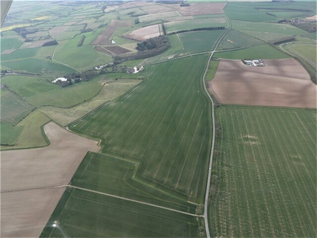
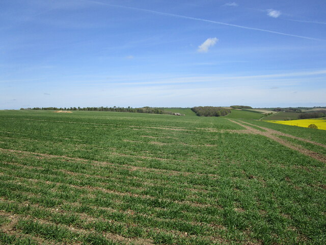
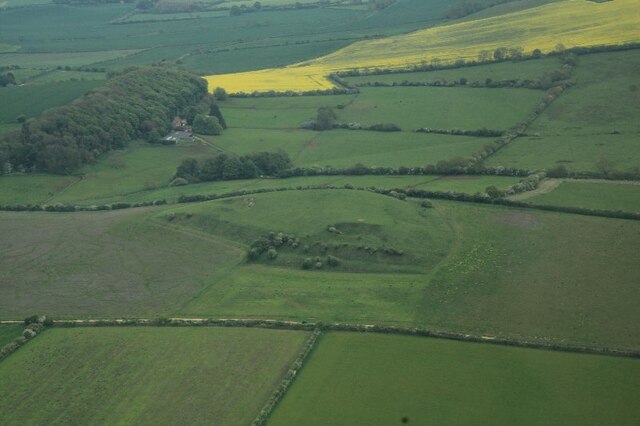
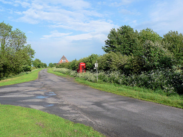
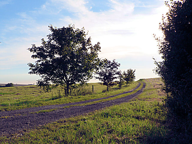
Long Covert Images

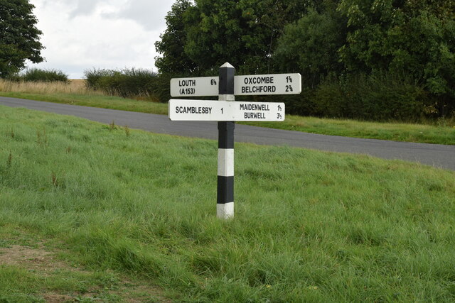
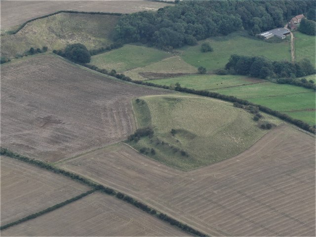
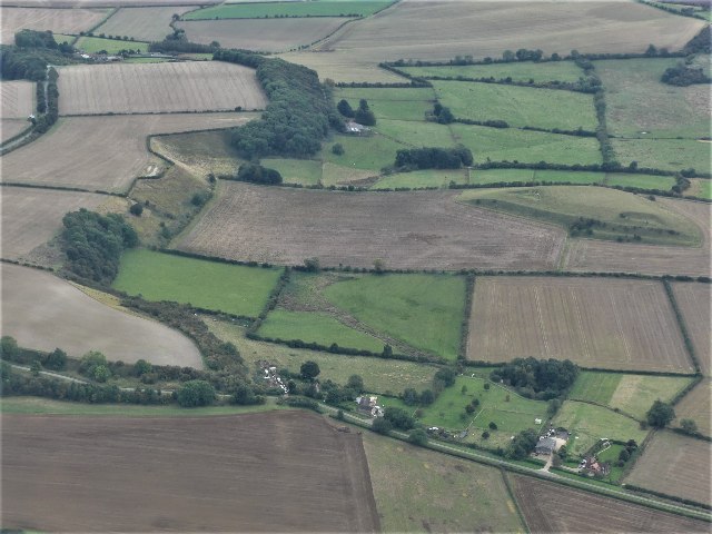
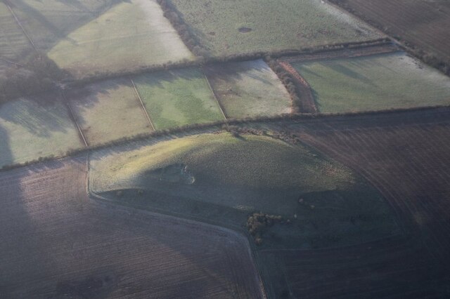
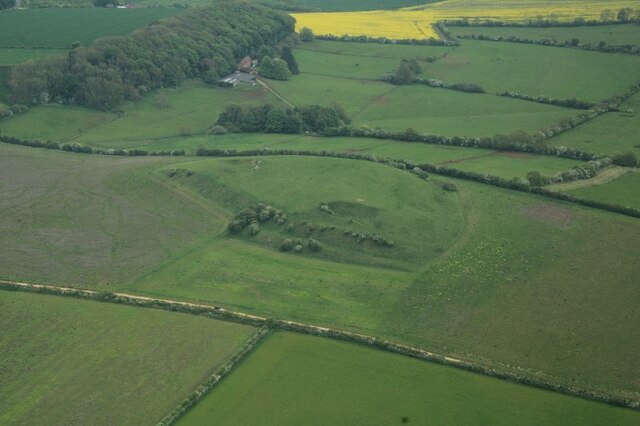
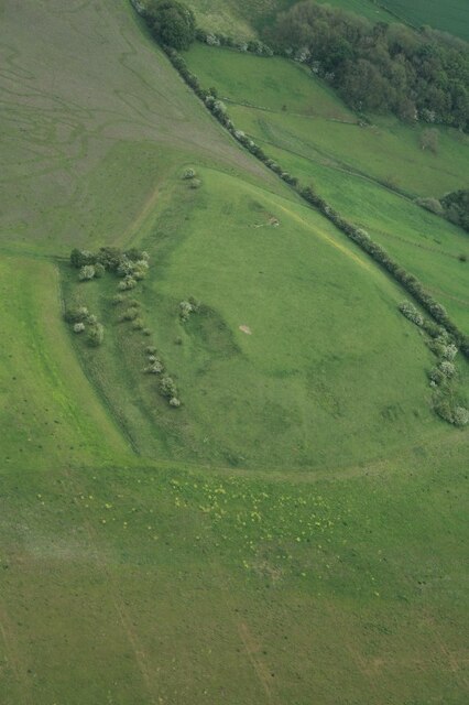
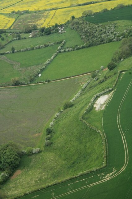
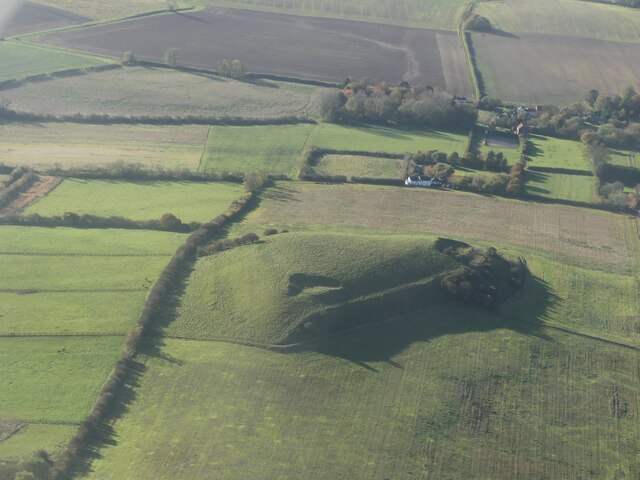
Images are sourced within 2km of 53.287215/-0.049552943 or Grid Reference TF3078. Thanks to Geograph Open Source API. All images are credited.

Direction Sign – Signpost on Rowgate Road, Scamblesby parish Located on the northwest side of the crossroads of Rowgate Road and Oslear's Lane, east of the village, Scamblesby parish. 4 arms and no finial. See also <a title="https://www.geograph.org.uk/photo/466098" href="https://www.geograph.org.uk/photo/466098">Link</a>.

Milestone Society National ID: LI_TF2978
Direction Sign – Signpost on Rowgate Road, Scamblesby parish
Located on the northwest side of the crossroads of Rowgate Road and Oslear's Lane, east of the village, Scamblesby parish. 4 arms and no finial. See also Link. Milestone Society National ID: LI_TF2978
Gaumer Hill, Scamblesby: aerial 2021 (1) See <span class="nowrap"><a title="https://www.heritagegateway.org.uk/Gateway/Results_Single.aspx?uid=MLI42287&resourceID=1006" rel="nofollow ugc noopener" href="https://www.heritagegateway.org.uk/Gateway/Results_Single.aspx?uid=MLI42287&resourceID=1006">Link</a><img style="margin-left:2px;" alt="External link" title="External link - shift click to open in new window" src="https://s1.geograph.org.uk/img/external.png" width="10" height="10"/></span> and <a href="https://www.geograph.org.uk/photo/7002944">TF2877 : Gaumer Hill, Scamblesby: aerial 2021 (1)</a>. 

A pronounced series of cultivation terraces with working platforms up to 9m wide and with 6.5m vertical intervals. Cultivation terraces were ploughed up by the farmer the week beginning 5th June 1995. The terraces were at Gaumer Hill, east of High Field Farm.
Gaumer Hill, Scamblesby: aerial 2021 (1)
See LinkExternal link and TF2877 : Gaumer Hill, Scamblesby: aerial 2021 (1). A pronounced series of cultivation terraces with working platforms up to 9m wide and with 6.5m vertical intervals. Cultivation terraces were ploughed up by the farmer the week beginning 5th June 1995. The terraces were at Gaumer Hill, east of High Field Farm.
Gaumer Hill, Scamblesby: aerial 2021 (2) See <span class="nowrap"><a title="https://www.heritagegateway.org.uk/Gateway/Results_Single.aspx?uid=MLI42287&resourceID=1006" rel="nofollow ugc noopener" href="https://www.heritagegateway.org.uk/Gateway/Results_Single.aspx?uid=MLI42287&resourceID=1006">Link</a><img style="margin-left:2px;" alt="External link" title="External link - shift click to open in new window" src="https://s1.geograph.org.uk/img/external.png" width="10" height="10"/></span> and <a href="https://www.geograph.org.uk/photo/7002944">TF2877 : Gaumer Hill, Scamblesby: aerial 2021 (1)</a>. 

A pronounced series of cultivation terraces with working platforms up to 9m wide and with 6.5m vertical intervals. Cultivation terraces were ploughed up by the farmer the week beginning 5th June 1995. The terraces were at Gaumer Hill, east of High Field Farm. 

Gaumer Hill right. View is southwards along western Wolds escarpment, with Bluestone Heath Road running parallel (top left).
Gaumer Hill, Scamblesby: aerial 2021 (2)
See LinkExternal link and TF2877 : Gaumer Hill, Scamblesby: aerial 2021 (1). A pronounced series of cultivation terraces with working platforms up to 9m wide and with 6.5m vertical intervals. Cultivation terraces were ploughed up by the farmer the week beginning 5th June 1995. The terraces were at Gaumer Hill, east of High Field Farm. Gaumer Hill right. View is southwards along western Wolds escarpment, with Bluestone Heath Road running parallel (top left).
Gaumer Hill, Scamblesby, cultivation terraces: aerial 2022 See: <span class="nowrap"><a title="https://www.heritagegateway.org.uk/Gateway/Results_Single.aspx?uid=MLI42287&resourceID=1006" rel="nofollow ugc noopener" href="https://www.heritagegateway.org.uk/Gateway/Results_Single.aspx?uid=MLI42287&resourceID=1006">Link</a><img style="margin-left:2px;" alt="External link" title="External link - shift click to open in new window" src="https://s1.geograph.org.uk/img/external.png" width="10" height="10"/></span>
Gaumer Hill, Scamblesby, cultivation terraces: aerial 2022
See: LinkExternal link
Circular cropmark near Cadwell Grange (1) The cropmark grid reference is given below, it is on the left hand side of the field in the centre, near the bulge in the light green field.

See <a href="https://www.geograph.org.uk/photo/7162744">TF2879 : Circular cropmark near Cadwell Grange (2)</a> for detail.
Circular cropmark near Cadwell Grange (1)
The cropmark grid reference is given below, it is on the left hand side of the field in the centre, near the bulge in the light green field. See TF2879 : Circular cropmark near Cadwell Grange (2) for detail.
Circular cropmark near Cadwell Grange (2) Detail of <a href="https://www.geograph.org.uk/photo/7162739">TF2879 : Circular cropmark near Cadwell Grange (1)</a>.
Circular cropmark near Cadwell Grange (2)
View towards Scotland Barn
Gaumer Hill, Scamblesby: aerial 2023 (1) Note the cultivation terraces: <span class="nowrap"><a title="https://www.heritagegateway.org.uk/Gateway/Results_Single.aspx?uid=563d78cc-6882-4a3d-b1c5-bd7eba4eb800&resourceID=19191" rel="nofollow ugc noopener" href="https://www.heritagegateway.org.uk/Gateway/Results_Single.aspx?uid=563d78cc-6882-4a3d-b1c5-bd7eba4eb800&resourceID=19191">Link</a><img style="margin-left:2px;" alt="External link" title="External link - shift click to open in new window" src="https://s1.geograph.org.uk/img/external.png" width="10" height="10"/></span> and
<span class="nowrap"><a title="https://www.heritagegateway.org.uk/Gateway/Results_Single.aspx?uid=MLI42287&resourceID=1006" rel="nofollow ugc noopener" href="https://www.heritagegateway.org.uk/Gateway/Results_Single.aspx?uid=MLI42287&resourceID=1006">Link</a><img style="margin-left:2px;" alt="External link" title="External link - shift click to open in new window" src="https://s1.geograph.org.uk/img/external.png" width="10" height="10"/></span>

For more cultivation terraces nearby see <a href="https://www.geograph.org.uk/photo/7504508">TF2978 : The Lofts, with cultivation terraces, SE of Scamblesby Thorpe: aerial 2023 (5)</a>.
Gaumer Hill, Scamblesby: aerial 2023 (1)
Note the cultivation terraces: LinkExternal link and LinkExternal link For more cultivation terraces nearby see TF2978 : The Lofts, with cultivation terraces, SE of Scamblesby Thorpe: aerial 2023 (5).
Gaumer Hill, Scamblesby: aerial 2023 (2) Note the cultivation terraces: <span class="nowrap"><a title="https://www.heritagegateway.org.uk/Gateway/Results_Single.aspx?uid=563d78cc-6882-4a3d-b1c5-bd7eba4eb800&resourceID=19191" rel="nofollow ugc noopener" href="https://www.heritagegateway.org.uk/Gateway/Results_Single.aspx?uid=563d78cc-6882-4a3d-b1c5-bd7eba4eb800&resourceID=19191">Link</a><img style="margin-left:2px;" alt="External link" title="External link - shift click to open in new window" src="https://s1.geograph.org.uk/img/external.png" width="10" height="10"/></span> and
<span class="nowrap"><a title="https://www.heritagegateway.org.uk/Gateway/Results_Single.aspx?uid=MLI42287&resourceID=1006" rel="nofollow ugc noopener" href="https://www.heritagegateway.org.uk/Gateway/Results_Single.aspx?uid=MLI42287&resourceID=1006">Link</a><img style="margin-left:2px;" alt="External link" title="External link - shift click to open in new window" src="https://s1.geograph.org.uk/img/external.png" width="10" height="10"/></span>

For more cultivation terraces nearby see <a href="https://www.geograph.org.uk/photo/7504508">TF2978 : The Lofts, with cultivation terraces, SE of Scamblesby Thorpe: aerial 2023 (5)</a>.
Gaumer Hill, Scamblesby: aerial 2023 (2)
Note the cultivation terraces: LinkExternal link and LinkExternal link For more cultivation terraces nearby see TF2978 : The Lofts, with cultivation terraces, SE of Scamblesby Thorpe: aerial 2023 (5).
Gaumer Hill, Scamblesby: aerial 2023 (3) Note the cultivation terraces: <span class="nowrap"><a title="https://www.heritagegateway.org.uk/Gateway/Results_Single.aspx?uid=563d78cc-6882-4a3d-b1c5-bd7eba4eb800&resourceID=19191" rel="nofollow ugc noopener" href="https://www.heritagegateway.org.uk/Gateway/Results_Single.aspx?uid=563d78cc-6882-4a3d-b1c5-bd7eba4eb800&resourceID=19191">Link</a><img style="margin-left:2px;" alt="External link" title="External link - shift click to open in new window" src="https://s1.geograph.org.uk/img/external.png" width="10" height="10"/></span> and
<span class="nowrap"><a title="https://www.heritagegateway.org.uk/Gateway/Results_Single.aspx?uid=MLI42287&resourceID=1006" rel="nofollow ugc noopener" href="https://www.heritagegateway.org.uk/Gateway/Results_Single.aspx?uid=MLI42287&resourceID=1006">Link</a><img style="margin-left:2px;" alt="External link" title="External link - shift click to open in new window" src="https://s1.geograph.org.uk/img/external.png" width="10" height="10"/></span>

For more cultivation terraces nearby see <a href="https://www.geograph.org.uk/photo/7504508">TF2978 : The Lofts, with cultivation terraces, SE of Scamblesby Thorpe: aerial 2023 (5)</a>.
Gaumer Hill, Scamblesby: aerial 2023 (3)
Note the cultivation terraces: LinkExternal link and LinkExternal link For more cultivation terraces nearby see TF2978 : The Lofts, with cultivation terraces, SE of Scamblesby Thorpe: aerial 2023 (5).
Chalk showing on Wolds escarpment, Scamblesby Grove: aerial 2023
Natural amphitheatre  in the Wolds escarpment near Scamblesby Grove: aerial 2023
Natural amphitheatre in the Wolds escarpment near Scamblesby Grove: aerial 2023
The Lofts, with cultivation terraces, SE of Scamblesby Thorpe: aerial 2023 (1) See: <span class="nowrap"><a title="https://www.heritagegateway.org.uk/Gateway/Results_Single.aspx?uid=205fbadd-b42b-43d3-b580-56ed115f3240&resourceID=19191" rel="nofollow ugc noopener" href="https://www.heritagegateway.org.uk/Gateway/Results_Single.aspx?uid=205fbadd-b42b-43d3-b580-56ed115f3240&resourceID=19191">Link</a><img style="margin-left:2px;" alt="External link" title="External link - shift click to open in new window" src="https://s1.geograph.org.uk/img/external.png" width="10" height="10"/></span> and

For more cultivation terraces nearby see <a href="https://www.geograph.org.uk/photo/7504467">TF2877 : Gaumer Hill, Scamblesby: aerial 2023 (3)</a>.
The Lofts, with cultivation terraces, SE of Scamblesby Thorpe: aerial 2023 (1)
See: LinkExternal link and For more cultivation terraces nearby see TF2877 : Gaumer Hill, Scamblesby: aerial 2023 (3).
The Lofts, with cultivation terraces, SE of Scamblesby Thorpe: aerial 2023 (2) See: <span class="nowrap"><a title="https://www.heritagegateway.org.uk/Gateway/Results_Single.aspx?uid=205fbadd-b42b-43d3-b580-56ed115f3240&resourceID=19191" rel="nofollow ugc noopener" href="https://www.heritagegateway.org.uk/Gateway/Results_Single.aspx?uid=205fbadd-b42b-43d3-b580-56ed115f3240&resourceID=19191">Link</a><img style="margin-left:2px;" alt="External link" title="External link - shift click to open in new window" src="https://s1.geograph.org.uk/img/external.png" width="10" height="10"/></span> and
<span class="nowrap"><a title="https://www.heritagegateway.org.uk/Gateway/Results_Single.aspx?uid=MLI42288&resourceID=1006" rel="nofollow ugc noopener" href="https://www.heritagegateway.org.uk/Gateway/Results_Single.aspx?uid=MLI42288&resourceID=1006">Link</a><img style="margin-left:2px;" alt="External link" title="External link - shift click to open in new window" src="https://s1.geograph.org.uk/img/external.png" width="10" height="10"/></span>

For more cultivation terraces nearby see <a href="https://www.geograph.org.uk/photo/7504467">TF2877 : Gaumer Hill, Scamblesby: aerial 2023 (3)</a>.
The Lofts, with cultivation terraces, SE of Scamblesby Thorpe: aerial 2023 (2)
See: LinkExternal link and LinkExternal link For more cultivation terraces nearby see TF2877 : Gaumer Hill, Scamblesby: aerial 2023 (3).
The Lofts, with cultivation terraces, SE of Scamblesby Thorpe: aerial 2023 (3) See: <span class="nowrap"><a title="https://www.heritagegateway.org.uk/Gateway/Results_Single.aspx?uid=205fbadd-b42b-43d3-b580-56ed115f3240&resourceID=19191" rel="nofollow ugc noopener" href="https://www.heritagegateway.org.uk/Gateway/Results_Single.aspx?uid=205fbadd-b42b-43d3-b580-56ed115f3240&resourceID=19191">Link</a><img style="margin-left:2px;" alt="External link" title="External link - shift click to open in new window" src="https://s1.geograph.org.uk/img/external.png" width="10" height="10"/></span> and
<span class="nowrap"><a title="https://www.heritagegateway.org.uk/Gateway/Results_Single.aspx?uid=MLI42288&resourceID=1006" rel="nofollow ugc noopener" href="https://www.heritagegateway.org.uk/Gateway/Results_Single.aspx?uid=MLI42288&resourceID=1006">Link</a><img style="margin-left:2px;" alt="External link" title="External link - shift click to open in new window" src="https://s1.geograph.org.uk/img/external.png" width="10" height="10"/></span>

For more cultivation terraces nearby see <a href="https://www.geograph.org.uk/photo/7504467">TF2877 : Gaumer Hill, Scamblesby: aerial 2023 (3)</a>.
The Lofts, with cultivation terraces, SE of Scamblesby Thorpe: aerial 2023 (3)
See: LinkExternal link and LinkExternal link For more cultivation terraces nearby see TF2877 : Gaumer Hill, Scamblesby: aerial 2023 (3).
The Lofts, with cultivation terraces, SE of Scamblesby Thorpe: aerial 2023 (4) See: <span class="nowrap"><a title="https://www.heritagegateway.org.uk/Gateway/Results_Single.aspx?uid=205fbadd-b42b-43d3-b580-56ed115f3240&resourceID=19191" rel="nofollow ugc noopener" href="https://www.heritagegateway.org.uk/Gateway/Results_Single.aspx?uid=205fbadd-b42b-43d3-b580-56ed115f3240&resourceID=19191">Link</a><img style="margin-left:2px;" alt="External link" title="External link - shift click to open in new window" src="https://s1.geograph.org.uk/img/external.png" width="10" height="10"/></span> and
<span class="nowrap"><a title="https://www.heritagegateway.org.uk/Gateway/Results_Single.aspx?uid=MLI42288&resourceID=1006" rel="nofollow ugc noopener" href="https://www.heritagegateway.org.uk/Gateway/Results_Single.aspx?uid=MLI42288&resourceID=1006">Link</a><img style="margin-left:2px;" alt="External link" title="External link - shift click to open in new window" src="https://s1.geograph.org.uk/img/external.png" width="10" height="10"/></span>

For more cultivation terraces nearby see <a href="https://www.geograph.org.uk/photo/7504467">TF2877 : Gaumer Hill, Scamblesby: aerial 2023 (3)</a>.
The Lofts, with cultivation terraces, SE of Scamblesby Thorpe: aerial 2023 (4)
See: LinkExternal link and LinkExternal link For more cultivation terraces nearby see TF2877 : Gaumer Hill, Scamblesby: aerial 2023 (3).
The Lofts, with cultivation terraces, SE of Scamblesby Thorpe: aerial 2023 (5) See: <span class="nowrap"><a title="https://www.heritagegateway.org.uk/Gateway/Results_Single.aspx?uid=205fbadd-b42b-43d3-b580-56ed115f3240&resourceID=19191" rel="nofollow ugc noopener" href="https://www.heritagegateway.org.uk/Gateway/Results_Single.aspx?uid=205fbadd-b42b-43d3-b580-56ed115f3240&resourceID=19191">Link</a><img style="margin-left:2px;" alt="External link" title="External link - shift click to open in new window" src="https://s1.geograph.org.uk/img/external.png" width="10" height="10"/></span> and
<span class="nowrap"><a title="https://www.heritagegateway.org.uk/Gateway/Results_Single.aspx?uid=MLI42288&resourceID=1006" rel="nofollow ugc noopener" href="https://www.heritagegateway.org.uk/Gateway/Results_Single.aspx?uid=MLI42288&resourceID=1006">Link</a><img style="margin-left:2px;" alt="External link" title="External link - shift click to open in new window" src="https://s1.geograph.org.uk/img/external.png" width="10" height="10"/></span>

For more cultivation terraces nearby see <a href="https://www.geograph.org.uk/photo/7504467">TF2877 : Gaumer Hill, Scamblesby: aerial 2023 (3)</a>.
The Lofts, with cultivation terraces, SE of Scamblesby Thorpe: aerial 2023 (5)
See: LinkExternal link and LinkExternal link For more cultivation terraces nearby see TF2877 : Gaumer Hill, Scamblesby: aerial 2023 (3).
Gaumer Hill, Scamblesby: aerial 2023 (4) Or maybe a happy toad? I think the "eyes" are pits.

A pronounced series of cultivation terraces with working platforms up to 9m wide and with 6.5m vertical intervals. 

See <span class="nowrap"><a title="https://www.heritagegateway.org.uk/Gateway/Results_Single.aspx?uid=MLI42287&resourceID=1006" rel="nofollow ugc noopener" href="https://www.heritagegateway.org.uk/Gateway/Results_Single.aspx?uid=MLI42287&resourceID=1006">Link</a><img style="margin-left:2px;" alt="External link" title="External link - shift click to open in new window" src="https://s1.geograph.org.uk/img/external.png" width="10" height="10"/></span> and <a href="https://www.geograph.org.uk/photo/7002944">TF2877 : Gaumer Hill, Scamblesby: aerial 2021 (1)</a>. 

The report says the cultivation terraces were ploughed up by the farmer the week beginning 5th June 1995, but some remain, and there appear to be traces of others in the shadow.
Gaumer Hill, Scamblesby: aerial 2023 (4)
Or maybe a happy toad? I think the "eyes" are pits. A pronounced series of cultivation terraces with working platforms up to 9m wide and with 6.5m vertical intervals. See LinkExternal link and TF2877 : Gaumer Hill, Scamblesby: aerial 2021 (1). The report says the cultivation terraces were ploughed up by the farmer the week beginning 5th June 1995, but some remain, and there appear to be traces of others in the shadow.
Show me another place!

Long Covert is located at Grid Ref: TF3078 (Lat: 53.287215, Lng: -0.049552943)

Administrative County: Lincolnshire

District: East Lindsey

Police Authority: Lincolnshire

What 3 Words

///gurgling.shame.bucks. Near Burwell, Lincolnshire

Related Wikis

Oxcombe

Oxcombe is a small village in the civil parish of Maidenwell, in the East Lindsey district of Lincolnshire, England. It is situated 3 miles (5 km) west...

Farforth

Farforth or Farforth-cum-Maidenwell is a hamlet in the East Lindsey district of Lincolnshire, England. It is in the civil parish of Maidenwell, and approximately...

Maidenwell, Lincolnshire

Maidenwell is a village and civil parish in the East Lindsey district of Lincolnshire, England. The village is 6 miles (10 km) south from Louth. Maidenwell...

Cawkwell

Cawkwell is a hamlet and former civil parish, now in the parish of Scamblesby, in the East Lindsey district of Lincolnshire, England. It is situated approximately...

Juicetrump Hill

Juicetrump Hill is a hill around half a mile north of Belchford and 4.5 miles north-east of Horncastle in Lincolnshire, UK within the Lincolnshire Wolds...

Scamblesby

Scamblesby is a village and civil parish in the East Lindsey district from Lincolnshire, England. It is situated 6 miles (10 km) south-west from Louth...

Cadwell Park

Cadwell Park is a motor racing circuit in Lincolnshire, England, 5 mi (8.0 km) south of Louth, owned and operated by MotorSport Vision, a business associated...

Belchford

Belchford is a village and civil parish in the East Lindsey district of Lincolnshire, England. The village is situated approximately 4 miles (6 km) north...

Nearby Amenities

Located within 500m of 53.287215,-0.049552943
Ele: 150
Natural: peak
Source: Bing
Lat/Long: 53.2907374/-0.0486596
Scotland Barn
Place: farm
Source: Bing
Lat/Long: 53.28348/-0.0475278
The data included in this document is from www.openstreetmap.org. The data is made available under ODbL.

Have you been to Long Covert?

Leave your review of Long Covert below (or comments, questions and feedback).