Forge Wood

Wood, Forest in Sussex Crawley

England

Forge Wood

The Shipley Bridge Pub, Shipley Bridge, Surrey A country pub with a large pub garden. View taken from E looking W. Popular on this Friday lunchtime.
The Shipley Bridge Pub, Shipley Bridge, Surrey Credit: Pete Chapman

Forge Wood is a residential area located in the district of Crawley, West Sussex, in the south of England. It is a relatively new development, with construction beginning in 2014 and ongoing expansion to accommodate the growing demand for housing in the area. The area is situated on the outskirts of Crawley, surrounded by beautiful countryside and adjacent to the Tilgate Forest.

The development of Forge Wood aims to create a sustainable and environmentally friendly community, with a focus on open spaces, green areas, and modern amenities. The neighborhood features a mix of houses, apartments, and community facilities, providing a range of housing options for residents.

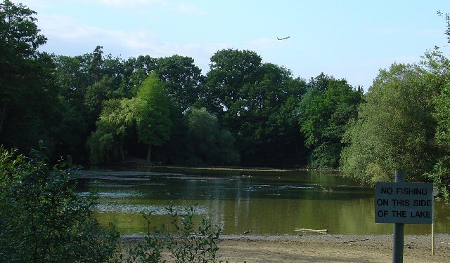
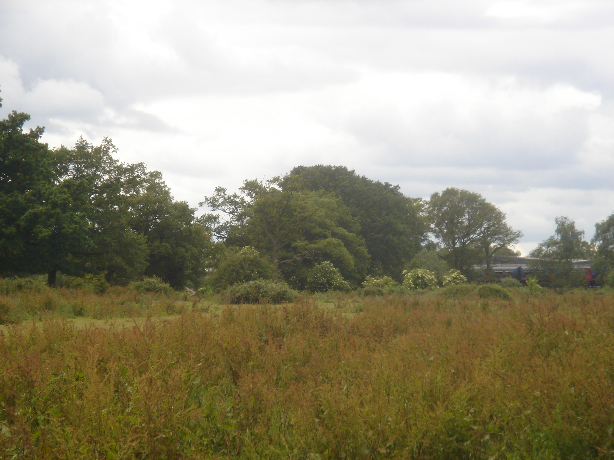
One of the key attractions of Forge Wood is its proximity to the stunning Tilgate Forest. This expansive woodland area offers a haven for nature lovers, with numerous walking trails, cycling paths, and wildlife habitats to explore. The forest is also home to Tilgate Park, a popular recreational area with a lake, gardens, and a variety of leisure activities.

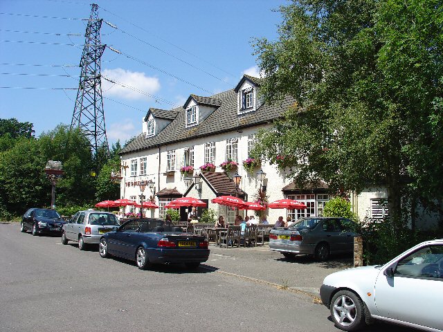
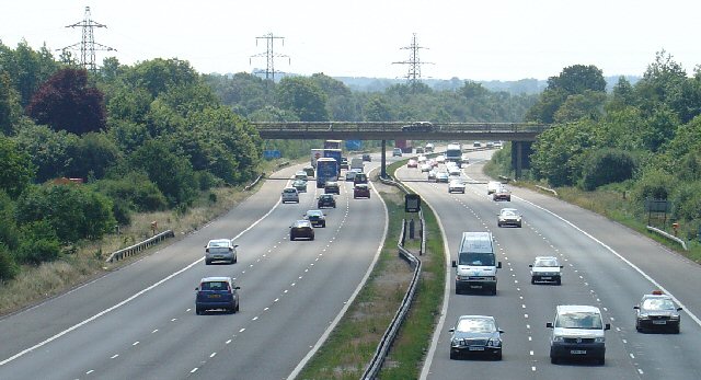
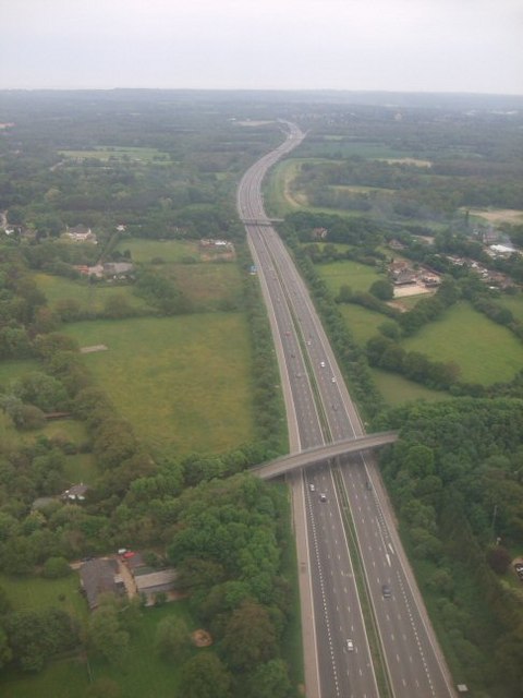
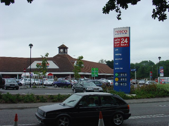
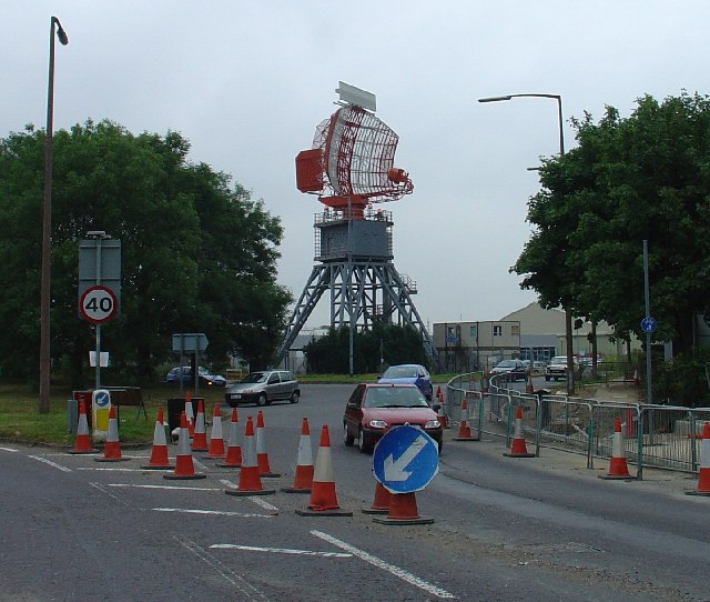
Forge Wood benefits from excellent transport links, with access to major roads such as the M23 and A23, making it convenient for commuters. The area is served by regular bus services, connecting residents to Crawley town center and surrounding areas. Crawley train station is also easily accessible, offering direct services to London and other major cities.

Overall, Forge Wood offers a modern and sustainable living environment, combining the tranquility of the surrounding countryside with the convenience of nearby amenities and excellent transport connections.

If you have any feedback on the listing, please let us know in the comments section below.

Forge Wood Images

Images are sourced within 2km of 51.137679/-0.15043901 or Grid Reference TQ2939. Thanks to Geograph Open Source API. All images are credited.

The Shipley Bridge Pub, Shipley Bridge, Surrey A country pub with a large pub garden. View taken from E looking W. Popular on this Friday lunchtime.
The Shipley Bridge Pub, Shipley Bridge, Surrey
A country pub with a large pub garden. View taken from E looking W. Popular on this Friday lunchtime.
Motorway Bridge of B2037 over M23, Shipley Bridge, Surrey View taken from Bridleway bridge to the N, looking S. The Shipley Bridge Pub is very close to this bridge.
Motorway Bridge of B2037 over M23, Shipley Bridge, Surrey
View taken from Bridleway bridge to the N, looking S. The Shipley Bridge Pub is very close to this bridge.
M23 Motorway
M23 Motorway
Fly tipping on Church Lane Although a public bridleway, this part of the lane is vehicular access to several houses and commercial premises over the M23 bridge ahead. Composed largely of old brick rubble, this is not the sort of thing to run into when coming over the hump in the dark.
Fly tipping on Church Lane
Although a public bridleway, this part of the lane is vehicular access to several houses and commercial premises over the M23 bridge ahead. Composed largely of old brick rubble, this is not the sort of thing to run into when coming over the hump in the dark.
Airborne above the M23 We have just taken off from Gatwick airport in the less usual easterly direction.  This was the day before most European airspace was closed for six days due to an ash cloud caused by a volcanic eruption in Iceland.
In the foreground we can see the minor road at Worth crossing the M23 and in the distance junction 10, which is in <a href="https://www.geograph.org.uk/gridref/TQ3038">TQ3038</a>
Airborne above the M23
We have just taken off from Gatwick airport in the less usual easterly direction. This was the day before most European airspace was closed for six days due to an ash cloud caused by a volcanic eruption in Iceland. In the foreground we can see the minor road at Worth crossing the M23 and in the distance junction 10, which is in TQ3038
The Shipley Bridge Inn, Shipley Bridge, Surrey
Gatwick Beehive Original 1930s Circular Airport Terminal. The airport was re-built approximately 1/2 mile to the north in the 1950s. The "Beehive" is now used as offices
Gatwick Beehive
Original 1930s Circular Airport Terminal. The airport was re-built approximately 1/2 mile to the north in the 1950s. The "Beehive" is now used as offices
Tesco Superstore, Hazelwick Avenue, Crawley, West Sussex One of three major supermarkets in Crawley, the others being Asda (Southgate) and Sainsbury's (West Green).
Tesco Superstore, Hazelwick Avenue, Crawley, West Sussex
One of three major supermarkets in Crawley, the others being Asda (Southgate) and Sainsbury's (West Green).
Cycle Subway (on National Cycle Network Route 20) between Manor Royal Industrial Estate and Northgate, Crawley, West Sussex National Cycle Network route 20 passes through Crawley. Here we see where the cycle path is routed under the main Crawley dual carriageway inner bypass. NCN 20 is a route from London to Brighton.
Cycle Subway (on National Cycle Network Route 20) between Manor Royal Industrial Estate and Northgate, Crawley, West Sussex
National Cycle Network route 20 passes through Crawley. Here we see where the cycle path is routed under the main Crawley dual carriageway inner bypass. NCN 20 is a route from London to Brighton.
Gatwick Road, Manor Royal Industrial Estate, Crawley, West Sussex The Manor Royal industrial estate is centred on TQ2738, but also spreads over about a third of this grid square. A feature here is the bridge over the main road linking two buildings belonging to the same organisation. The road building works are connected with the installation of the "Fastway" guided bus network throughout Crawley.
Gatwick Road, Manor Royal Industrial Estate, Crawley, West Sussex
The Manor Royal industrial estate is centred on TQ2738, but also spreads over about a third of this grid square. A feature here is the bridge over the main road linking two buildings belonging to the same organisation. The road building works are connected with the installation of the "Fastway" guided bus network throughout Crawley.
Milton Mount Lake, Pound Hill, Crawley, West Sussex Milton Mount Lake was once in the grounds of the Worth Park country estate. The estate was absorbed into the residential neighbourhood of Pound Hill and built upon. In the background, it is just possible to see an aircraft that has just taken off from Gatwick airport. The E end of the runway is 2km north of here. Aircraft taking off would not normally be seen from here, as they usually take off into the West (against the prevailing wind). The wind on this day was from the east.
Milton Mount Lake, Pound Hill, Crawley, West Sussex
Milton Mount Lake was once in the grounds of the Worth Park country estate. The estate was absorbed into the residential neighbourhood of Pound Hill and built upon. In the background, it is just possible to see an aircraft that has just taken off from Gatwick airport. The E end of the runway is 2km north of here. Aircraft taking off would not normally be seen from here, as they usually take off into the West (against the prevailing wind). The wind on this day was from the east.
Radar, Tinsley Green, Crawley, West Sussex A Radar adjacent to Gatwick airport.
Radar, Tinsley Green, Crawley, West Sussex
A Radar adjacent to Gatwick airport.
Old Stable Block of Worth Park House, Milton Mount, Pound Hill, Crawley, West Sussex This is the old Victoria Stable block of Worth Park House. There is a carved plaque on the wall with the date 1882. The original Worth Park House was demolished and the site is now Milton Mount Gardens, but this stable block remains.
Old Stable Block of Worth Park House, Milton Mount, Pound Hill, Crawley, West Sussex
This is the old Victoria Stable block of Worth Park House. There is a carved plaque on the wall with the date 1882. The original Worth Park House was demolished and the site is now Milton Mount Gardens, but this stable block remains.
Radar (2) Tinsley Green, Crawley, West Sussex Another radars on this site. This one is less obvious. Picture taken from adjacent railway bridge.
Radar (2) Tinsley Green, Crawley, West Sussex
Another radars on this site. This one is less obvious. Picture taken from adjacent railway bridge.
London to Brighton Railway Line, Tinsley Green, Crawley, West Sussex View looking S towards Three Bridges station (3km further on). The bridge just in view in the distance is that of the A2011 spur road from Crawley to the M23 motorway.
London to Brighton Railway Line, Tinsley Green, Crawley, West Sussex
View looking S towards Three Bridges station (3km further on). The bridge just in view in the distance is that of the A2011 spur road from Crawley to the M23 motorway.
The Greyhound Pub, Tinsley Green, Crawley, West Sussex - Venue for the Annual World Marbles Championships. This is the venue of the world marbles championships. The concrete circular plinth in the foreground is one of the playing surfaces. There are several of these in the grounds of the pub.
The Greyhound Pub, Tinsley Green, Crawley, West Sussex - Venue for the Annual World Marbles Championships.
This is the venue of the world marbles championships. The concrete circular plinth in the foreground is one of the playing surfaces. There are several of these in the grounds of the pub.
Tinsley Bridge, over the Gatwick Stream, Tinsley Green, Crawley, West Sussex The Gatwick stream is one of the main drainage channels for this area. Levels can rise quickly and flooding is a possibility. Just out of view is a depth gauge. View taken looking N.
Tinsley Bridge, over the Gatwick Stream, Tinsley Green, Crawley, West Sussex
The Gatwick stream is one of the main drainage channels for this area. Levels can rise quickly and flooding is a possibility. Just out of view is a depth gauge. View taken looking N.
Junction of Steers Lane and Radford Road, Tinsley Green, Crawley, West Sussex Although both classified as minor roads, the size of the junction shows how busy these routes are with local traffic - one of the exit routes from the NE of Manor Royal Industrial Estate.
Junction of Steers Lane and Radford Road, Tinsley Green, Crawley, West Sussex
Although both classified as minor roads, the size of the junction shows how busy these routes are with local traffic - one of the exit routes from the NE of Manor Royal Industrial Estate.
Show me another place!

Forge Wood is located at Grid Ref: TQ2939 (Lat: 51.137679, Lng: -0.15043901)

Administrative County: West Sussex

District: Crawley

Police Authority: Sussex

What 3 Words

///these.learn.sand. Near Copthorne, West Sussex

Related Wikis

Forge Wood

Forge Wood (under construction and semi-occupied, but scheduled for completion in 2026) is the 14th residential neighbourhood in Crawley, a town and borough...

Pound Hill & Worth (electoral division)

Pound Hill & Worth is an electoral division of West Sussex in England, and returns one member to sit on West Sussex County Council. == Extent == The division...

Tinsley Green, West Sussex

Tinsley Green is an area in the Borough of Crawley, one of seven local government districts in the English county of West Sussex. Originally a hamlet...

The Gatwick School

The Gatwick School is an all-through free school located on the Manor Royal estate, on the northern outskirts of Crawley, just south of the Gatwick Airport...

Worth Park Gardens

Worth Park (formerly known as Milton Mount Gardens) is in Pound Hill, Crawley. The park covers eight hectares and includes formal gardens, and a lake area...

Beehive, Gatwick Airport

The Beehive is the original terminal building at Gatwick Airport, England. Opened in 1936, it became obsolete in the 1950s as the airport expanded. In...

City Place Gatwick

City Place Gatwick is an office complex located on the property of London Gatwick Airport in Crawley, West Sussex, England. The complex includes four buildings...

Oakwood F.C.

Oakwood Football Club are a football club based in Crawley, England. They were established in 1962 and joined the Sussex County League Division Three in...

Nearby Amenities

Located within 500m of 51.137679,-0.15043901
Traffic Signals
Traffic Signals Direction: forward
Lat/Long: 51.1401474/-0.1508183
Removed Power: tower
Lat/Long: 51.133238/-0.1507584
Removed Power: tower
Lat/Long: 51.1338951/-0.147308
Crossing
Bicycle: yes
Crossing: traffic_signals
Crossing Island: no
Crossing Ref: toucan
Kerb: flush
Tactile Paving: yes
Lat/Long: 51.1355001/-0.1466746
Pub
Heathy Farm
Brand: Greene King
Brand Wikidata: Q5564162
Operator: Greene King
Outdoor Seating: yes
Smoking: outside
Website: https://www.greeneking.co.uk/pubs/west-sussex/heathy-farm
Lat/Long: 51.1360855/-0.1460266
Bus Stop
Crematorium
Bench: no
Bus: yes
Naptan AtcoCode: 4400CY0548
Naptan Bearing: S
Naptan CommonName: Crematorium
Naptan Indicator: opp
Naptan Landmark: Crematorium
Naptan NaptanCode: wsxgdtdp
Naptan ShortCommonName: Crematorium
Naptan Street: Balcombe road
Naptan Verified: no
Public Transport: platform
Shelter: no
Source: naptan_import
Lat/Long: 51.1360349/-0.1466144
Bus Stop
Crematorium
Bus: yes
Naptan AtcoCode: 4400CY0549
Naptan Bearing: N
Naptan CommonName: Crematorium
Naptan Indicator: adj
Naptan Landmark: Crematorium
Naptan NaptanCode: wsxgdtdt
Naptan ShortCommonName: Crematorium
Naptan Street: Balcombe Road
Naptan Verified: no
Public Transport: platform
Source: naptan_import
Lat/Long: 51.1360833/-0.1467759
Traffic Signals
Traffic Signals Direction: backward
Lat/Long: 51.1387018/-0.1470888
Forge Wood
Place: village
Wikidata: Q19654854
Wikipedia: en:Forge Wood
Lat/Long: 51.1369727/-0.1483785
Addr Flats: 9-16
Entrance: yes
Lat/Long: 51.139162/-0.1520573
Addr Flats: 4-11
Entrance: yes
Lat/Long: 51.1394534/-0.1541238
Addr Flats: 4-11
Entrance: yes
Lat/Long: 51.1391392/-0.1542441
Wiltshires Florist
Shop: florist
Lat/Long: 51.1367318/-0.1465671
Car Wash
Lat/Long: 51.1369157/-0.1464251
Fast Food
Burger Van
Cuisine: burger
Lat/Long: 51.1371092/-0.1464924
Traffic Signals
Traffic Signals Direction: backward
Lat/Long: 51.1353336/-0.1464483
Crossing
Bicycle: no
Crossing: traffic_signals
Crossing Island: yes
Crossing Ref: puffin
Kerb: lowered
Tactile Paving: yes
Lat/Long: 51.1401194/-0.1512678
Crossing
Bicycle: yes
Crossing: traffic_signals
Crossing Island: yes
Crossing Ref: toucan
Kerb: lowered
Tactile Paving: yes
Lat/Long: 51.1387384/-0.1470981
Traffic Signals
Traffic Signals Direction: forward
Lat/Long: 51.1388968/-0.1471205
Traffic Signals
Traffic Signals Direction: backward
Lat/Long: 51.1388379/-0.1472989
Traffic Signals
Traffic Signals Direction: backward
Lat/Long: 51.14009/-0.1513128
Traffic Signals
Traffic Signals Direction: backward
Lat/Long: 51.1403567/-0.1512954
Traffic Signals
Traffic Signals Direction: forward
Lat/Long: 51.1355401/-0.1466712
Bus Stop
Wimblehurst Road
Bus: yes
Naptan AtcoCode: 4400CY0603
Naptan NaptanCode: wsxwadja
Public Transport: platform
Shelter: no
Lat/Long: 51.1395005/-0.1524778
Defibrillator
Defibrillator Location: Call 999 for the access code
Emergency: defibrillator
Lat/Long: 51.1390186/-0.1528335
Traffic Signals
Lat/Long: 51.14038/-0.1509262
Crossing
Lat/Long: 51.1403683/-0.1513166
Crossing
Lat/Long: 51.1401245/-0.1507579
Leisure: picnic_table
Lat/Long: 51.1382106/-0.1442687
Leisure: picnic_table
Lat/Long: 51.1381446/-0.143316
Forge Wood Unity Cricket Club
Club: sport
Sport: cricket
Website: https://forgewoodcc.play-cricket.com/
Lat/Long: 51.1384075/-0.1433671
Entrance: staircase
Lat/Long: 51.1394037/-0.1563278
Entrance: staircase
Lat/Long: 51.1394783/-0.1562945
Entrance: staircase
Lat/Long: 51.1396464/-0.1560159
Entrance: staircase
Lat/Long: 51.1397172/-0.1559899
Entrance: staircase
Lat/Long: 51.1381908/-0.1461611
Entrance: staircase
Lat/Long: 51.1382848/-0.1461613
Addr Flats: 1-6
Entrance: staircase
Lat/Long: 51.1381485/-0.1457787
Addr Flats: 1-6
Entrance: staircase
Lat/Long: 51.1380927/-0.1456607
Addr Flats: 7-12
Entrance: staircase
Lat/Long: 51.1381631/-0.1455064
Addr Flats: 7-12
Entrance: staircase
Lat/Long: 51.1379911/-0.1450731
Addr Flats: 7-12
Entrance: staircase
Lat/Long: 51.1380597/-0.1450473
Addr Flats: 1-6
Entrance: staircase
Lat/Long: 51.1379325/-0.1448166
Addr Flats: 1-6
Entrance: staircase
Lat/Long: 51.1379983/-0.1447839
Addr Flats: 1-6
Entrance: staircase
Lat/Long: 51.1378661/-0.1443364
Addr Flats: 1-6
Entrance: staircase
Lat/Long: 51.1379347/-0.144314
Addr Flats: 7-12
Entrance: staircase
Lat/Long: 51.1378485/-0.1440293
Addr Flats: 7-12
Entrance: staircase
Lat/Long: 51.1379182/-0.1440339
Addr Flats: 1-6
Entrance: staircase
Lat/Long: 51.137847/-0.1435732
Addr Flats: 1-6
Entrance: staircase
Lat/Long: 51.1379189/-0.1435695
Addr Flats: 7-12
Entrance: staircase
Lat/Long: 51.137933/-0.1433106
Entrance: staircase
Lat/Long: 51.1362693/-0.1452951
Entrance: staircase
Lat/Long: 51.1363421/-0.1457182
Entrance: staircase
Lat/Long: 51.1364356/-0.1456983
Entrance: staircase
Lat/Long: 51.1363592/-0.1452709
Bench
Backrest: yes
Lat/Long: 51.1388437/-0.1544599
Bench
Backrest: yes
Lat/Long: 51.1388366/-0.1543783
Bench
Backrest: yes
Lat/Long: 51.1387869/-0.154385
Bench
Backrest: yes
Lat/Long: 51.1387869/-0.1544856
Bench
Lat/Long: 51.1381584/-0.1546439
Bench
Lat/Long: 51.1379807/-0.1545367
Bench
Lat/Long: 51.1380683/-0.1545661
Waste Basket
Lat/Long: 51.1392767/-0.1544896
Waste Basket
Lat/Long: 51.1394901/-0.1524451
Waste Basket
Waste: dog_excrement
Lat/Long: 51.1392468/-0.1556821
Addr Flats: 7-12
Entrance: yes
Lat/Long: 51.1387768/-0.1572019
Addr Flats: 7-12
Entrance: yes
Lat/Long: 51.1388178/-0.1572594
Addr Flats: 1-6
Entrance: yes
Lat/Long: 51.1389202/-0.1569851
Addr Flats: 1-6
Entrance: yes
Lat/Long: 51.1389587/-0.1570464
Addr Flats: 1-6
Entrance: staircase
Lat/Long: 51.1392333/-0.1565113
Addr Flats: 7-12
Entrance: staircase
Lat/Long: 51.1390916/-0.1567221
Addr Flats: 1-6
Entrance: staircase
Lat/Long: 51.1392735/-0.1565846
Addr Flats: 7-12
Entrance: staircase
Lat/Long: 51.1391301/-0.1567979
Addr Flats: 1-6
Entrance: staircase
Lat/Long: 51.1386225/-0.1573708
Addr Flats: 1-6
Entrance: staircase
Lat/Long: 51.1385379/-0.157425
Addr Flats: 7-12
Entrance: staircase
Lat/Long: 51.1384635/-0.1571713
Addr Flats: 1-9
Entrance: staircase
Lat/Long: 51.1382707/-0.1571719
Addr Flats: 1-9
Entrance: staircase
Lat/Long: 51.1382402/-0.1570229
Addr Flats: 10-15
Entrance: staircase
Lat/Long: 51.1381774/-0.1572354
Addr Flats: 10-15
Entrance: staircase
Lat/Long: 51.1381414/-0.1570902
Entrance: yes
Lat/Long: 51.1380699/-0.157544
Addr Flats: 1-9
Entrance: staircase
Lat/Long: 51.1379002/-0.1573073
Addr Flats: 1-9
Entrance: staircase
Lat/Long: 51.137867/-0.1571809
Addr Flats: 10-15
Entrance: staircase
Lat/Long: 51.137762/-0.1574039
Addr Flats: 10-15
Entrance: staircase
Lat/Long: 51.1377243/-0.1572818
Addr Flats: 7-12
Entrance: staircase
Lat/Long: 51.1374624/-0.1574215
Addr Flats: 1-6
Entrance: staircase
Lat/Long: 51.1376109/-0.1575962
Entrance: yes
Lat/Long: 51.133916/-0.1533461
Entrance: yes
Lat/Long: 51.1338672/-0.1534419
Entrance: yes
Lat/Long: 51.1353482/-0.1549515
Entrance: yes
Lat/Long: 51.1352924/-0.1548633
Barrier: bollard
Bollard: fixed
Lat/Long: 51.1394951/-0.1560219
Barrier: bollard
Bollard: flexible
Lat/Long: 51.1392332/-0.1556703
Entrance: yes
Lat/Long: 51.1382691/-0.152425
Addr Flats: 1-4
Entrance: yes
Lat/Long: 51.1394231/-0.1520657
Addr Flats: 5
Entrance: yes
Lat/Long: 51.1392934/-0.1521591
Addr Flats: 6
Entrance: yes
Lat/Long: 51.1392333/-0.1521677
Addr Flats: 7
Entrance: yes
Lat/Long: 51.1391597/-0.1522103
Addr Flats: 9-16
Entrance: yes
Lat/Long: 51.1390957/-0.1521156
Addr Flats: 8
Entrance: yes
Lat/Long: 51.1390857/-0.1520393
Addr Flats: 17-20
Entrance: yes
Lat/Long: 51.1390548/-0.1518153
Addr Flats: 17-20
Entrance: yes
Lat/Long: 51.1391165/-0.1517855
Addr Flats: 1-4
Entrance: yes
Lat/Long: 51.1393699/-0.1519626
Addr Flats: 4-11
Entrance: yes
Lat/Long: 51.1393797/-0.1541707
Addr Flats: 1
Entrance: yes
Lat/Long: 51.1393684/-0.1540943
Addr Flats: 2
Entrance: yes
Lat/Long: 51.1394633/-0.1542534
Addr Flats: 3
Entrance: yes
Lat/Long: 51.1395965/-0.1541116
Addr Flats: 3
Entrance: yes
Lat/Long: 51.1390686/-0.1544186
Addr Flats: 2
Entrance: yes
Lat/Long: 51.1392023/-0.1543724
Addr Flats: 4-11
Entrance: yes
Lat/Long: 51.1392252/-0.1542318
Addr Flats: 1
Entrance: yes
Lat/Long: 51.1392141/-0.1541493
Access: yes
Entrance: yes
Wheelchair: yes
Lat/Long: 51.1389602/-0.1528436
Addr Flats: 19-26
Entrance: yes
Lat/Long: 51.1385071/-0.1543743
Addr Flats: 10-17
Entrance: yes
Lat/Long: 51.1383834/-0.1541494
Noexit: yes
Lat/Long: 51.1385121/-0.1545694
Addr Flats: 27
Entrance: yes
Lat/Long: 51.1385528/-0.1544928
Addr Flats: 28
Entrance: yes
Lat/Long: 51.138638/-0.1542813
Addr Flats: 1-6
Entrance: yes
Lat/Long: 51.1385714/-0.153877
Addr Flats: 1-6
Entrance: yes
Lat/Long: 51.1385135/-0.1537705
Addr Flats: 7
Entrance: yes
Lat/Long: 51.1384545/-0.1539488
Noexit: yes
Lat/Long: 51.1382564/-0.1541226
Addr Flats: 8
Entrance: yes
Lat/Long: 51.1382915/-0.154083
Addr Flats: 19-26
Entrance: yes
Lat/Long: 51.1384533/-0.1544795
Addr Flats: 10-17
Entrance: yes
Lat/Long: 51.1383118/-0.1542257
Addr Flats: 18
Entrance: yes
Lat/Long: 51.1384156/-0.1544123
Addr Flats: 9
Entrance: yes
Lat/Long: 51.1383502/-0.1542963
Crossing
Crossing: traffic_signals
Lat/Long: 51.1404172/-0.1508831
The data included in this document is from www.openstreetmap.org. The data is made available under ODbL.

Have you been to Forge Wood?

Leave your review of Forge Wood below (or comments, questions and feedback).