Beanfield Wood

Wood, Forest in Hertfordshire East Hertfordshire

England

Beanfield Wood

Main Road, Bramfield
Main Road, Bramfield Credit: David Howard

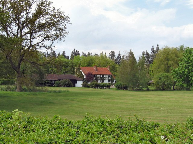
Beanfield Wood is a picturesque woodland located in Hertfordshire, England. Covering an area of approximately 50 acres, it is a captivating destination for nature lovers and outdoor enthusiasts alike. The wood is situated near the village of Beanfield, within close proximity to the town of Hertford.

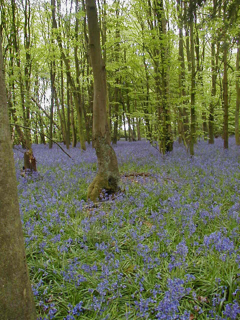
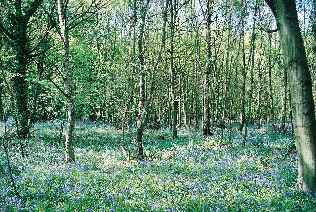
This woodland boasts a diverse range of flora and fauna, providing a haven for wildlife. The ancient woodland is predominantly made up of oak, beech, and birch trees, which create a dense canopy that allows dappled sunlight to filter through, giving the wood a magical and ethereal atmosphere.

Visitors to Beanfield Wood can enjoy a network of well-maintained trails, allowing for leisurely walks and exploration of the natural surroundings. These paths wind through the wood, leading visitors through a variety of habitats including wildflower meadows, wetland areas, and small ponds. The wood is known for its rich biodiversity, with a plethora of bird species, butterflies, and small mammals inhabiting the area.

Beanfield Wood is also home to several rare and protected species, including the great crested newt and the white admiral butterfly. Nature enthusiasts can spot these creatures in their natural habitat, making it an ideal destination for wildlife photographers and nature lovers.

In addition to its natural beauty, Beanfield Wood offers educational opportunities for schools and environmental organizations. It provides a platform for learning about woodland ecosystems, conservation efforts, and the importance of preserving natural habitats.

Overall, Beanfield Wood is a hidden gem in Hertfordshire, offering a tranquil escape for those seeking to reconnect with nature and explore the diverse flora and fauna of the region.

If you have any feedback on the listing, please let us know in the comments section below.

Beanfield Wood Images

Images are sourced within 2km of 51.833236/-0.1301331 or Grid Reference TL2816. Thanks to Geograph Open Source API. All images are credited.

Main Road, Bramfield
Looking towards Priest Wood, Bramfield
Main Road, Bramfield
Angry skies, Widow Bushes near Stapleford
Bramfield Village Looking north from the village church.
Bramfield Village
Looking north from the village church.
Bluebells in Row Wood
Hazeldell Wood Sally & I were out for a walk to celebrate Beltane and the arrival of Spring. The woods were beautiful. There was a carpet of bluebells in almost every one.
Hazeldell Wood
Sally & I were out for a walk to celebrate Beltane and the arrival of Spring. The woods were beautiful. There was a carpet of bluebells in almost every one.
Bramfield Shelter Built 2 June 1953 to commemorate Queen Elizabeth's Coronation it was originally the village well house.
Bramfield Shelter
Built 2 June 1953 to commemorate Queen Elizabeth's Coronation it was originally the village well house.
Bramfield Village Post Office A rare sight these days, a working, village post office and store.
Bramfield Village Post Office
A rare sight these days, a working, village post office and store.
The Horns Public House A nice Village Pub & Restaurant in Bull's Green
The Horns Public House
A nice Village Pub & Restaurant in Bull's Green
Bramfieldbury This house may be on the site of the dwelling-house said to have been built by Robert Ware, bursar of St. Albans, at Bramfield. It is generally called Bramfieldbury or Nancy Bury.
Bramfieldbury
This house may be on the site of the dwelling-house said to have been built by Robert Ware, bursar of St. Albans, at Bramfield. It is generally called Bramfieldbury or Nancy Bury.
Greenhill This house stands just to the south of Bramfield Woods.
It is the only house in this grid-square apart from the Lodge-house at the end of the drive.
Greenhill
This house stands just to the south of Bramfield Woods. It is the only house in this grid-square apart from the Lodge-house at the end of the drive.
Westend Farmland Farmland to the south of Bramfield.  The oak tree in the foreground has fully developed acorns.  Beyond the near boundary, the field has a new crop, possibly winter wheat, growing.   The small dot near the centre of the photo is a pair of joggers on the bridleway that cuts diagonally across the field.
Westend Farmland
Farmland to the south of Bramfield. The oak tree in the foreground has fully developed acorns. Beyond the near boundary, the field has a new crop, possibly winter wheat, growing. The small dot near the centre of the photo is a pair of joggers on the bridleway that cuts diagonally across the field.
Great Gobions Farm Entrance to the farm.  The track to the right is a public bridleway.
Great Gobions Farm
Entrance to the farm. The track to the right is a public bridleway.
Conservation Walks Marker Post marking the route and showing a map of a local conservation walk.  The section it is indicating does not appear as a footpath on the OS map.
Conservation Walks Marker
Post marking the route and showing a map of a local conservation walk. The section it is indicating does not appear as a footpath on the OS map.
Veteran Hornbeam Pollard along old green lane Veteran trees like this provide a really important wildlife habitat.
Veteran Hornbeam Pollard along old green lane
Veteran trees like this provide a really important wildlife habitat.
St Andrew, Bramfield, Herts
Show me another place!

Beanfield Wood is located at Grid Ref: TL2816 (Lat: 51.833236, Lng: -0.1301331)

Administrative County: Hertfordshire

District: East Hertfordshire

Police Authority: Hertfordshire

What 3 Words

///skills.fruit.tiles. Near Datchworth, Hertfordshire

Related Wikis

Bramfield, Hertfordshire

Bramfield is a village and civil parish in the East Hertfordshire district, in the county of Hertfordshire, England. Nearby settlements include Hertford...

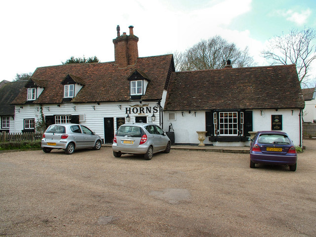
The Horns, Bull's Green

The Horns is a public house in Datchworth, Hertfordshire, England. It is situated on Bramfield Road in Bull's Green, a hamlet in the parish of Datchworth...

Stapleford railway station

Stapleford railway station was a station on the Hertford Loop Line, and was situated in the village of Stapleford, Hertfordshire, England. == History... ==

Tewin Orchard and Hopkyns Wood

Tewin Orchard and Hopkyns Wood is a 4.3-hectare (11-acre) nature reserve in Tewin in Hertfordshire. It is managed by the Herts and Middlesex Wildlife Trust...

Tewin

Tewin is an English village and civil parish in Hertfordshire, England between the towns of Welwyn Garden City, Stevenage, Welwyn (village) and the county...

Hopper's Hall

Hopper's Hall is a grade II listed house in Watton Road, Datchworth, Hertfordshire. It dates from around 1640 with minor additions and alterations since...

The Tilbury, Datchworth

The Tilbury is a public house and restaurant in Datchworth, Hertfordshire, England. It was formerly known as The Inn on the Green and The Three Horseshoes...

The White Horse, Burnham Green

The White Horse is a grade II listed public house in Whitehorse Lane, Burnham Green, in the parish of Datchworth in Hertfordshire. The building dates from...

Nearby Amenities

Located within 500m of 51.833236,-0.1301331
Power: pole
Lat/Long: 51.8300144/-0.133633
Power: pole
Lat/Long: 51.830026/-0.1323536
Power: pole
Lat/Long: 51.8300211/-0.1311868
Power: pole
Lat/Long: 51.8300111/-0.1292691
Power: pole
Lat/Long: 51.8299954/-0.1276276
Power: pole
Lat/Long: 51.8306526/-0.1261148
Power: pole
Lat/Long: 51.8318593/-0.1259565
Power: pole
Lat/Long: 51.8326599/-0.1254094
Power: pole
Lat/Long: 51.8336958/-0.1244491
Power: pole
Lat/Long: 51.8343323/-0.1242024
Power: pole
Lat/Long: 51.835335/-0.1237786
The data included in this document is from www.openstreetmap.org. The data is made available under ODbL.

Have you been to Beanfield Wood?

Leave your review of Beanfield Wood below (or comments, questions and feedback).