Basil's Park
Wood, Forest in Hertfordshire East Hertfordshire
England
Basil's Park

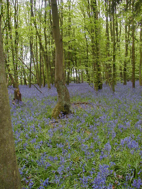
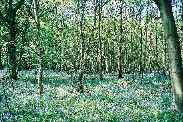
Basil's Park, located in Hertfordshire, England, is a magnificent wood or forest area that covers approximately 200 acres of land. It is a popular destination for nature enthusiasts, hikers, and families seeking outdoor activities.
The park is named after Basil, a prominent figure in the local community who played a significant role in its establishment. With its diverse range of flora and fauna, Basil's Park offers a serene and picturesque environment for visitors to explore and appreciate the beauty of nature.
The wood is primarily composed of native trees such as oak, beech, and birch, which create a dense canopy overhead, providing shade and shelter for various wildlife species. Visitors can witness a plethora of wildlife, including deer, squirrels, rabbits, and a variety of bird species, making it a haven for wildlife enthusiasts and birdwatchers.
Basil's Park offers a network of well-maintained walking trails, allowing visitors to immerse themselves in the tranquil surroundings and enjoy leisurely strolls or more challenging hikes. The park also houses picnic areas and benches strategically placed throughout, providing opportunities for relaxation and enjoying a meal amidst nature.
Moreover, the park management organizes educational programs and guided tours to educate visitors about the local ecosystem, emphasizing the importance of conservation and environmental sustainability.
Basil's Park, Hertfordshire is not only a haven for nature lovers but also a vital habitat for various wildlife species. Its breathtaking landscapes, diverse wildlife, and well-maintained trails make it an ideal destination for those seeking solace in nature and a break from the hustle and bustle of everyday life.
If you have any feedback on the listing, please let us know in the comments section below.
Basil's Park Images
Images are sourced within 2km of 51.83468/-0.13495019 or Grid Reference TL2816. Thanks to Geograph Open Source API. All images are credited.


Basil's Park is located at Grid Ref: TL2816 (Lat: 51.83468, Lng: -0.13495019)
Administrative County: Hertfordshire
District: East Hertfordshire
Police Authority: Hertfordshire
What 3 Words
///frosted.having.winks. Near Datchworth, Hertfordshire
Nearby Locations
Related Wikis

Bramfield, Hertfordshire
Bramfield is a village and civil parish in the East Hertfordshire district, in the county of Hertfordshire, England. Nearby settlements include Hertford...
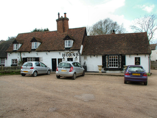
The Horns, Bull's Green
The Horns is a public house in Datchworth, Hertfordshire, England. It is situated on Bramfield Road in Bull's Green, a hamlet in the parish of Datchworth...

Tewin Orchard and Hopkyns Wood
Tewin Orchard and Hopkyns Wood is a 4.3-hectare (11-acre) nature reserve in Tewin in Hertfordshire. It is managed by the Herts and Middlesex Wildlife Trust...

Hopper's Hall
Hopper's Hall is a grade II listed house in Watton Road, Datchworth, Hertfordshire. It dates from around 1640 with minor additions and alterations since...

The Tilbury, Datchworth
The Tilbury is a public house and restaurant in Datchworth, Hertfordshire, England. It was formerly known as The Inn on the Green and The Three Horseshoes...

Stapleford railway station
Stapleford railway station was a station on the Hertford Loop Line, and was situated in the village of Stapleford, Hertfordshire, England. == History... ==

The White Horse, Burnham Green
The White Horse is a grade II listed public house in Whitehorse Lane, Burnham Green, in the parish of Datchworth in Hertfordshire. The building dates from...

Tewin
Tewin is an English village and civil parish in Hertfordshire, England between the towns of Welwyn Garden City, Stevenage, Welwyn (village) and the county...
Nearby Amenities
Located within 500m of 51.83468,-0.13495019Have you been to Basil's Park?
Leave your review of Basil's Park below (or comments, questions and feedback).