Summersvere Wood

Wood, Forest in Sussex Crawley

England

Summersvere Wood

Road by Three Bridges station The station at Three Bridges is on the London-Brighton line but this is also where trains heading off to Crawley or Horsham or the coast normally pass through. But I can see only one Bridge - where are the other two?
Road by Three Bridges station Credit: Nigel Freeman

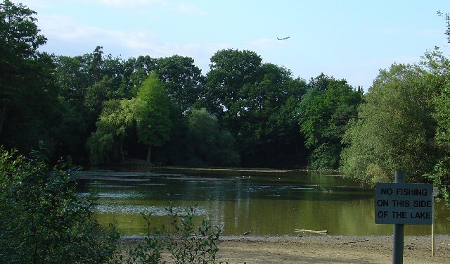
Summersvere Wood is a picturesque woodland located in Sussex, England. Covering an area of approximately 500 acres, it is known for its pristine beauty and diverse ecosystem. The wood is predominantly comprised of mature oak trees, which provide a dense canopy that filters sunlight, creating a cool and tranquil atmosphere.

The woodland is home to a wide variety of flora and fauna, making it a haven for nature enthusiasts and wildlife lovers. Bluebells carpet the forest floor during spring, creating a breathtaking sight for visitors. Other notable plant species include wild garlic, foxgloves, and wood anemones. These plants attract a rich array of wildlife, including deer, foxes, badgers, and a myriad of bird species.

Summersvere Wood is also renowned for its network of walking trails that wind through the forest, allowing visitors to explore its beauty at their own pace. These well-maintained paths offer stunning views of the surrounding countryside and are suitable for people of all ages and abilities.

The wood is managed by a local conservation organization, which ensures the preservation of its natural heritage. They conduct regular surveys to monitor the health of the woodland and implement sustainable practices to maintain its ecological balance.

Summersvere Wood is not only a place of natural beauty but also a vital habitat for wildlife and a cherished recreational space for the local community. Its serene ambiance and stunning landscapes make it a must-visit destination for anyone seeking a peaceful retreat into nature.

If you have any feedback on the listing, please let us know in the comments section below.

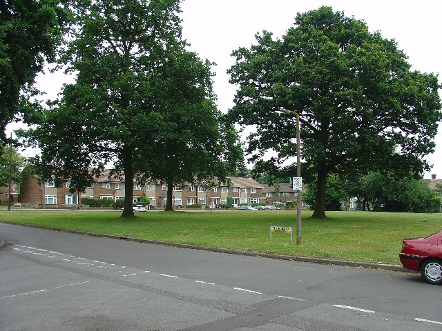
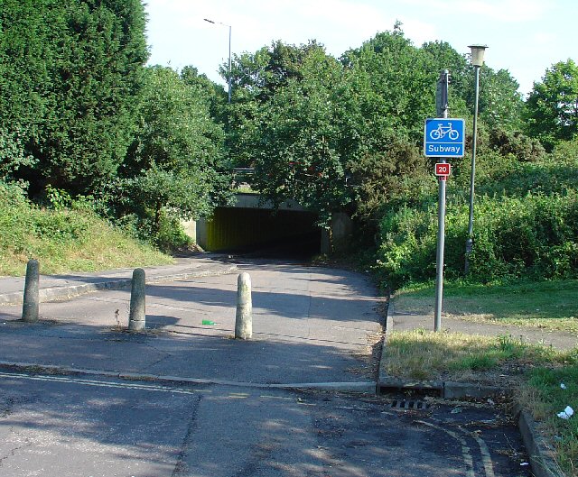
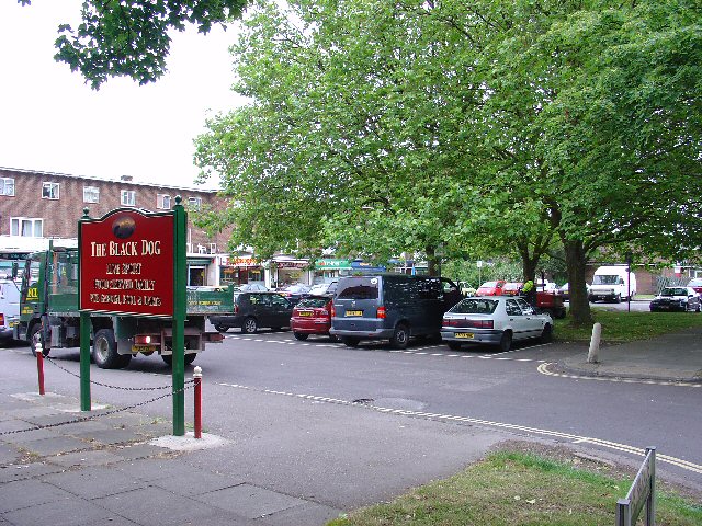
Summersvere Wood Images

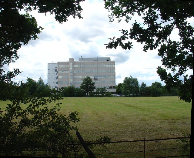
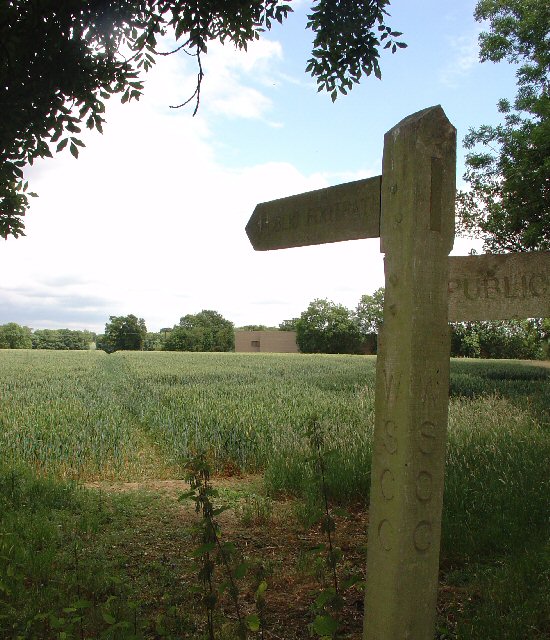
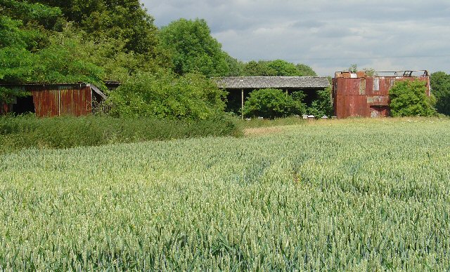
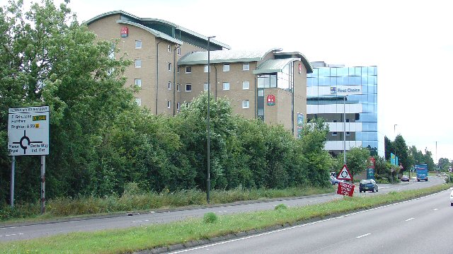
Images are sourced within 2km of 51.13206/-0.16249809 or Grid Reference TQ2838. Thanks to Geograph Open Source API. All images are credited.

Road by Three Bridges station The station at Three Bridges is on the London-Brighton line but this is also where trains heading off to Crawley or Horsham or the coast normally pass through. But I can see only one Bridge - where are the other two?
Road by Three Bridges station
The station at Three Bridges is on the London-Brighton line but this is also where trains heading off to Crawley or Horsham or the coast normally pass through. But I can see only one Bridge - where are the other two?
Gatwick Beehive Original 1930s Circular Airport Terminal. The airport was re-built approximately 1/2 mile to the north in the 1950s. The "Beehive" is now used as offices
Gatwick Beehive
Original 1930s Circular Airport Terminal. The airport was re-built approximately 1/2 mile to the north in the 1950s. The "Beehive" is now used as offices
Manor Royal Industrial Estate, Crawley, West Sussex - Lunch Time Manor Royal Industrial Estate dominates Grid square TQ2738. The industries are varied and include various types of light to medium weight engineering, pharmaceuticals, administrative head offices, storage, etc. The view here shows one of the many snack bars that are found at strategic points round the estate. Most of the larger premises include on-site catering for employees, but there are many small companies who don't.
Manor Royal Industrial Estate, Crawley, West Sussex - Lunch Time
Manor Royal Industrial Estate dominates Grid square TQ2738. The industries are varied and include various types of light to medium weight engineering, pharmaceuticals, administrative head offices, storage, etc. The view here shows one of the many snack bars that are found at strategic points round the estate. Most of the larger premises include on-site catering for employees, but there are many small companies who don't.
County Oak Retail Park, Crawley, West Sussex The largest of several small retail parks in Crawley that are situated away from the town centre. Carpets, Furniture, Consumer electronics and electrical items, Office supplies, motoring and cycling spares, pet supplies, and a motor vehicle tyre and exhaust replacement service are all represented.
County Oak Retail Park, Crawley, West Sussex
The largest of several small retail parks in Crawley that are situated away from the town centre. Carpets, Furniture, Consumer electronics and electrical items, Office supplies, motoring and cycling spares, pet supplies, and a motor vehicle tyre and exhaust replacement service are all represented.
Astral Towers, County Oak, Crawley, West Sussex The centre of Manor Royal industrial estate contains most of the light and medium industrial premises. Various clusters of administrative offices form satellites surrounding the main estate. One such satellite is at County Oak, just across the A23 trunk road from the main estate. A typical office block is Astral Towers.
Astral Towers, County Oak, Crawley, West Sussex
The centre of Manor Royal industrial estate contains most of the light and medium industrial premises. Various clusters of administrative offices form satellites surrounding the main estate. One such satellite is at County Oak, just across the A23 trunk road from the main estate. A typical office block is Astral Towers.
Pasture between Manor Royal Industrial Estate and Gatwick Airport, Near Crawley, West Sussex "The Atrium" office block in the background is on the extreme fringe of the Manor Royal Industrial Estate. The view has been taken from a public bridleway across a field, looking south. Most of this grid square is comprised of fields such as this. There are currently (2005) plans being discussed for a second runway for Gatwick Airport. One of the options would have the proposed runway in this area.
Pasture between Manor Royal Industrial Estate and Gatwick Airport, Near Crawley, West Sussex
"The Atrium" office block in the background is on the extreme fringe of the Manor Royal Industrial Estate. The view has been taken from a public bridleway across a field, looking south. Most of this grid square is comprised of fields such as this. There are currently (2005) plans being discussed for a second runway for Gatwick Airport. One of the options would have the proposed runway in this area.
Public Footpath across fields between County Oak and Rowley Farm, Near Crawley, West Sussex. One of several long standing public rights of way in this area. This path has been in use since long before the creation of the Manor Royal Industrial Estate, immediately behind the photographer and Gatwick Airport (1.5km N of here). The path cuts diagonally SW-NE across the fields, which are growing wheat. This area is currently (2005) being suggested as a possible location for a second runway for Gatwick International Airport.
Public Footpath across fields between County Oak and Rowley Farm, Near Crawley, West Sussex.
One of several long standing public rights of way in this area. This path has been in use since long before the creation of the Manor Royal Industrial Estate, immediately behind the photographer and Gatwick Airport (1.5km N of here). The path cuts diagonally SW-NE across the fields, which are growing wheat. This area is currently (2005) being suggested as a possible location for a second runway for Gatwick International Airport.
Farm buildings near Manor Royal Industrial Estate, Crawley, West Sussex These metal clad farm buildings are in various states of dilapidation, with the central barn still intact. A row of bee hives are set in front of the barn. Wheat is growing in the field. Photo taken (looking N) from the public footpath between County Oak and Rowley Farm, just after emerging out of the Manor Royal Industrial Estate.
Farm buildings near Manor Royal Industrial Estate, Crawley, West Sussex
These metal clad farm buildings are in various states of dilapidation, with the central barn still intact. A row of bee hives are set in front of the barn. Wheat is growing in the field. Photo taken (looking N) from the public footpath between County Oak and Rowley Farm, just after emerging out of the Manor Royal Industrial Estate.
Ibis Hotel, County Oak, Crawley West Sussex. A typical airport hotel, approximately 1.5km (straight line) from Gatwick airport. On the extreme N fringe of the Manor Royal industrial estate.
Ibis Hotel, County Oak, Crawley West Sussex.
A typical airport hotel, approximately 1.5km (straight line) from Gatwick airport. On the extreme N fringe of the Manor Royal industrial estate.
First Choice Holidays plc HQ, County Oak, Crawley, West Sussex The administrative headquarters of First Choice Holidays plc, a holiday company. This office block is situated in the extreme SW corner of the grid square and is on the north western edge of the Manor Royal industrial estate. Most of the square is farmland, with the A23 trunk road sweeping through the W edge and a few hotels adjacent to the road.
First Choice Holidays plc HQ, County Oak, Crawley, West Sussex
The administrative headquarters of First Choice Holidays plc, a holiday company. This office block is situated in the extreme SW corner of the grid square and is on the north western edge of the Manor Royal industrial estate. Most of the square is farmland, with the A23 trunk road sweeping through the W edge and a few hotels adjacent to the road.
Open Space in Residential Area of Three Bridges, Crawley, West Sussex A grass covered square open space with a number of oak trees. This grid square has a high proportion of residential usage and holds approximately half of the housing in the Three Bridges neighbourhood of Crawley. Such open spaces are common throughout the various Crawley neighbourhoods.
Open Space in Residential Area of Three Bridges, Crawley, West Sussex
A grass covered square open space with a number of oak trees. This grid square has a high proportion of residential usage and holds approximately half of the housing in the Three Bridges neighbourhood of Crawley. Such open spaces are common throughout the various Crawley neighbourhoods.
Tesco Superstore, Hazelwick Avenue, Crawley, West Sussex One of three major supermarkets in Crawley, the others being Asda (Southgate) and Sainsbury's (West Green).
Tesco Superstore, Hazelwick Avenue, Crawley, West Sussex
One of three major supermarkets in Crawley, the others being Asda (Southgate) and Sainsbury's (West Green).
Cycle Subway (on National Cycle Network Route 20) between Manor Royal Industrial Estate and Northgate, Crawley, West Sussex National Cycle Network route 20 passes through Crawley. Here we see where the cycle path is routed under the main Crawley dual carriageway inner bypass. NCN 20 is a route from London to Brighton.
Cycle Subway (on National Cycle Network Route 20) between Manor Royal Industrial Estate and Northgate, Crawley, West Sussex
National Cycle Network route 20 passes through Crawley. Here we see where the cycle path is routed under the main Crawley dual carriageway inner bypass. NCN 20 is a route from London to Brighton.
Northgate Shopping Parade, Crawley, West Sussex Shopping parade at the heart of the residential area of Northgate, which occupies most of this grid square. As is common with most of the neighbourhood parades in Crawley, the Northgate one includes its own pub (The Black Dog)
Northgate Shopping Parade, Crawley, West Sussex
Shopping parade at the heart of the residential area of Northgate, which occupies most of this grid square. As is common with most of the neighbourhood parades in Crawley, the Northgate one includes its own pub (The Black Dog)
Gatwick Road, Manor Royal Industrial Estate, Crawley, West Sussex The Manor Royal industrial estate is centred on TQ2738, but also spreads over about a third of this grid square. A feature here is the bridge over the main road linking two buildings belonging to the same organisation. The road building works are connected with the installation of the "Fastway" guided bus network throughout Crawley.
Gatwick Road, Manor Royal Industrial Estate, Crawley, West Sussex
The Manor Royal industrial estate is centred on TQ2738, but also spreads over about a third of this grid square. A feature here is the bridge over the main road linking two buildings belonging to the same organisation. The road building works are connected with the installation of the "Fastway" guided bus network throughout Crawley.
Milton Mount Lake, Pound Hill, Crawley, West Sussex Milton Mount Lake was once in the grounds of the Worth Park country estate. The estate was absorbed into the residential neighbourhood of Pound Hill and built upon. In the background, it is just possible to see an aircraft that has just taken off from Gatwick airport. The E end of the runway is 2km north of here. Aircraft taking off would not normally be seen from here, as they usually take off into the West (against the prevailing wind). The wind on this day was from the east.
Milton Mount Lake, Pound Hill, Crawley, West Sussex
Milton Mount Lake was once in the grounds of the Worth Park country estate. The estate was absorbed into the residential neighbourhood of Pound Hill and built upon. In the background, it is just possible to see an aircraft that has just taken off from Gatwick airport. The E end of the runway is 2km north of here. Aircraft taking off would not normally be seen from here, as they usually take off into the West (against the prevailing wind). The wind on this day was from the east.
Radar, Tinsley Green, Crawley, West Sussex A Radar adjacent to Gatwick airport.
Radar, Tinsley Green, Crawley, West Sussex
A Radar adjacent to Gatwick airport.
Old Stable Block of Worth Park House, Milton Mount, Pound Hill, Crawley, West Sussex This is the old Victoria Stable block of Worth Park House. There is a carved plaque on the wall with the date 1882. The original Worth Park House was demolished and the site is now Milton Mount Gardens, but this stable block remains.
Old Stable Block of Worth Park House, Milton Mount, Pound Hill, Crawley, West Sussex
This is the old Victoria Stable block of Worth Park House. There is a carved plaque on the wall with the date 1882. The original Worth Park House was demolished and the site is now Milton Mount Gardens, but this stable block remains.
Show me another place!

Summersvere Wood is located at Grid Ref: TQ2838 (Lat: 51.13206, Lng: -0.16249809)

Administrative County: West Sussex

District: Crawley

Police Authority: Sussex

What 3 Words

///influencing.loving.vine. Near Crawley, West Sussex

Nearby Locations

Summersvere Wood

Related Wikis

Oakwood F.C.

Oakwood Football Club are a football club based in Crawley, England. They were established in 1962 and joined the Sussex County League Division Three in...

Forest Row F.C.

Forest Row Football Club is a football club based in Forest Row in East Sussex, England. They are currently members of the Southern Combination Division...

Grattons Park

Grattons Park is a 7.7-hectare (19-acre) Local Nature Reserve in Crawley in West Sussex, England. It is owned by Crawley Borough Council and managed by...

The Gatwick School

The Gatwick School is an all-through free school located on the Manor Royal estate, on the northern outskirts of Crawley, just south of the Gatwick Airport...

Nearby Amenities

Located within 500m of 51.13206,-0.16249809
Created By: Potlatch 0.10b
Power: tower
Lat/Long: 51.131843/-0.1586977
Created By: Potlatch 0.10b
Power: tower
Lat/Long: 51.1312667/-0.1618992
Created By: Potlatch 0.10b
Power: tower
Lat/Long: 51.1285574/-0.1617275
Post Box
Brand: Royal Mail
Brand Wikidata: Q638098
Brand Wikipedia: en:Royal Mail
Operator: Royal Mail
Operator Wikidata: Q638098
Ref: RH10 65
Royal Cypher: yes
Lat/Long: 51.1321754/-0.1659677
Crossing
Crossing: traffic_signals
Crossing Ref: puffin
Kerb: flush
Tactile Paving: yes
Lat/Long: 51.1346634/-0.1667249
Bus Stop
Fleming Way East
Bus: yes
Naptan AtcoCode: 4400CY0088
Naptan Bearing: W
Naptan CommonName: Fleming Way East
Naptan Indicator: opp Priestley Way
Naptan Landmark: Priestley Way
Naptan NaptanCode: wsxajpjw
Naptan PlusbusZoneRef: CRAWLEY
Naptan Street: Fleming Way
Naptan Verified: no
Public Transport: platform
Source: naptan_import
Lat/Long: 51.1352575/-0.1674135
Bus Stop
Gatwick Road Central
Bench: yes
Bus: yes
Naptan AtcoCode: 4400CY0399
Naptan Bearing: SW
Naptan CommonName: Gatwick Road Central
Naptan Indicator: adj Northwood Park
Naptan Landmark: Tinsley Lane
Naptan NaptanCode: wsxamjtj
Naptan PlusbusZoneRef: CRAWLEY
Naptan Street: Gatwick Road
Naptan Verified: yes
Public Transport: platform
Shelter: yes
Source: naptan_import
Lat/Long: 51.1331626/-0.1676011
Bus Stop
Gatwick Road Central
Bus: yes
Naptan AtcoCode: 4400CY0400
Naptan Bearing: NE
Naptan CommonName: Gatwick Road Central
Naptan Indicator: opposite Northwood Park
Naptan Landmark: Tinsley Lane
Naptan NaptanCode: wsxamjtm
Naptan PlusbusZoneRef: CRAWLEY
Naptan Street: Gatwick Road
Naptan Verified: no
Public Transport: platform
Source: naptan_import
Lat/Long: 51.1328331/-0.1680339
Crossing
Crossing: traffic_signals
Crossing Ref: puffin
Kerb: flush
Tactile Paving: yes
Lat/Long: 51.1351245/-0.1666599
Railway: switch
Lat/Long: 51.1362864/-0.1610112
Railway: switch
Lat/Long: 51.1308962/-0.1609415
Railway: switch
Lat/Long: 51.132178/-0.1610112
Railway: switch
Lat/Long: 51.1306605/-0.1610219
Railway: switch
Lat/Long: 51.1317798/-0.1610139
Railway: switch
Lat/Long: 51.1311186/-0.1609361
Railway: switch
Lat/Long: 51.1329463/-0.1611051
Railway: switch
Lat/Long: 51.1303553/-0.1608851
Railway: switch
Lat/Long: 51.1327847/-0.1610997
Railway: switch
Lat/Long: 51.134123/-0.1610863
Railway: switch
Lat/Long: 51.1334247/-0.1611024
Crossing
Crossing: traffic_signals
Crossing Ref: puffin
Kerb: flush
Tactile Paving: yes
Lat/Long: 51.1351348/-0.1668679
Power: tower
Lat/Long: 51.1323263/-0.1558669
South East Coast Ambulance Service HQ
Addr City: crawley
Addr Housename: Nexus House
Addr Housenumber: 4
Addr Postcode: RH10 9BG
Addr Street: Gatwick Road
Government: healthcare
Office: government
Opening Hours: 24/7
Lat/Long: 51.1326214/-0.1686791
Barrier: lift_gate
Lat/Long: 51.1349052/-0.1680083
Traffic Signals
Direction: forward
Lat/Long: 51.131419/-0.1689997
Barrier: bollard
Lat/Long: 51.1310312/-0.1692628
Washout Hydrant
Fire Hydrant
Emergency: fire_hydrant
Fire Hydrant Type: underground
Survey Date: 2018-11-11
Water Source: main
Lat/Long: 51.1315555/-0.1645028
Crossing
Crossing: unmarked
Crossing Markings: no
Tactile Paving: yes
Lat/Long: 51.1353491/-0.1672636
Post Box
Brand: Royal Mail
Brand Wikidata: Q638098
Brand Wikipedia: en:Royal Mail
Collection Times: Mo-Fr 18:00; Sa 11:00
Operator: Royal Mail
Operator Wikidata: Q638098
Post Box Type: meter
Ref: RH10 161P
Royal Cypher: no
Lat/Long: 51.1347996/-0.1674007
Post Box
Brand: Royal Mail
Brand Wikidata: Q638098
Brand Wikipedia: en:Royal Mail
Collection Times: Mo-Fr 17:45; Sa 11:00
Operator: Royal Mail
Operator Wikidata: Q638098
Post Box Type: pillar
Ref: RH10 162
Royal Cypher: EIIR
Royal Cypher Wikidata: Q33102113
Lat/Long: 51.1347987/-0.1673672
Crossing
Crossing: traffic_signals
Crossing Ref: puffin
Kerb: flush
Tactile Paving: yes
Lat/Long: 51.1344773/-0.166663
Traffic Signals
Traffic Signals: signal
Traffic Signals Direction: forward
Lat/Long: 51.1349858/-0.1661633
Access: private
Barrier: lift_gate
Lat/Long: 51.132503/-0.1690355
Traffic Signals
Direction: backward
Lat/Long: 51.1314828/-0.1689408
Crossing
Crossing: traffic_signals
Crossing Ref: puffin
Lat/Long: 51.1314518/-0.1689694
Marshall Toyota Gatwick
Brand: Toyota
Shop: car_repair;car
Lat/Long: 51.134709/-0.1652181
Volvo Sales
Brand: Volvo
Brand Wikidata: Q215293
Shop: car
Lat/Long: 51.1308543/-0.1687606
Leisure: fishing
Lat/Long: 51.1333178/-0.1595785
Leisure: fishing
Lat/Long: 51.1336829/-0.159973
Leisure: fishing
Lat/Long: 51.1337691/-0.1601617
Leisure: fishing
Lat/Long: 51.1330927/-0.1593642
Addr Flats: 7-12
Addr Postcode: RH10 2AF
Entrance: yes
Lat/Long: 51.1343312/-0.1588251
Addr Flats: 1-6
Addr Postcode: RH10 2AF
Entrance: yes
Lat/Long: 51.1344684/-0.1591546
Addr Flats: 13-18
Addr Postcode: RH10 2AG
Entrance: yes
Lat/Long: 51.1341488/-0.1588254
Addr Flats: 19-24
Addr Postcode: RH10 2AG
Entrance: yes
Lat/Long: 51.1340037/-0.158832
Addr Flats: 25-27
Addr Postcode: RH10 2AG
Entrance: yes
Lat/Long: 51.1339332/-0.1588351
Addr Flats: 13-18
Addr Postcode: RH10 2AG
Entrance: yes
Lat/Long: 51.1341536/-0.1589954
Addr Flats: 19-24
Addr Postcode: RH10 2AG
Entrance: yes
Lat/Long: 51.1340173/-0.1590015
Addr Flats: 25-27
Addr Postcode: RH10 2AG
Entrance: yes
Lat/Long: 51.1339361/-0.1590052
Addr Flats: 1-6
Addr Postcode: RH10 2AF
Entrance: yes
Lat/Long: 51.1343765/-0.1592282
Entrance: yes
Lat/Long: 51.133716/-0.1588529
Entrance: yes
Lat/Long: 51.1337177/-0.1589938
Addr Flats: 1-6
Entrance: staircase
Lat/Long: 51.1355718/-0.1580413
Addr Flats: 1-6
Entrance: staircase
Lat/Long: 51.1354945/-0.1579801
Addr Flats: 7-12
Entrance: staircase
Lat/Long: 51.1354506/-0.1580698
Addr Flats: 7-12
Entrance: staircase
Lat/Long: 51.1353162/-0.1576947
Addr Flats: 1-6
Entrance: staircase
Lat/Long: 51.1352442/-0.1579597
Addr Flats: 1-6
Entrance: staircase
Lat/Long: 51.1351682/-0.1579012
Addr Flats: 7-12
Entrance: staircase
Lat/Long: 51.1352331/-0.1576519
Addr Flats: 7-12
Entrance: staircase
Lat/Long: 51.1350456/-0.157512
Addr Flats: 1-6
Entrance: staircase
Lat/Long: 51.1349724/-0.1577634
Addr Flats: 1-6
Entrance: staircase
Lat/Long: 51.1349029/-0.1577184
Addr Flats: 7-12
Entrance: staircase
Lat/Long: 51.1354245/-0.158203
Addr Flats: 7-12
Entrance: staircase
Lat/Long: 51.1357665/-0.1584442
Bench
Lat/Long: 51.1355991/-0.1600896
Bench
Lat/Long: 51.1356202/-0.160055
Bench
Lat/Long: 51.1356195/-0.1599869
Bench
Lat/Long: 51.1355998/-0.1599564
Bench
Lat/Long: 51.1355494/-0.1599473
Bench
Lat/Long: 51.1355309/-0.1599788
Bench
Lat/Long: 51.1355271/-0.160058
Bench
Lat/Long: 51.1355488/-0.1600896
Addr Flats: 9-16
Entrance: staircase
Lat/Long: 51.1288699/-0.1670512
Addr Flats: 1-8
Entrance: staircase
Lat/Long: 51.1288892/-0.1672952
Addr Flats: 17-24
Entrance: staircase
Lat/Long: 51.1289745/-0.1670778
Entrance: yes
Lat/Long: 51.1289387/-0.1661522
The data included in this document is from www.openstreetmap.org. The data is made available under ODbL.

Have you been to Summersvere Wood?

Leave your review of Summersvere Wood below (or comments, questions and feedback).