Ash Wood

Wood, Forest in Middlesex

England

Ash Wood

Enfield Greenway This walking and cycling track follows the route of the London Loop from The Ridgeway towards Hadley Wood.  As part of the Greenway project, thousands of saplings have been planted along the way.
Enfield Greenway Credit: Mark Percy

Ash Wood is a small woodland area located in Middlesex, England. Nestled within the larger region of Middlesex, Ash Wood covers an area of approximately 20 acres. The wood is primarily composed of ash trees, hence its name, but it also features a diverse range of other tree species such as oak, beech, and birch.

The wood is known for its serene and tranquil atmosphere, making it a popular destination for nature enthusiasts and hikers. The dense foliage creates a shady canopy that provides relief from the sun during the summer months. This, combined with the melodic sounds of birds and the gentle rustling of leaves, makes Ash Wood an idyllic spot for relaxation and contemplation.

The wood is home to a variety of wildlife, including small mammals such as squirrels, rabbits, and hedgehogs. It is also a haven for a wide range of bird species, including woodpeckers, owls, and thrushes. Nature lovers can often spot these creatures while walking along the well-maintained paths that wind through the wood.

Ash Wood is easily accessible and is located just a short distance from the town of Middlesex. Visitors can reach the wood by car or public transportation, with several parking areas available nearby. The wood is open to the public year-round and offers a peaceful retreat from the hustle and bustle of everyday life.

If you have any feedback on the listing, please let us know in the comments section below.
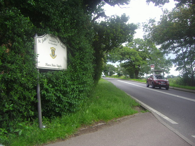
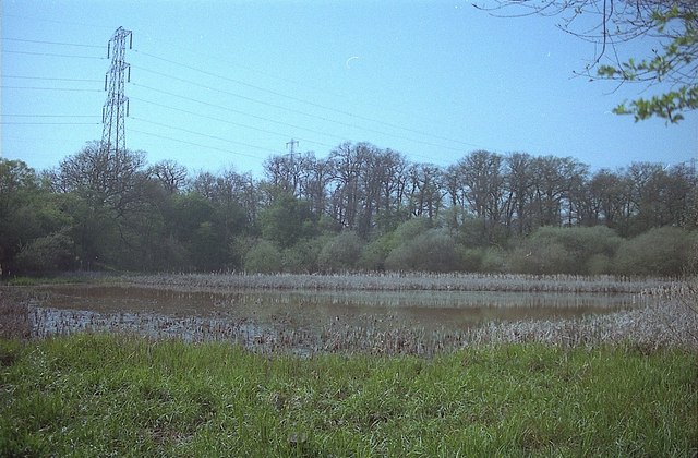
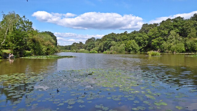
Ash Wood Images

Images are sourced within 2km of 51.669571/-0.14495016 or Grid Reference TQ2898. Thanks to Geograph Open Source API. All images are credited.

Enfield Greenway This walking and cycling track follows the route of the London Loop from The Ridgeway towards Hadley Wood.  As part of the Greenway project, thousands of saplings have been planted along the way.
Enfield Greenway
This walking and cycling track follows the route of the London Loop from The Ridgeway towards Hadley Wood. As part of the Greenway project, thousands of saplings have been planted along the way.
Trent Park Woods Looking North The landscape looks like anywhere in middle England but is inside the M25 motorway in the London Borough of Enfield. In the gap on the horizon between the trees about a third in from the right is the Ridgeway, the road linking Enfield to Potters Bar. The grass in the field had just been mown and baled away. It was a baking June day and I can almost smell the hot cut grass in the photo.
Trent Park Woods Looking North
The landscape looks like anywhere in middle England but is inside the M25 motorway in the London Borough of Enfield. In the gap on the horizon between the trees about a third in from the right is the Ridgeway, the road linking Enfield to Potters Bar. The grass in the field had just been mown and baled away. It was a baking June day and I can almost smell the hot cut grass in the photo.
Holly Hill Farm, The Ridgeway, Enfield Holly Hill Farm on an open day with the M25 in the background.
Holly Hill Farm, The Ridgeway, Enfield
Holly Hill Farm on an open day with the M25 in the background.
Fields south of the M25 near North Lodge Farm
Buildings at Holly Hill Farm There doesn't seem to be a working farm as such here. There is a dog training centre and a waste disposal company based here.
Buildings at Holly Hill Farm
There doesn't seem to be a working farm as such here. There is a dog training centre and a waste disposal company based here.
Out house at Holly Hill Farm Note the Goodyear airship in the sky above.
Out house at Holly Hill Farm
Note the Goodyear airship in the sky above.
The entrance to St John's preparatory school, The Ridgeway
Wetland at Pond Wood near Potters Bar Part of a nature reserve managed by the Herts and Middlesex Wildlife Trust <span class="nowrap"><a title="http://www.hertswildlifetrust.org.uk/NatureReserves/Local/firpondwood" rel="nofollow ugc noopener" href="http://www.hertswildlifetrust.org.uk/NatureReserves/Local/firpondwood">Link</a><img style="margin-left:2px;" alt="External link" title="External link - shift click to open in new window" src="https://s1.geograph.org.uk/img/external.png" width="10" height="10"/></span>.
Wetland at Pond Wood near Potters Bar
Part of a nature reserve managed by the Herts and Middlesex Wildlife Trust LinkExternal link.
M25 anticlockwise, Electricity Transmission Lines
M25 heading west At distance marker M25 B 140.4. The B appears to denote the inner carriageway, the number the distance in km measured clockwise from the zero datum, which is curiously not on the M25, but some point (the Thurrock/Kent border?) on the A282 connection under and over the Thames between the ends of the M25.
M25 heading west
At distance marker M25 B 140.4. The B appears to denote the inner carriageway, the number the distance in km measured clockwise from the zero datum, which is curiously not on the M25, but some point (the Thurrock/Kent border?) on the A282 connection under and over the Thames between the ends of the M25.
Heading south on Cockfosters Road at the junction with Chalk Lane
Cockfosters Service Station on Cockfosters Road, heading south
On Stagg Hill approaching the start of Cockfosters Road, heading south
Going under powerlines on the A111, heading north
Jack's Lake, Monken Hadley Common Maps describe it as Beech Hill Lake, but all the local signage refers to Jack's Lake.
Jack's Lake, Monken Hadley Common
Maps describe it as Beech Hill Lake, but all the local signage refers to Jack's Lake.
Cockfosters Cricket Club Cockfosters Cricket Club was founded in 1873.
Cockfosters Cricket Club
Cockfosters Cricket Club was founded in 1873.
Monken Hadley Common The display board and map welcomes visitors at the eastern entrance to the common.

The Common is a remnant of the former Royal Forest of Enfield Chase, which was enclosed by an Act of Parliament of 1777.  A small part was allotted to the village of Monken Hadley.  It's the only land which has remained as a common. Until the 1950s the commoners exercised their rights to use the land for grazing.
Monken Hadley Common
The display board and map welcomes visitors at the eastern entrance to the common. The Common is a remnant of the former Royal Forest of Enfield Chase, which was enclosed by an Act of Parliament of 1777. A small part was allotted to the village of Monken Hadley. It's the only land which has remained as a common. Until the 1950s the commoners exercised their rights to use the land for grazing.
Trent Park According to an inscription on the monument, work on the gardens began in 1700.
Trent Park
According to an inscription on the monument, work on the gardens began in 1700.
Show me another place!

Ash Wood is located at Grid Ref: TQ2898 (Lat: 51.669571, Lng: -0.14495016)

Unitary Authority: Enfield

Police Authority: Metropolitan

What 3 Words

///jeeps.brings.spoil. Near Hadley Wood, London

Related Wikis

Trent Park

Trent Park is an English country house, together with its former extensive grounds, in north London. The original great house and a number of statues and...

Cockfosters Water Tower

The Cockfosters Water Tower is a water tower in Cockfosters Road, north London, on the edge of Trent Park, that is known for its hyperboloid structure...

Beech Hill Park

Beech Hill Park is a Grade II listed building off Beech Hill in Hadley Wood, North London, that is used today as the club house of Hadley Wood Golf Course...

Hadley Wood Golf Course

Hadley Wood Golf Course is a golf course in Hadley Wood, in the London Borough of Enfield. The course opened in 1922 in the grounds of Beech Hill Park...

Nearby Amenities

Located within 500m of 51.669571,-0.14495016
George Grey's Obelisk
Historic: monument
Inscription: To the memory of the birth of George Grey, Earl of Harold, son of Henry and Sophia, Duke and Duchess of Kent.
Wikidata: Q27085621
Lat/Long: 51.6665265/-0.1425318
Barrier: cycle_barrier
Bicycle: yes
Description: Chicane barrier. Challenging for tandems, trailers, wide or three wheeler bicycles
Lat/Long: 51.6677154/-0.1419841
Camlet Moat
Historic: archaeological_site
Lat/Long: 51.6676416/-0.1388408
Cafe
Ferny Hill Tea Rooms
Addr City: Barnet
Addr Postcode: EN4 0PZ
Addr Street: Ferny Hill
Lat/Long: 51.6666747/-0.1484495
Bench
Material: wood
Lat/Long: 51.6726529/-0.1451825
Fixme: add fences and gates
Lat/Long: 51.6676929/-0.1388529
Barrier: kissing_gate
Lat/Long: 51.6654187/-0.1446086
Crossing
Crossing: unmarked
Crossing Island: yes
Crossing Markings: no
Tactile Paving: no
Traffic Calming: table
Lat/Long: 51.6676334/-0.1418983
Enfield Chase
Hiking: yes
Information: guidepost
Tourism: information
Lat/Long: 51.672635/-0.145302
Enfield Chase Woodland Restoration
Bicycle: yes
Hiking: yes
Information: map
Map Size: site
Map Type: scheme
Tourism: information
Lat/Long: 51.6676895/-0.1433989
Bench
Lat/Long: 51.6664996/-0.1424991
The data included in this document is from www.openstreetmap.org. The data is made available under ODbL.

Have you been to Ash Wood?

Leave your review of Ash Wood below (or comments, questions and feedback).