New Plantation

Wood, Forest in Lincolnshire East Lindsey

England

New Plantation

Direction Sign – Signpost on Bluestone Heath Road in Donington on Bain parish Located in Donington on Bain parish on the southwest side of the crossroads on Bluestone Heath Road between Welsdale Bottom and North Farm. 4 arms and no finial. See also <a title="https://www.geograph.org.uk/photo/619423," href="https://www.geograph.org.uk/photo/619423,">Link</a> <a title="https://www.geograph.org.uk/photo/4818741" href="https://www.geograph.org.uk/photo/4818741">Link</a> and <a title="https://www.geograph.org.uk/photo/3818447" href="https://www.geograph.org.uk/photo/3818447">Link</a>.

Milestone Society National ID: LI_TF2584
Direction Sign – Signpost on Bluestone Heath Road in Donington on Bain parish Credit: A Riley

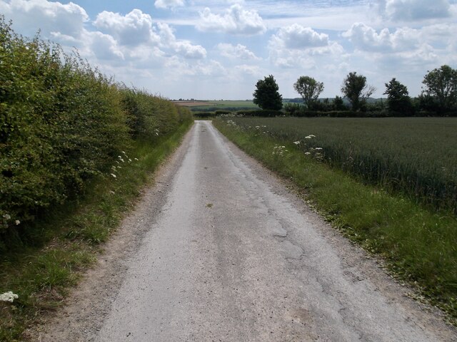
New Plantation, located in Lincolnshire, is a picturesque woodland area known for its natural beauty and serene surroundings. The plantation is situated on the outskirts of the town of Lincoln, making it easily accessible for both locals and visitors alike.

Covering a vast area, New Plantation is home to a diverse range of plant species, creating a rich and vibrant ecosystem. The woodland is predominantly composed of mature trees, including oak, ash, and birch, which provide a stunning canopy and offer shelter to a variety of wildlife.

Visitors to New Plantation can enjoy a peaceful retreat from the hustle and bustle of daily life. The well-maintained pathways meander through the woods, allowing for leisurely walks and providing ample opportunities for birdwatching and wildlife spotting. The tranquil atmosphere of the plantation makes it an ideal spot for nature lovers, photographers, and those seeking a moment of solitude.

The management of New Plantation is dedicated to preserving the natural habitat and ensuring the protection of the wildlife that call it home. They organize regular conservation initiatives and educational programs to raise awareness about the importance of biodiversity and sustainable practices.

For those looking for more adventurous activities, New Plantation also offers opportunities for cycling and horseback riding. The designated trails provide a safe and enjoyable experience for outdoor enthusiasts of all ages.

In conclusion, New Plantation in Lincolnshire is a captivating woodland area that offers a peaceful retreat, abundant wildlife, and recreational activities for visitors. It is a haven for nature enthusiasts and a place where one can immerse themselves in the beauty of the natural world.

If you have any feedback on the listing, please let us know in the comments section below.

New Plantation Images

Images are sourced within 2km of 53.339261/-0.084039628 or Grid Reference TF2784. Thanks to Geograph Open Source API. All images are credited.

Direction Sign – Signpost on Bluestone Heath Road in Donington on Bain parish Located in Donington on Bain parish on the southwest side of the crossroads on Bluestone Heath Road between Welsdale Bottom and North Farm. 4 arms and no finial. See also <a title="https://www.geograph.org.uk/photo/619423," href="https://www.geograph.org.uk/photo/619423,">Link</a> <a title="https://www.geograph.org.uk/photo/4818741" href="https://www.geograph.org.uk/photo/4818741">Link</a> and <a title="https://www.geograph.org.uk/photo/3818447" href="https://www.geograph.org.uk/photo/3818447">Link</a>.

Milestone Society National ID: LI_TF2584
Direction Sign – Signpost on Bluestone Heath Road in Donington on Bain parish
Located in Donington on Bain parish on the southwest side of the crossroads on Bluestone Heath Road between Welsdale Bottom and North Farm. 4 arms and no finial. See also Link Link and Link. Milestone Society National ID: LI_TF2584
Disused Louth-Bardney line and tunnel's end near Withcall: aerial 2022 See <a href="https://www.geograph.org.uk/photo/7166507">TF2682 : Red soil and tunnel's end on the Stenigot Estate: aerial 2022</a> for the site of the other end of the tunnel.
Disused Louth-Bardney line and tunnel's end near Withcall: aerial 2022
See TF2682 : Red soil and tunnel's end on the Stenigot Estate: aerial 2022 for the site of the other end of the tunnel.
South Farm, near Raithby: aerial 2022
Bridleway near Hallington Top
Hallington Top The buildings on the 1;25000 map disappear at larger scale and this is what remains or has replaced them.
Hallington Top
The buildings on the 1;25000 map disappear at larger scale and this is what remains or has replaced them.
Dendritic soilmarks west of Hallington: aerial 2023 (1)
Dendritic soilmarks near Poke Holes: aerial (2)
Shrunken Medieval Village of Withcall: aerial 2023  See: <span class="nowrap"><a title="https://www.heritagegateway.org.uk/Gateway/Results_Single.aspx?uid=MLI40813&resourceID=1006" rel="nofollow ugc noopener" href="https://www.heritagegateway.org.uk/Gateway/Results_Single.aspx?uid=MLI40813&resourceID=1006">Link</a><img style="margin-left:2px;" alt="External link" title="External link - shift click to open in new window" src="https://s1.geograph.org.uk/img/external.png" width="10" height="10"/></span>
Shrunken Medieval Village of Withcall: aerial 2023
See: LinkExternal link
Sugar beet near Hallington
Stubble field near North Farm
Shelter belt, North Farm
From Hallington Top to Welton le Wold: aerial 2015 Shallow valley, with a disused pit in the trees at the bottom. Valley leads to Glebe Farm.
From Hallington Top to Welton le Wold: aerial 2015
Shallow valley, with a disused pit in the trees at the bottom. Valley leads to Glebe Farm.
Public bridleway sign
Heading West from Hallington
The hamlet of North Farm
North Farm
North Farm
Foul muddy track
Foul muddy track
A fine signpost at the crossroads
Show me another place!

New Plantation is located at Grid Ref: TF2784 (Lat: 53.339261, Lng: -0.084039628)

Administrative County: Lincolnshire

District: East Lindsey

Police Authority: Lincolnshire

What 3 Words

///loudness.poppy.chimp. Near Louth, Lincolnshire

Nearby Locations

New Plantation

Related Wikis

Withcall

Withcall is a small farming village and civil parish in the East Lindsey district of Lincolnshire, England. It lies within the Lincolnshire Wolds, and...

Withcall railway station

Withcall railway station was a station in Withcall, Lincolnshire, England. == History == The Great Northern Railway planned and built a branch line from...

Lincolnshire Wolds

The Lincolnshire Wolds are a range of low hills in the county of Lincolnshire, England which run roughly parallel with the North Sea coast, from the Humber...

RAF Stenigot

RAF Stenigot is a former Second World War radar station situated at Stenigot, near Donington on Bain, Lincolnshire. == Second World War == It was built...

Welton Le Wold

Welton le Wold is a village and civil parish in the East Lindsey district of Lincolnshire, England. It is situated approximately 4 miles (6 km) west of...

Hallington railway station

Hallington railway station was a station in Hallington, Lincolnshire. == History == The Great Northern Railway planned and built a branch line from Bardney...

Hallington

Hallington is a small village and civil parish in the East Lindsey district of Lincolnshire, England. It is situated 2 miles (3 km) south-west from the...

Maltby Preceptory

Maltby Preceptory was a house of the Knights Hospitaller in the village of Maltby, Lincolnshire, England. There are two differing accounts regarding its...

Nearby Amenities

Located within 500m of 53.339261,-0.084039628
Bus Stop
Village Lane End
Naptan AtcoCode: 270000014403
Naptan Bearing: SW
Naptan CommonName: Village Lane End
Naptan Indicator: adj
Naptan Landmark: Village Lane End
Naptan NaptanCode: linjpmjd
Naptan Street: Withcall
Naptan Verified: no
Source: naptan_import
Lat/Long: 53.3383848/-0.0797738
Bus Stop
Village Lane End
Naptan AtcoCode: 270000014404
Naptan Bearing: NE
Naptan CommonName: Village Lane End
Naptan Indicator: opp
Naptan Landmark: Village Lane End
Naptan NaptanCode: linjpmjg
Naptan Street: Withcall
Naptan Verified: no
Source: naptan_import
Lat/Long: 53.3384317/-0.0798426
The data included in this document is from www.openstreetmap.org. The data is made available under ODbL.

Have you been to New Plantation?

Leave your review of New Plantation below (or comments, questions and feedback).