Brooches Wood

Wood, Forest in Hertfordshire North Hertfordshire

England

Brooches Wood

Stonesley and Harbourclose Woods, near Graveley Stonesley wood is in the distance, with Harbourclose Wood to the right
Stonesley and Harbourclose Woods, near Graveley Credit: Paul Dixon

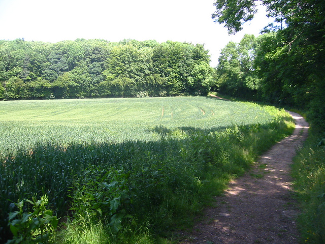
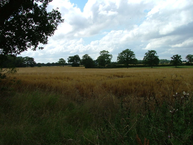
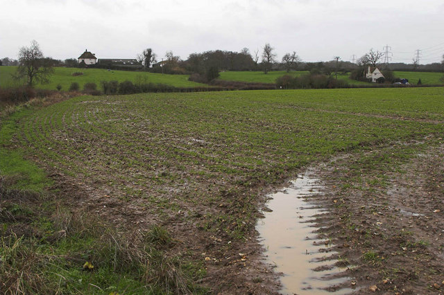
Brooches Wood is a small forest located in the county of Hertfordshire, England. It covers an area of approximately 10 acres and is nestled in the countryside, surrounded by rolling hills and picturesque landscapes. The wood is primarily composed of deciduous trees, with oak, beech, and ash being the dominant species.

The woodland is known for its tranquil and serene atmosphere, offering visitors a peaceful retreat from the hustle and bustle of everyday life. It is a popular destination for nature enthusiasts, hikers, and birdwatchers, as it is home to a diverse range of wildlife.

Walking trails wind their way through the wood, allowing visitors to explore and discover its hidden gems. The forest floor is carpeted with wildflowers during the spring and summer months, creating a vibrant and colorful display.

Brooches Wood is also of historical interest, with evidence of human habitation dating back to the Iron Age. Archaeological finds have included pottery fragments, tools, and burial sites, providing insights into the lives of past civilizations.

The wood is managed and maintained by the local authorities, who ensure its preservation and protection. They organize educational programs and events to raise awareness about the importance of conservation and to encourage visitors to appreciate and respect the natural environment.

Overall, Brooches Wood is a cherished natural asset in Hertfordshire, offering visitors a chance to connect with nature, learn about history, and enjoy the beauty of the forest.

If you have any feedback on the listing, please let us know in the comments section below.

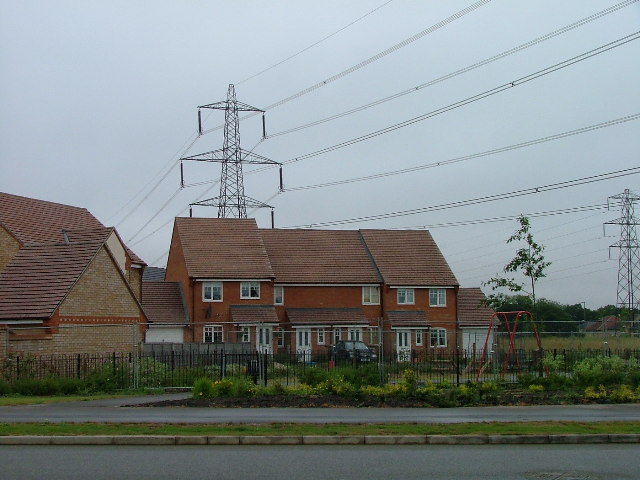
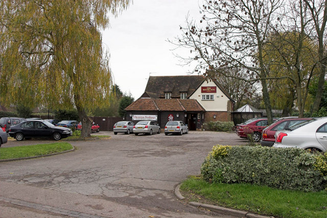
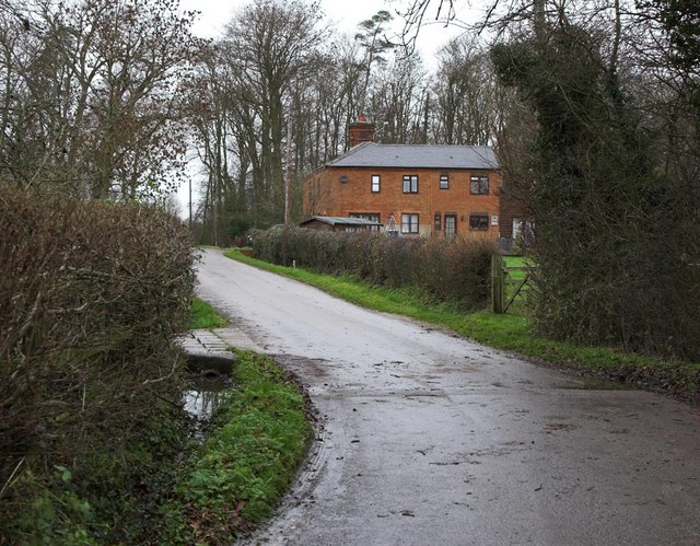
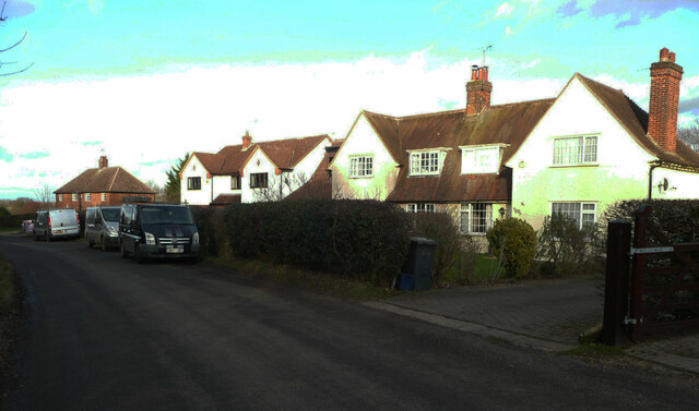
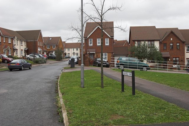
Brooches Wood Images

Images are sourced within 2km of 51.931042/-0.16668133 or Grid Reference TL2627. Thanks to Geograph Open Source API. All images are credited.

Stonesley and Harbourclose Woods, near Graveley Stonesley wood is in the distance, with Harbourclose Wood to the right
Stonesley and Harbourclose Woods, near Graveley
Stonesley wood is in the distance, with Harbourclose Wood to the right
Mildmay Road. These houses were built in a variety of styles.  These are not untypical but some of the architectural styles bring their own maintenance problems.
Mildmay Road.
These houses were built in a variety of styles. These are not untypical but some of the architectural styles bring their own maintenance problems.
Fortuna Close One of the more modern parts of Stevenage and with some more imaginative building - three storeys!
Fortuna Close
One of the more modern parts of Stevenage and with some more imaginative building - three storeys!
Mastercare warehousing Although this photograph is actually taken (just) from neighbouring TL2526, this warehouse is typical of this industrial estate.  Not all are grey and red.  Some are grey and another colour!
Mastercare warehousing
Although this photograph is actually taken (just) from neighbouring TL2526, this warehouse is typical of this industrial estate. Not all are grey and red. Some are grey and another colour!
Weston Rd Cemetery Although Weston Rd Cemetery takes up a relatively small portion of this square, Stevenage has lots and lots of houses but only two cemeteries.
Weston Rd Cemetery
Although Weston Rd Cemetery takes up a relatively small portion of this square, Stevenage has lots and lots of houses but only two cemeteries.
Great Ashby Estate. This development started about three years ago and is still being built.  The empty space to the right will be built on sooner or later.  The pylons are of course part of the National Grid.  Why on earth are we building houses under these lines?
Great Ashby Estate.
This development started about three years ago and is still being built. The empty space to the right will be built on sooner or later. The pylons are of course part of the National Grid. Why on earth are we building houses under these lines?
Fields opposite Tile Kiln Farm Typical farmland in this area.
Fields opposite Tile Kiln Farm
Typical farmland in this area.
Rising Sun Public House In the small Hamlet of Hall's Green can be found the Public House named the rising sun. Very popular it is too judging by the car park.
Rising Sun Public House
In the small Hamlet of Hall's Green can be found the Public House named the rising sun. Very popular it is too judging by the car park.
Dane End Dane End Farm is on the left with Dane End Cottage on the right of frame. The very wet ground can be seen in the foreground after a night of heavy rain.
Dane End
Dane End Farm is on the left with Dane End Cottage on the right of frame. The very wet ground can be seen in the foreground after a night of heavy rain.
Boxbury Farm Looking across the fields to Boxbury Farm on bright New Years day.
Boxbury Farm
Looking across the fields to Boxbury Farm on bright New Years day.
Play area and recreation ground Play area and recreation ground created after the construction of the housing at Great Ashby below Clayhills Springs
Play area and recreation ground
Play area and recreation ground created after the construction of the housing at Great Ashby below Clayhills Springs
Cottages at Warren's Green Warrens Green is made up of 4 or 5 cottages. This is an example.
Cottages at Warren's Green
Warrens Green is made up of 4 or 5 cottages. This is an example.
Great  Ashby, Stevenage Great Ashby is a very new (and still expanding) area of new housing development on the Eastern boundary of Stevenage.

The houses shown are typical of the area
Great Ashby, Stevenage
Great Ashby is a very new (and still expanding) area of new housing development on the Eastern boundary of Stevenage. The houses shown are typical of the area
Bluebells in Brooches Wood
Single Track Road Has a number of pass places, just to the east of Gravely.
Single Track Road
Has a number of pass places, just to the east of Gravely.
Easy Life Cattle debating the weather.
Easy Life
Cattle debating the weather.
Semi-detached houses. Hall's Green I am sure that I have seen gables shaped like this in other Hertfordshire villages and in Hitchin, so maybe they were built by the council.
Semi-detached houses. Hall's Green
I am sure that I have seen gables shaped like this in other Hertfordshire villages and in Hitchin, so maybe they were built by the council.
A quiet day at the Rising Sun, Hall's Green
Show me another place!

Brooches Wood is located at Grid Ref: TL2627 (Lat: 51.931042, Lng: -0.16668133)

Administrative County: Hertfordshire

District: North Hertfordshire

Police Authority: Hertfordshire

What 3 Words

///vocal.exact.bunch. Near Walkern, Hertfordshire

Related Wikis

Great Ashby

Great Ashby is a civil parish in Stevenage in the North Hertfordshire district, in the county of Hertfordshire, England. The name Great Ashby was coined...

Pryor's Wood

Pryor's Wood is an 8.7-hectare (21-acre) nature reserve in Great Ashby, near Stevenage in Hertfordshire. It was formerly managed by the Herts and Middlesex...

Rooks Nest House

Rooks Nest House is a house on Weston Road, Stevenage, Hertfordshire. It was the childhood home of the author E. M. Forster (1879–1970) who described it...

The Nobel School

The Nobel School is a co-educational secondary school and sixth form located in Stevenage in the English county of Hertfordshire. == History == The Nobel...

The Traveller Movement

The Traveller Movement (TM) is a charity based in the United Kingdom that supports the Gypsy, Roma and Traveller (GRT) community and challenge discrimination...

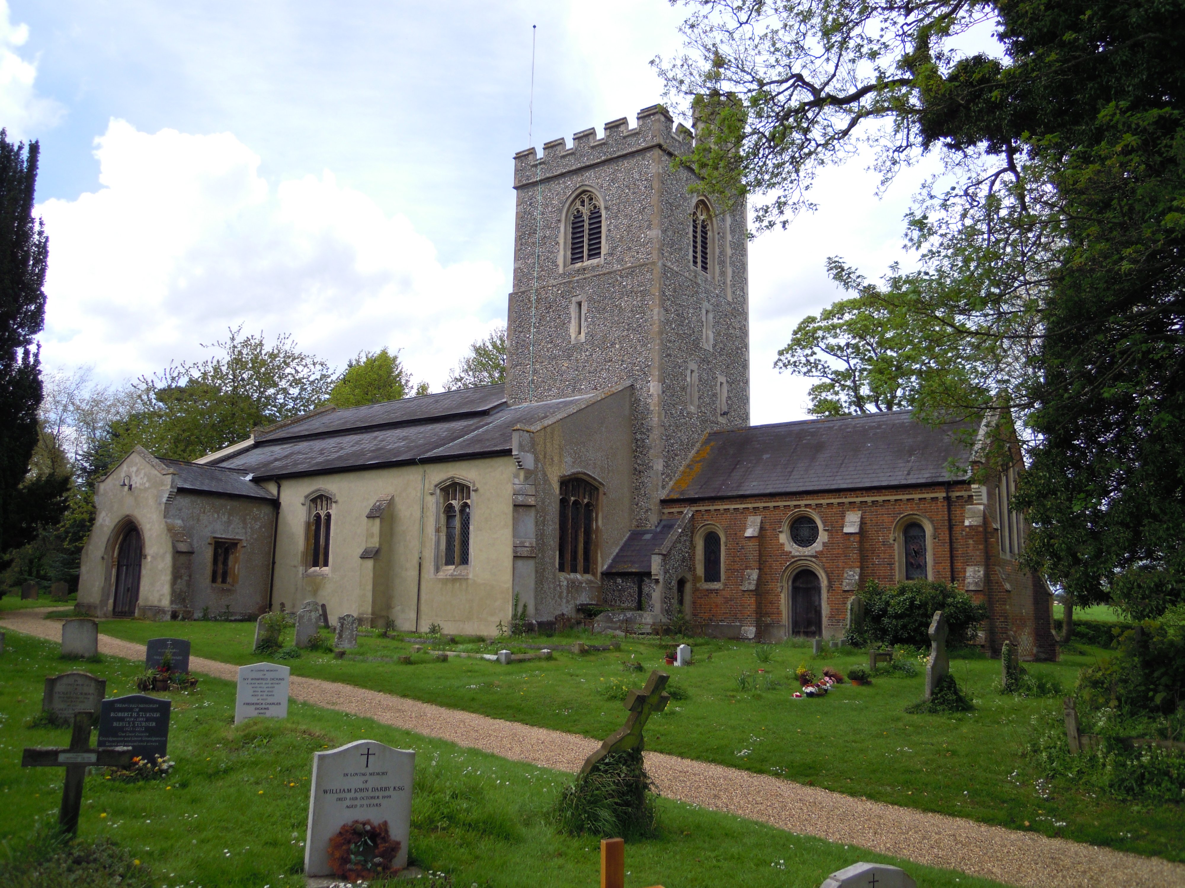
St Nicholas' Church, Stevenage

St Nicholas' Church is an Anglican parish church in Stevenage, a town in Hertfordshire, England. It occupies a hilltop site above Old Stevenage. It is...

Holy Trinity Church, Weston

Holy Trinity Church is the parish church for the village of Weston in Hertfordshire. The church building stands to the south-east of the village on high...
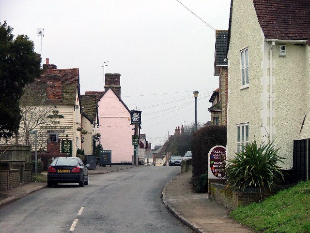
Walkern

Walkern is a village and civil parish in East Hertfordshire, England. It is about two miles (3 km) from Stevenage. The village has several shops, including...

Nearby Amenities

Located within 500m of 51.931042,-0.16668133
Crossing
Crossing: unmarked
Crossing Island: yes
Tactile Paving: yes
Traffic Calming: table
Lat/Long: 51.9296495/-0.1719984
Crossing
Bicycle: yes
Crossing: unmarked
Crossing Island: no
Horse: yes
Tactile Paving: yes
Lat/Long: 51.9279948/-0.1644491
Power: tower
Ref: 4TB 57
Source: GPS Survey
Source Ref: interpolation
Lat/Long: 51.9331121/-0.1682312
Power: tower
Lat/Long: 51.9328146/-0.1672964
Barrier: kissing_gate
Lat/Long: 51.9268831/-0.1646228
Barrier: cycle_barrier
Bicycle: yes
Cycle Barrier: double
Cycle Barrier Installation: fixed
Foot: yes
Lat/Long: 51.9280548/-0.1649099
Bus Stop
Fairfield Way
Bench: no
Bin: no
Lit: yes
Local Ref: NR
Naptan AtcoCode: 210021102225
Naptan Bearing: S
Naptan CommonName: Fairfield Way
Naptan Crossing: Neighbourhood Centre
Naptan Indicator: nr
Naptan Landmark: Neighbourhood Centre
Naptan NaptanCode: hrtgjwag
Naptan PlusbusZoneRef: STEVNGE
Naptan ShortCommonName: NA
Naptan Street: Fairfield Way
Naptan Verified: no
Shelter: no
Source: naptan_import
Tactile Paving: no
Lat/Long: 51.928774/-0.1682668
Bus Stop
Foyle Close
Bench: no
Bin: no
Lit: yes
Local Ref: NR
Naptan AtcoCode: 210021102235
Naptan Bearing: NE
Naptan CommonName: Foyle Close
Naptan Indicator: nr
Naptan Landmark: Unknown
Naptan NaptanCode: hrtgjwaj
Naptan PlusbusZoneRef: STEVNGE
Naptan ShortCommonName: NA
Naptan Street: Foyle Close
Naptan Verified: no
Shelter: no
Source: naptan_import
Tactile Paving: no
Lat/Long: 51.9277086/-0.1656775
Bus Stop
Fairfield Way
Bench: yes
Bin: yes
Lit: yes
Naptan AtcoCode: 210021102725
Naptan Bearing: N
Naptan CommonName: Fairfield Way
Naptan Crossing: Neighbourhood Centre
Naptan Indicator: opp
Naptan Landmark: Neighbourhood Centre
Naptan NaptanCode: hrtgjtjg
Naptan PlusbusZoneRef: STEVNGE
Naptan ShortCommonName: NA
Naptan Street: Great Ashby Way
Naptan Verified: no
Shelter: yes
Source: naptan_import
Tactile Paving: no
Lat/Long: 51.9278978/-0.1676458
Bus Stop
Business and Industrial Park
Bench: yes
Bin: yes
Lit: yes
Naptan AtcoCode: 210021202295
Naptan Bearing: S
Naptan CommonName: Business and Industrial Park
Naptan Crossing: Wedgwood Court
Naptan Indicator: S-bound
Naptan Landmark: Wedgwood Court
Naptan NaptanCode: hrtdwptp
Naptan PlusbusZoneRef: STEVNGE
Naptan ShortCommonName: NA
Naptan Street: Wedgwood Way
Naptan Verified: no
Shelter: yes
Source: naptan_import
Tactile Paving: yes
Lat/Long: 51.9273996/-0.1689336
Crossing
Crossing: unmarked
Crossing Island: yes
Tactile Paving: yes
Lat/Long: 51.9282468/-0.1682752
Crossing
Crossing: unmarked
Tactile Paving: yes
Lat/Long: 51.9268714/-0.1643704
Mini Roundabout
Lat/Long: 51.9312876/-0.1703775
Power: tower
Ref: 4TB 58
Source: GPS Survey
Source Ref: interpolation
Lat/Long: 51.9320871/-0.172965
Power: tower
Source: GPS Survey
Lat/Long: 51.9320944/-0.1707
Post Box
Check Date: 2021-01-17
Collection Times: Mo-Fr 17:00, Sa 11:30
Post Box Type: pillar
Ref: SG1 412
Royal Cypher: EIIR
Royal Cypher Wikidata: Q33102113
Lat/Long: 51.929939/-0.171295
Power: tower
Ref: 4TB 56
Source: observation and estimation
Source Ref: interpolation
Lat/Long: 51.9341117/-0.1635384
Power: tower
Source: observation and estimation
Lat/Long: 51.9336627/-0.1633265
Crossing
Crossing: unmarked
Tactile Paving: yes
Lat/Long: 51.9304611/-0.1726741
Crossing
Crossing: unmarked
Crossing Island: yes
Tactile Paving: yes
Lat/Long: 51.9303017/-0.1723314
Crossing
Crossing: unmarked
Tactile Paving: yes
Lat/Long: 51.9268798/-0.1642921
Crossing
Crossing: unmarked
Tactile Paving: yes
Lat/Long: 51.9304004/-0.172611
Crossing
Crossing: unmarked
Crossing Island: no
Kerb: lowered
Tactile Paving: no
Lat/Long: 51.9286394/-0.1653028
Crossing
Crossing: unmarked
Tactile Paving: yes
Lat/Long: 51.9281375/-0.1678662
Barrier: cycle_barrier
Cycle Barrier: double
Cycle Barrier Installation: fixed
Lat/Long: 51.9294115/-0.1622006
Crossing
Crossing: unmarked
Tactile Paving: yes
Lat/Long: 51.9304909/-0.1720736
Crossing
Crossing: unmarked
Tactile Paving: yes
Lat/Long: 51.930462/-0.1720784
Crossing
Crossing: unmarked
Crossing Island: no
Kerb: lowered
Tactile Paving: no
Lat/Long: 51.9292206/-0.1652874
Waste Basket
Lat/Long: 51.9279177/-0.1676568
Entrance: yes
Lat/Long: 51.9294272/-0.1708545
Sun Booth
Beauty: tanning
Fixme: Not sure what this is (shutters over front)
Shop: beauty
Lat/Long: 51.9296102/-0.1707588
Pharmacy
Jhoots Pharmacy
Lat/Long: 51.9296366/-0.1707776
Geoffrey Matthew
Office: estate_agent
Lat/Long: 51.9297069/-0.1708272
Fixme: Not sure what this is (can't read name on dashcam footage)
Shop: yes
Lat/Long: 51.9297433/-0.1708567
Restaurant
Fortune's Place
Cuisine: chinese
Lat/Long: 51.9298053/-0.1709037
Crossing
Crossing: unmarked
Crossing Island: yes
Tactile Paving: yes
Lat/Long: 51.9283979/-0.1677059
Crossing
Crossing: unmarked
Tactile Paving: yes
Lat/Long: 51.9281828/-0.167803
Crossing
Crossing: unmarked
Tactile Paving: yes
Lat/Long: 51.9284512/-0.1680853
Crossing
Crossing: unmarked
Tactile Paving: yes
Lat/Long: 51.9284317/-0.1681545
Crossing
Crossing: unmarked
Tactile Paving: no
Lat/Long: 51.9297223/-0.168428
Crossing
Crossing: unmarked
Tactile Paving: no
Lat/Long: 51.9297447/-0.1685085
Crossing
Crossing: unmarked
Tactile Paving: yes
Lat/Long: 51.9294521/-0.1685068
Crossing
Crossing: unmarked
Tactile Paving: yes
Lat/Long: 51.9294455/-0.1685972
Crossing
Crossing: unmarked
Tactile Paving: yes
Lat/Long: 51.9295549/-0.1688193
Crossing
Crossing: unmarked
Tactile Paving: yes
Lat/Long: 51.929607/-0.1688267
Waste Basket
Lat/Long: 51.9302494/-0.1710244
Crossing
Crossing: unmarked
Crossing Island: yes
Tactile Paving: yes
Lat/Long: 51.9306501/-0.1724705
Crossing
Crossing: unmarked
Crossing Island: no
Tactile Paving: yes
Traffic Calming: table
Lat/Long: 51.9304235/-0.1737842
Traffic Calming: island
Lat/Long: 51.9279519/-0.1645762
Traffic Calming: table
Lat/Long: 51.9285538/-0.1672641
Barrier: bollard
Bollard: fixed
Lat/Long: 51.9309154/-0.1723376
Waste Basket
Waste: dog_excrement
Lat/Long: 51.9297838/-0.1650118
Waste Basket
Waste: dog_excrement
Lat/Long: 51.9283017/-0.1652948
Crossing
Kerb: lowered
Lat/Long: 51.9274724/-0.1691146
The data included in this document is from www.openstreetmap.org. The data is made available under ODbL.

Have you been to Brooches Wood?

Leave your review of Brooches Wood below (or comments, questions and feedback).