Anne's Wood West

Wood, Forest in Sussex Mid Sussex

England

Anne's Wood West

House on Staplefield Road This is called "Brook Cottage", according to the large scale map.
House on Staplefield Road Credit: Ian Cunliffe

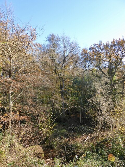
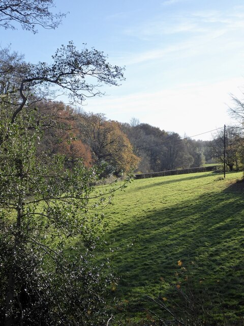
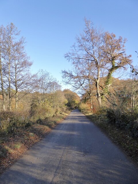
Anne's Wood is a picturesque woodland located in West Sussex, England. Covering an area of approximately 50 hectares, it is a part of the larger West Sussex Forest complex. The wood is named after Anne, a local landowner who was instrumental in its preservation and management.

Anne's Wood is known for its diverse range of tree species, including oak, beech, ash, and birch. These trees provide a rich habitat for a variety of wildlife, including birds, mammals, and insects. The wood is particularly renowned for its population of rare and protected species, such as the lesser spotted woodpecker and the silver-washed fritillary butterfly.

Visitors to Anne's Wood can enjoy a network of well-maintained footpaths and trails that wind their way through the woodland. These paths offer stunning views of the surrounding countryside and provide opportunities for walking, jogging, and cycling. The wood is also a popular spot for nature lovers, who come to observe and photograph the abundant flora and fauna.

Anne's Wood is managed by the local council in collaboration with conservation organizations to ensure the preservation of its natural beauty and biodiversity. Regular maintenance work is carried out to control invasive species and promote the growth of native plants. The wood is also monitored to prevent illegal activities, such as logging and poaching.

Overall, Anne's Wood is a cherished natural resource in West Sussex, offering both locals and tourists a tranquil escape into nature. Its diverse ecosystem and well-maintained trails make it an ideal destination for outdoor enthusiasts and wildlife enthusiasts alike.

If you have any feedback on the listing, please let us know in the comments section below.

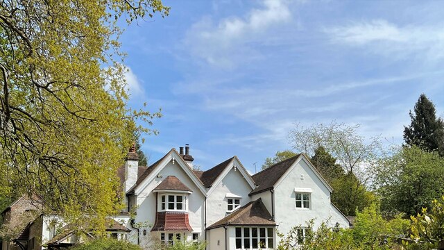
Anne's Wood West Images

Images are sourced within 2km of 51.022977/-0.20666915 or Grid Reference TQ2526. Thanks to Geograph Open Source API. All images are credited.

House on Staplefield Road This is called "Brook Cottage", according to the large scale map.
House on Staplefield Road
This is called "Brook Cottage", according to the large scale map.
Equipment at the water treatment plant This is a small site - I couldn't see much else apart from the two green tanks. It smells a bit too, but luckily it's quite a way from any houses
Equipment at the water treatment plant
This is a small site - I couldn't see much else apart from the two green tanks. It smells a bit too, but luckily it's quite a way from any houses
Barn at Rout Farm
Barn at Rout Farm
Slaugham Mill Pond The largest of three ponds along one of the small streams at the head of the River Ouse.
Slaugham Mill Pond
The largest of three ponds along one of the small streams at the head of the River Ouse.
Slaugham Manor Slaugham Manor has had an eventful life. Completed in 1901 as a wealthy family home, it subsequently became a hotel and country club before changing again into a police training centre. It is now apartments.
History on <span class="nowrap"><a title="https://www.linkedin.com/pulse/history-slaugham-manor-superb-conversion-important-house-van-loock/" rel="nofollow ugc noopener" href="https://www.linkedin.com/pulse/history-slaugham-manor-superb-conversion-important-house-van-loock/">Link</a><img style="margin-left:2px;" alt="External link" title="External link - shift click to open in new window" src="https://s1.geograph.org.uk/img/external.png" width="10" height="10"/></span>
Strangely, the 200 metres or so of road past the manor is signed as no public right of way. As the public path walk around is quite lengthy I doubt many people worry about that. 
But if anybody does care, this is a zoom and crop image taken from the public footpath at the end of the private bit.
Slaugham Manor
Slaugham Manor has had an eventful life. Completed in 1901 as a wealthy family home, it subsequently became a hotel and country club before changing again into a police training centre. It is now apartments. History on LinkExternal link Strangely, the 200 metres or so of road past the manor is signed as no public right of way. As the public path walk around is quite lengthy I doubt many people worry about that. But if anybody does care, this is a zoom and crop image taken from the public footpath at the end of the private bit.
Bridges over Staplefield Road Two separate bridges, one for each carriageway, take the A23 over Staplefield Road.
Bridges over Staplefield Road
Two separate bridges, one for each carriageway, take the A23 over Staplefield Road.
Remains of a Slip Road A look at the map shows there was once access on and off the A23 from Stapleford Road.
This looks to have been stopped some time ago.
Remains of a Slip Road
A look at the map shows there was once access on and off the A23 from Stapleford Road. This looks to have been stopped some time ago.
Furnace Pond Cottage, Staplefield Road, Slaugham Common A conglomeration of buildings from different eras. The earliest parts dates from the 16th century and was built for an iron worker from nearby Slaugham Furnace. This section is on the right. It was extended in the late 18th century to become a pair of cottages with that part now in the middle. The house became one again in the 1930s when another extension was added on the eastern side.
Furnace Pond Cottage, Staplefield Road, Slaugham Common
A conglomeration of buildings from different eras. The earliest parts dates from the 16th century and was built for an iron worker from nearby Slaugham Furnace. This section is on the right. It was extended in the late 18th century to become a pair of cottages with that part now in the middle. The house became one again in the 1930s when another extension was added on the eastern side.
The Lag The name of the field according to Slaugham's 1842 tithe map that is now woodland. It is bounded to the east by Slaugham Lane and to the north and west by Scotland Gill, a tributary of the River Ouse.
The Lag
The name of the field according to Slaugham's 1842 tithe map that is now woodland. It is bounded to the east by Slaugham Lane and to the north and west by Scotland Gill, a tributary of the River Ouse.
Pond Bay, Slaugham Furnace A view of the southern side of the dam which now carries Hampshire Hill, see <a href="https://www.geograph.org.uk/photo/7659112">TQ2428 : Hampshire Hill</a>, past the pond, see <a href="https://www.geograph.org.uk/photo/7659118">TQ2428 : Furnace Pond</a>. The furnace was known to be in operation between 1574-1601 and was sited at the point Scotland Gill turns south, see <a href="https://www.geograph.org.uk/photo/7659100">TQ2428 : Site of Slaugham Furnace</a>
Pond Bay, Slaugham Furnace
A view of the southern side of the dam which now carries Hampshire Hill, see TQ2428 : Hampshire Hill, past the pond, see TQ2428 : Furnace Pond. The furnace was known to be in operation between 1574-1601 and was sited at the point Scotland Gill turns south, see TQ2428 : Site of Slaugham Furnace
Site of Slaugham Furnace Known to be in operation between 1574 and 1601. The pond bay still survives, see <a href="https://www.geograph.org.uk/photo/7659097">TQ2428 : Pond Bay, Slaugham Furnace</a> and <a href="https://www.geograph.org.uk/photo/7659112">TQ2428 : Hampshire Hill</a>, as well as the pond, see <a href="https://www.geograph.org.uk/photo/7659118">TQ2428 : Furnace Pond</a>.
Site of Slaugham Furnace
Known to be in operation between 1574 and 1601. The pond bay still survives, see TQ2428 : Pond Bay, Slaugham Furnace and TQ2428 : Hampshire Hill, as well as the pond, see TQ2428 : Furnace Pond.
Front Meadow The name of the field according to Slaugham's 1842 tithe map located to the south of the pond bay carrying Hampshire Hill and west of Scotland Gill, a tributary of the River Ouse.
Front Meadow
The name of the field according to Slaugham's 1842 tithe map located to the south of the pond bay carrying Hampshire Hill and west of Scotland Gill, a tributary of the River Ouse.
Hampshire Hill The lane links Ashfold Crossways to Slaugham Common and here traverses across the former pond bay of Slaugham Furnace, see also <a href="https://www.geograph.org.uk/photo/7659097">TQ2428 : Pond Bay, Slaugham Furnace</a>. The site of the furnace was on the southern side, see <a href="https://www.geograph.org.uk/photo/7659100">TQ2428 : Site of Slaugham Furnace</a>, whilst the pond still survives and is to the north, see <a href="https://www.geograph.org.uk/photo/7659118">TQ2428 : Furnace Pond</a>. There are 56 former anti-tank buoys lining the pond side of the road.
Hampshire Hill
The lane links Ashfold Crossways to Slaugham Common and here traverses across the former pond bay of Slaugham Furnace, see also TQ2428 : Pond Bay, Slaugham Furnace. The site of the furnace was on the southern side, see TQ2428 : Site of Slaugham Furnace, whilst the pond still survives and is to the north, see TQ2428 : Furnace Pond. There are 56 former anti-tank buoys lining the pond side of the road.
Barn Meadow The name of the field according to Slaugham's 1842 tithe map located to the south of Hampshire hill and west of Scotland Farm, whose barn can be seen.
Barn Meadow
The name of the field according to Slaugham's 1842 tithe map located to the south of Hampshire hill and west of Scotland Farm, whose barn can be seen.
Park Field The name of the field according to Slaugham's 1842 tithe map bounded to the east by the village of Slaugham, to the west by Marchants Gill and to the south by Staplefield Road.
Park Field
The name of the field according to Slaugham's 1842 tithe map bounded to the east by the village of Slaugham, to the west by Marchants Gill and to the south by Staplefield Road.
1-3, Carpenters Arms, Park Road, Slaugham Numbers 1 and 2 on the left date from the early 19th century with number 3 added later. The latter became a public house sometime in the mid 19th century and closed in 1914. It was convertred back to a dwelling but has retained the former pub's shop like window.
1-3, Carpenters Arms, Park Road, Slaugham
Numbers 1 and 2 on the left date from the early 19th century with number 3 added later. The latter became a public house sometime in the mid 19th century and closed in 1914. It was convertred back to a dwelling but has retained the former pub's shop like window.
1-2, The Cottage, Park Road, Slaugham Located at the northern end of the village and dating from the early 19th century. The gate beyond prevents motor vehicles from using Park Road to get to Handcross.
1-2, The Cottage, Park Road, Slaugham
Located at the northern end of the village and dating from the early 19th century. The gate beyond prevents motor vehicles from using Park Road to get to Handcross.
White Cottage, Park Road, Slaugham Dating from around 1720 and catching the late afternoon sun.
White Cottage, Park Road, Slaugham
Dating from around 1720 and catching the late afternoon sun.
Show me another place!

Anne's Wood West is located at Grid Ref: TQ2526 (Lat: 51.022977, Lng: -0.20666915)

Administrative County: West Sussex

District: Mid Sussex

Police Authority: Sussex

What 3 Words

///consoles.spouse.probing. Near Handcross, West Sussex

Related Wikis

Warninglid

Warninglid (historically known as Warninglyth and Warningeld) is a small village in the Mid Sussex District of West Sussex, England. It lies on the B2115...

St Mary's Church, Slaugham

St Mary's Church is an Anglican church in the village of Slaugham in Mid Sussex, one of seven local government districts in the English county of West...

Slaugham

Slaugham () is a village and civil parish in the Mid Sussex District of West Sussex, England. It is located 7 miles (11 km) to the south of Crawley, on...

Wykehurst Place

Wykehurst Place (or Park) is a Gothic Revival mansion in Bolney, West Sussex, England, resembling more the châteaux of the Loire than an English manor...

Staplefield

Staplefield is a village in the Mid Sussex District of West Sussex, England, situated 6 kilometres (3.7 mi) north-west of Haywards Heath on the B2114...

Colwood, West Sussex

Colwood is a village near Warninglid in West Sussex, England. It is the site of Colwood Manor. == References == The geographic coordinates are from the...

Ansty and Staplefield

Ansty and Staplefield, previously Cuckfield Rural, is a civil parish in the Mid Sussex District of West Sussex, England, covering an area from the north...

Nymans

Nymans is an English garden to the east of the village of Handcross, and in the civil parish of Slaugham in West Sussex, England. The garden was developed...

Nearby Amenities

Located within 500m of 51.022977,-0.20666915
Power: tower
Lat/Long: 51.0208929/-0.2043491
Power: tower
Lat/Long: 51.0229646/-0.2051912
Power: tower
Lat/Long: 51.0260695/-0.2029374
Barrier: stile
Lat/Long: 51.0190036/-0.2063646
Barrier: stile
Lat/Long: 51.0237286/-0.2068851
Barrier: cattle_grid
Lat/Long: 51.0199827/-0.2061673
Barrier: kissing_gate
Lat/Long: 51.0189395/-0.20588
Addr City: Haywards Heath
Addr Housename: Portways Farm Cottages
Addr Postcode: RH17 5SN
Addr Street: Cuckfield Lane
Addr Village: Warninglid
Lat/Long: 51.0205682/-0.2073133
Bench
Lat/Long: 51.0189969/-0.2059284
The data included in this document is from www.openstreetmap.org. The data is made available under ODbL.

Have you been to Anne's Wood West?

Leave your review of Anne's Wood West below (or comments, questions and feedback).