Nashlands Wood

Wood, Forest in Sussex Mid Sussex

England

Nashlands Wood

Nymans Woodland Nymans Woods are 90 hectares of ancient woodland attached to Nymans Gardens, which is managed by the National Trust.
Nymans Woodland Credit: N Chadwick

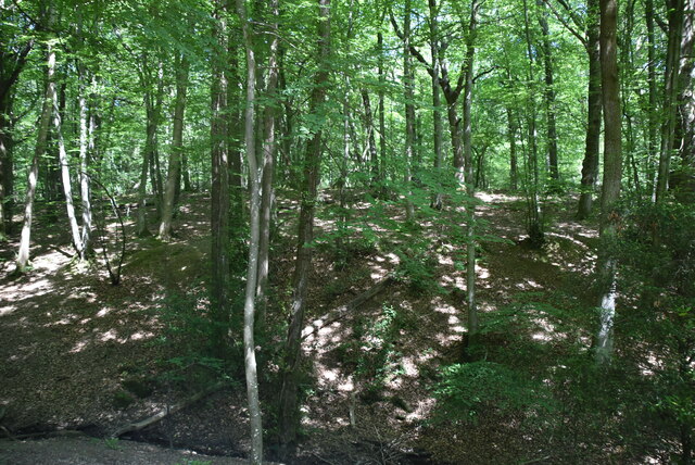
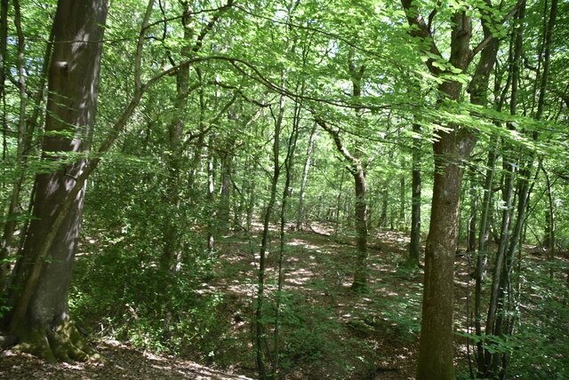
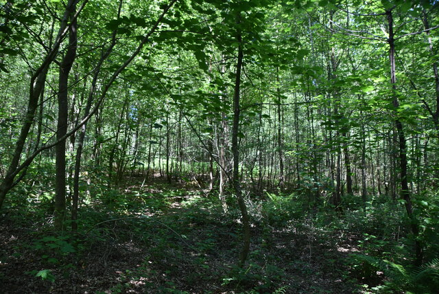
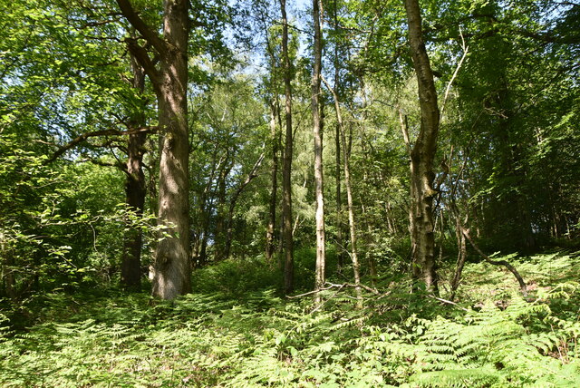
Nashlands Wood is a picturesque woodland located in the county of Sussex, England. Covering an area of approximately 50 hectares, the wood is renowned for its natural beauty and rich biodiversity. It is situated near the village of Nashlands, nestled within the rolling hills and valleys of the Sussex countryside.

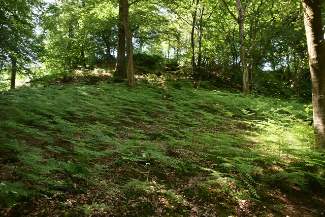
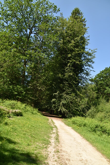
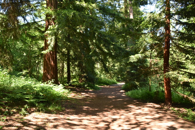
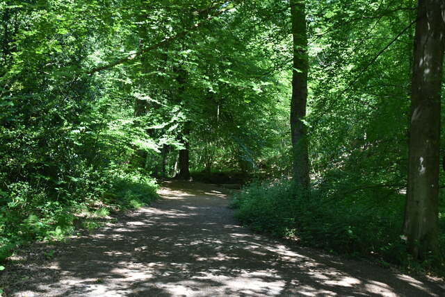
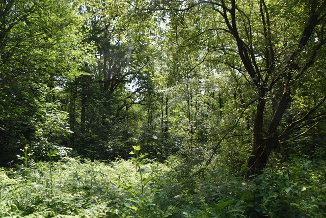
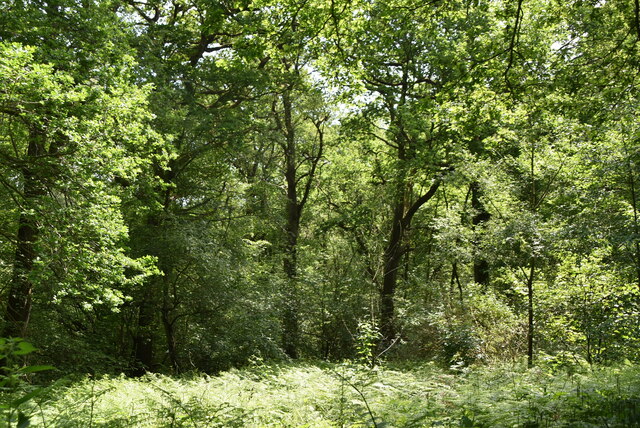
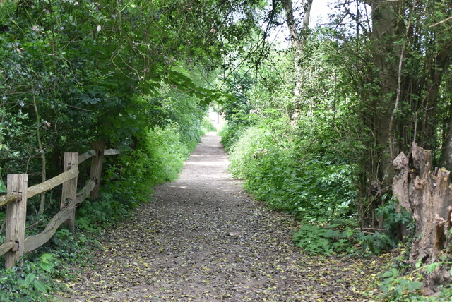
The wood is predominantly composed of native broadleaf trees, including oak, beech, and ash, which create a dense canopy that provides shade and shelter for various flora and fauna. The forest floor is covered in a thick carpet of mosses, ferns, and wildflowers, adding to the wood's enchanting atmosphere.

Nashlands Wood is a haven for wildlife, attracting a wide range of species. Birdwatchers can spot woodland birds such as woodpeckers, nuthatches, and warblers, while lucky visitors may catch a glimpse of roe deer, foxes, and badgers. The wood is also home to numerous insects, including butterflies and beetles.

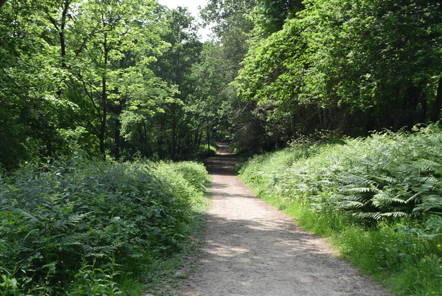
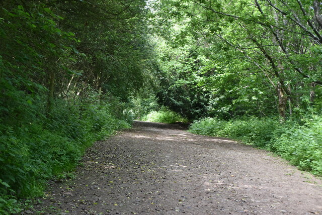
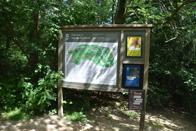
The wood offers a network of well-maintained footpaths and trails, allowing visitors to explore its natural wonders. It is a popular destination for walkers, joggers, and nature enthusiasts seeking tranquility and an escape from the bustling city life. The wood's peaceful ambiance is further enhanced by the gentle rustling of leaves and the occasional chirping of birds.

Nashlands Wood is a protected area, managed by local conservation organizations and authorities. Efforts are made to preserve its unique habitat and promote sustainable practices. The wood serves as an important educational resource, with guided tours and nature programs organized to raise awareness about its ecological significance.

Overall, Nashlands Wood is a cherished natural gem in Sussex, offering a serene and immersive woodland experience for visitors while playing a vital role in the local ecosystem.

If you have any feedback on the listing, please let us know in the comments section below.

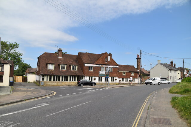
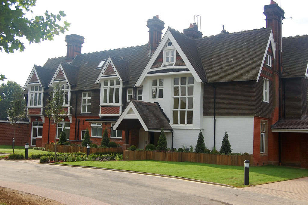
Nashlands Wood Images

Images are sourced within 2km of 51.063148/-0.20543125 or Grid Reference TQ2530. Thanks to Geograph Open Source API. All images are credited.

Nymans Woodland Nymans Woods are 90 hectares of ancient woodland attached to Nymans Gardens, which is managed by the National Trust.
Nymans Woodland
Nymans Woods are 90 hectares of ancient woodland attached to Nymans Gardens, which is managed by the National Trust.
Sussex Border Path Nymans Woods are 90 hectares of ancient woodland attached to Nymans Gardens, which is managed by the National Trust.
Sussex Border Path
Nymans Woods are 90 hectares of ancient woodland attached to Nymans Gardens, which is managed by the National Trust.
Sussex Ouse Valley Way, Nymans Woodland Nymans Woods are 90 hectares of ancient woodland attached to Nymans Gardens, which is managed by the National Trust.
Sussex Ouse Valley Way, Nymans Woodland
Nymans Woods are 90 hectares of ancient woodland attached to Nymans Gardens, which is managed by the National Trust.
Nymans Woodland Nymans Woods are 90 hectares of ancient woodland attached to Nymans Gardens, which is managed by the National Trust.
Nymans Woodland
Nymans Woods are 90 hectares of ancient woodland attached to Nymans Gardens, which is managed by the National Trust.
Nymans Woodland Nymans Woods are 90 hectares of ancient woodland attached to Nymans Gardens, which is managed by the National Trust.
Nymans Woodland
Nymans Woods are 90 hectares of ancient woodland attached to Nymans Gardens, which is managed by the National Trust.
Nymans Woodland Nymans Woods are 90 hectares of ancient woodland attached to Nymans Gardens, which is managed by the National Trust.
Nymans Woodland
Nymans Woods are 90 hectares of ancient woodland attached to Nymans Gardens, which is managed by the National Trust.
Nymans Woodland Nymans Woods are 90 hectares of ancient woodland attached to Nymans Gardens, which is managed by the National Trust.
Nymans Woodland
Nymans Woods are 90 hectares of ancient woodland attached to Nymans Gardens, which is managed by the National Trust.
Nymans Woodland Nymans Woods are 90 hectares of ancient woodland attached to Nymans Gardens, which is managed by the National Trust.
Nymans Woodland
Nymans Woods are 90 hectares of ancient woodland attached to Nymans Gardens, which is managed by the National Trust.
Sussex Ouse Valley Way, Nymans Woodland Opened in 2005, the Sussex Ouse Valley Way is a beautiful 42 mile journey that broadly follows the River Ouse from its source close to Lower Beeding in the High Weald to the sea at Seaford Bay. It is signed using a picture of the Ouse Valley Viaduct. Website: <span class="nowrap"><a title="http://www.sussexousevalleyway.co.uk/index.htm" rel="nofollow ugc noopener" href="http://www.sussexousevalleyway.co.uk/index.htm">Link</a><img style="margin-left:2px;" alt="External link" title="External link - shift click to open in new window" src="https://s1.geograph.org.uk/img/external.png" width="10" height="10"/></span>
Sussex Ouse Valley Way, Nymans Woodland
Opened in 2005, the Sussex Ouse Valley Way is a beautiful 42 mile journey that broadly follows the River Ouse from its source close to Lower Beeding in the High Weald to the sea at Seaford Bay. It is signed using a picture of the Ouse Valley Viaduct. Website: LinkExternal link
Welcome to Nymans Woodland Nymans Woods are 90 hectares of ancient woodland attached to Nymans Gardens, which is managed by the National Trust.
Welcome to Nymans Woodland
Nymans Woods are 90 hectares of ancient woodland attached to Nymans Gardens, which is managed by the National Trust.
Sussex Ouse Valley Way Opened in 2005, the Sussex Ouse Valley Way is a beautiful 42 mile journey that broadly follows the River Ouse from its source close to Lower Beeding in the High Weald to the sea at Seaford Bay. It is signed using a picture of the Ouse Valley Viaduct. Website: <span class="nowrap"><a title="http://www.sussexousevalleyway.co.uk/index.htm" rel="nofollow ugc noopener" href="http://www.sussexousevalleyway.co.uk/index.htm">Link</a><img style="margin-left:2px;" alt="External link" title="External link - shift click to open in new window" src="https://s1.geograph.org.uk/img/external.png" width="10" height="10"/></span>
Sussex Ouse Valley Way
Opened in 2005, the Sussex Ouse Valley Way is a beautiful 42 mile journey that broadly follows the River Ouse from its source close to Lower Beeding in the High Weald to the sea at Seaford Bay. It is signed using a picture of the Ouse Valley Viaduct. Website: LinkExternal link
Village sign, Handcross
B2110, B2114 junction The B2110 runs 25 miles from Langton Green <a href="https://www.geograph.org.uk/photo/5257058">TQ5338 : Crockers Hatch Corner</a>, west of Tunbridge Wells, to Lower Beeding. It skirts the northern edge of the Ashdown Forest. It runs through the villages of Groombridge, Hartfield, Withyham and Coleman's Hatch, then Hand Cross, Turners Hill and East Grinstead.
<span class="nowrap"><a title="http://www.sabre-roads.org.uk/wiki/index.php?title=B2110" rel="nofollow ugc noopener" href="http://www.sabre-roads.org.uk/wiki/index.php?title=B2110">Link</a><img style="margin-left:2px;" alt="External link" title="External link - shift click to open in new window" src="https://s1.geograph.org.uk/img/external.png" width="10" height="10"/></span>
B2110, B2114 junction
The B2110 runs 25 miles from Langton Green TQ5338 : Crockers Hatch Corner, west of Tunbridge Wells, to Lower Beeding. It skirts the northern edge of the Ashdown Forest. It runs through the villages of Groombridge, Hartfield, Withyham and Coleman's Hatch, then Hand Cross, Turners Hill and East Grinstead. LinkExternal link
B2110, B2114 junction The B2114 runs 4 miles from Slough Green to Pease Pottage.
<span class="nowrap"><a title="https://www.sabre-roads.org.uk/wiki/index.php?title=B2114" rel="nofollow ugc noopener" href="https://www.sabre-roads.org.uk/wiki/index.php?title=B2114">Link</a><img style="margin-left:2px;" alt="External link" title="External link - shift click to open in new window" src="https://s1.geograph.org.uk/img/external.png" width="10" height="10"/></span>
B2110, B2114 junction
The B2114 runs 4 miles from Slough Green to Pease Pottage. LinkExternal link
Show me another place!

Nashlands Wood is located at Grid Ref: TQ2530 (Lat: 51.063148, Lng: -0.20543125)

Administrative County: West Sussex

District: Mid Sussex

Police Authority: Sussex

What 3 Words

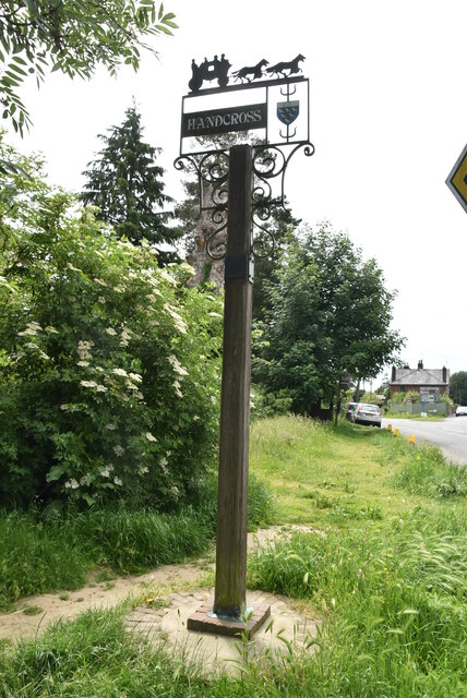
///being.reader.screeches. Near Handcross, West Sussex

Related Wikis

Handcross Park School

Handcross Park School is an independent co-educational preparatory school in Handcross, between Crawley, Horsham and Haywards Heath in West Sussex, England...

Handcross Hill bus crash

On 12 July 1906, a bus crashed into a tree on Handcross Hill in Sussex, England, killing 10 people and injuring a further 26 in the worst road crash in...

Handcross

Handcross is a village in the Mid Sussex District of West Sussex, England. It lies on the A23 road 4.2 miles (6.8 kilometres) south of Crawley. At the...

Cow Wood and Harry's Wood

Cow Wood and Harry's Wood is a 75.5-hectare (187-acre) biological Site of Special Scientific Interest east of Handcross in West Sussex. it is in the High...

Nymans

Nymans is an English garden to the east of the village of Handcross, and in the civil parish of Slaugham in West Sussex, England. The garden was developed...

Cedars (immigration detention)

Cedars was an immigration detention facility in Crawley, West Sussex, United Kingdom adjacent to Gatwick Airport. It was operated by UK Visas and Immigration...

Pease Pottage

Pease Pottage is a village in the Mid Sussex District of West Sussex, England. It lies on the southern edge of the Crawley built-up area, in the civil...

Pease Pottage MSA

Pease Pottage services is a motorway service station at Junction 11 of the M23 motorway near Crawley. It is owned by Moto. == Facilities == Facilities...

Nearby Amenities

Located within 500m of 51.063148,-0.20543125
Noexit: yes
Lat/Long: 51.0614438/-0.1999886
Maxspeed: 70 mph
Maxspeed Type: GB:nsl_dual
Source: Mapillary (2019-05-08)
Traffic Sign: maxspeed
Lat/Long: 51.0662479/-0.2047134
Maxspeed: 70 mph
Maxspeed Type: GB:nsl_dual
Source: Mapillary (2019-05-08)
Traffic Sign: maxspeed
Lat/Long: 51.0662709/-0.2044917
Bus Stop
Brighton Road
Bus: yes
Naptan AtcoCode: 4400HR0983
Naptan Bearing: NW
Naptan BusStopType: CUS
Naptan CommonName: Brighton Road
Naptan Indicator: HAR
Naptan Landmark: Hail & Ride
Naptan NaptanCode: wsxgapag
Naptan Street: Brighton Road
Naptan Verified: no
Public Transport: platform
Source: naptan_import
Lat/Long: 51.0644066/-0.201144
Bus Stop
Brighton Road
Bus: yes
Naptan AtcoCode: 4400HR0984
Naptan Bearing: SE
Naptan BusStopType: CUS
Naptan CommonName: Brighton Road
Naptan Indicator: HAR
Naptan Landmark: Hail & Ride
Naptan NaptanCode: wsxgapaj
Naptan Street: Brighton Roaf
Naptan Verified: no
Public Transport: platform
Source: naptan_import
Lat/Long: 51.0644305/-0.2009432
Post Box
Operator: Royal Mail
Post Box Type: wall
Ref: RH17 30D
Royal Cypher: GR
Royal Cypher Wikidata: Q33102273
Lat/Long: 51.0609392/-0.1998097
Street Lamp
Lamp Model: Siemens Broadway
Lamp Type: high_pressure_sodium
Light Count: 2
Source: Mapillary (2019-05-08)
Lat/Long: 51.0676248/-0.2048519
Street Lamp
Lamp Model: Siemens Broadway
Lamp Type: high_pressure_sodium
Light Count: 2
Source: Mapillary (2019-05-08)
Lat/Long: 51.0672771/-0.2048124
Street Lamp
Lamp Model: Siemens Broadway
Lamp Type: high_pressure_sodium
Light Count: 2
Source: Mapillary (2019-05-08)
Lat/Long: 51.0669495/-0.2047557
Street Lamp
Lamp Model: Siemens Broadway
Lamp Type: high_pressure_sodium
Light Count: 2
Source: Mapillary (2019-05-08)
Lat/Long: 51.0665952/-0.2046803
Street Lamp
Lamp Model: Siemens Broadway
Lamp Type: high_pressure_sodium
Light Count: 2
Source: Mapillary (2019-05-08)
Lat/Long: 51.0642858/-0.2040179
Street Lamp
Lamp Model: Siemens Broadway
Lamp Type: high_pressure_sodium
Light Count: 2
Source: Mapillary (2019-05-08)
Lat/Long: 51.0647697/-0.2041635
Street Lamp
Lamp Model: Siemens Broadway
Lamp Type: high_pressure_sodium
Light Count: 2
Source: Mapillary (2019-05-08)
Lat/Long: 51.0645277/-0.2040907
Street Lamp
Lamp Model: Siemens Broadway
Lamp Type: high_pressure_sodium
Light Count: 2
Source: Mapillary (2019-05-08)
Lat/Long: 51.0640439/-0.2039451
Street Lamp
Lamp Model: Siemens Broadway
Lamp Type: high_pressure_sodium
Light Count: 2
Source: Mapillary (2019-05-08)
Lat/Long: 51.0651426/-0.2042773
Street Lamp
Lamp Model: Siemens Broadway
Lamp Type: high_pressure_sodium
Light Count: 2
Source: Mapillary (2019-05-08)
Lat/Long: 51.0655154/-0.2043889
Street Lamp
Lamp Model: Siemens Broadway
Lamp Type: high_pressure_sodium
Light Count: 2
Source: Mapillary (2019-05-08)
Lat/Long: 51.0638025/-0.2038759
Street Lamp
Lamp Model: Siemens Broadway
Lamp Type: high_pressure_sodium
Light Count: 2
Source: Mapillary (2019-05-08)
Lat/Long: 51.0658883/-0.2045004
Street Lamp
Lamp Model: Siemens Broadway
Lamp Type: high_pressure_sodium
Light Count: 2
Source: Mapillary (2019-05-08)
Lat/Long: 51.0662594/-0.2046025
Street Lamp
Lamp Model: Siemens Broadway
Lamp Type: high_pressure_sodium
Light Count: 2
Source: Mapillary (2019-05-08)
Lat/Long: 51.0635611/-0.2038068
Street Lamp
Lamp Model: Siemens Broadway
Lamp Type: high_pressure_sodium
Light Count: 2
Source: Mapillary (2019-05-08)
Lat/Long: 51.0630896/-0.2036745
Street Lamp
Lamp Model: Philips SGS203
Lamp Type: high_pressure_sodium
Light Count: 1
Source: Mapillary (2019-05-08)
Lat/Long: 51.0633264/-0.2037027
Street Lamp
Lamp Model: Siemens Broadway
Lamp Type: high_pressure_sodium
Light Count: 1
Source: Mapillary (2019-05-08)
Lat/Long: 51.0633176/-0.2037736
Street Lamp
Lamp Model: Siemens Broadway
Lamp Type: high_pressure_sodium
Light Count: 2
Source: Mapillary (2019-05-08)
Lat/Long: 51.0626185/-0.2035406
Street Lamp
Lamp Model: Siemens Broadway
Lamp Type: high_pressure_sodium
Light Count: 2
Source: Mapillary (2019-05-08)
Lat/Long: 51.062383/-0.2034737
Street Lamp
Lamp Model: Siemens Broadway
Lamp Type: high_pressure_sodium
Light Count: 2
Source: Mapillary (2019-05-08)
Lat/Long: 51.0628541/-0.2036076
Street Lamp
Lamp Model: Siemens Broadway
Lamp Type: high_pressure_sodium
Light Count: 2
Source: Mapillary (2019-05-08)
Lat/Long: 51.0614407/-0.2032058
Street Lamp
Lamp Model: Siemens Broadway
Lamp Type: high_pressure_sodium
Light Count: 2
Source: Mapillary (2019-05-08)
Lat/Long: 51.0604985/-0.202938
Street Lamp
Lamp Model: Siemens Broadway
Lamp Type: high_pressure_sodium
Light Count: 2
Source: Mapillary (2019-05-08)
Lat/Long: 51.0607341/-0.2030049
Street Lamp
Lamp Model: Siemens Broadway
Lamp Type: high_pressure_sodium
Light Count: 2
Source: Mapillary (2019-05-08)
Lat/Long: 51.0612052/-0.2031388
Street Lamp
Lamp Model: Siemens Broadway
Lamp Type: high_pressure_sodium
Light Count: 2
Source: Mapillary (2019-05-08)
Lat/Long: 51.0609696/-0.2030719
Street Lamp
Lamp Model: Siemens Broadway
Lamp Type: high_pressure_sodium
Light Count: 2
Source: Mapillary (2019-05-08)
Lat/Long: 51.0619119/-0.2033397
Street Lamp
Lamp Model: Siemens Broadway
Lamp Type: high_pressure_sodium
Light Count: 2
Source: Mapillary (2019-05-08)
Lat/Long: 51.0616763/-0.2032728
Street Lamp
Lamp Model: Siemens Broadway
Lamp Type: high_pressure_sodium
Light Count: 2
Source: Mapillary (2019-05-08)
Lat/Long: 51.0621474/-0.2034067
Street Lamp
Lamp Model: Siemens Broadway
Lamp Type: high_pressure_sodium
Light Count: 2
Source: Mapillary (2019-05-08)
Lat/Long: 51.0600311/-0.2028193
Street Lamp
Lamp Model: Siemens Broadway
Lamp Type: high_pressure_sodium
Light Count: 2
Source: Mapillary (2019-05-08)
Lat/Long: 51.0602596/-0.2028713
Street Lamp
Lamp Model: Siemens Broadway
Lamp Type: high_pressure_sodium
Light Count: 2
Source: Mapillary (2019-05-08)
Lat/Long: 51.0597891/-0.2027579
Street Lamp
Lamp Model: Siemens Broadway
Lamp Type: high_pressure_sodium
Light Count: 2
Source: Mapillary (2019-05-08)
Lat/Long: 51.0595566/-0.202713
Street Lamp
Lamp Model: Siemens Broadway
Lamp Type: high_pressure_sodium
Light Count: 2
Source: Mapillary (2019-05-08)
Lat/Long: 51.0593175/-0.2026668
Street Lamp
Lamp Model: Siemens Broadway
Lamp Type: high_pressure_sodium
Light Count: 2
Source: Mapillary (2019-05-08)
Lat/Long: 51.0590707/-0.2026189
Hoadlands Farm
Place: farm
Postal Code: RH17 6HB
Lat/Long: 51.0597693/-0.2041107
Addr City: Haywards Heath
Addr Housename: Hoadlands Cottages
Addr Postcode: RH17 6HB
Addr Street: London Road
Addr Village: Handcross
Lat/Long: 51.0603534/-0.2041027
Addr City: Haywards Heath
Addr Housename: Hoadlands Cottages
Addr Postcode: RH17 6HB
Addr Street: London Road
Addr Village: Handcross
Lat/Long: 51.0603492/-0.2018282
Addr City: Haywards Heath
Addr Housename: Oak Cottages
Addr Postcode: RH17 6HD
Addr Street: London Road
Addr Village: Handcross
Lat/Long: 51.0646862/-0.2014246
Addr City: Haywards Heath
Addr Housename: Nashlands Cottages
Addr Postcode: RH17 6HD
Addr Street: London Road
Addr Village: Handcross
Lat/Long: 51.063976/-0.2013776
Addr City: Haywards Heath
Addr Housename: Coopers Wood
Addr Postcode: RH17 6HD
Addr Street: London Road
Addr Village: Handcross
Lat/Long: 51.0654391/-0.2017102
Nashlands Farm
Place: farm
Lat/Long: 51.0629542/-0.2076129
Man Made: mast
Tower Type: communication
Lat/Long: 51.06374/-0.2044541
The data included in this document is from www.openstreetmap.org. The data is made available under ODbL.

Have you been to Nashlands Wood?

Leave your review of Nashlands Wood below (or comments, questions and feedback).