Magpie Corner Wood

Wood, Forest in Hertfordshire Stevenage

England

Magpie Corner Wood

Stevenage Skyline - December 2023 (Harrow Court) Taken in the early evening on the 16/12/2023 from the 17th Floor of Harrow Court in Stevenage.
Overlooking Stevenage Town Centre lights glowing as the evening becomes night.
Stevenage Skyline - December 2023 (Harrow Court) Credit: Andy Steele

Magpie Corner Wood is a beautiful woodland area located in Hertfordshire, England. Spanning over several acres, it is a popular destination for nature lovers and outdoor enthusiasts seeking tranquility and natural beauty. The wood is situated in a rural setting, surrounded by picturesque countryside and rolling hills.

Magpie Corner Wood is characterized by its diverse range of tree species, including oak, beech, and birch. The dense forest is home to a variety of wildlife, such as deer, foxes, and a wide array of bird species, including magpies, from which the wood takes its name. The wood also features a captivating array of flora, with wildflowers and ferns adding bursts of color throughout the seasons.

Visitors to Magpie Corner Wood can explore its well-maintained trails, which meander through the forest, providing opportunities for peaceful walks, jogging, or cycling. The wood is also a haven for birdwatching enthusiasts, who can enjoy spotting and observing various avian species in their natural habitat.

The wood is well-equipped with facilities for visitors, including parking spaces, picnic areas, and benches where one can rest and soak in the tranquil atmosphere. There is also an information center, providing educational resources about the local wildlife and history of the area.

Magpie Corner Wood offers a peaceful escape from the hustle and bustle of everyday life, allowing visitors to connect with nature and unwind in a serene setting. Its natural beauty and abundance of wildlife make it a true gem in the heart of Hertfordshire.

If you have any feedback on the listing, please let us know in the comments section below.

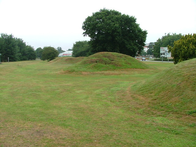
Magpie Corner Wood Images

Images are sourced within 2km of 51.896664/-0.18688858 or Grid Reference TL2423. Thanks to Geograph Open Source API. All images are credited.

Stevenage Skyline - December 2023 (Harrow Court) Taken in the early evening on the 16/12/2023 from the 17th Floor of Harrow Court in Stevenage.
Overlooking Stevenage Town Centre lights glowing as the evening becomes night.
Stevenage Skyline - December 2023 (Harrow Court)
Taken in the early evening on the 16/12/2023 from the 17th Floor of Harrow Court in Stevenage. Overlooking Stevenage Town Centre lights glowing as the evening becomes night.
Harrow Court & Brent Court - Stevenage Taken on King George V Recreation Ground in Stevenage.

The photo showing two well known Stevenage high rise tower blocks Harrow Court (Left) Brent Court (Right) which have been used mostly for social housing since the 1990s.

Both buildings are Council property owned by Stevenage Borough Council and they was built in 1965.
Harrow Court & Brent Court - Stevenage
Taken on King George V Recreation Ground in Stevenage. The photo showing two well known Stevenage high rise tower blocks Harrow Court (Left) Brent Court (Right) which have been used mostly for social housing since the 1990s. Both buildings are Council property owned by Stevenage Borough Council and they was built in 1965.
Hydean Way Shops Typical of local shops in Stevenage new town.  Above a parade of shops including a small supermarket, take away food outlet and Post Office there are maisonettes accessed from the rear.  To the right there are 2/3 bedroomed homes.
Hydean Way Shops
Typical of local shops in Stevenage new town. Above a parade of shops including a small supermarket, take away food outlet and Post Office there are maisonettes accessed from the rear. To the right there are 2/3 bedroomed homes.
South end of Fairlands Valley Park. This photograph was taken facing north into Fairlands Valley Park from the car park used for Stevenage Borough FC (see TL2422).  This park is also used for travelling fairs and circuses.
South end of Fairlands Valley Park.
This photograph was taken facing north into Fairlands Valley Park from the car park used for Stevenage Borough FC (see TL2422). This park is also used for travelling fairs and circuses.
Stevenage Borough FC Taken from the club's car park across the Hertford Road.
Stevenage Borough FC
Taken from the club's car park across the Hertford Road.
Novotel / Knebworth Park. Just off the A1(M) this is at the entrance of Knebworth Park home to "rock concerts through the ages".  The hotel has a helipad in its grounds.  Better access that by A1(M)
Novotel / Knebworth Park.
Just off the A1(M) this is at the entrance of Knebworth Park home to "rock concerts through the ages". The hotel has a helipad in its grounds. Better access that by A1(M)
Stevenage Town Centre The clock tower features a memorial to Lewis Silkin, the Minister for Town and Country Planning.
Stevenage Town Centre
The clock tower features a memorial to Lewis Silkin, the Minister for Town and Country Planning.
Fairlands Valley Park This large lake is used by sailors and fishermen.  This photo is taken facing south.  To the rear there are two smaller lakes.  The park is very popular in the summer.
Fairlands Valley Park
This large lake is used by sailors and fishermen. This photo is taken facing south. To the rear there are two smaller lakes. The park is very popular in the summer.
Silam Rd. To the right are houses not untypical of Stevenage new town.  Looming over Silam Rd is one of a pair of high rise flats close to the town centre.
Silam Rd.
To the right are houses not untypical of Stevenage new town. Looming over Silam Rd is one of a pair of high rise flats close to the town centre.
Parishes Mead. Parishes mead is a newer development on the east side of Stevenage.  There is a mixture of private and social housing here.
Parishes Mead.
Parishes mead is a newer development on the east side of Stevenage. There is a mixture of private and social housing here.
Six Hills OK do you believe the OS who say that these features are tumuli or legend which says that these humps are lumps of soil thrown at travellers on the old Great North Road (just to the right of these humps but rather imposing nowadays)?  It is said that these were thrown here from Weston Woods (<a href="https://www.geograph.org.uk/gridref/TL2432">TL2432</a> and <a href="https://www.geograph.org.uk/gridref/TL2532">TL2532</a>).  Dick Turpin would have ridden past these on Black Bess on his ride from York to London.
Six Hills
OK do you believe the OS who say that these features are tumuli or legend which says that these humps are lumps of soil thrown at travellers on the old Great North Road (just to the right of these humps but rather imposing nowadays)? It is said that these were thrown here from Weston Woods (TL2432 and TL2532). Dick Turpin would have ridden past these on Black Bess on his ride from York to London.
Hampson Park / Pin Green Water Tower. Although this water tower is right on the edge of this square I have used it because it dominates the locality.  The large flat construction on the left, behind the fence, is a covered reservoir.  The tower is now bristling with aerials of all sorts.
Hampson Park / Pin Green Water Tower.
Although this water tower is right on the edge of this square I have used it because it dominates the locality. The large flat construction on the left, behind the fence, is a covered reservoir. The tower is now bristling with aerials of all sorts.
Ferrier Rd This could be any road in this area.  Plans seem to have been bought as a job lot.
Ferrier Rd
This could be any road in this area. Plans seem to have been bought as a job lot.
Telford Avenue. On the edge of TL2525..  I wasn't going any further into this estate.  I always get lost even though it's not that big by local standards.  This estate, in common with others in the area suffers from the increase in car ownership.  Parking is awkward, the roads not wide and the layout is twisting.
Telford Avenue.
On the edge of TL2525.. I wasn't going any further into this estate. I always get lost even though it's not that big by local standards. This estate, in common with others in the area suffers from the increase in car ownership. Parking is awkward, the roads not wide and the layout is twisting.
Ridlins Athletics Track This photo of the Ridlins Athletics track shows the west corner and the Bert Hill stand.  The back of the stand has space for community groups such as playgroups.
Ridlins Athletics Track
This photo of the Ridlins Athletics track shows the west corner and the Bert Hill stand. The back of the stand has space for community groups such as playgroups.
Football pitches These are to the north west of the running track.
Football pitches
These are to the north west of the running track.
Church of St Peter, Broadwater. One of a series of three photos taken from within a couple of hundred yards of each other.  Church shops and flats.  A whole community?
Church of St Peter, Broadwater.
One of a series of three photos taken from within a couple of hundred yards of each other. Church shops and flats. A whole community?
Flats on Broadwater Avenue Most housing in this area consists of two storey houses but there are a number of blocks of flats like this.
Flats on Broadwater Avenue
Most housing in this area consists of two storey houses but there are a number of blocks of flats like this.
Show me another place!

Magpie Corner Wood is located at Grid Ref: TL2423 (Lat: 51.896664, Lng: -0.18688858)

Administrative County: Hertfordshire

District: Stevenage

Police Authority: Hertfordshire

What 3 Words

///feed.figure.poem. Near Stevenage, Hertfordshire

Related Wikis

Broadhall Way

Broadhall Way, known as the Lamex Stadium for sponsorship purposes, is an association football stadium in Stevenage, Hertfordshire. It has been the home...

North Hertfordshire College

North Hertfordshire College ("NHC") is a further education and higher education college operating in Stevenage, Hitchin, and Letchworth Garden City. NHC...

The Heathcote School

The Heathcote School was an 11-18 comprehensive school in Stevenage, Hertfordshire. The school was founded in the 1950s. It was awarded Specialist Engineering...

List of local nature reserves in Hertfordshire

Hertfordshire is a county in eastern England. It is bordered by Bedfordshire to the north, Cambridgeshire to the north-east, Essex to the east, Buckinghamshire...

Shephall

Shephall (SHEP-all) is a neighbourhood of the new town of Stevenage in Hertfordshire. It was formerly a separate village and parish, being absorbed into...

Women's Engineering Society

The Women's Engineering Society is a United Kingdom professional learned society and networking body for women engineers, scientists and technologists...

Marriotts School

Marriotts School is a secondary school in Stevenage, Hertfordshire, England. The school was rebuilt along with Lonsdale School (for special needs children...

Stevenage Mail Centre

Stevenage mail centre was a Royal Mail mail centre in Stevenage, Hertfordshire, England. In 2010, Royal Mail announced that a number of sorting offices...

Nearby Amenities

Located within 500m of 51.896664,-0.18688858
Mini Roundabout
Direction: clockwise
Lat/Long: 51.8993122/-0.1926848
Mini Roundabout
Direction: clockwise
Lat/Long: 51.8974011/-0.1806257
Crossing
Crossing: unmarked
Crossing Island: no
Kerb: lowered
Tactile Paving: no
Lat/Long: 51.8994306/-0.1860039
Turning Circle
Created By: Potlatch 0.10f
Lat/Long: 51.8988316/-0.183738
Bus Stop
Whomerley Road
Bench: no
Naptan AtcoCode: 210021200970
Naptan Bearing: NE
Naptan CommonName: Whomerley Road
Naptan Crossing: Bowcock Way
Naptan Indicator: adj
Naptan Landmark: Bowcock Way
Naptan NaptanCode: hrtgagad
Naptan PlusbusZoneRef: STEVNGE
Naptan ShortCommonName: NA
Naptan Street: Rockingham Way
Naptan Verified: no
Shelter: no
Source: naptan_import
Lat/Long: 51.8956958/-0.1935363
Bus Stop
Denton Road
Bench: yes
Local Ref: NR
Naptan AtcoCode: 210021200975
Naptan Bearing: NW
Naptan CommonName: Denton Road
Naptan Crossing: Whittington Lane
Naptan Indicator: nr
Naptan Landmark: Whittington Lane
Naptan NaptanCode: hrtgagag
Naptan PlusbusZoneRef: STEVNGE
Naptan ShortCommonName: NA
Naptan Street: Rockingham Way
Naptan Verified: no
Shelter: yes
Source: naptan_import
Lat/Long: 51.8979605/-0.1928641
Bus Stop
Peartree Centre
Bench: yes
Bin: yes
Lit: yes
Naptan AtcoCode: 210021201420
Naptan Bearing: NE
Naptan CommonName: Peartree Centre
Naptan Crossing: Shackleton Spring
Naptan Indicator: opp
Naptan Landmark: Shackleton Spring
Naptan NaptanCode: hrtgadjd
Naptan PlusbusZoneRef: STEVNGE
Naptan ShortCommonName: NA
Naptan Street: Valley Way
Naptan Verified: no
Shelter: yes
Source: naptan_import
Lat/Long: 51.8928749/-0.1834234
Bus Stop
Peartree Way
Bench: yes
Bin: yes
Lit: yes
Naptan AtcoCode: 210021201440
Naptan Bearing: NE
Naptan CommonName: Peartree Way
Naptan Crossing: Fairlands Valley Park
Naptan Indicator: opp
Naptan Landmark: Fairlands Valley Park
Naptan NaptanCode: hrtgadjg
Naptan PlusbusZoneRef: STEVNGE
Naptan ShortCommonName: NA
Naptan Street: Valley Way
Naptan Verified: no
Shelter: yes
Source: naptan_import
Tactile Paving: no
Wheelchair: yes
Lat/Long: 51.8958606/-0.1814661
Bus Stop
Rockingham Way
Bench: yes
Bin: yes
Bus: yes
Lit: yes
Local Ref: NR
Naptan AtcoCode: 210021201690
Naptan Bearing: W
Naptan CommonName: Rockingham Way
Naptan Crossing: Homestead Moat
Naptan Indicator: nr
Naptan Landmark: Homestead Moat
Naptan NaptanCode: hrtgadgt
Naptan PlusbusZoneRef: STEVNGE
Naptan ShortCommonName: NA
Naptan Street: Six Hills Way
Naptan Verified: no
Public Transport: platform
Shelter: yes
Source: naptan_import
Lat/Long: 51.8992918/-0.1917205
Bus Stop
Colestrete Close
Bench: no
Bin: no
Bus: yes
Lit: yes
Naptan AtcoCode: 210021201700
Naptan Bearing: NE
Naptan CommonName: Colestrete Close
Naptan Crossing: Poppy Mead
Naptan Indicator: opp
Naptan Landmark: Poppy Mead
Naptan NaptanCode: hrtdwtpm
Naptan PlusbusZoneRef: STEVNGE
Naptan ShortCommonName: NA
Naptan Street: Colestrete
Naptan Verified: no
Public Transport: platform
Shelter: yes
Source: naptan_import
Lat/Long: 51.9009289/-0.1853315
Bus Stop
Colestrete Close
Bench: no
Bin: yes
Bus: yes
Lit: yes
Local Ref: NR
Naptan AtcoCode: 210021202960
Naptan Bearing: SW
Naptan CommonName: Colestrete Close
Naptan Crossing: The Hawthorns
Naptan Indicator: nr
Naptan Landmark: The Hawthorns
Naptan NaptanCode: hrtdwmjd
Naptan PlusbusZoneRef: STEVNGE
Naptan ShortCommonName: NA
Naptan Street: Colestrete
Naptan Verified: no
Public Transport: platform
Shelter: no
Source: naptan_import
Tactile Paving: no
Lat/Long: 51.9004805/-0.1854077
Bus Stop
Peartree Way
Bench: no
Bin: no
Lit: yes
Naptan AtcoCode: 210021203220
Naptan Bearing: SW
Naptan CommonName: Peartree Way
Naptan Crossing: Peartree Way
Naptan Indicator: adj
Naptan Landmark: Peartree Way
Naptan NaptanCode: hrtdwmam
Naptan PlusbusZoneRef: STEVNGE
Naptan ShortCommonName: NA
Naptan Street: Valley Way
Naptan Verified: no
Shelter: no
Source: naptan_import
Tactile Paving: yes
Wheelchair: yes
Lat/Long: 51.8953497/-0.1815739
Mini Roundabout
Direction: clockwise
Lat/Long: 51.8949302/-0.1926491
Turning Circle
Lat/Long: 51.8975982/-0.1939965
Fixme: incomplete
Lat/Long: 51.8946264/-0.1898461
Barrier: bollard
Lat/Long: 51.8980393/-0.1837039
Post Box
Collection Times: Mo-Fr 09:00; Sa 07:00
Post Box Type: pillar
Ref: SG2 303
Royal Cypher: EIIR
Royal Cypher Wikidata: Q33102113
Lat/Long: 51.895241/-0.180067
Post Box
Collection Times: Mo-Fr 18:45; Sa 12:00
Post Box Type: pillar
Ref: SG1 277
Lat/Long: 51.897865/-0.192593
Post Box
Collection Times: Mo-Fr 17:30; Sa 12:00
Post Box Type: pillar
Ref: SG1 288
Royal Cypher: EIIR
Royal Cypher Wikidata: Q33102113
Lat/Long: 51.900436/-0.185421
Bench
Backrest: yes
Colour: silver
Material: metal
Seats: 3
Lat/Long: 51.8993452/-0.1820356
Bench
Backrest: yes
Colour: silver
Material: metal
Seats: 3
Lat/Long: 51.8992105/-0.1820199
Addr City: Stevenage
Addr Housenumber: 217
Addr Street: Shephall View
Lat/Long: 51.900016/-0.183078
Waste Basket
Waste: dog_excrement
Lat/Long: 51.8931177/-0.1884949
Bench
Lat/Long: 51.8987385/-0.1806255
Waterway: drain
Lat/Long: 51.8977104/-0.1827229
Bench
Backrest: yes
Lat/Long: 51.8955217/-0.1868606
Bench
Backrest: yes
Lat/Long: 51.8958221/-0.1864587
Bench
Backrest: yes
Lat/Long: 51.8962408/-0.1858726
Bench
Backrest: yes
Check Date: 2023-09-10
Lat/Long: 51.8945835/-0.1884651
Turning Circle
Lat/Long: 51.9004459/-0.1837227
Waste Basket
Lat/Long: 51.8994994/-0.1916412
Waste Basket
Lat/Long: 51.8992983/-0.1916666
Waste Basket
Lat/Long: 51.8995035/-0.1888825
Waste Basket
Lat/Long: 51.8993496/-0.187005
Barrier: bollard
Bollard: fixed
Height: 1
Lat/Long: 51.8981605/-0.1825141
Waste Basket
Lat/Long: 51.8981911/-0.1827939
Waste Basket
Lat/Long: 51.8971922/-0.1806495
Waste Basket
Lat/Long: 51.8928423/-0.1834537
Waste Basket
Lat/Long: 51.8956347/-0.1812878
Waste Basket
Lat/Long: 51.8957572/-0.1815011
Waste Basket
Lat/Long: 51.8979328/-0.1928317
Crossing
Crossing: unmarked
Crossing Island: yes
Kerb: lowered
Tactile Paving: no
Lat/Long: 51.8973897/-0.1804947
Traffic Calming: island
Lat/Long: 51.8974389/-0.1807469
Traffic Calming: island
Lat/Long: 51.8973266/-0.1806651
Traffic Calming: island
Lat/Long: 51.8991561/-0.186131
Waste Basket
Lat/Long: 51.9004668/-0.185401
Waste Basket
Lat/Long: 51.900936/-0.1853541
Traffic Calming: island
Lat/Long: 51.8993247/-0.1925367
The data included in this document is from www.openstreetmap.org. The data is made available under ODbL.

Have you been to Magpie Corner Wood?

Leave your review of Magpie Corner Wood below (or comments, questions and feedback).