Monk's Wood

Wood, Forest in Hertfordshire Stevenage

England

Monk's Wood

Painted House at Norton Green Norton Green is a small hamlet clinging to the western edge of the New Town of Stevenage but separated by the A1(M). Despite this the place retains a quiet rural atmosphere.
Painted House at Norton Green Credit: Deb Cunningham

Monk's Wood is a picturesque woodland located in Hertfordshire, England. Covering an area of approximately 220 hectares, this ancient forest is renowned for its natural beauty and rich biodiversity. It lies within close proximity to the town of Abbots Langley and is easily accessible to nature enthusiasts and visitors alike.

The woodland is predominantly composed of native broadleaf trees such as oak, beech, and ash, resulting in a diverse and thriving ecosystem. The forest floor is adorned with an array of wildflowers, including bluebells, primroses, and wood anemones, creating a vibrant and colorful landscape during the spring months.

Monk's Wood is home to an abundance of wildlife, making it a haven for nature lovers and birdwatchers. Over 100 species of birds have been recorded in the area, including the rare and elusive nightingale, which can be heard serenading visitors with its melodious song during the summer evenings. The woodland also provides a habitat for various mammals, such as deer, badgers, and foxes, as well as a diverse range of insects and reptiles.

The wood is crisscrossed by a network of well-maintained footpaths and trails, allowing visitors to explore its natural wonders at their leisure. There are also designated picnic areas and benches scattered throughout the woodland, providing the perfect opportunity to relax and soak in the tranquil atmosphere.

Monk's Wood is not only a cherished local gem but also a valuable conservation site. It is managed by the Woodland Trust, an organization dedicated to the preservation and enhancement of woodlands across the United Kingdom.

If you have any feedback on the listing, please let us know in the comments section below.
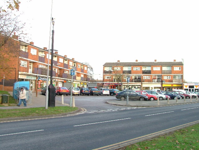
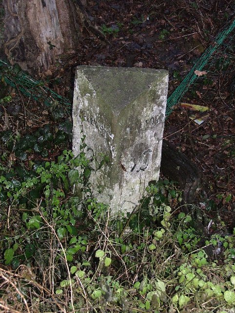
Monk's Wood Images

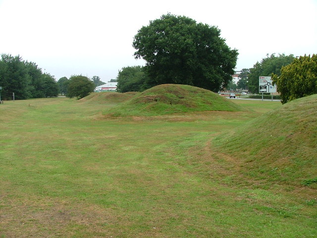
Images are sourced within 2km of 51.89273/-0.19357232 or Grid Reference TL2423. Thanks to Geograph Open Source API. All images are credited.

Painted House at Norton Green Norton Green is a small hamlet clinging to the western edge of the New Town of Stevenage but separated by the A1(M). Despite this the place retains a quiet rural atmosphere.
Painted House at Norton Green
Norton Green is a small hamlet clinging to the western edge of the New Town of Stevenage but separated by the A1(M). Despite this the place retains a quiet rural atmosphere.
Hydean Way Shops Typical of local shops in Stevenage new town.  Above a parade of shops including a small supermarket, take away food outlet and Post Office there are maisonettes accessed from the rear.  To the right there are 2/3 bedroomed homes.
Hydean Way Shops
Typical of local shops in Stevenage new town. Above a parade of shops including a small supermarket, take away food outlet and Post Office there are maisonettes accessed from the rear. To the right there are 2/3 bedroomed homes.
South end of Fairlands Valley Park. This photograph was taken facing north into Fairlands Valley Park from the car park used for Stevenage Borough FC (see TL2422).  This park is also used for travelling fairs and circuses.
South end of Fairlands Valley Park.
This photograph was taken facing north into Fairlands Valley Park from the car park used for Stevenage Borough FC (see TL2422). This park is also used for travelling fairs and circuses.
Stevenage Borough FC Taken from the club's car park across the Hertford Road.
Stevenage Borough FC
Taken from the club's car park across the Hertford Road.
Novotel / Knebworth Park. Just off the A1(M) this is at the entrance of Knebworth Park home to "rock concerts through the ages".  The hotel has a helipad in its grounds.  Better access that by A1(M)
Novotel / Knebworth Park.
Just off the A1(M) this is at the entrance of Knebworth Park home to "rock concerts through the ages". The hotel has a helipad in its grounds. Better access that by A1(M)
Stevenage Town Centre The clock tower features a memorial to Lewis Silkin, the Minister for Town and Country Planning.
Stevenage Town Centre
The clock tower features a memorial to Lewis Silkin, the Minister for Town and Country Planning.
Fairlands Valley Park This large lake is used by sailors and fishermen.  This photo is taken facing south.  To the rear there are two smaller lakes.  The park is very popular in the summer.
Fairlands Valley Park
This large lake is used by sailors and fishermen. This photo is taken facing south. To the rear there are two smaller lakes. The park is very popular in the summer.
Silam Rd. To the right are houses not untypical of Stevenage new town.  Looming over Silam Rd is one of a pair of high rise flats close to the town centre.
Silam Rd.
To the right are houses not untypical of Stevenage new town. Looming over Silam Rd is one of a pair of high rise flats close to the town centre.
Six Hills OK do you believe the OS who say that these features are tumuli or legend which says that these humps are lumps of soil thrown at travellers on the old Great North Road (just to the right of these humps but rather imposing nowadays)?  It is said that these were thrown here from Weston Woods (<a href="https://www.geograph.org.uk/gridref/TL2432">TL2432</a> and <a href="https://www.geograph.org.uk/gridref/TL2532">TL2532</a>).  Dick Turpin would have ridden past these on Black Bess on his ride from York to London.
Six Hills
OK do you believe the OS who say that these features are tumuli or legend which says that these humps are lumps of soil thrown at travellers on the old Great North Road (just to the right of these humps but rather imposing nowadays)? It is said that these were thrown here from Weston Woods (TL2432 and TL2532). Dick Turpin would have ridden past these on Black Bess on his ride from York to London.
Football pitches These are to the north west of the running track.
Football pitches
These are to the north west of the running track.
Church of St Peter, Broadwater. One of a series of three photos taken from within a couple of hundred yards of each other.  Church shops and flats.  A whole community?
Church of St Peter, Broadwater.
One of a series of three photos taken from within a couple of hundred yards of each other. Church shops and flats. A whole community?
Flats on Broadwater Avenue Most housing in this area consists of two storey houses but there are a number of blocks of flats like this.
Flats on Broadwater Avenue
Most housing in this area consists of two storey houses but there are a number of blocks of flats like this.
Broadwater Avenue shops Very busy local shops in the same style as several other Stevenage neighbourhood centres.
Broadwater Avenue shops
Very busy local shops in the same style as several other Stevenage neighbourhood centres.
Longmeadow Evangelical Church Many of Stevenage's churche seem to thrive and this is one of them.
Longmeadow Evangelical Church
Many of Stevenage's churche seem to thrive and this is one of them.
Old Knebworth Lane / A1(M) A1(M) over the top, Old Knebworth Lane underneath.  Puddle, car, car, puddle.  Just like that.
Old Knebworth Lane / A1(M)
A1(M) over the top, Old Knebworth Lane underneath. Puddle, car, car, puddle. Just like that.
Muddy track leading to railway bridge The track disappears under the main line into Kings Cross.  Kings Cross to the left, Grantham and the North to the right.
Muddy track leading to railway bridge
The track disappears under the main line into Kings Cross. Kings Cross to the left, Grantham and the North to the right.
Neglected milestone Well.  That will be er um miles to aaah hmm, and um er miles  to aaaaah.  Yes well it's probably a long way anyway.
Neglected milestone
Well. That will be er um miles to aaah hmm, and um er miles to aaaaah. Yes well it's probably a long way anyway.
Knebworth Golf Club Not many out on the course today.  No trolleys allowed today.  This is the er... well I don't know which hole it is but today the place to be is the 19th.
Knebworth Golf Club
Not many out on the course today. No trolleys allowed today. This is the er... well I don't know which hole it is but today the place to be is the 19th.
Show me another place!

Monk's Wood is located at Grid Ref: TL2423 (Lat: 51.89273, Lng: -0.19357232)

Administrative County: Hertfordshire

District: Stevenage

Police Authority: Hertfordshire

What 3 Words

///rather.fines.tolls. Near Stevenage, Hertfordshire

Related Wikis

Broadhall Way

Broadhall Way, known as the Lamex Stadium for sponsorship purposes, is an association football stadium in Stevenage, Hertfordshire. It has been the home...

North Hertfordshire College

North Hertfordshire College ("NHC") is a further education and higher education college operating in Stevenage, Hitchin, and Letchworth Garden City. NHC...

Women's Engineering Society

The Women's Engineering Society is a United Kingdom professional learned society and networking body for women engineers, scientists and technologists...

Stevenage Mail Centre

Stevenage mail centre was a Royal Mail mail centre in Stevenage, Hertfordshire, England. In 2010, Royal Mail announced that a number of sorting offices...

Six Hills

The Six Hills are a collection of Roman barrows situated alongside the old Great North Road on Six Hills Common in Stevenage, Hertfordshire, England....

List of local nature reserves in Hertfordshire

Hertfordshire is a county in eastern England. It is bordered by Bedfordshire to the north, Cambridgeshire to the north-east, Essex to the east, Buckinghamshire...

Warren Spring Laboratory

Warren Spring Laboratory was a UK government environmental science research centre that operated in Stevenage, Hertfordshire from 1958 until its closure...

Stevenage Borough Council

Stevenage Borough Council is the local authority for the Stevenage non-metropolitan district of England, the United Kingdom. Stevenage is located in the...

Nearby Amenities

Located within 500m of 51.89273,-0.19357232
Crossing
Crossing: unmarked
Crossing Island: no
Kerb: lowered
Tactile Paving: no
Lat/Long: 51.8900366/-0.1951161
Crossing
Crossing: unmarked
Crossing Island: no
Kerb: lowered
Tactile Paving: no
Lat/Long: 51.8900329/-0.1950217
Traffic Calming: bump
Lat/Long: 51.890613/-0.1973169
Crossing
Crossing: marked
Tactile Paving: yes
Lat/Long: 51.8920242/-0.1967102
Crossing
Crossing: unmarked
Crossing Island: no
Crossing Markings: no
Tactile Paving: no
Lat/Long: 51.8906355/-0.198527
Traffic Calming: hump
Lat/Long: 51.8933025/-0.1980119
Barrier: bollard
Bollard: removable
Lat/Long: 51.8910183/-0.193143
Barrier: bollard
Bollard: removable
Lat/Long: 51.8918389/-0.1925552
Bus Stop
Elder Way
Bench: yes
Bin: yes
Bus: yes
Naptan AtcoCode: 210021200960
Naptan Bearing: S
Naptan CommonName: Elder Way
Naptan Crossing: Elder Way
Naptan Indicator: S-bound
Naptan Landmark: Elder Way
Naptan NaptanCode: hrtgagdt
Naptan PlusbusZoneRef: STEVNGE
Naptan ShortCommonName: NA
Naptan Street: Monkswood Way
Naptan Verified: no
Public Transport: platform
Shelter: yes
Source: naptan_import
Tactile Paving: no
Lat/Long: 51.8957404/-0.1980112
Bus Stop
Whomerley Road
Bench: no
Naptan AtcoCode: 210021200970
Naptan Bearing: NE
Naptan CommonName: Whomerley Road
Naptan Crossing: Bowcock Way
Naptan Indicator: adj
Naptan Landmark: Bowcock Way
Naptan NaptanCode: hrtgagad
Naptan PlusbusZoneRef: STEVNGE
Naptan ShortCommonName: NA
Naptan Street: Rockingham Way
Naptan Verified: no
Shelter: no
Source: naptan_import
Lat/Long: 51.8956958/-0.1935363
Bus Stop
Roaring Meg Retail Park
Bench: yes
Bin: yes
Bus: yes
Lit: yes
Local Ref: D
Naptan AtcoCode: 210021200980
Naptan Bearing: S
Naptan CommonName: Roaring Meg Retail Park
Naptan Crossing: Monk's Wood
Naptan Indicator: Stop D
Naptan Landmark: Monk's Wood
Naptan NaptanCode: hrtgagaj
Naptan PlusbusZoneRef: STEVNGE
Naptan ShortCommonName: NA
Naptan Street: Monkswood Way
Naptan Verified: no
Public Transport: platform
Shelter: yes
Source: naptan_import
Lat/Long: 51.8914989/-0.1954119
Bus Stop
Roaring Meg Retail Park
Local Ref: B
Naptan AtcoCode: 210021200990
Naptan Bearing: SE
Naptan CommonName: Roaring Meg Retail Park
Naptan Indicator: Stop B
Naptan Landmark: Unknown
Naptan NaptanCode: hrtgagam
Naptan PlusbusZoneRef: STEVNGE
Naptan ShortCommonName: NA
Naptan Street: London Road
Naptan Verified: no
Source: naptan_import
Lat/Long: 51.8922865/-0.1999079
Bus Stop
PC World
Naptan AtcoCode: 210021200995
Naptan Bearing: SE
Naptan CommonName: PC World
Naptan Crossing: Langley Junction
Naptan Indicator: opp
Naptan Landmark: Langley Junction
Naptan NaptanCode: hrtgagap
Naptan PlusbusZoneRef: STEVNGE
Naptan ShortCommonName: NA
Naptan Street: London Road
Naptan Verified: no
Source: naptan_import
Lat/Long: 51.8889738/-0.1973227
Bus Stop
Stevenage FC
Bench: yes
Bin: yes
Lit: yes
Naptan AtcoCode: 210021203600
Naptan Bearing: NW
Naptan CommonName: Stevenage FC
Naptan Crossing: St Margaret Clitherow RC Primary School
Naptan Indicator: o/s
Naptan Landmark: St Margaret Clitherow RC Primary School
Naptan NaptanCode: hrtdwjpg
Naptan PlusbusZoneRef: STEVNGE
Naptan ShortCommonName: NA
Naptan Street: Broadhall Way
Naptan Verified: no
Shelter: yes
Source: naptan_import
Lat/Long: 51.890355/-0.192399
Bus Stop
Roaring Meg Retail Park
Local Ref: A
Naptan AtcoCode: 210021203630
Naptan Bearing: NW
Naptan CommonName: Roaring Meg Retail Park
Naptan Indicator: Stop A
Naptan Landmark: Unknown
Naptan NaptanCode: hrtdwjta
Naptan PlusbusZoneRef: STEVNGE
Naptan ShortCommonName: NA
Naptan Street: London Road
Naptan Verified: no
Source: naptan_import
Lat/Long: 51.8928074/-0.2004539
Bus Stop
Roaring Meg Retail Park
Bench: yes
Bin: yes
Bus: yes
Lit: yes
Local Ref: C
Naptan AtcoCode: 210021203640
Naptan Bearing: NW
Naptan CommonName: Roaring Meg Retail Park
Naptan Indicator: Stop C
Naptan Landmark: Unknown
Naptan NaptanCode: hrtdwjtd
Naptan PlusbusZoneRef: STEVNGE
Naptan ShortCommonName: NA
Naptan Street: Monkswood Way
Naptan Verified: no
Public Transport: platform
Shelter: yes
Source: naptan_import
Lat/Long: 51.8930574/-0.1968105
Crossing
Crossing: unmarked
Crossing Island: no
Tactile Paving: yes
Lat/Long: 51.8953284/-0.1983717
Crossing
Crossing: marked
Lat/Long: 51.890659/-0.1977594
Bicycle Parking
Bicycle Parking: stands
Capacity: 12
Covered: no
Cyclestreets Id: 34750
Lat/Long: 51.8925646/-0.1994693
Bicycle Parking
Bicycle Parking: stands
Capacity: 16
Check Date: 2023-09-10
Covered: no
Lat/Long: 51.8938965/-0.2001024
Bicycle Parking
Bicycle Parking: stands
Check Date: 2023-09-10
Covered: no
Lat/Long: 51.8932192/-0.1990818
Bicycle Parking
Lat/Long: 51.8942715/-0.197861
Crossing
Crossing: unmarked
Tactile Paving: no
Lat/Long: 51.8917929/-0.196278
Post Box
Collection Times: Mo-Fr 09:00; Sa 07:00
Post Box Type: pillar
Ref: SG1 274
Royal Cypher: GVIR
Source: Stop-motion GPS
Lat/Long: 51.895576/-0.196804
Mini Roundabout
Direction: clockwise
Lat/Long: 51.8949302/-0.1926491
Fixme: incomplete
Lat/Long: 51.8946264/-0.1898461
Post Box
Collection Times: Mo-Fr 17:30; Sa 12:30
Post Box Type: pillar
Ref: SG2 295
Royal Cypher: EIIR
Royal Cypher Wikidata: Q33102113
Lat/Long: 51.888786/-0.190815
Crossing
Crossing: marked
Tactile Paving: no
Lat/Long: 51.8935172/-0.198627
Bicycle Parking
Bicycle Parking: stands
Capacity: 14
Check Date: 2023-09-10
Covered: no
Lat/Long: 51.8931901/-0.1992504
Crossing
Crossing: unmarked
Crossing Island: no
Crossing Markings: no
Tactile Paving: no
Lat/Long: 51.8908853/-0.1986925
Barrier: bollard
Bollard: fixed
Lat/Long: 51.8948507/-0.1999388
Traffic Calming: cushion
Lat/Long: 51.8893875/-0.1902601
Crossing
Crossing: marked
Lat/Long: 51.8911612/-0.1967573
Barrier: bollard
Bollard: fixed
Lat/Long: 51.8901897/-0.1916648
Barrier: bollard
Bollard: fixed
Lat/Long: 51.8899315/-0.1909787
Barrier: bollard
Bollard: fixed
Lat/Long: 51.8902162/-0.1906756
Barrier: bollard
Bollard: fixed
Lat/Long: 51.8904992/-0.1913703
Crossing
Crossing: marked
Lat/Long: 51.8912316/-0.1971584
Crossing
Crossing: marked
Lat/Long: 51.8911942/-0.1969434
Crossing
Crossing: unmarked
Lat/Long: 51.8911291/-0.196566
Crossing
Crossing: marked
Lat/Long: 51.8912705/-0.1973808
Crossing: informal
Lat/Long: 51.8955969/-0.1971791
Waste Basket
Waste: dog_excrement
Lat/Long: 51.8917849/-0.1895527
Waste Basket
Waste: dog_excrement
Lat/Long: 51.8931177/-0.1884949
Crossing
Crossing: unmarked
Crossing Island: no
Tactile Paving: no
Lat/Long: 51.8954086/-0.197634
Crossing
Lat/Long: 51.8889767/-0.1962812
Crossing
Crossing: unmarked
Tactile Paving: no
Lat/Long: 51.8949923/-0.1979226
Crossing
Crossing: unmarked
Lat/Long: 51.8951073/-0.1978372
Crossing
Crossing: marked
Kerb: flush
Tactile Paving: incorrect
Lat/Long: 51.8926757/-0.197314
Crossing
Lat/Long: 51.8923782/-0.197021
Bench
Backrest: yes
Check Date: 2023-09-10
Lat/Long: 51.8945835/-0.1884651
Waste Basket
Lat/Long: 51.8903411/-0.1923908
Waste Basket
Lat/Long: 51.8895375/-0.1901968
Waste Basket
Lat/Long: 51.8958491/-0.1980624
Waste Basket
Lat/Long: 51.8950297/-0.1980959
Waste Basket
Lat/Long: 51.8930261/-0.1968125
Waste Basket
Lat/Long: 51.8915686/-0.1954781
Noexit: yes
Lat/Long: 51.896411/-0.1947834
Give Way
Lat/Long: 51.8954722/-0.1981912
Give Way
Direction: backward
Lat/Long: 51.8951236/-0.198885
Give Way
Lat/Long: 51.8949985/-0.1988148
Give Way
Lat/Long: 51.8948973/-0.1986138
Give Way
Lat/Long: 51.8948965/-0.1985201
Crossing
Crossing: marked
Lat/Long: 51.8949698/-0.1984127
Crossing
Crossing: marked
Lat/Long: 51.8944156/-0.1985846
Crossing
Crossing: marked
Lat/Long: 51.8942947/-0.1984681
Crossing
Crossing: marked
Lat/Long: 51.8941754/-0.1983531
Give Way
Direction: forward
Lat/Long: 51.894545/-0.1983245
Give Way
Direction: forward
Lat/Long: 51.8953772/-0.1979094
Give Way
Direction: backward
Lat/Long: 51.8941734/-0.1969428
Street Lamp
Lat/Long: 51.8915678/-0.1967244
Give Way
Lat/Long: 51.8917802/-0.1964599
Crossing
Crossing: marked
Lat/Long: 51.8911293/-0.1968708
Traffic Calming: bump
Lat/Long: 51.8910312/-0.1968135
Crossing
Crossing: marked
Lat/Long: 51.8911256/-0.197578
Crossing
Crossing: unmarked
Lat/Long: 51.8910718/-0.1963542
Crossing
Crossing: marked
Lat/Long: 51.8911964/-0.1961386
Give Way
Direction: backward
Lat/Long: 51.8905893/-0.1974273
Crossing
Crossing: marked
Lat/Long: 51.8922679/-0.1987409
Crossing
Crossing: marked
Lat/Long: 51.8927423/-0.1992455
Crossing
Crossing: marked
Lat/Long: 51.8933573/-0.1997471
Give Way
Direction: backward
Lat/Long: 51.8933911/-0.2006532
Crossing
Crossing: marked
Lat/Long: 51.8935655/-0.199631
Crossing
Crossing: marked
Tactile Paving: yes
Lat/Long: 51.8936874/-0.1995947
Crossing
Crossing: marked
Tactile Paving: yes
Lat/Long: 51.8939316/-0.1998158
Crossing
Crossing: marked
Tactile Paving: yes
Lat/Long: 51.8938114/-0.1997071
Crossing
Crossing: unmarked
Crossing Island: yes
Tactile Paving: yes
Lat/Long: 51.8925691/-0.2002217
Give Way
Direction: forward
Lat/Long: 51.8937867/-0.1969706
Give Way
Direction: backward
Lat/Long: 51.8895399/-0.1950526
Give Way
Direction: forward
Lat/Long: 51.8896246/-0.1948357
Give Way
Direction: backward
Lat/Long: 51.8894386/-0.1948675
Entrance: yes
Lat/Long: 51.8905392/-0.1934846
Entrance: yes
Lat/Long: 51.8895574/-0.194795
Entrance: yes
Lat/Long: 51.8901833/-0.1924566
TK Maxx
Brand: TK Maxx
Brand Wikidata: Q23823668
Shop: department_store
Lat/Long: 51.8922124/-0.1978315
HomeSense
Brand: HomeSense
Brand Wikidata: Q16844433
Shop: interior_decoration
Lat/Long: 51.8923426/-0.1979703
The data included in this document is from www.openstreetmap.org. The data is made available under ODbL.

Have you been to Monk's Wood?

Leave your review of Monk's Wood below (or comments, questions and feedback).