Canterbury Wood

Wood, Forest in Sussex Mid Sussex

England

Canterbury Wood

House on Staplefield Road This is called "Brook Cottage", according to the large scale map.
House on Staplefield Road Credit: Ian Cunliffe

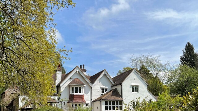
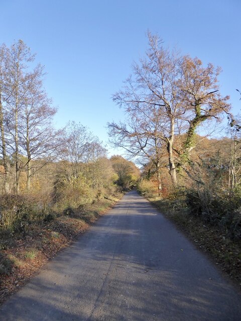
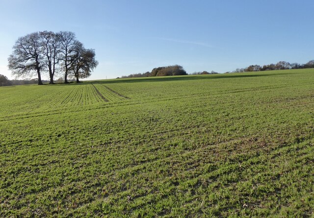
Canterbury Wood, Sussex, also known as Canterbury Forest, is a woodland area located in the county of Sussex, England. Covering an approximate area of several square miles, this ancient forest is renowned for its natural beauty and rich biodiversity, attracting visitors from all over the world.

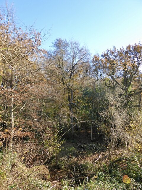
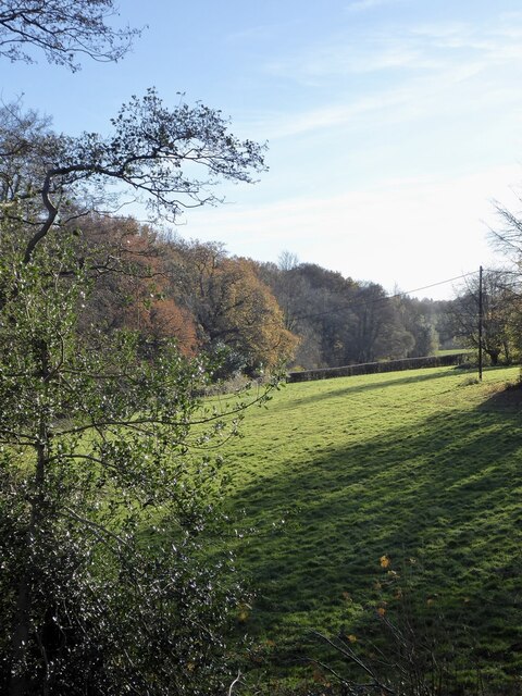
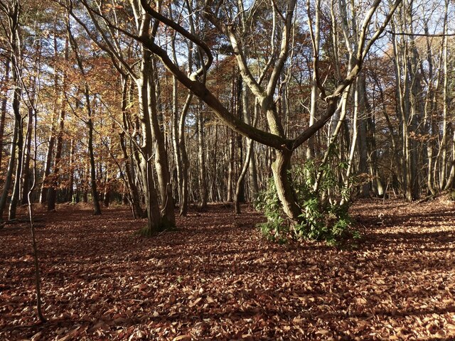
The wood is predominantly composed of a mix of broadleaf and coniferous trees, including oak, beech, pine, and birch. These trees provide a lush canopy that creates a unique and tranquil environment, making it a popular destination for nature enthusiasts and hikers.

Canterbury Wood is home to a diverse range of wildlife, including various species of birds, mammals, and insects. Birdwatchers can spot woodpeckers, owls, and other woodland birds, while mammals such as deer, foxes, and rabbits can be glimpsed roaming the forest floor. The wood also hosts a variety of plant species, including wildflowers, ferns, and mosses, adding to its natural charm.

The wood offers several walking trails, allowing visitors to explore its picturesque landscapes and discover hidden gems along the way. These trails are well-maintained and provide opportunities for leisurely strolls, jogging, or more challenging hikes.

Canterbury Wood, Sussex, holds historical significance as well. It is believed to have been part of the ancient woodland that covered much of southern England and played a crucial role in supplying timber for various purposes throughout history.

With its remarkable scenery, abundant wildlife, and historical value, Canterbury Wood, Sussex, is a captivating destination for nature lovers and those seeking tranquility amidst the beauty of the English countryside.

If you have any feedback on the listing, please let us know in the comments section below.

Canterbury Wood Images

Images are sourced within 2km of 51.031448/-0.22549586 or Grid Reference TQ2427. Thanks to Geograph Open Source API. All images are credited.

House on Staplefield Road This is called "Brook Cottage", according to the large scale map.
House on Staplefield Road
This is called "Brook Cottage", according to the large scale map.
Equipment at the water treatment plant This is a small site - I couldn't see much else apart from the two green tanks. It smells a bit too, but luckily it's quite a way from any houses
Equipment at the water treatment plant
This is a small site - I couldn't see much else apart from the two green tanks. It smells a bit too, but luckily it's quite a way from any houses
Slaugham Mill Pond The largest of three ponds along one of the small streams at the head of the River Ouse.
Slaugham Mill Pond
The largest of three ponds along one of the small streams at the head of the River Ouse.
Slaugham Manor Slaugham Manor has had an eventful life. Completed in 1901 as a wealthy family home, it subsequently became a hotel and country club before changing again into a police training centre. It is now apartments.
History on <span class="nowrap"><a title="https://www.linkedin.com/pulse/history-slaugham-manor-superb-conversion-important-house-van-loock/" rel="nofollow ugc noopener" href="https://www.linkedin.com/pulse/history-slaugham-manor-superb-conversion-important-house-van-loock/">Link</a><img style="margin-left:2px;" alt="External link" title="External link - shift click to open in new window" src="https://s1.geograph.org.uk/img/external.png" width="10" height="10"/></span>
Strangely, the 200 metres or so of road past the manor is signed as no public right of way. As the public path walk around is quite lengthy I doubt many people worry about that. 
But if anybody does care, this is a zoom and crop image taken from the public footpath at the end of the private bit.
Slaugham Manor
Slaugham Manor has had an eventful life. Completed in 1901 as a wealthy family home, it subsequently became a hotel and country club before changing again into a police training centre. It is now apartments. History on LinkExternal link Strangely, the 200 metres or so of road past the manor is signed as no public right of way. As the public path walk around is quite lengthy I doubt many people worry about that. But if anybody does care, this is a zoom and crop image taken from the public footpath at the end of the private bit.
Furnace Pond Cottage, Staplefield Road, Slaugham Common A conglomeration of buildings from different eras. The earliest parts dates from the 16th century and was built for an iron worker from nearby Slaugham Furnace. This section is on the right. It was extended in the late 18th century to become a pair of cottages with that part now in the middle. The house became one again in the 1930s when another extension was added on the eastern side.
Furnace Pond Cottage, Staplefield Road, Slaugham Common
A conglomeration of buildings from different eras. The earliest parts dates from the 16th century and was built for an iron worker from nearby Slaugham Furnace. This section is on the right. It was extended in the late 18th century to become a pair of cottages with that part now in the middle. The house became one again in the 1930s when another extension was added on the eastern side.
The Lag The name of the field according to Slaugham's 1842 tithe map that is now woodland. It is bounded to the east by Slaugham Lane and to the north and west by Scotland Gill, a tributary of the River Ouse.
The Lag
The name of the field according to Slaugham's 1842 tithe map that is now woodland. It is bounded to the east by Slaugham Lane and to the north and west by Scotland Gill, a tributary of the River Ouse.
Pond Bay, Slaugham Furnace A view of the southern side of the dam which now carries Hampshire Hill, see <a href="https://www.geograph.org.uk/photo/7659112">TQ2428 : Hampshire Hill</a>, past the pond, see <a href="https://www.geograph.org.uk/photo/7659118">TQ2428 : Furnace Pond</a>. The furnace was known to be in operation between 1574-1601 and was sited at the point Scotland Gill turns south, see <a href="https://www.geograph.org.uk/photo/7659100">TQ2428 : Site of Slaugham Furnace</a>
Pond Bay, Slaugham Furnace
A view of the southern side of the dam which now carries Hampshire Hill, see TQ2428 : Hampshire Hill, past the pond, see TQ2428 : Furnace Pond. The furnace was known to be in operation between 1574-1601 and was sited at the point Scotland Gill turns south, see TQ2428 : Site of Slaugham Furnace
Site of Slaugham Furnace Known to be in operation between 1574 and 1601. The pond bay still survives, see <a href="https://www.geograph.org.uk/photo/7659097">TQ2428 : Pond Bay, Slaugham Furnace</a> and <a href="https://www.geograph.org.uk/photo/7659112">TQ2428 : Hampshire Hill</a>, as well as the pond, see <a href="https://www.geograph.org.uk/photo/7659118">TQ2428 : Furnace Pond</a>.
Site of Slaugham Furnace
Known to be in operation between 1574 and 1601. The pond bay still survives, see TQ2428 : Pond Bay, Slaugham Furnace and TQ2428 : Hampshire Hill, as well as the pond, see TQ2428 : Furnace Pond.
Front Meadow The name of the field according to Slaugham's 1842 tithe map located to the south of the pond bay carrying Hampshire Hill and west of Scotland Gill, a tributary of the River Ouse.
Front Meadow
The name of the field according to Slaugham's 1842 tithe map located to the south of the pond bay carrying Hampshire Hill and west of Scotland Gill, a tributary of the River Ouse.
Hampshire Hill The lane links Ashfold Crossways to Slaugham Common and here traverses across the former pond bay of Slaugham Furnace, see also <a href="https://www.geograph.org.uk/photo/7659097">TQ2428 : Pond Bay, Slaugham Furnace</a>. The site of the furnace was on the southern side, see <a href="https://www.geograph.org.uk/photo/7659100">TQ2428 : Site of Slaugham Furnace</a>, whilst the pond still survives and is to the north, see <a href="https://www.geograph.org.uk/photo/7659118">TQ2428 : Furnace Pond</a>. There are 56 former anti-tank buoys lining the pond side of the road.
Hampshire Hill
The lane links Ashfold Crossways to Slaugham Common and here traverses across the former pond bay of Slaugham Furnace, see also TQ2428 : Pond Bay, Slaugham Furnace. The site of the furnace was on the southern side, see TQ2428 : Site of Slaugham Furnace, whilst the pond still survives and is to the north, see TQ2428 : Furnace Pond. There are 56 former anti-tank buoys lining the pond side of the road.
Furnace Pond Created to power Slaugham Furnace which was in operation between 1574 and 1601. The pond bay still survives, see <a href="https://www.geograph.org.uk/photo/7659097">TQ2428 : Pond Bay, Slaugham Furnace</a> and <a href="https://www.geograph.org.uk/photo/7659112">TQ2428 : Hampshire Hill</a>, with the former site to the south, see <a href="https://www.geograph.org.uk/photo/7659100">TQ2428 : Site of Slaugham Furnace</a>.
Furnace Pond
Created to power Slaugham Furnace which was in operation between 1574 and 1601. The pond bay still survives, see TQ2428 : Pond Bay, Slaugham Furnace and TQ2428 : Hampshire Hill, with the former site to the south, see TQ2428 : Site of Slaugham Furnace.
Barn Meadow The name of the field according to Slaugham's 1842 tithe map located to the south of Hampshire hill and west of Scotland Farm, whose barn can be seen.
Barn Meadow
The name of the field according to Slaugham's 1842 tithe map located to the south of Hampshire hill and west of Scotland Farm, whose barn can be seen.
Three Cornered Field/Three Acres/Little Field The name of the fields according to Slaugham's 1842 tithe map that have been merged along with <a href="https://www.geograph.org.uk/photo/7659122">TQ2428 : Barn Meadow</a> to the east. Little Field is adjacent to Barn Meadow, whilst Three Acres and Three Cornered Field are sandwiched between Hampshire Hill to the north and Hamshire Wood to the south. Three Cornered Field abuts the parish boundary with Lower Beeding whose unnamed field lies in the foreground next to the bridleway heading south to the B2115.
Three Cornered Field/Three Acres/Little Field
The name of the fields according to Slaugham's 1842 tithe map that have been merged along with TQ2428 : Barn Meadow to the east. Little Field is adjacent to Barn Meadow, whilst Three Acres and Three Cornered Field are sandwiched between Hampshire Hill to the north and Hamshire Wood to the south. Three Cornered Field abuts the parish boundary with Lower Beeding whose unnamed field lies in the foreground next to the bridleway heading south to the B2115.
Tulleys Rough A view of the newly planted eastern side of the wood.
Tulleys Rough
A view of the newly planted eastern side of the wood.
Lower Sandpit Plantation The southern end of the wood adjacent to Hampshire Hill.
Lower Sandpit Plantation
The southern end of the wood adjacent to Hampshire Hill.
Plummers Plain The eastern end of what was once an expanse of heathland located on the southern side of St Leonard's Forest. The area has now been converted to fields.
Plummers Plain
The eastern end of what was once an expanse of heathland located on the southern side of St Leonard's Forest. The area has now been converted to fields.
Handcross Road The B2110 heading east to Handcross from Ashfold Crossways
Handcross Road
The B2110 heading east to Handcross from Ashfold Crossways
Green Valley, Hammerpond Road, Ashfold Crossways Does not appear on an aerial photograph from 1947 but does on a 1958 OS map. One of the few dwellings that make up the small hamlet of Ashfold Crossways.
Green Valley, Hammerpond Road, Ashfold Crossways
Does not appear on an aerial photograph from 1947 but does on a 1958 OS map. One of the few dwellings that make up the small hamlet of Ashfold Crossways.
Show me another place!

Canterbury Wood is located at Grid Ref: TQ2427 (Lat: 51.031448, Lng: -0.22549586)

Administrative County: West Sussex

District: Mid Sussex

Police Authority: Sussex

What 3 Words

///starfish.splints.shatters. Near Handcross, West Sussex

Related Wikis

Warninglid

Warninglid (historically known as Warninglyth and Warningeld) is a small village in the Mid Sussex District of West Sussex, England. It lies on the B2115...

St Mary's Church, Slaugham

St Mary's Church is an Anglican church in the village of Slaugham in Mid Sussex, one of seven local government districts in the English county of West...

Slaugham

Slaugham () is a village and civil parish in the Mid Sussex District of West Sussex, England. It is located 7 miles (11 km) to the south of Crawley, on...

Newells Preparatory School

Newells Preparatory School came to Lower Beeding, Sussex, in 1946. It has been at Handcross and known as Handcross Park School since 1968. It merged with...

Lower Beeding

Lower Beeding is a village and civil parish in the Horsham District of West Sussex, England. The village lies on the B2110, B2115 and A281 roads 3.5 miles...

Leonardslee

Leonardslee is an English country house and English landscape garden and woodland garden in Lower Beeding, near Horsham, West Sussex, England. The Grade...

Nymans

Nymans is an English garden to the east of the village of Handcross, and in the civil parish of Slaugham in West Sussex, England. The garden was developed...

Colwood, West Sussex

Colwood is a village near Warninglid in West Sussex, England. It is the site of Colwood Manor. == References == The geographic coordinates are from the...

Nearby Amenities

Located within 500m of 51.031448,-0.22549586
The data included in this document is from www.openstreetmap.org. The data is made available under ODbL.

Have you been to Canterbury Wood?

Leave your review of Canterbury Wood below (or comments, questions and feedback).