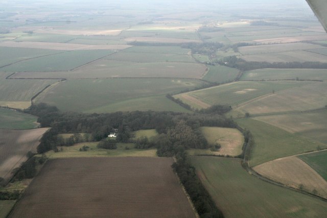
Wold Newton Covert

Wood, Forest in Lincolnshire

England

Wold Newton Covert

Scallows Hall, near Binbrook: aerial 2015 See also <a href="https://www.geograph.org.uk/photo/4777104">TF2494 : Scallows Hall to Wold Newton: aerial 2015</a>.
Scallows Hall, near Binbrook: aerial 2015 Credit: Chris

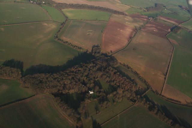
Wold Newton Covert is a picturesque village located in Lincolnshire, England. Situated in the heart of the Wolds, it is renowned for its stunning woodland landscapes and serene atmosphere. The village derives its name from the Old English word "wold," referring to an elevated area of land, and "covert," meaning a dense thicket or forest.

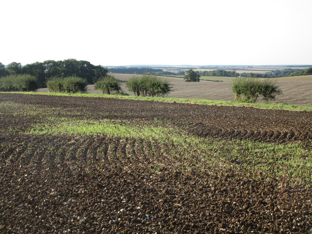
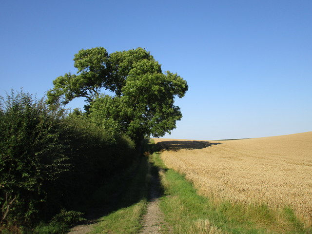
This charming village is nestled amidst rolling hills, offering breathtaking views of the surrounding countryside. The area is characterized by dense woodlands, which contribute to the village's tranquil ambiance and make it an ideal retreat for nature lovers and outdoor enthusiasts.

Wold Newton Covert is home to a small and close-knit community that takes great pride in maintaining the village's natural beauty and preserving its heritage. The village is dotted with picturesque cottages, many of which date back several centuries, adding to its traditional charm.

In addition to its natural splendor, Wold Newton Covert boasts several attractions and amenities. The village is home to a quaint church, St. Peter's, which is a focal point for the community and features stunning architectural details. There are also walking and hiking trails that meander through the woodlands, providing an opportunity to explore the area's flora and fauna.

The village is well-connected to nearby towns and cities by road, making it easily accessible for both residents and visitors. Wold Newton Covert offers a peaceful and idyllic setting, making it a desirable destination for those seeking solace in the beauty of the English countryside.

If you have any feedback on the listing, please let us know in the comments section below.

Wold Newton Covert Images

Images are sourced within 2km of 53.436212/-0.131319 or Grid Reference TF2494. Thanks to Geograph Open Source API. All images are credited.

Scallows Hall, near Binbrook: aerial 2015 See also <a href="https://www.geograph.org.uk/photo/4777104">TF2494 : Scallows Hall to Wold Newton: aerial 2015</a>.
Scallows Hall, near Binbrook: aerial 2015
Scallows Hall to Wold Newton: aerial 2015 The Hall itself is in the trees behind the camera - see <a href="https://www.geograph.org.uk/photo/4777088">TF2494 : Scallows Hall, near Binbrook: aerial 2015</a>.
Wold Newton (in <a href="https://www.geograph.org.uk/gridref/TF2496">TF2496</a>) is the next village upwards and to the left.
Scallows Hall to Wold Newton: aerial 2015
The Hall itself is in the trees behind the camera - see TF2494 : Scallows Hall, near Binbrook: aerial 2015. Wold Newton (in TF2496) is the next village upwards and to the left.
Wold Newton: aerial 2016
Boundary hedge The hedge crossing the picture marks the boundary between the parihses of Binbrook (this side) and Swinhope. It is also the boundary between East Lindsey (this side) and West Lindsey Districts.
Boundary hedge
The hedge crossing the picture marks the boundary between the parihses of Binbrook (this side) and Swinhope. It is also the boundary between East Lindsey (this side) and West Lindsey Districts.
Farm track to Top Farm Not a public right of way.
Farm track to Top Farm
Not a public right of way.
Stubble field above Binbrook This has had a crop of oilseed rape, The farmer has started to prepare for the next crop.
Stubble field above Binbrook
This has had a crop of oilseed rape, The farmer has started to prepare for the next crop.
Bridleway to Parsonage Farm The route of the bridleway can be discerned by the line of weeds in a field that has had a crop of oilseed rape in it.
Bridleway to Parsonage Farm
The route of the bridleway can be discerned by the line of weeds in a field that has had a crop of oilseed rape in it.
Entrance to Bingham's Farm
Stubble field and small plantation near Binbrook Hall The field has had a crop of oilseed rape.
Stubble field and small plantation near Binbrook Hall
The field has had a crop of oilseed rape.
Small plantation near Binbrook Hall
Curious green strip Not a footpath, nor does it separate two different crops.
Curious green strip
Not a footpath, nor does it separate two different crops.
Around the bend at Cold Harbour
Junction on a windy bike ride through the Lincolnshire Wolds The Red Arrows flew over as I was having a minute.
Junction on a windy bike ride through the Lincolnshire Wolds
The Red Arrows flew over as I was having a minute.
Earth marks east of Binbrook: aerial 2018 Between Limber Hill and Binbrook Hall (in <a href="https://www.geograph.org.uk/gridref/TF2494">TF2494</a>).
Earth marks east of Binbrook: aerial 2018
Between Limber Hill and Binbrook Hall (in TF2494).
Earth marks east of Binbrook: aerial 2018 (2) Between Limber Hill and Binbrook Hall (in <a href="https://www.geograph.org.uk/gridref/TF2494">TF2494</a>).
Earth marks east of Binbrook: aerial 2018 (2)
Between Limber Hill and Binbrook Hall (in TF2494).
Field designs east of Binbrook: aerial 2018 Near Parsonage Farm.
Field designs east of Binbrook: aerial 2018
Near Parsonage Farm.
Farm east of Binbrook: aerial 2018 Binbrook Hall and Binbrook Hall Farm.
Farm east of Binbrook: aerial 2018
Binbrook Hall and Binbrook Hall Farm.
Woodland and house between Binbrook and Wold Newton: aerial 2018 Scallows Hall.
Woodland and house between Binbrook and Wold Newton: aerial 2018
Scallows Hall.
Show me another place!

Wold Newton Covert is located at Grid Ref: TF2494 (Lat: 53.436212, Lng: -0.131319)

Unitary Authority: North East Lincolnshire

Police Authority: Humberside

What 3 Words

///flattered.detection.prices. Near Wold Newton, Lincolnshire

Related Wikis

Wold Newton, Lincolnshire

Wold Newton is a village and civil parish in North East Lincolnshire, England. It is situated just over 1 mile (1.6 km) west from the A18 road, 7 miles...

Swinhope

Swinhope is a village and civil parish about 6 miles west south west of North Thoresby railway station, in the West Lindsey district, in the county of...

RAF Kelstern

Royal Air Force Kelstern or RAF Kelstern is a former Royal Air Force station 3.6 miles (5.8 km) south east of Binbrook, Lincolnshire and 4.9 miles (7...

Binbrook

Binbrook is a village and civil parish in the East Lindsey district of Lincolnshire, England. It is situated on the B1203 road, and 8 miles (13 km) north...

Have you been to Wold Newton Covert?

Leave your review of Wold Newton Covert below (or comments, questions and feedback).