Perching Hovel Wood

Wood, Forest in Sussex Mid Sussex

England

Perching Hovel Wood

Devil's Dyke View Point Devil's Dyke is a V-shaped valley on the South Downs Way in southern England, near Brighton and Hove. It is part of the Southern England Chalk Formation.

The 300-foot-deep valley was carved by tremendous amounts of water running off the Downs during the last Ice Age when large amounts of snow thawed and the frozen chalk prevented any further absorption; erosion was aided by the freeze-thaw cycle and the valley was deepened by the 'sludging' of the saturated chalk
<span class="nowrap"><a title="http://en.wikipedia.org/wiki/Devil%27s_Dyke,_Sussex" rel="nofollow ugc noopener" href="http://en.wikipedia.org/wiki/Devil%27s_Dyke,_Sussex">Link</a><img style="margin-left:2px;" alt="External link" title="External link - shift click to open in new window" src="https://s1.geograph.org.uk/img/external.png" width="10" height="10"/></span>
Devil's Dyke View Point Credit: PAUL FARMER

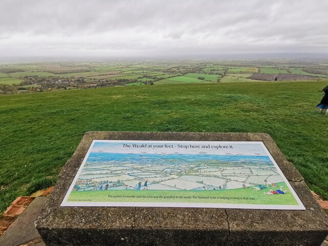
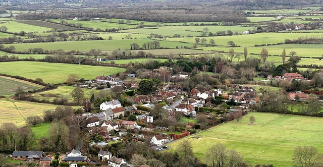
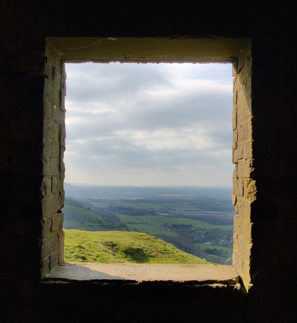
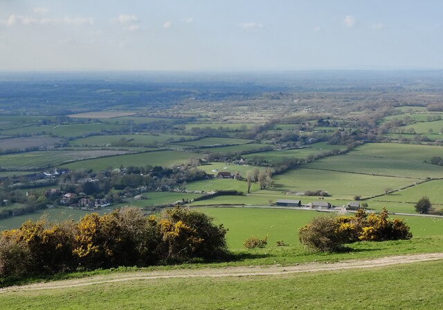
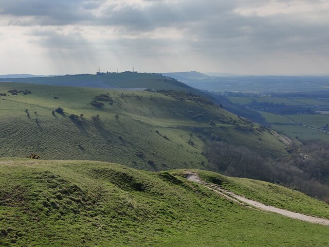
Perching Hovel Wood, located in Sussex, England, is a picturesque woodland area that offers a serene and tranquil escape from bustling city life. Covering an area of approximately 30 acres, this enchanting forest is known for its diverse range of flora and fauna, making it a haven for nature enthusiasts and wildlife lovers alike.

The wood is dominated by a mix of native broadleaf trees, including oak, ash, and beech, which create a dense canopy that filters sunlight and provides a cool and shaded environment. The forest floor is adorned with a carpet of wildflowers, such as bluebells and wood anemones, which burst into vibrant displays during the spring months.

Perching Hovel Wood is also home to a variety of wildlife species, including deer, rabbits, and a plethora of bird species. It is not uncommon to hear the melodious songs of thrushes and warblers as you wander through the woodland trails.

Visitors to Perching Hovel Wood can enjoy a range of activities, from leisurely walks along well-maintained paths to birdwatching and nature photography. The wood is also a popular spot for families, with designated picnic areas and a small playground for children to enjoy.

The management of Perching Hovel Wood is committed to preserving the natural beauty and biodiversity of the area. They regularly undertake conservation efforts, including tree planting and habitat restoration, to ensure the long-term sustainability of the woodland ecosystem.

In conclusion, Perching Hovel Wood in Sussex is a captivating and idyllic woodland destination that offers a peaceful retreat and an opportunity to connect with nature. Whether you are seeking solitude or a family outing, this enchanting forest promises a memorable experience for all who visit.

If you have any feedback on the listing, please let us know in the comments section below.

Perching Hovel Wood Images

Images are sourced within 2km of 50.893045/-0.23811248 or Grid Reference TQ2411. Thanks to Geograph Open Source API. All images are credited.

Devil's Dyke View Point Devil's Dyke is a V-shaped valley on the South Downs Way in southern England, near Brighton and Hove. It is part of the Southern England Chalk Formation.

The 300-foot-deep valley was carved by tremendous amounts of water running off the Downs during the last Ice Age when large amounts of snow thawed and the frozen chalk prevented any further absorption; erosion was aided by the freeze-thaw cycle and the valley was deepened by the 'sludging' of the saturated chalk
<span class="nowrap"><a title="http://en.wikipedia.org/wiki/Devil%27s_Dyke,_Sussex" rel="nofollow ugc noopener" href="http://en.wikipedia.org/wiki/Devil%27s_Dyke,_Sussex">Link</a><img style="margin-left:2px;" alt="External link" title="External link - shift click to open in new window" src="https://s1.geograph.org.uk/img/external.png" width="10" height="10"/></span>
Devil's Dyke View Point
Devil's Dyke is a V-shaped valley on the South Downs Way in southern England, near Brighton and Hove. It is part of the Southern England Chalk Formation. The 300-foot-deep valley was carved by tremendous amounts of water running off the Downs during the last Ice Age when large amounts of snow thawed and the frozen chalk prevented any further absorption; erosion was aided by the freeze-thaw cycle and the valley was deepened by the 'sludging' of the saturated chalk LinkExternal link
Fulking - from the South Downs This is a cross-grid shot. The camera was in the square to the south.
Fulking - from the South Downs
This is a cross-grid shot. The camera was in the square to the south.
Tree and reflection A collection of photographs taken around midday by Geographers from all over Britain and Ireland. 
See all the images on the map: <a title="https://www.geograph.org.uk/stuff/xmas.php?year=2022" href="https://www.geograph.org.uk/stuff/xmas.php?year=2022">Link</a>
Tree and reflection
A collection of photographs taken around midday by Geographers from all over Britain and Ireland. See all the images on the map: Link
Inscription by the spring
View through a window A derelict building at Devil's Dyke, with a view through the window towards Fulking.
View through a window
A derelict building at Devil's Dyke, with a view through the window towards Fulking.
View from Devil's Dyke across the Low Weald
The South Downs near Fulking The South Downs is one of the four areas of chalk downland in southern England. They extend from the eastern side of Hampshire through Sussex, culminating in the cliffs at Beachy Head.
The South Downs is England's newest National Park, its designation taking effect on March 31, 2010. There are many Sites of Special Scientific Interest within the park.
The area is relatively unpopulated, although along its southern periphery there is an almost uninterrupted ribbon of seaside towns. It is extremely popular with walkers, having one principal long distance footpath, the South Downs Way, and many interconnecting ones. There are three principal gaps in the upland through which rivers flow; and there are also many dry valleys along its length.
The South Downs have a long history; there are archaeological remains from Neolithic times. Until the middle of the 20th century, sheep-rearing was the main occupation of those living on the Downs.

At 886ft, Butser Hill is the highest point of the South Downs.

Extract from Wikipedia <span class="nowrap"><a title="http://en.wikipedia.org/wiki/South_Downs" rel="nofollow ugc noopener" href="http://en.wikipedia.org/wiki/South_Downs">Link</a><img style="margin-left:2px;" alt="External link" title="External link - shift click to open in new window" src="https://s1.geograph.org.uk/img/external.png" width="10" height="10"/></span>
The South Downs near Fulking
The South Downs is one of the four areas of chalk downland in southern England. They extend from the eastern side of Hampshire through Sussex, culminating in the cliffs at Beachy Head. The South Downs is England's newest National Park, its designation taking effect on March 31, 2010. There are many Sites of Special Scientific Interest within the park. The area is relatively unpopulated, although along its southern periphery there is an almost uninterrupted ribbon of seaside towns. It is extremely popular with walkers, having one principal long distance footpath, the South Downs Way, and many interconnecting ones. There are three principal gaps in the upland through which rivers flow; and there are also many dry valleys along its length. The South Downs have a long history; there are archaeological remains from Neolithic times. Until the middle of the 20th century, sheep-rearing was the main occupation of those living on the Downs. At 886ft, Butser Hill is the highest point of the South Downs. Extract from Wikipedia LinkExternal link
Inside a derelict building at Devil's Dyke
View from the South Downs near Devil's Dyke The South Downs is one of the four areas of chalk downland in southern England. They extend from the eastern side of Hampshire through Sussex, culminating in the cliffs at Beachy Head.
The South Downs is England's newest National Park, its designation taking effect on March 31, 2010. There are many Sites of Special Scientific Interest within the park.
The area is relatively unpopulated, although along its southern periphery there is an almost uninterrupted ribbon of seaside towns. It is extremely popular with walkers, having one principal long distance footpath, the South Downs Way, and many interconnecting ones. There are three principal gaps in the upland through which rivers flow; and there are also many dry valleys along its length.
The South Downs have a long history; there are archaeological remains from Neolithic times. Until the middle of the 20th century, sheep-rearing was the main occupation of those living on the Downs.

At 886ft, Butser Hill is the highest point of the South Downs.

Extract from Wikipedia <span class="nowrap"><a title="http://en.wikipedia.org/wiki/South_Downs" rel="nofollow ugc noopener" href="http://en.wikipedia.org/wiki/South_Downs">Link</a><img style="margin-left:2px;" alt="External link" title="External link - shift click to open in new window" src="https://s1.geograph.org.uk/img/external.png" width="10" height="10"/></span>
View from the South Downs near Devil's Dyke
The South Downs is one of the four areas of chalk downland in southern England. They extend from the eastern side of Hampshire through Sussex, culminating in the cliffs at Beachy Head. The South Downs is England's newest National Park, its designation taking effect on March 31, 2010. There are many Sites of Special Scientific Interest within the park. The area is relatively unpopulated, although along its southern periphery there is an almost uninterrupted ribbon of seaside towns. It is extremely popular with walkers, having one principal long distance footpath, the South Downs Way, and many interconnecting ones. There are three principal gaps in the upland through which rivers flow; and there are also many dry valleys along its length. The South Downs have a long history; there are archaeological remains from Neolithic times. Until the middle of the 20th century, sheep-rearing was the main occupation of those living on the Downs. At 886ft, Butser Hill is the highest point of the South Downs. Extract from Wikipedia LinkExternal link
Summer pastimes on the South Downs On fine summer Saturdays the hang-gliders and para-gliders gather to catch the rising thermals. This location, above Devil's Dyke in the South Downs, is managed by the National Trust and offers stunning views. Here you can see right across to the North Downs.
Summer pastimes on the South Downs
On fine summer Saturdays the hang-gliders and para-gliders gather to catch the rising thermals. This location, above Devil's Dyke in the South Downs, is managed by the National Trust and offers stunning views. Here you can see right across to the North Downs.
Fulking The village of Fulking is a classic spring line settlement.  It is viewed here from the South Downs Way which runs along the top of the South Downs escarpment.
Fulking
The village of Fulking is a classic spring line settlement. It is viewed here from the South Downs Way which runs along the top of the South Downs escarpment.
Edburton The tiny village of Edburton is one of the spring line settlements at the foot of the northern edge of the South Downs.
Edburton
The tiny village of Edburton is one of the spring line settlements at the foot of the northern edge of the South Downs.
Dip slope of the South Downs escarpment This view is taken looking south from the South Downs Way and shows the undulating nature of the dip slope of the escarpment.
Dip slope of the South Downs escarpment
This view is taken looking south from the South Downs Way and shows the undulating nature of the dip slope of the escarpment.
ascending Truleigh Hill - view to the west The buildings in the middle distance are Tottington Manor Farm and Hotel.
ascending Truleigh Hill - view to the west
The buildings in the middle distance are Tottington Manor Farm and Hotel.
Tumulus, Edburton Hill, Sussex Close to the South Downs Way, probably an ancient routeway. The tumulus is not in an obvious position where its outline would stand out on the skyline. Looking West towards the radio masts on Truleigh Hill.
Tumulus, Edburton Hill, Sussex
Close to the South Downs Way, probably an ancient routeway. The tumulus is not in an obvious position where its outline would stand out on the skyline. Looking West towards the radio masts on Truleigh Hill.
A Lone Armchair at Devil's Dyke Not the kind of landmark you would normally expect to see!
A Lone Armchair at Devil's Dyke
Not the kind of landmark you would normally expect to see!
Perching Hill Taken from the South Downs Way looking south. The site of the medieval village of Perching is where the bushes are in the dip to the right of the picture.
Perching Hill
Taken from the South Downs Way looking south. The site of the medieval village of Perching is where the bushes are in the dip to the right of the picture.
Trailer near the track to Brookfields Farm Looking south towards the Downs with (I think) Truleigh Hill in the far distance.
Trailer near the track to Brookfields Farm
Looking south towards the Downs with (I think) Truleigh Hill in the far distance.
Show me another place!

Perching Hovel Wood is located at Grid Ref: TQ2411 (Lat: 50.893045, Lng: -0.23811248)

Administrative County: West Sussex

District: Mid Sussex

Police Authority: Sussex

What 3 Words

///vibes.issued.troll. Near Henfield, West Sussex

Related Wikis

Edburton

Edburton is a small village and former civil parish, now in the parish of Upper Beeding, in the Horsham district, in the county of West Sussex, England...

Fulking

Fulking is a village and civil parish in the Mid Sussex District of West Sussex, England. The parish lies wholly with the South Downs National Park. The...

Edburton Castle Ring

Edburton Castle Ring (or Castle Rings) is an archaeological site in West Sussex, England, on the peak of Edburton Hill on the South Downs, near the villages...

Beeding Hill to Newtimber Hill

Beeding Hill to Newtimber Hill is a 321 ha (790-acre) biological and geological Downland Site of Special Scientific Interest (SSSI) north of Shoreham-by...

Nearby Amenities

Located within 500m of 50.893045,-0.23811248
Power: tower
Lat/Long: 50.8924199/-0.233428
Barrier: kissing_gate
Lat/Long: 50.8952743/-0.2437138
Power: tower
Source: Bing
Lat/Long: 50.8892779/-0.2344286
Power: tower
Lat/Long: 50.8952041/-0.2325058
Barrier: kissing_gate
Lat/Long: 50.8950775/-0.2402186
The data included in this document is from www.openstreetmap.org. The data is made available under ODbL.

Have you been to Perching Hovel Wood?

Leave your review of Perching Hovel Wood below (or comments, questions and feedback).