The Little Rough

Wood, Forest in Sussex Horsham

England

The Little Rough

House on Staplefield Road This is called "Brook Cottage", according to the large scale map.
House on Staplefield Road Credit: Ian Cunliffe

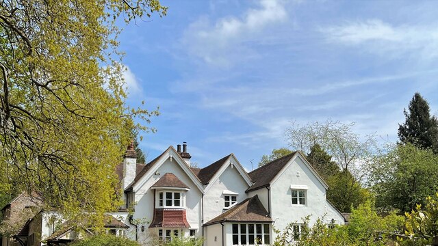
The Little Rough, Sussex, also known as Wood or Forest, is a picturesque area located in the county of Sussex, England. This enchanting woodland is a haven for nature lovers and outdoor enthusiasts alike, offering a serene and tranquil environment.

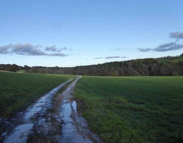
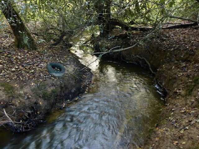
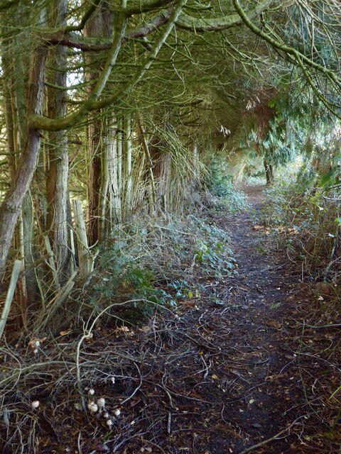
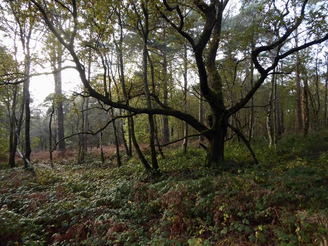
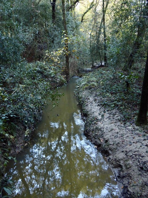
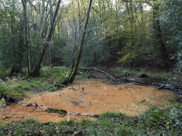
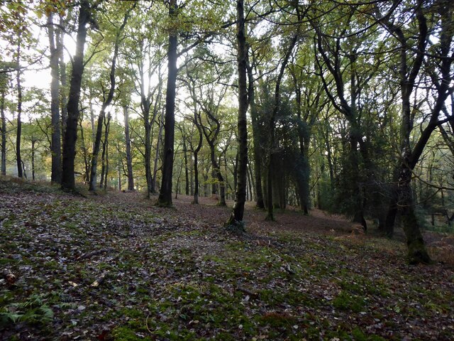
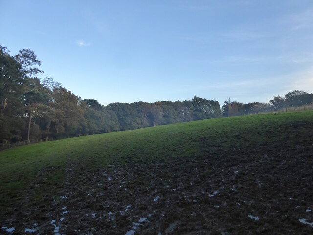
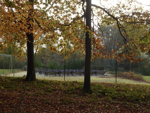
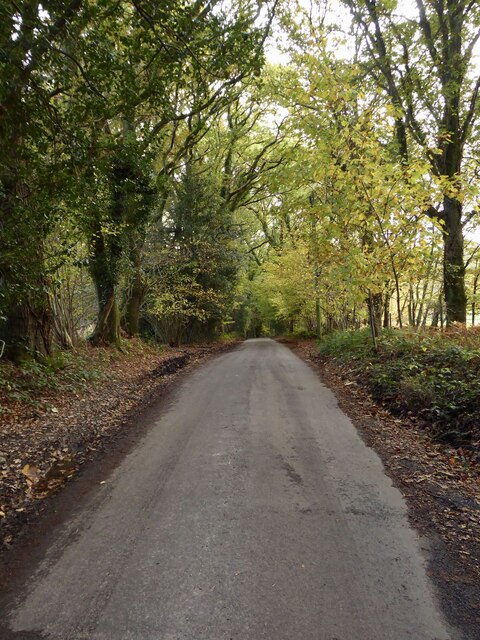
Situated amidst rolling hills and bordered by quaint villages, The Little Rough boasts an impressive variety of flora and fauna. The woodland is abundant with towering oak, beech, and birch trees, creating a dense canopy that filters sunlight and creates a magical atmosphere. The forest floor is adorned with carpets of vibrant wildflowers, ferns, and mosses, adding a splash of color to the verdant surroundings.

The Little Rough is home to an array of wildlife species. Visitors may catch glimpses of deer gracefully darting through the undergrowth, squirrels playfully scampering up trees, and a plethora of bird species soaring through the skies. The forest is a birdwatcher's paradise, with species such as woodpeckers, owls, and thrushes frequently spotted.

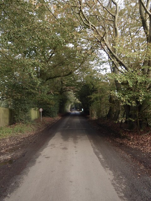
For those seeking outdoor activities, The Little Rough offers a myriad of options. Hiking trails meander through the woodland, allowing visitors to explore its hidden gems and discover breathtaking viewpoints. Nature enthusiasts can also enjoy birdwatching, photography, or simply immersing themselves in the peaceful ambiance.

Additionally, The Little Rough is a designated nature reserve, ensuring the protection and preservation of its unique ecosystem. The woodland is managed by dedicated conservationists who strive to maintain its natural beauty and safeguard its inhabitants.

In summary, The Little Rough, Sussex, is a captivating woodland that beckons visitors with its idyllic charm. With its diverse flora and fauna, stunning scenery, and array of outdoor activities, it is a destination that truly encapsulates the beauty of nature.

If you have any feedback on the listing, please let us know in the comments section below.

The Little Rough Images

Images are sourced within 2km of 51.041193/-0.23296922 or Grid Reference TQ2328. Thanks to Geograph Open Source API. All images are credited.

House on Staplefield Road This is called "Brook Cottage", according to the large scale map.
House on Staplefield Road
This is called "Brook Cottage", according to the large scale map.
Equipment at the water treatment plant This is a small site - I couldn't see much else apart from the two green tanks. It smells a bit too, but luckily it's quite a way from any houses
Equipment at the water treatment plant
This is a small site - I couldn't see much else apart from the two green tanks. It smells a bit too, but luckily it's quite a way from any houses
Slaugham Mill Pond The largest of three ponds along one of the small streams at the head of the River Ouse.
Slaugham Mill Pond
The largest of three ponds along one of the small streams at the head of the River Ouse.
St Leonard's Forest An open area of the forest located on the western side of Newstead Gill.
St Leonard's Forest
An open area of the forest located on the western side of Newstead Gill.
Newstead Gill A part of the River Arun catchment area that rises to the south of Pease Pottage and feeds Hammer Pond before joining Goldings Stream.
Newstead Gill
A part of the River Arun catchment area that rises to the south of Pease Pottage and feeds Hammer Pond before joining Goldings Stream.
Public Footpath 1702 Linking the High Weald Landscape Trail to the east of Grouse Road with Hammerpond Road, crossing Newstead Gill and Carterslodge Gill in the process. Plenty of fungi on the ground.
Public Footpath 1702
Linking the High Weald Landscape Trail to the east of Grouse Road with Hammerpond Road, crossing Newstead Gill and Carterslodge Gill in the process. Plenty of fungi on the ground.
St Leonard's Forest An area of the forest located to the north of Carterslodge Gill and east of Newstead Gill.
St Leonard's Forest
An area of the forest located to the north of Carterslodge Gill and east of Newstead Gill.
Carterslodge Gill Part of the River Arun catchment area that rises near Handcross and feeds Hammer Pond.
Carterslodge Gill
Part of the River Arun catchment area that rises near Handcross and feeds Hammer Pond.
Boggy Area, Hammerhill Wood Located to the immediate south of Carterslodge Gill.
Boggy Area, Hammerhill Wood
Located to the immediate south of Carterslodge Gill.
Hammerhill Wood Located on the southern side of Carterslodge Gill.
Hammerhill Wood
Located on the southern side of Carterslodge Gill.
Field next to Hammerhill Wood Not named as Lower Beeding parish was only formed in 1838 and thus was not surveyed for tithes. The mist is actually smoke from a nearby bonfire.
Field next to Hammerhill Wood
Not named as Lower Beeding parish was only formed in 1838 and thus was not surveyed for tithes. The mist is actually smoke from a nearby bonfire.
Hammerpond Road A minor road linking Alford Crossways to the eastern edge of Horsham passing three former hammer ponds.
Hammerpond Road
A minor road linking Alford Crossways to the eastern edge of Horsham passing three former hammer ponds.
Jacksons Farmhouse, Hammerpond Road Dating from the 19th century.
Jacksons Farmhouse, Hammerpond Road
Dating from the 19th century.
Solar Panels, Woodbank, Hammerpond Road An old tennis court now used for generating electricity.
Solar Panels, Woodbank, Hammerpond Road
An old tennis court now used for generating electricity.
Church Lane Heading south from Hammerpond Road to Lower Beeding.
Church Lane
Heading south from Hammerpond Road to Lower Beeding.
Furnace Pond Cottage, Staplefield Road, Slaugham Common A conglomeration of buildings from different eras. The earliest parts dates from the 16th century and was built for an iron worker from nearby Slaugham Furnace. This section is on the right. It was extended in the late 18th century to become a pair of cottages with that part now in the middle. The house became one again in the 1930s when another extension was added on the eastern side.
Furnace Pond Cottage, Staplefield Road, Slaugham Common
A conglomeration of buildings from different eras. The earliest parts dates from the 16th century and was built for an iron worker from nearby Slaugham Furnace. This section is on the right. It was extended in the late 18th century to become a pair of cottages with that part now in the middle. The house became one again in the 1930s when another extension was added on the eastern side.
The Lag The name of the field according to Slaugham's 1842 tithe map that is now woodland. It is bounded to the east by Slaugham Lane and to the north and west by Scotland Gill, a tributary of the River Ouse.
The Lag
The name of the field according to Slaugham's 1842 tithe map that is now woodland. It is bounded to the east by Slaugham Lane and to the north and west by Scotland Gill, a tributary of the River Ouse.
Pond Bay, Slaugham Furnace A view of the southern side of the dam which now carries Hampshire Hill, see <a href="https://www.geograph.org.uk/photo/7659112">TQ2428 : Hampshire Hill</a>, past the pond, see <a href="https://www.geograph.org.uk/photo/7659118">TQ2428 : Furnace Pond</a>. The furnace was known to be in operation between 1574-1601 and was sited at the point Scotland Gill turns south, see <a href="https://www.geograph.org.uk/photo/7659100">TQ2428 : Site of Slaugham Furnace</a>
Pond Bay, Slaugham Furnace
A view of the southern side of the dam which now carries Hampshire Hill, see TQ2428 : Hampshire Hill, past the pond, see TQ2428 : Furnace Pond. The furnace was known to be in operation between 1574-1601 and was sited at the point Scotland Gill turns south, see TQ2428 : Site of Slaugham Furnace
Show me another place!

The Little Rough is located at Grid Ref: TQ2328 (Lat: 51.041193, Lng: -0.23296922)

Administrative County: West Sussex

District: Horsham

Police Authority: Sussex

What 3 Words

///twit.shepherds.tests. Near Handcross, West Sussex

Related Wikis

Slaugham

Slaugham () is a village and civil parish in the Mid Sussex District of West Sussex, England. It is located 7 miles (11 km) to the south of Crawley, on...

St Mary's Church, Slaugham

St Mary's Church is an Anglican church in the village of Slaugham in Mid Sussex, one of seven local government districts in the English county of West...

Newells Preparatory School

Newells Preparatory School came to Lower Beeding, Sussex, in 1946. It has been at Handcross and known as Handcross Park School since 1968. It merged with...

Lower Beeding

Lower Beeding is a village and civil parish in the Horsham District of West Sussex, England. The village lies on the B2110, B2115 and A281 roads 3.5 miles...

Warninglid

Warninglid (historically known as Warninglyth and Warningeld) is a small village in the Mid Sussex District of West Sussex, England. It lies on the B2115...

Handcross Hill bus crash

On 12 July 1906, a bus crashed into a tree on Handcross Hill in Sussex, England, killing 10 people and injuring a further 26 in the worst road crash in...

Handcross

Handcross is a village in the Mid Sussex District of West Sussex, England. It lies on the A23 road 4.2 miles (6.8 kilometres) south of Crawley. At the...

Nymans

Nymans is an English garden to the east of the village of Handcross, and in the civil parish of Slaugham in West Sussex, England. The garden was developed...

Nearby Amenities

Located within 500m of 51.041193,-0.23296922
Ashfold Crossways
Place: locality
Lat/Long: 51.0428509/-0.2332204
Addr City: Plummers Plain
Addr Housename: Warleys
Addr Postcode: RH13 6PE
Addr Street: Hammerpond Road
Building: house
Lat/Long: 51.0444794/-0.2365947
Noexit: yes
Lat/Long: 51.042304/-0.2331785
Fountain
Lat/Long: 51.040863/-0.2386346
Noexit: yes
Lat/Long: 51.0421834/-0.2339076
Noexit: yes
Lat/Long: 51.0420338/-0.2341709
Noexit: yes
Lat/Long: 51.0428206/-0.2339899
Post Box
Collection Times: Mo-Fr 17:15; Sa 10:00
Operator: Royal Mail
Post Box Mounting: pier
Post Box Type: lamp
Ref: RH13 106
Royal Cypher: EIIR
Royal Cypher Wikidata: Q33102113
Lat/Long: 51.0429117/-0.2332596
Power: pole
Lat/Long: 51.0455927/-0.2336818
The data included in this document is from www.openstreetmap.org. The data is made available under ODbL.

Have you been to The Little Rough?

Leave your review of The Little Rough below (or comments, questions and feedback).