Aspull

Settlement in Lancashire

England

Aspull

The Engine Shed For the miniature railway in Haig Hall Country Park
The Engine Shed Credit: Kevin Waterhouse

Aspull is a village and civil parish located in the Metropolitan Borough of Wigan, Lancashire, England. Situated approximately 3 miles west of Wigan town center, it is a part of the historic county of Lancashire. Aspull falls under the administrative jurisdiction of the Greater Manchester Combined Authority, despite being historically part of Lancashire.

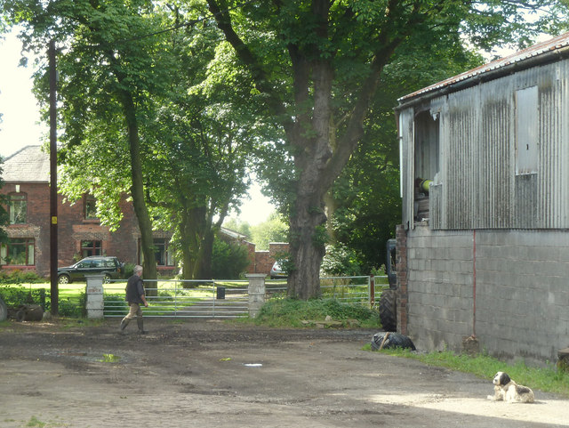
The village is known for its historical significance, with records dating back to the 13th century. Historically, Aspull was primarily an agricultural community, and it later developed into a coal mining area during the Industrial Revolution. Many of the village's original buildings still stand, providing a glimpse into its rich history.

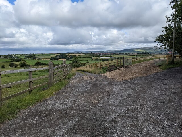
Today, Aspull is a thriving community with a population of approximately 7,000 residents. The village retains its rural charm, surrounded by picturesque countryside and green spaces. It offers a range of amenities, including local shops, pubs, and community facilities such as schools and a leisure center.

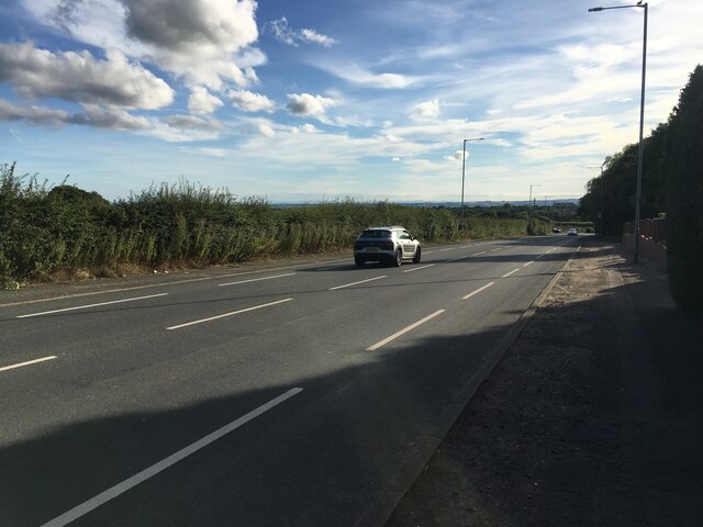
The village is well-connected, with easy access to major transportation routes, including the M61 motorway and several railway stations nearby. This makes Aspull an attractive place for commuters who work in nearby towns and cities.

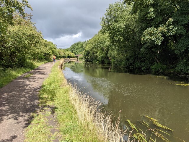
Aspull's close proximity to the larger urban areas of Wigan and Manchester provides residents with a variety of employment and leisure opportunities. Additionally, the village is nestled near several natural attractions, such as Haigh Hall Country Park and the Leeds and Liverpool Canal, offering opportunities for outdoor activities and leisurely walks.

Overall, Aspull is a charming village with a rich history, offering a balance of rural living and convenient access to nearby urban centers.

If you have any feedback on the listing, please let us know in the comments section below.

Aspull Images

Images are sourced within 2km of 53.569448/-2.579059 or Grid Reference SD6108. Thanks to Geograph Open Source API. All images are credited.

The Engine Shed For the miniature railway in Haig Hall Country Park
The Engine Shed
For the miniature railway in Haig Hall Country Park
St David’s Crescent, Aspull
B5239 Dicconson Lane
Approaching Springs Bridge The bridge carries Wigan Road over the Leeds and Liverpool Canal
Approaching Springs Bridge
The bridge carries Wigan Road over the Leeds and Liverpool Canal
Path on route of former railway One of the many paths around Wigan following the routes of former mineral railways to collieries or iron works. This path is off the Cale Lane / Withington Lane junction.
Path on route of former railway
One of the many paths around Wigan following the routes of former mineral railways to collieries or iron works. This path is off the Cale Lane / Withington Lane junction.
A quiet stretch of canal
Trees encroaching on to the canal A great haven for wildlife in an urban environment.
Trees encroaching on to the canal
A great haven for wildlife in an urban environment.
An impressive set of boaters' facilities at Top Lock
A junction on Toddington Lane
The impressive approach to Haigh Hall
Footpath from Dicconson Lane to Brinsop Hall
Brinsop Hall Farm from Cinder Hill
Old barn at Cinder Hill Probably once part of Cinder Hill Farm
Old barn at Cinder Hill
Probably once part of Cinder Hill Farm
Old barn at Cinder Hill Probably once part of Cinder Hill Farm
Old barn at Cinder Hill
Probably once part of Cinder Hill Farm
Footpath between Landlord's Farm and Hilton House
Brinsop Hall
Brinsop Hall
Springs Bridge Springs Bridge is Bridge 59A on the Leeds-Liverpool Canal near Aspull, Wigan.
Springs Bridge
Springs Bridge is Bridge 59A on the Leeds-Liverpool Canal near Aspull, Wigan.
Wigan Top Lock Junction Two narrowboats waiting above the Wigan Top Lock Junction on the Leeds-Liverpool Canal.
Wigan Top Lock Junction
Two narrowboats waiting above the Wigan Top Lock Junction on the Leeds-Liverpool Canal.
Show me another place!

Aspull is located at Grid Ref: SD6108 (Lat: 53.569448, Lng: -2.579059)

Unitary Authority: Wigan

Police Authority: Greater Manchester

What 3 Words

///skews.roadblock.gurgling. Near Blackrod, Manchester

Nearby Locations

Aspull

Related Wikis

Aspull

Aspull is a village in the Metropolitan Borough of Wigan, in Greater Manchester, England. Historically in Lancashire, Aspull, along with Haigh, is surrounded...

Haigh, Greater Manchester

Haigh () is a village and civil parish in the Metropolitan Borough of Wigan, Greater Manchester, England. Historically part of Lancashire, it is located...

St David's Church, Haigh

St David's Church is in Copperas Lane, Haigh, Wigan, Greater Manchester, England. It is an active Anglican parish church in the deanery of Wigan, the archdeaconry...

Haigh Hall Miniature Railway

Haigh Hall Miniature Railway (HHMR) is a 15 in (381 mm) gauge miniature railway, situated in the grounds of Haigh Country Park in Haigh, Greater Manchester...

Nearby Amenities

Located within 500m of 53.569448,-2.579059
Source: Yahoo Aerial Imagery
Lat/Long: 53.5731011/-2.5750347
Source: Yahoo Aerial Imagery
Lat/Long: 53.5725639/-2.5767991
Source: Yahoo Aerial Imagery
Lat/Long: 53.5724107/-2.5775977
Source: Yahoo Aerial Imagery
Lat/Long: 53.5722864/-2.578453
Source: Yahoo Aerial Imagery
Lat/Long: 53.5719428/-2.5797108
Source: Yahoo Aerial Imagery
Lat/Long: 53.571175/-2.5817125
Source: Yahoo Aerial Imagery
Lat/Long: 53.5709905/-2.5821454
Source: Yahoo Aerial Imagery
Lat/Long: 53.5707473/-2.5827483
Source: Yahoo Aerial Imagery
Lat/Long: 53.5705086/-2.5832939
Source: Yahoo Aerial Imagery
Lat/Long: 53.5702438/-2.5838007
Source: Yahoo Aerial Imagery
Lat/Long: 53.5696281/-2.5845592
Source: Yahoo Aerial Imagery
Lat/Long: 53.5686709/-2.5853625
Source: Yahoo Aerial Imagery
Lat/Long: 53.5685824/-2.5854447
Source: Yahoo Aerial Imagery
Lat/Long: 53.5676329/-2.5846664
Source: Yahoo Aerial Imagery
Lat/Long: 53.5674447/-2.5842631
Source: Yahoo Aerial Imagery
Lat/Long: 53.5669593/-2.5829553
Source: Yahoo Aerial Imagery
Lat/Long: 53.5663994/-2.5815805
Source: Yahoo Aerial Imagery
Lat/Long: 53.5661823/-2.5818575
Source: Yahoo Aerial Imagery
Lat/Long: 53.5661444/-2.5821467
Source: Yahoo Aerial Imagery
Lat/Long: 53.5662564/-2.5829214
Source: Yahoo Aerial Imagery
Lat/Long: 53.5662482/-2.5833611
Source: Yahoo Aerial Imagery
Lat/Long: 53.5666664/-2.5841924
Source: Yahoo Aerial Imagery
Lat/Long: 53.5661705/-2.5825385
Source: Yahoo Aerial Imagery
Lat/Long: 53.5659218/-2.5827462
Source: Yahoo Aerial Imagery
Lat/Long: 53.5674013/-2.5821827
Source: Yahoo Aerial Imagery
Lat/Long: 53.5675531/-2.5815081
Source: Yahoo Aerial Imagery
Lat/Long: 53.5671402/-2.5807322
Noexit: yes
Source: Yahoo Aerial Imagery
Lat/Long: 53.567183/-2.5804819
Source: Yahoo Aerial Imagery
Lat/Long: 53.5680281/-2.583372
Source: Yahoo Aerial Imagery
Lat/Long: 53.5686388/-2.5843445
Source: Yahoo Aerial Imagery
Lat/Long: 53.5689623/-2.5846422
Source: Yahoo Aerial Imagery
Lat/Long: 53.5683672/-2.5838878
Source: Yahoo Aerial Imagery
Lat/Long: 53.5689586/-2.5828857
Source: Yahoo Aerial Imagery
Lat/Long: 53.5690237/-2.5827937
Source: Yahoo Aerial Imagery
Lat/Long: 53.5698757/-2.5815972
Source: Yahoo Aerial Imagery
Lat/Long: 53.5686082/-2.5822689
Source: Yahoo Aerial Imagery
Lat/Long: 53.5682051/-2.5816852
Source: Yahoo Aerial Imagery
Lat/Long: 53.5682545/-2.5815343
Source: Yahoo Aerial Imagery
Lat/Long: 53.5686538/-2.5809791
Source: Yahoo Aerial Imagery
Lat/Long: 53.5690796/-2.580413
Source: Yahoo Aerial Imagery
Lat/Long: 53.5682439/-2.5801883
Source: Yahoo Aerial Imagery
Lat/Long: 53.569547/-2.5809162
Source: Yahoo Aerial Imagery
Lat/Long: 53.5694127/-2.5834669
Source: Yahoo Aerial Imagery
Lat/Long: 53.5691368/-2.5838239
Source: Yahoo Aerial Imagery
Lat/Long: 53.5701373/-2.5824601
Source: Yahoo Aerial Imagery
Lat/Long: 53.5697442/-2.5811966
Source: Yahoo Aerial Imagery
Lat/Long: 53.5684027/-2.5790225
Source: Yahoo Aerial Imagery
Lat/Long: 53.5679641/-2.5796059
Source: Yahoo Aerial Imagery
Lat/Long: 53.5683836/-2.5787427
Source: Yahoo Aerial Imagery
Lat/Long: 53.5684877/-2.5782043
Source: Yahoo Aerial Imagery
Lat/Long: 53.568715/-2.5777838
Source: Yahoo Aerial Imagery
Lat/Long: 53.5690214/-2.5776502
Source: Yahoo Aerial Imagery
Lat/Long: 53.5690562/-2.5774467
Source: Yahoo Aerial Imagery
Lat/Long: 53.5694868/-2.5769868
Source: Yahoo Aerial Imagery
Lat/Long: 53.5696475/-2.576752
Noexit: yes
Source: Yahoo Aerial Imagery
Lat/Long: 53.56999/-2.5763172
Source: Yahoo Aerial Imagery
Lat/Long: 53.5692193/-2.5779486
Source: Yahoo Aerial Imagery
Lat/Long: 53.5695289/-2.5785329
Source: Yahoo Aerial Imagery
Lat/Long: 53.5697184/-2.5791944
Source: Yahoo Aerial Imagery
Lat/Long: 53.5696418/-2.5796766
Source: Yahoo Aerial Imagery
Lat/Long: 53.5696028/-2.5799977
Source: Yahoo Aerial Imagery
Lat/Long: 53.5697639/-2.5805468
Source: Yahoo Aerial Imagery
Lat/Long: 53.569988/-2.5808236
Source: Yahoo Aerial Imagery
Lat/Long: 53.5703177/-2.5810388
Source: Yahoo Aerial Imagery
Lat/Long: 53.5704051/-2.5811483
Source: Yahoo Aerial Imagery
Lat/Long: 53.5705822/-2.5815599
Source: Yahoo Aerial Imagery
Lat/Long: 53.570822/-2.579655
Source: Yahoo Aerial Imagery
Lat/Long: 53.5704948/-2.5792191
Source: Yahoo Aerial Imagery
Lat/Long: 53.5703432/-2.5787937
Source: Yahoo Aerial Imagery
Lat/Long: 53.570733/-2.5787928
Source: Yahoo Aerial Imagery
Lat/Long: 53.5700153/-2.5790054
Source: Yahoo Aerial Imagery
Lat/Long: 53.5705592/-2.5784176
Source: Yahoo Aerial Imagery
Lat/Long: 53.5705883/-2.5780586
Source: Yahoo Aerial Imagery
Lat/Long: 53.5701868/-2.577309
Source: Yahoo Aerial Imagery
Lat/Long: 53.5707322/-2.5836878
Source: Yahoo Aerial Imagery
Lat/Long: 53.5708857/-2.584193
Source: Yahoo Aerial Imagery
Lat/Long: 53.5709252/-2.5844344
Source: Yahoo Aerial Imagery
Lat/Long: 53.5709686/-2.5852683
Source: Yahoo Aerial Imagery
Lat/Long: 53.5698751/-2.5852707
Source: Yahoo Aerial Imagery
Lat/Long: 53.5702163/-2.5859179
Source: Yahoo Aerial Imagery
Lat/Long: 53.5712993/-2.5833233
Source: Yahoo Aerial Imagery
Lat/Long: 53.5723242/-2.5837632
Source: Yahoo Aerial Imagery
Lat/Long: 53.5722569/-2.584879
Source: Yahoo Aerial Imagery
Lat/Long: 53.5724492/-2.5838178
Source: Yahoo Aerial Imagery
Lat/Long: 53.5717099/-2.585079
Source: Yahoo Aerial Imagery
Lat/Long: 53.5717571/-2.583035
Source: Yahoo Aerial Imagery
Lat/Long: 53.5718889/-2.5822699
Source: Yahoo Aerial Imagery
Lat/Long: 53.5721107/-2.5810788
Source: Yahoo Aerial Imagery
Lat/Long: 53.5714616/-2.5820229
Source: Yahoo Aerial Imagery
Lat/Long: 53.5692651/-2.5862061
Source: Yahoo Aerial Imagery
Lat/Long: 53.5683803/-2.586389
Bus Stop
Stanley Road/Ratcliffe Road
Bus: yes
Naptan AtcoCode: 1800WK01151
Naptan Bearing: SE
Naptan CommonName: Stanley Road/Ratcliffe Road
Naptan Indicator: Nr Aspull Commo
Naptan Landmark: ASPULL COMMON
Naptan NaptanCode: manpmjpa
Naptan PlusbusZoneRef: MNCRPIC
Naptan ShortCommonName: Ratcliffe Road
Naptan Street: STANLEY ROAD
Naptan Verified: no
Network: TfGM
Public Transport: platform
Source: naptan_import
Lat/Long: 53.5728073/-2.5838997
Bus Stop
Scot Lane/Stanley Road
Bus: yes
Naptan AtcoCode: 1800WK06831
Naptan Bearing: NE
Naptan CommonName: Scot Lane/Stanley Road
Naptan Indicator: Os House 42
Naptan Landmark: HOUSE 42
Naptan NaptanCode: manptwdt
Naptan PlusbusZoneRef: MNCRPIC
Naptan ShortCommonName: Stanley Road
Naptan Street: SCOT LANE
Naptan Verified: no
Network: TfGM
Public Transport: platform
Source: naptan_import
Lat/Long: 53.5706812/-2.5830248
Bus Stop
Scot Lane/Stanley Road
Bus: yes
Naptan AtcoCode: 1800WK06881
Naptan Bearing: SW
Naptan CommonName: Scot Lane/Stanley Road
Naptan Indicator: Grass Verge
Naptan Landmark: HOUSE 36
Naptan NaptanCode: manptwgm
Naptan PlusbusZoneRef: MNCRPIC
Naptan ShortCommonName: Stanley Road
Naptan Street: SCOT LANE
Naptan Verified: no
Network: TfGM
Public Transport: platform
Source: naptan_import
Lat/Long: 53.5705643/-2.5830383
Bus Stop
Haigh Road/Aspull Clinic (Stop A)
Bus: yes
Local Ref: A
Naptan AtcoCode: 1800WK07991
Naptan Bearing: SE
Naptan CommonName: Haigh Road/Aspull Clinic (Stop A)
Naptan Indicator: Stop A
Naptan Landmark: ASPULL CLINIC
Naptan NaptanCode: manpwamg
Naptan PlusbusZoneRef: MNCRPIC
Naptan ShortCommonName: Aspull Clinic
Naptan Street: HAIGH ROAD
Naptan Verified: no
Network: TfGM
Public Transport: platform
Source: naptan_import
Lat/Long: 53.5691655/-2.5860089
Bus Stop
Bolton Road/Aspull Common
Bus: yes
Naptan AtcoCode: 1800WK33641
Naptan Bearing: SE
Naptan CommonName: Bolton Road/Aspull Common
Naptan Indicator: Opp House 69
Naptan Landmark: HOUSE 49
Naptan NaptanCode: mantapwd
Naptan PlusbusZoneRef: MNCRPIC
Naptan ShortCommonName: Aspull Common
Naptan Street: BOLTON ROAD
Naptan Verified: no
Network: TfGM
Public Transport: platform
Source: naptan_import
Lat/Long: 53.5665166/-2.5817596
Bus Stop
Bolton Road/Aspull Common
Bus: yes
Naptan AtcoCode: 1800WK33651
Naptan Bearing: NW
Naptan CommonName: Bolton Road/Aspull Common
Naptan Indicator: Spare Land
Naptan Landmark: HOUSE 75
Naptan NaptanCode: mantapwg
Naptan PlusbusZoneRef: MNCRPIC
Naptan ShortCommonName: Aspull Common
Naptan Street: BOLTON ROAD
Naptan Verified: no
Network: TfGM
Public Transport: platform
Source: naptan_import
Lat/Long: 53.56616/-2.5811507
Bus Stop
Finger Post (Stop C)
Bus: yes
Local Ref: C
Naptan AtcoCode: 1800WK33661
Naptan Bearing: W
Naptan CommonName: Finger Post (Stop C)
Naptan Indicator: Stop C
Naptan Landmark: QUEENS HEAD PUB
Naptan NaptanCode: mantapwj
Naptan PlusbusZoneRef: MNCRPIC
Naptan ShortCommonName: Finger Post
Naptan Street: BOLTON ROAD
Naptan Verified: no
Network: TfGM
Public Transport: platform
Source: naptan_import
Lat/Long: 53.5676757/-2.5855353
Bus Stop
Finger Post (Stop B)
Bus: yes
Departures Board: timetable
Local Ref: B
Naptan AtcoCode: 1800WK33821
Naptan Bearing: N
Naptan CommonName: Finger Post (Stop B)
Naptan Indicator: Stop B
Naptan Landmark: NR ROUNDABOUT
Naptan NaptanCode: mantatdt
Naptan PlusbusZoneRef: MNCRPIC
Naptan ShortCommonName: Finger Post
Naptan Street: WIGAN ROAD
Naptan Verified: no
Network: TfGM
Public Transport: platform
Shelter: yes
Source: naptan_import
Lat/Long: 53.5682571/-2.5857797
Bus Stop
Scot Lane/Scot Lane Farm
Bus: yes
Naptan AtcoCode: 1800WK34191
Naptan Bearing: SW
Naptan CommonName: Scot Lane/Scot Lane Farm
Naptan Indicator: Farm
Naptan Landmark: FARM
Naptan NaptanCode: mantatgt
Naptan PlusbusZoneRef: MNCRPIC
Naptan ShortCommonName: Scot Lane Farm
Naptan Street: SCOT LANE
Naptan Verified: no
Network: TfGM
Public Transport: platform
Source: naptan_import
Lat/Long: 53.5726641/-2.576362
Bus Stop
Scot Lane/British Legion Club
Bus: yes
Naptan AtcoCode: 1800WK34211
Naptan Bearing: SW
Naptan CommonName: Scot Lane/British Legion Club
Naptan Indicator: British Legion
Naptan Landmark: BRITISH LEGION
Naptan NaptanCode: mantatgw
Naptan PlusbusZoneRef: MNCRPIC
Naptan ShortCommonName: British Legion
Naptan Street: SCOT LANE
Naptan Verified: no
Network: TfGM
Public Transport: platform
Source: naptan_import
Lat/Long: 53.5713735/-2.5811467
Source: Yahoo Aerial Imagery
Lat/Long: 53.5686201/-2.5853778
Aspull
Place: village
Lat/Long: 53.5686712/-2.5862312
Noexit: yes
Lat/Long: 53.5661958/-2.5799419
Crossing
Crossing: unmarked
Crossing Island: yes
Tactile Paving: yes
Lat/Long: 53.5677519/-2.5848054
Crossing
Crossing: unmarked
Crossing Island: yes
Tactile Paving: yes
Lat/Long: 53.568783/-2.5853323
Crossing
Crossing: unmarked
Crossing Island: yes
Tactile Paving: yes
Lat/Long: 53.5684016/-2.5854072
Aspull War Memorial
Historic: memorial
Memorial: war_memorial
Lat/Long: 53.5679548/-2.5853548
Clock
Aspull Clock
Date: no
Display: analog
Faces: 4
Support: pole
Lat/Long: 53.5689917/-2.5855032
Bench
Lat/Long: 53.5689933/-2.5856642
Bench
Lat/Long: 53.5690969/-2.5853423
Post Office
Aspull Moor Post Office
Addr City: Wigan
Addr Housenumber: 3
Addr Postcode: WN2 1YX
Addr Street: Scot Lane
Addr Suburb: Aspull
Branch: Aspull Moor
Brand: Post Office
Brand Wikidata: Q1783168
Check Date: 2020-02-20
Contact Website: https://www.postoffice.co.uk/branch-finder/2724065/aspull-moor
Operator: Post Office
Ref Pol Id: 10860
Lat/Long: 53.569088/-2.5843914
Post Box
Drive Through: no
Operator: Royal Mail
Operator Wikidata: Q638098
Post Box Design: type_b
Post Box Type: pillar
Ref: WN2 100
Royal Cypher: EIIR
Lat/Long: 53.5692247/-2.5846946
Crossing
Crossing: unmarked
Crossing Island: no
Crossing Markings: no
Tactile Paving: yes
Lat/Long: 53.567736/-2.5859588
Crossing
Crossing: uncontrolled
Crossing Island: no
Crossing Markings: zebra
Crossing Ref: zebra
Tactile Paving: yes
Lat/Long: 53.5675162/-2.5844431
Give Way
Lat/Long: 53.5683265/-2.5853779
Crossing
Crossing: unmarked
Crossing Island: yes
Tactile Paving: yes
Lat/Long: 53.5683985/-2.5855554
Crossing
Crossing: unmarked
Crossing Island: no
Crossing Markings: no
Tactile Paving: yes
Lat/Long: 53.567793/-2.5860492
Crossing
Crossing: unmarked
Crossing Island: yes
Tactile Paving: yes
Lat/Long: 53.5676825/-2.5848651
Crossing
Crossing: unmarked
Crossing Island: yes
Tactile Paving: yes
Lat/Long: 53.5687286/-2.585255
Give Way
Lat/Long: 53.5678792/-2.5859477
Give Way
Lat/Long: 53.5677/-2.5849915
Bus Stop
Scot Lane/British Legion Club
Bus: yes
Naptan AtcoCode: 1800WK13141
Naptan Bearing: NE
Naptan Landmark: BRITISH LEGION
Naptan NaptanCode: MANTPGPG
Naptan Street: Scot Lane
Naptan Verified: no
Network: TfGM
Public Transport: platform
Source: naptan_import
Lat/Long: 53.5714555/-2.5811736
Traffic Signals
Traffic Signals: crossing
Traffic Signals Direction: backward
Lat/Long: 53.5693969/-2.5847634
Traffic Signals
Traffic Signals: crossing
Traffic Signals Direction: forward
Lat/Long: 53.5694546/-2.5847137
Crossing
Button Operated: yes
Crossing: traffic_signals
Crossing Island: no
Crossing Markings: dots
Crossing Ref: puffin
Tactile Paving: yes
Lat/Long: 53.5694248/-2.5847393
Crossing
Crossing: unmarked
Crossing Island: no
Crossing Markings: no
Tactile Paving: no
Lat/Long: 53.5696612/-2.5846566
Grit Bin
Material: plastic
Lat/Long: 53.5697522/-2.5848114
Waste Basket
Colour: #000000
Material: metal
Lat/Long: 53.5698004/-2.5849341
Crossing
Crossing: pavement
Lat/Long: 53.5693255/-2.5847463
Give Way
Lat/Long: 53.5680079/-2.583406
The data included in this document is from www.openstreetmap.org. The data is made available under ODbL.

Have you been to Aspull?

Leave your review of Aspull below (or comments, questions and feedback).