Furzefield Wood
Wood, Forest in Sussex Horsham
England
Furzefield Wood

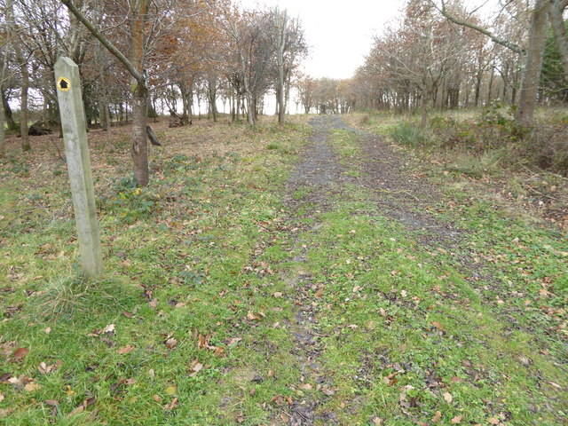
Furzefield Wood, located in Sussex, England, is a picturesque woodland covering an area of approximately 100 acres. This ancient woodland is renowned for its natural beauty and diverse ecosystem, making it a popular destination for nature enthusiasts and hikers alike.
The wood is predominantly composed of broadleaf trees, including oak, beech, and ash, which create a dense canopy providing shade and shelter for numerous wildlife species. The forest floor is adorned with a vibrant carpet of bluebells in the spring, creating a breathtaking sight for visitors.
One of the standout features of Furzefield Wood is its abundance of wildlife. The woodland is home to a variety of bird species, including woodpeckers, owls, and warblers, making it an excellent spot for birdwatching. Mammals such as deer, foxes, and badgers can also be spotted roaming through the undergrowth.
The wood offers a network of well-maintained footpaths and trails, allowing visitors to explore its tranquil surroundings. These paths wind through the ancient trees, taking visitors on a journey of discovery and providing ample opportunities to witness the woodland's natural wonders up close.
Furzefield Wood is managed by a local conservation organization, ensuring its preservation and protection for future generations. The wood also serves as an important site for scientific research, contributing to our understanding of woodland ecosystems and biodiversity.
Whether you are seeking a peaceful escape into nature or an opportunity to engage with wildlife, Furzefield Wood offers a captivating experience for visitors of all ages.
If you have any feedback on the listing, please let us know in the comments section below.
Furzefield Wood Images
Images are sourced within 2km of 50.971372/-0.25402273 or Grid Reference TQ2220. Thanks to Geograph Open Source API. All images are credited.


Furzefield Wood is located at Grid Ref: TQ2220 (Lat: 50.971372, Lng: -0.25402273)
Administrative County: West Sussex
District: Horsham
Police Authority: Sussex
What 3 Words
///slimy.zealous.freezers. Near Cowfold, West Sussex
Nearby Locations
Related Wikis
Wineham
Wineham is a hamlet mainly in the Shermanbury civil parish (and the same ecclesiastical parish) of the Horsham district of West Sussex, England. It is...

St Hugh's Charterhouse
St Hugh's Charterhouse, Parkminster, is the only post-Reformation Carthusian monastery in the United Kingdom. It is located in the parish of Cowfold, West...

Cowfold
Cowfold is a village and civil parish between Billingshurst and Haywards Heath in the Horsham District of West Sussex, England. The village is at the intersection...

Shermanbury
Shermanbury is a village and civil parish in the Horsham District of West Sussex, England. It lies on the A281 road approximately 2 miles (3 km) north...
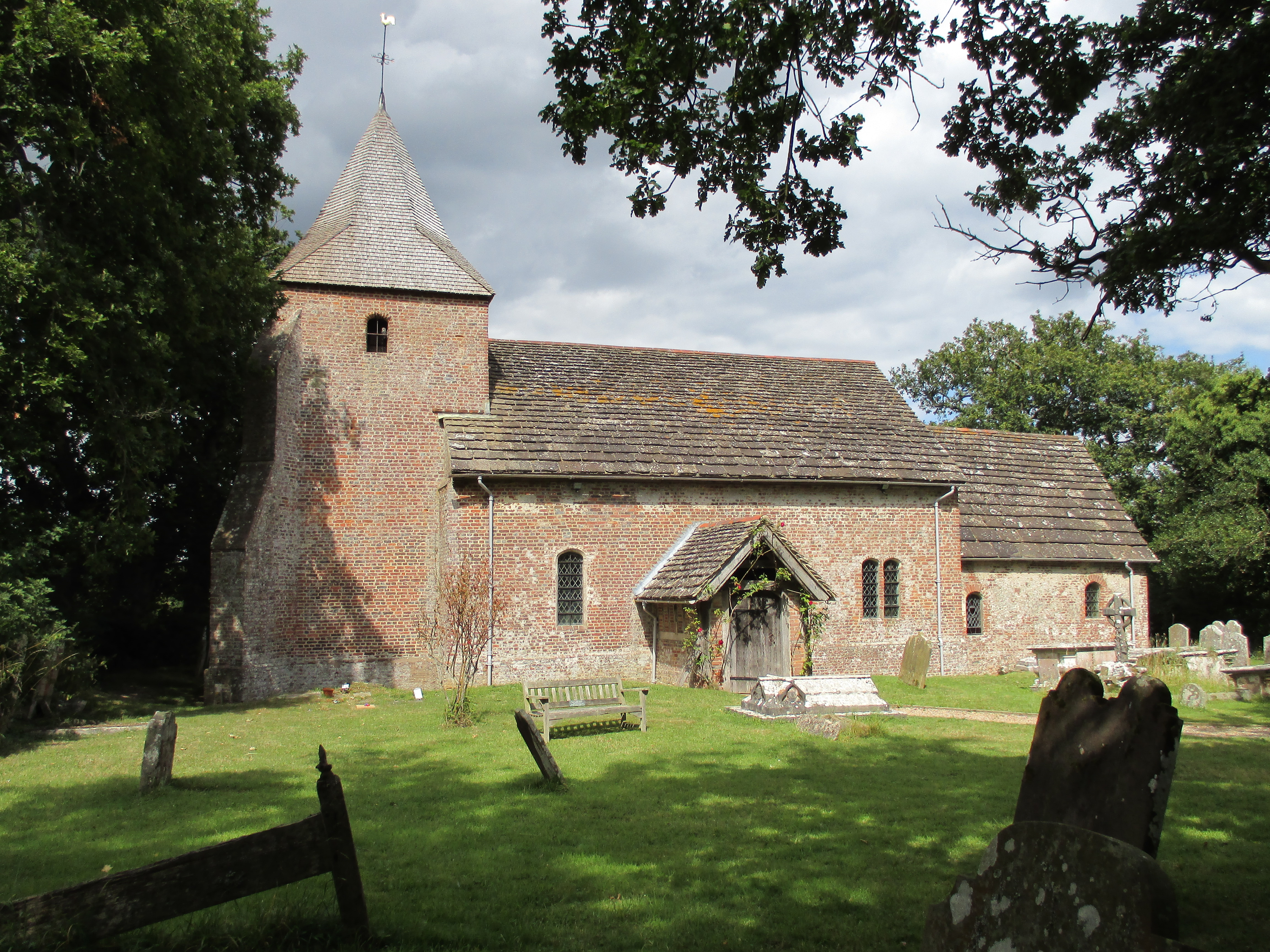
St Peter's Church, Twineham
St Peter's Church is the Church of England parish church of Twineham, a village in the Mid Sussex District of West Sussex, England. The church, with St...
Twineham
Twineham is a village and civil parish in the Mid Sussex District of West Sussex, England. It is located eight kilometres (5 miles) to the west of Burgess...

Henfield (electoral division)
Henfield is an electoral division of West Sussex in the United Kingdom and returns one member to sit on West Sussex County Council. The current County...

Littleworth, West Sussex
Littleworth is a hamlet in the Horsham District of West Sussex, England. It lies on the Partridge Green to Maplehurst road 2.9 miles (4.7 km) north of...
Nearby Amenities
Located within 500m of 50.971372,-0.25402273Have you been to Furzefield Wood?
Leave your review of Furzefield Wood below (or comments, questions and feedback).