Ten Pound Plantation

Wood, Forest in Yorkshire

England

Ten Pound Plantation

Farmland Copse This is a pretty little copse which breaks up the monotony of the flat Holderness Plain farmland.
Farmland Copse Credit: Andy Beecroft

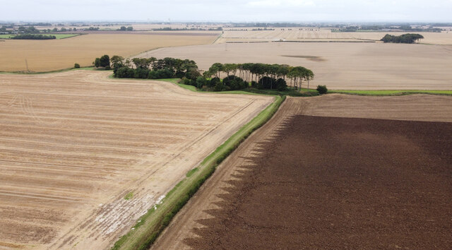
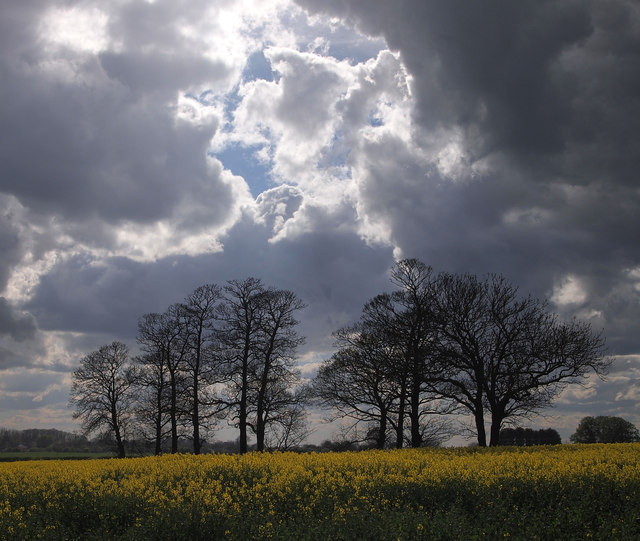
Ten Pound Plantation is a picturesque woodland located in Yorkshire, England. It spans over several acres and is known for its diverse and lush vegetation. The plantation is situated in a rural area, offering a tranquil and peaceful environment for visitors to explore and enjoy.

The woodland is named after an old legend that claims a ten-pound note was once lost and found within its grounds. The plantation features a variety of tree species, including oak, beech, and pine, which create a harmonious canopy above. The forest floor is covered in a thick layer of moss and ferns, adding to the enchanting atmosphere.

Ten Pound Plantation is a haven for nature enthusiasts and wildlife lovers. It is home to numerous bird species, such as woodpeckers, owls, and robins, making it an ideal spot for birdwatching. Squirrels can also be spotted scurrying up and down the trees, adding a touch of charm to the woodland experience.

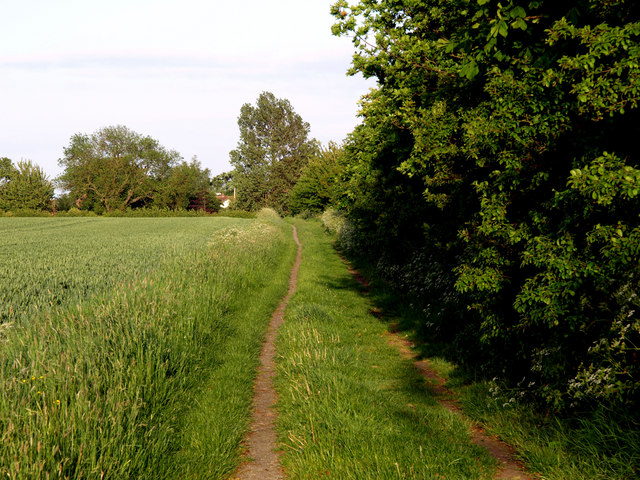
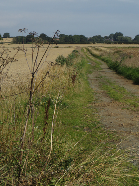
The plantation offers several well-maintained walking trails, allowing visitors to explore the diverse flora and fauna at their own pace. These paths wind through the forest, leading to hidden clearings and peaceful streams. There are also designated picnic areas where visitors can relax and enjoy the serenity of the surroundings.

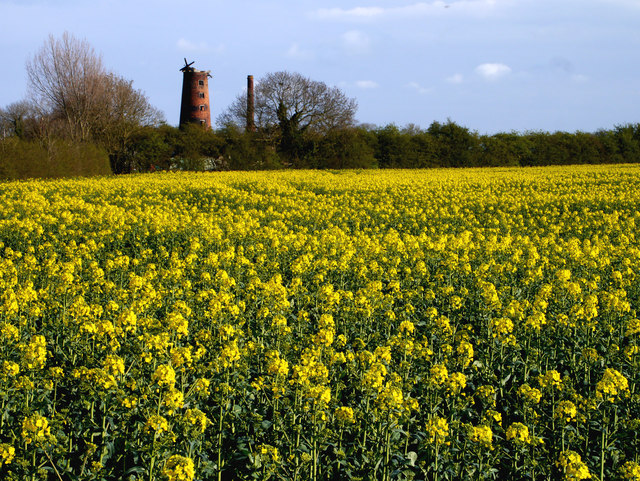
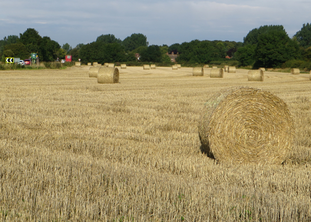
Ten Pound Plantation is open to the public year-round, with different seasons offering unique experiences. In spring, the woodland comes alive with vibrant wildflowers and blossoming trees, while autumn showcases a dazzling display of colors as the leaves change. The plantation is managed by a dedicated team that ensures its conservation and preservation, making it a beloved destination for nature lovers in Yorkshire.

If you have any feedback on the listing, please let us know in the comments section below.

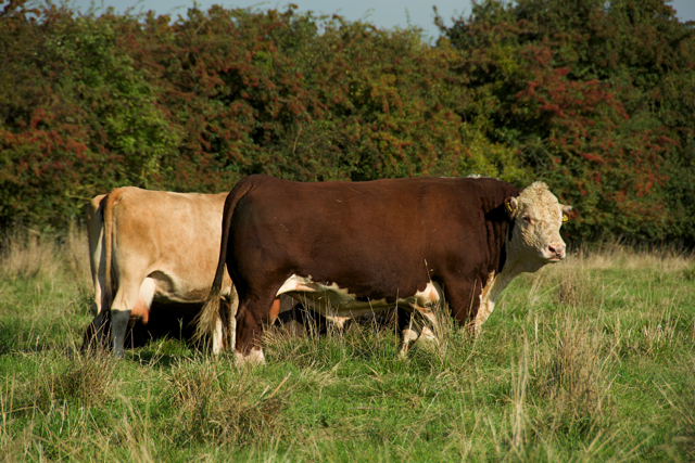
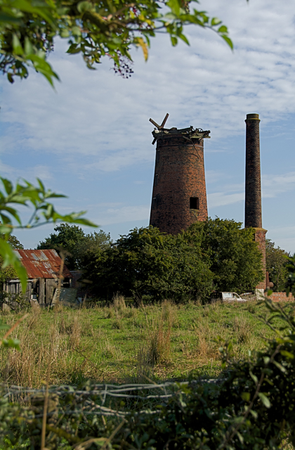
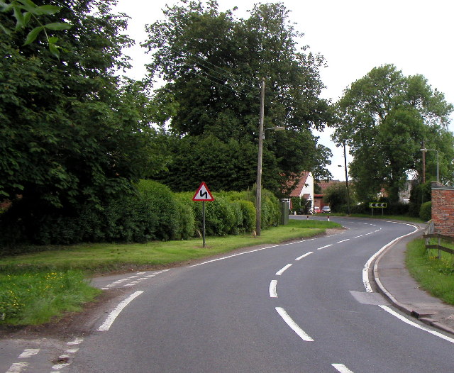
Ten Pound Plantation Images

Images are sourced within 2km of 53.783779/-0.14177283 or Grid Reference TA2233. Thanks to Geograph Open Source API. All images are credited.

Farmland Copse This is a pretty little copse which breaks up the monotony of the flat Holderness Plain farmland.
Farmland Copse
This is a pretty little copse which breaks up the monotony of the flat Holderness Plain farmland.
Late Summer Farm Activities I don't know exactly what the tractor's task was, but it just milled up and down this huge field.  The photo was taken from above the bend in the Humbleton to Elstronwick road.
Late Summer Farm Activities
I don't know exactly what the tractor's task was, but it just milled up and down this huge field. The photo was taken from above the bend in the Humbleton to Elstronwick road.
Humbleton, St Peter
Humbleton, St Peter
Lelley Balk
Lelley Balk
Looking east towards Stock Dove Shaw
Looking west towards Boggle Plantation
The Derelict Mill near Elstronwick The sail-less derelict windmill continues to relentlessly decay. The newly-flowered rapeseed has taken a lot longer than normal to reach this stage - presumably due to the cold weather we've had of late.
The Derelict Mill near Elstronwick
The sail-less derelict windmill continues to relentlessly decay. The newly-flowered rapeseed has taken a lot longer than normal to reach this stage - presumably due to the cold weather we've had of late.
Trees near Humbleton Grange
Church of St Lawrence, Elstronwick Sited at the far end of Front Lane, this secluded 19th century church is Grade 2 listed. Seen here from its southern side, where the graveyard is far more overgrown than at the front.
Church of St Lawrence, Elstronwick
Sited at the far end of Front Lane, this secluded 19th century church is Grade 2 listed. Seen here from its southern side, where the graveyard is far more overgrown than at the front.
Danthorpe cottages Row of dwellings on Southfield Lane in this hamlet
Danthorpe cottages
Row of dwellings on Southfield Lane in this hamlet
Back Lane, Elstronwick Heading east from the village towards Danthorpe
Back Lane, Elstronwick
Heading east from the village towards Danthorpe
Front Lane, Elstronwick The post box in the gatepost on the right is not a Royal Mail one but appears to have been recycled as a mail box for a private house.
Front Lane, Elstronwick
The post box in the gatepost on the right is not a Royal Mail one but appears to have been recycled as a mail box for a private house.
Farm track, Humbleton Track near Humbleton Manor Farm, leading to Flinton Grange from Long Lane
Farm track, Humbleton
Track near Humbleton Manor Farm, leading to Flinton Grange from Long Lane
Elstronwick church Seen from Front Lane, the secluded 19th century church of St Lawrence is Grade 2 listed.
Elstronwick church
Seen from Front Lane, the secluded 19th century church of St Lawrence is Grade 2 listed.
Bales near Lelley Seen from the public bridleway which leads from Newfield Lane towards Elstronwick
Bales near Lelley
Seen from the public bridleway which leads from Newfield Lane towards Elstronwick
Ploughing near Humbleton Arable field cultivation close to Humbleton Road
Ploughing near Humbleton
Arable field cultivation close to Humbleton Road
Elstronwick cattle Large bull, thankfully of apparently placid temperament (though I didn't test it) with several cows and calves in a field next to the mill
Elstronwick cattle
Large bull, thankfully of apparently placid temperament (though I didn't test it) with several cows and calves in a field next to the mill
Old mill, Elstronwick In the relatively featureless and generally flat local landscape, this derelict windmill is a clearly visible landmark for miles around
Old mill, Elstronwick
In the relatively featureless and generally flat local landscape, this derelict windmill is a clearly visible landmark for miles around
Show me another place!

Ten Pound Plantation is located at Grid Ref: TA2233 (Lat: 53.783779, Lng: -0.14177283)

Division: East Riding

Unitary Authority: East Riding of Yorkshire

Police Authority: Humberside

What 3 Words

///invested.puddings.scribble. Near Humbleton, East Yorkshire

Related Wikis

Humbleton

Humbleton is a village and civil parish in the East Riding of Yorkshire, England, in an area known as Holderness. It is situated approximately 9 miles...

Holderness Rural District

Holderness was a rural district in the East Riding of Yorkshire from 1935 to 1974. It covered the southern part of the East Riding's North Sea coast.It...

Elstronwick

Elstronwick is a village and civil parish in the East Riding of Yorkshire, England, in an area known as Holderness. It is situated approximately 3.5 miles...

Lelley

Lelley is a small village in the civil parish of Elstronwick, in the East Riding of Yorkshire, England, in an area known as Holderness. It is situated...

Beverley and Holderness (UK Parliament constituency)

Beverley and Holderness is a county constituency in the East Riding of Yorkshire for the House of Commons of the Parliament of the United Kingdom. It elects...

Danthorpe

Danthorpe is a hamlet in the civil parish of Elstronwick and the East Riding of Yorkshire, England, and in an area known as Holderness. The hamlet is approximately...

Holderness (borough)

Holderness was a local government district and borough in northern England, named after the Holderness peninsula. It was formed on 1 April 1974 along with...

Flinton, East Riding of Yorkshire

Flinton is a village in the civil parish of Humbleton, in the East Riding of Yorkshire, England, in an area known as Holderness. It is situated approximately...

Nearby Amenities

Located within 500m of 53.783779,-0.14177283
Power: pole
Lat/Long: 53.7813406/-0.1360811
Power: pole
Lat/Long: 53.7817214/-0.1384748
Power: pole
Lat/Long: 53.7820433/-0.1405296
Power: pole
Lat/Long: 53.7824027/-0.1423272
Power: pole
Lat/Long: 53.7827299/-0.1440498
Power: pole
Lat/Long: 53.7830846/-0.1457343
Power: pole
Lat/Long: 53.7834798/-0.1477195
Hoggart Hill
Place: locality
Lat/Long: 53.7860999/-0.1427158
The data included in this document is from www.openstreetmap.org. The data is made available under ODbL.

Have you been to Ten Pound Plantation?

Leave your review of Ten Pound Plantation below (or comments, questions and feedback).