Flacketts Wood

Wood, Forest in Sussex Horsham

England

Flacketts Wood

Fungi growing on horse manure
Fungi growing on horse manure Credit: Ian Cunliffe

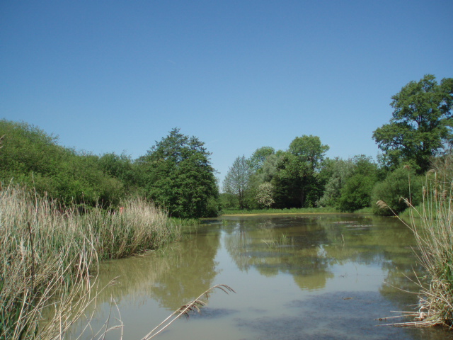
Flacketts Wood is a picturesque woodland located in Sussex, England. Covering an area of approximately 100 acres, this enchanting forest is nestled within the High Weald Area of Outstanding Natural Beauty. The wood is situated near the village of Sharpthorne and is easily accessible by car or on foot.

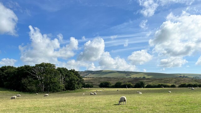
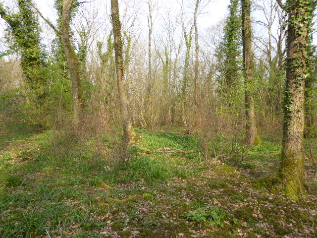
Flacketts Wood boasts a diverse range of tree species, including oak, beech, and birch, creating a rich and vibrant ecosystem. The woodland floor is adorned with an array of wildflowers, adding bursts of color throughout the seasons. In spring, bluebells carpet the forest floor, creating a breathtaking sight for visitors.

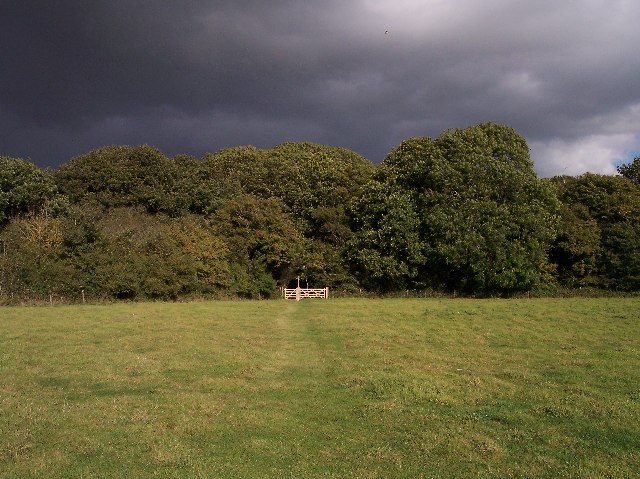
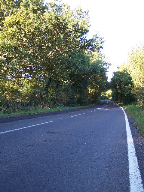
The wood is crisscrossed by a network of well-maintained pathways, making it an ideal destination for walkers, nature enthusiasts, and families. These paths lead visitors through the heart of the woodland, offering opportunities to observe wildlife such as deer, squirrels, and a variety of bird species.

Flacketts Wood is also home to a number of ancient trees, some of which are believed to be over 300 years old. These majestic giants provide a sense of history and tranquility to the forest, creating a truly magical atmosphere.

The wood is managed by a local conservation group, ensuring its preservation and protection for future generations. The group organizes regular guided walks and educational events, offering visitors a chance to learn about the flora and fauna that inhabit the wood.

Overall, Flacketts Wood is a hidden gem in Sussex, offering visitors a serene escape into nature. Its diverse wildlife, ancient trees, and well-maintained paths make it a must-visit destination for anyone seeking a peaceful and immersive woodland experience.

If you have any feedback on the listing, please let us know in the comments section below.

Flacketts Wood Images

Images are sourced within 2km of 50.899181/-0.26225627 or Grid Reference TQ2212. Thanks to Geograph Open Source API. All images are credited.

Fungi growing on horse manure
View SE towards Truleigh Hill Horton Wood is on the left.
View SE towards Truleigh Hill
Horton Wood is on the left.
Outbuilding at New Hall
Edburton The tiny village of Edburton is one of the spring line settlements at the foot of the northern edge of the South Downs.
Edburton
The tiny village of Edburton is one of the spring line settlements at the foot of the northern edge of the South Downs.
Golding Barn 4x4 Off Road Centre Golding Barn Farm has found more profitable use for some of its land.
Golding Barn 4x4 Off Road Centre
Golding Barn Farm has found more profitable use for some of its land.
ascending Truleigh Hill - view to the west The buildings in the middle distance are Tottington Manor Farm and Hotel.
ascending Truleigh Hill - view to the west
The buildings in the middle distance are Tottington Manor Farm and Hotel.
Woods Mill Nature Reserve. The entrance gates to the reserve which is also the headquarters of the Sussex Wildlife Trust.
Woods Mill Nature Reserve.
The entrance gates to the reserve which is also the headquarters of the Sussex Wildlife Trust.
Oreham Common 14 acres of herb rich grassland with some scrub and woodland, it has a small pond in the western corner. In its earliest days a Roman road ran its length, and in the 17th and 18th Centuries, Smugglers such as “Black Jack” used a pathway across the Common, known as “Old Mans Neck” to bring their ill-gotten gains northwards from the coast. see <span class="nowrap"><a title="http://www.henfield.gov.uk/commons.htm" rel="nofollow ugc noopener" href="http://www.henfield.gov.uk/commons.htm">Link</a><img style="margin-left:2px;" alt="External link" title="External link - shift click to open in new window" src="https://s1.geograph.org.uk/img/external.png" width="10" height="10"/></span>
Oreham Common
14 acres of herb rich grassland with some scrub and woodland, it has a small pond in the western corner. In its earliest days a Roman road ran its length, and in the 17th and 18th Centuries, Smugglers such as “Black Jack” used a pathway across the Common, known as “Old Mans Neck” to bring their ill-gotten gains northwards from the coast. see LinkExternal link
Small Dole Looking south from the Small Dole 2000 sign to the Post Office.
Small Dole
Looking south from the Small Dole 2000 sign to the Post Office.
Horton Wood, near Small Dole Looking north east a few minutes before the deluge.
Horton Wood, near Small Dole
Looking north east a few minutes before the deluge.
Horton Hall With a flag of St George flying proudly. According to :-  
<span class="nowrap"><a title="http://www.british-history.ac.uk/report.asp?compid=18389&strquery=horton%20hall" rel="nofollow ugc noopener" href="http://www.british-history.ac.uk/report.asp?compid=18389&strquery=horton%20hall">Link</a><img style="margin-left:2px;" alt="External link" title="External link - shift click to open in new window" src="https://s1.geograph.org.uk/img/external.png" width="10" height="10"/></span>
The manor of HORTON was held in demesne by William de Braose in 1073.
Horton Hall
With a flag of St George flying proudly. According to :- LinkExternal link The manor of HORTON was held in demesne by William de Braose in 1073.
Horn Lane - Roman Road Trying to follow the Roman road marked on the map, I found it difficult to pin down. This is certainly not as straight as I was expecting. Looking westwards.
Horn Lane - Roman Road
Trying to follow the Roman road marked on the map, I found it difficult to pin down. This is certainly not as straight as I was expecting. Looking westwards.
Tottington Mount Looking south from Tottington Manor Hotel car park.
Tottington Mount
Looking south from Tottington Manor Hotel car park.
Avian Fattening Station This picture shows a bird feeder somewhat bigger than ones you find hanging from bird tables! This industrial sized mango chutney tub has been converted to dispense grain to game birds that are shot for sport. The footpath from Edburton to Small Dole runs along the hedge in the background.
Avian Fattening Station
This picture shows a bird feeder somewhat bigger than ones you find hanging from bird tables! This industrial sized mango chutney tub has been converted to dispense grain to game birds that are shot for sport. The footpath from Edburton to Small Dole runs along the hedge in the background.
Path to Oreham Common This is the bridle path from Edburton on the South Downs to Oreham Common
Path to Oreham Common
This is the bridle path from Edburton on the South Downs to Oreham Common
Couldn't Agree More! This is the footpath from Oreham Common to New Barn Farm where it crosses a golf course.
Couldn't Agree More!
This is the footpath from Oreham Common to New Barn Farm where it crosses a golf course.
Dragonfly Female Common Darter/sympetrum (Sympetrum striolatum). There were several different kinds of dragonfly buzzing around the South Downs on this glorious October afternoon.
Dragonfly
Female Common Darter/sympetrum (Sympetrum striolatum). There were several different kinds of dragonfly buzzing around the South Downs on this glorious October afternoon.
Common sympetrum This is a Common sympetrum (Sympetrum striolatum) Dragonfly, this species is common in the late summer in this part of the world.
Common sympetrum
This is a Common sympetrum (Sympetrum striolatum) Dragonfly, this species is common in the late summer in this part of the world.
Show me another place!

Flacketts Wood is located at Grid Ref: TQ2212 (Lat: 50.899181, Lng: -0.26225627)

Administrative County: West Sussex

District: Horsham

Police Authority: Sussex

What 3 Words

///edge.ripen.silk. Near Henfield, West Sussex

Related Wikis

Tottington Wood

Tottington Wood is a 5.1-hectare (13-acre) Local Nature Reserve in Small Dole in West Sussex. It is owned by Hopegar Properties and managed by The Tottington...

Small Dole

Small Dole is a village in the Horsham District of West Sussex, in England. It lies on the A2037 road two miles (3.2 km) south of Henfield. In the late...

Horton Clay Pit

Horton Clay Pit is a 0.4-hectare (0.99-acre) geological Site of Special Scientific Interest in Small Dole in West Sussex. It is a Geological Conservation...

Woods Mill

Woods Mill is a 19-hectare (47-acre) nature reserve south of Henfield in West Sussex. It is managed by the Sussex Wildlife Trust.This is the headquarters...

Related Videos

The Oestrogen Adventures - South Downs Way - Part 5

TheChambles #wildcamping #southdownsway #motherdaughterhike #Chuncanstravels #winchester #eastbourne You've been ...

Dilly loves goosegrass

Dilly just adores eating "Sticky Willy" aka goosegrass or Galium aparine.

Pipistrel Velis Electric landing at Truleigh Farm airstrip

Very exciting landing in gusty cross winds at Truleigh Farm..... don't try it at home, without adequate training and experience !

Drone on the South Downs, Birthday Walk

Hi folks, something a bit different today. Yesterday was my birthday so my wife and I went for a walk along the South Downs.

Nearby Amenities

Located within 500m of 50.899181,-0.26225627
Barrier: kissing_gate
Lat/Long: 50.9025574/-0.2634067
Barrier: cycle_barrier
Lat/Long: 50.8989386/-0.2552788
Barrier: stile
Source: gps
Lat/Long: 50.8999038/-0.2566514
The data included in this document is from www.openstreetmap.org. The data is made available under ODbL.

Have you been to Flacketts Wood?

Leave your review of Flacketts Wood below (or comments, questions and feedback).