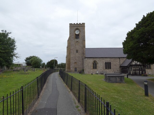
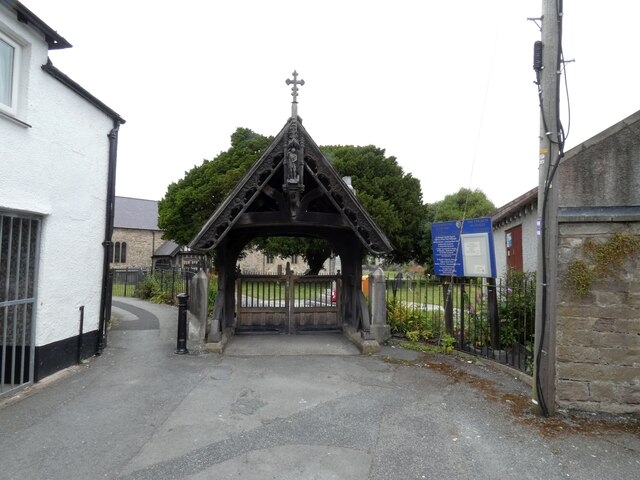
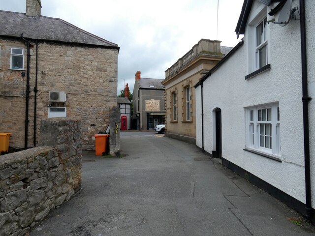
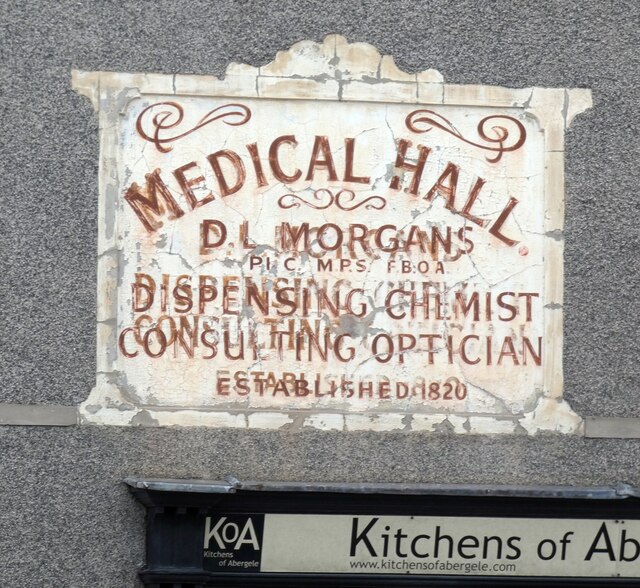
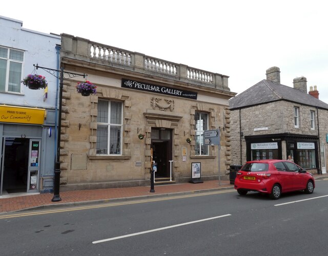
Abergele

Settlement in Denbighshire

Wales

Abergele

Morglawdd ym Mhensarn / Sea wall at Pensarn
Morglawdd ym Mhensarn / Sea wall at Pensarn Credit: Ceri Thomas

Abergele is a small town located in the county of Denbighshire, Wales. Situated on the north coast of the country, it lies approximately 40 miles west of the city of Chester. With a population of around 10,000 residents, Abergele is known for its picturesque surroundings and rich history.

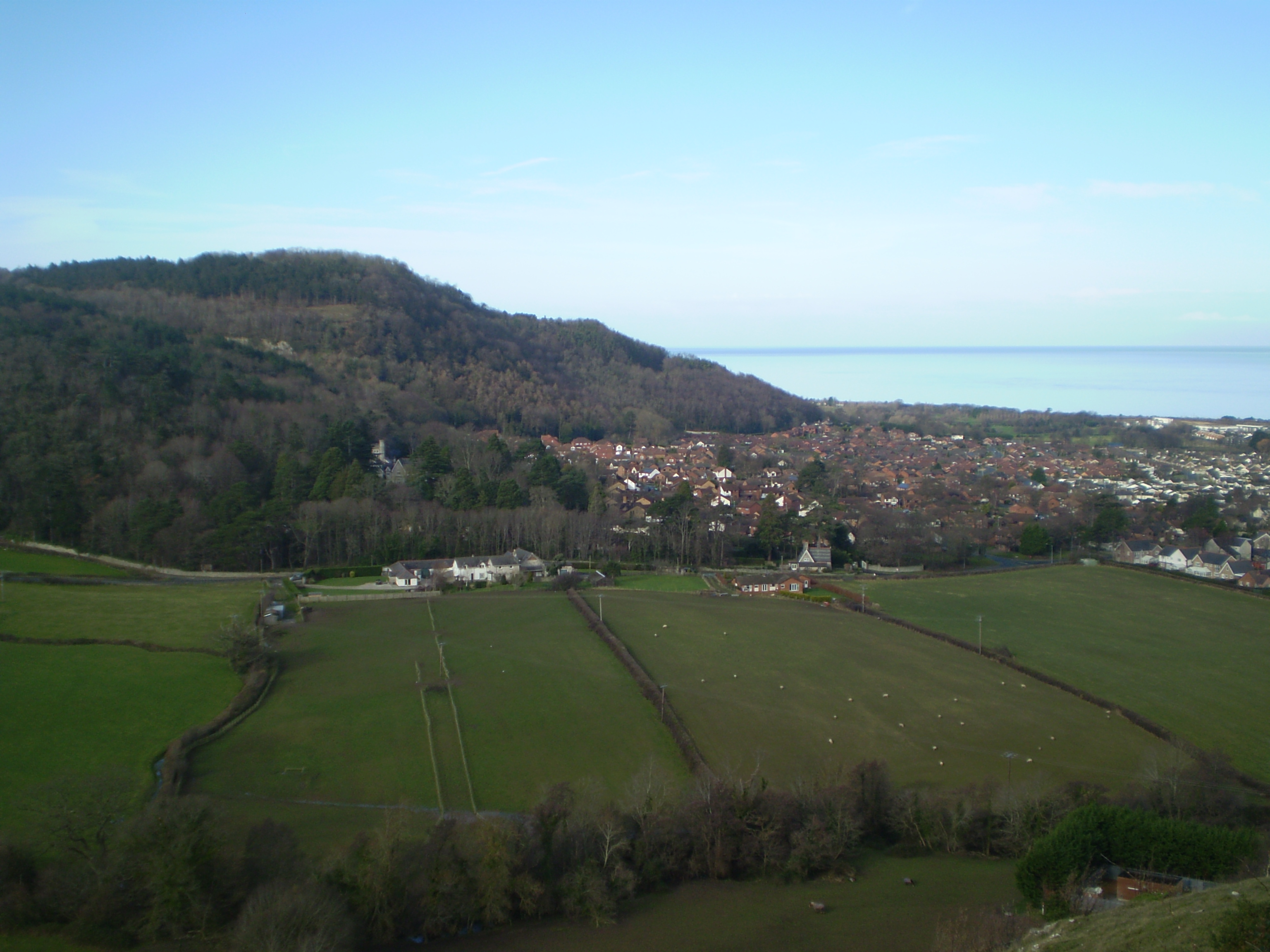
The town boasts a scenic location, situated between the Irish Sea to the north and the Clwydian Range to the south. Its sandy beach, known as Pensarn Beach, attracts visitors and locals alike during the summer months. Abergele also benefits from easy access to the A55 North Wales Expressway, making it a popular destination for tourists exploring the region.

Historically, Abergele played a significant role in the development of the railways in Wales. The town was a prominent stop along the London and North Western Railway, and it was here that the first ever steam-hauled train operated in Wales in 1848. Today, the Abergele and Pensarn Railway Station serves as a link to nearby towns and cities.

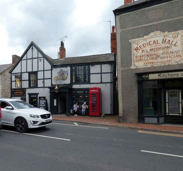
Abergele offers a range of amenities and services to its residents, including a variety of shops, restaurants, and cafes. The town is also home to several primary and secondary schools, providing education to the local community.

In terms of attractions, Abergele boasts Gwrych Castle, a Grade I listed 19th-century country house. The castle, with its stunning architecture and surrounding gardens, attracts visitors interested in history and architecture.

Overall, Abergele is a charming town with a rich heritage, beautiful surroundings, and convenient transport links, making it an attractive place to live and visit in Denbighshire.

If you have any feedback on the listing, please let us know in the comments section below.
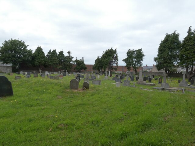
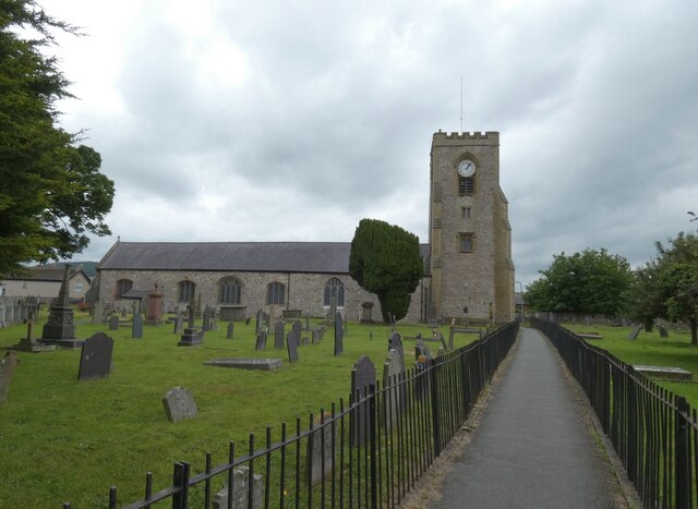
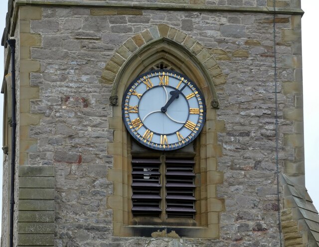
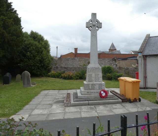
Abergele Images

Images are sourced within 2km of 53.284373/-3.58296 or Grid Reference SH9477. Thanks to Geograph Open Source API. All images are credited.

Morglawdd ym Mhensarn / Sea wall at Pensarn
Peel Street Off Water Street.
Peel Street
Off Water Street.
Abergele Bowling Green 
Abergele Bowling Club dates back to the 1930s <span class="nowrap"><a title="https://www.abergelebowlingclub.com/about.html" rel="nofollow ugc noopener" href="https://www.abergelebowlingclub.com/about.html">Link</a><img style="margin-left:2px;" alt="External link" title="External link - shift click to open in new window" src="https://s1.geograph.org.uk/img/external.png" width="10" height="10"/></span>
Abergele Bowling Green
Abergele Bowling Club dates back to the 1930s LinkExternal link
Abergele Cemetery
Abergele Cemetery
St Michael's Church 
The footpath from Groes Lwyd to St Michael's Church is one of several narrow lanes and paths in the town.

The parish church occupies the site of a church erected in the eighth century on land granted by Maelgwyn Gwynedd to Elfod, Bishop of Bangor. The Church is dedicated to St Michael and follows the usual type of church found in the vale; rubble stone walls with limestone and sandstone dressings, slate roof with two large aisles. A large tower stands at the west end of the north aisle and the long outline of the south side is broken by a porch.

The present building is of the late twelfth-early thirteenth century origin, modified or largely rebuilt ca1400, at which time the tower was probably built. It was repaired after neglect in 1663 and was restored and the tower raised in height and buttresses added in 1858-1861. The timber-framed south porch was added in 1879, the date cut on a tie beam.

The church is Grade II*-listed as "a regionally important church with surviving medieval fabric, and a good collection of monuments" (Cadw Building ID: 237 <span class="nowrap"><a title="http://www.britishlistedbuildings.co.uk/wa-237-church-of-st-michael-abergele#.VTtWC2d0x_s" rel="nofollow ugc noopener" href="http://www.britishlistedbuildings.co.uk/wa-237-church-of-st-michael-abergele#.VTtWC2d0x_s">Link</a><img style="margin-left:2px;" alt="External link" title="External link - shift click to open in new window" src="https://s1.geograph.org.uk/img/external.png" width="10" height="10"/></span>  British Listed Buildings).

  History Points: <span class="nowrap"><a title="http://historypoints.org/index.php?page=st-michael-s-church-abergele" rel="nofollow ugc noopener" href="http://historypoints.org/index.php?page=st-michael-s-church-abergele">Link</a><img style="margin-left:2px;" alt="External link" title="External link - shift click to open in new window" src="https://s1.geograph.org.uk/img/external.png" width="10" height="10"/></span>
St Michael's Church
The footpath from Groes Lwyd to St Michael's Church is one of several narrow lanes and paths in the town. The parish church occupies the site of a church erected in the eighth century on land granted by Maelgwyn Gwynedd to Elfod, Bishop of Bangor. The Church is dedicated to St Michael and follows the usual type of church found in the vale; rubble stone walls with limestone and sandstone dressings, slate roof with two large aisles. A large tower stands at the west end of the north aisle and the long outline of the south side is broken by a porch. The present building is of the late twelfth-early thirteenth century origin, modified or largely rebuilt ca1400, at which time the tower was probably built. It was repaired after neglect in 1663 and was restored and the tower raised in height and buttresses added in 1858-1861. The timber-framed south porch was added in 1879, the date cut on a tie beam. The church is Grade II*-listed as "a regionally important church with surviving medieval fabric, and a good collection of monuments" (Cadw Building ID: 237 LinkExternal link British Listed Buildings). History Points: LinkExternal link
St Michael's Clock 
The clock in the tower of  St Michael's Church <a href="https://www.geograph.org.uk/photo/6926556">SH9477 : St Michael's Church</a> was maintained in Victorian times by the poet Clwydfardd (David Griffith) <span class="nowrap"><a title="https://historypoints.org/index.php?page=former-clock-shop-of-first-archdruid-caernarfon" rel="nofollow ugc noopener" href="https://historypoints.org/index.php?page=former-clock-shop-of-first-archdruid-caernarfon">Link</a><img style="margin-left:2px;" alt="External link" title="External link - shift click to open in new window" src="https://s1.geograph.org.uk/img/external.png" width="10" height="10"/></span>  a clockmaker by trade and famous as the first Archdruid of Wales. He restored the clock in 1883, shortly after his 83rd birthday!
St Michael's Clock
The clock in the tower of St Michael's Church SH9477 : St Michael's Church was maintained in Victorian times by the poet Clwydfardd (David Griffith) LinkExternal link a clockmaker by trade and famous as the first Archdruid of Wales. He restored the clock in 1883, shortly after his 83rd birthday!
St Michael's, Abergele 
 The timber-framed south porch of  St Michael's Church <a href="https://www.geograph.org.uk/photo/6926556">SH9477 : St Michael's Church</a>  was added in 1879.
St Michael's, Abergele
The timber-framed south porch of St Michael's Church SH9477 : St Michael's Church was added in 1879.
Abergele War Memorial  
The Abergele War Memorial commemorates those men of the area who died during World War I and World War II. It is in the form of a stone, standing Celtic cross featuring Celtic knotwork, and stands in the grounds of St Michael's Parish Church. It was dedicated on 7 Jul 1921.
Abergele War Memorial
The Abergele War Memorial commemorates those men of the area who died during World War I and World War II. It is in the form of a stone, standing Celtic cross featuring Celtic knotwork, and stands in the grounds of St Michael's Parish Church. It was dedicated on 7 Jul 1921.
St Michael's Church The parish church occupies the site of a church erected in the eighth century on land granted by Maelgwyn Gwynedd to Elfod, Bishop of Bangor. The Church is dedicated to St Michael and follows the usual type of church found in the vale; rubble stone walls with limestone and sandstone dressings, slate roof with two large aisles. A large tower stands at the west end of the north aisle and the long outline of the south side is broken by a porch.

The present building is of the late twelfth/early thirteenth century origin, modified or largely rebuilt ca1400, at which time the tower was probably built. It was repaired after neglect in 1663 and was restored, the tower raised in height and buttresses added in 1858-1861. The timber-framed south porch was added in 1879, the date cut on a tie beam.

The church is Grade II* listed as "a regionally important church with surviving medieval fabric, and a good collection of monuments" (Cadw Building ID: 237 <span class="nowrap"><a title="http://www.britishlistedbuildings.co.uk/wa-237-church-of-st-michael-abergele" rel="nofollow ugc noopener" href="http://www.britishlistedbuildings.co.uk/wa-237-church-of-st-michael-abergele">Link</a><img style="margin-left:2px;" alt="External link" title="External link - shift click to open in new window" src="https://s1.geograph.org.uk/img/external.png" width="10" height="10"/></span>
  British Listed Buildings ).

  History Points: <span class="nowrap"><a title="http://historypoints.org/index.php?page=st-michael-s-church-abergele" rel="nofollow ugc noopener" href="http://historypoints.org/index.php?page=st-michael-s-church-abergele">Link</a><img style="margin-left:2px;" alt="External link" title="External link - shift click to open in new window" src="https://s1.geograph.org.uk/img/external.png" width="10" height="10"/></span>
St Michael's Church
The parish church occupies the site of a church erected in the eighth century on land granted by Maelgwyn Gwynedd to Elfod, Bishop of Bangor. The Church is dedicated to St Michael and follows the usual type of church found in the vale; rubble stone walls with limestone and sandstone dressings, slate roof with two large aisles. A large tower stands at the west end of the north aisle and the long outline of the south side is broken by a porch. The present building is of the late twelfth/early thirteenth century origin, modified or largely rebuilt ca1400, at which time the tower was probably built. It was repaired after neglect in 1663 and was restored, the tower raised in height and buttresses added in 1858-1861. The timber-framed south porch was added in 1879, the date cut on a tie beam. The church is Grade II* listed as "a regionally important church with surviving medieval fabric, and a good collection of monuments" (Cadw Building ID: 237 LinkExternal link British Listed Buildings ). History Points: LinkExternal link
St Michael's Lych Gate 
The lych gate of St. Michael's church is a Victorian addition and was erected to commemorate Queen Victoria's Golden Jubilee in 1887. The current, varnished gates   replace a pair stolen by thieves posing as  workmen around 1998.
St Michael's Lych Gate
The lych gate of St. Michael's church is a Victorian addition and was erected to commemorate Queen Victoria's Golden Jubilee in 1887. The current, varnished gates replace a pair stolen by thieves posing as workmen around 1998.
Former Medical Hall, 51 Market Street, Abergele 
Seen from the road leading from the church. On the right is side of the former NatWest Bank <a href="https://www.geograph.org.uk/photo/3216258">SH9477 : NatWest Bank Abergele</a>.

This building was once promoted to the public as a "Medical Hall". The sign painted onto the wall above the shop front records that it was the premises of DL Morgans, dispensing chemist and consulting optician, and that the business was founded in 1820. As the paint has faded it has revealed some of the earlier painted sign beneath, which appears to have had the same wording. A plaque further up the wall implies that the building was erected or enlarged in 1827.

DL Morgans was the pharmacist here in the mid-20th century. During the Second World War he delivered medicines to Gwrych Castle for Jewish children who were living there after fleeing Nazi persecution in the "Kindertransport" initiative. The building fell into dereliction in the 1980s but was renovated in the 1990s. Since 1995 it has been home to Kitchens of Abergele <span class="nowrap"><a title="https://kitchensofabergele.com/" rel="nofollow ugc noopener" href="https://kitchensofabergele.com/">Link</a><img style="margin-left:2px;" alt="External link" title="External link - shift click to open in new window" src="https://s1.geograph.org.uk/img/external.png" width="10" height="10"/></span> 

History Points: <span class="nowrap"><a title="https://historypoints.org/index.php?page=former-medical-hall-abergele" rel="nofollow ugc noopener" href="https://historypoints.org/index.php?page=former-medical-hall-abergele">Link</a><img style="margin-left:2px;" alt="External link" title="External link - shift click to open in new window" src="https://s1.geograph.org.uk/img/external.png" width="10" height="10"/></span>
Former Medical Hall, 51 Market Street, Abergele
Seen from the road leading from the church. On the right is side of the former NatWest Bank SH9477 : NatWest Bank Abergele. This building was once promoted to the public as a "Medical Hall". The sign painted onto the wall above the shop front records that it was the premises of DL Morgans, dispensing chemist and consulting optician, and that the business was founded in 1820. As the paint has faded it has revealed some of the earlier painted sign beneath, which appears to have had the same wording. A plaque further up the wall implies that the building was erected or enlarged in 1827. DL Morgans was the pharmacist here in the mid-20th century. During the Second World War he delivered medicines to Gwrych Castle for Jewish children who were living there after fleeing Nazi persecution in the "Kindertransport" initiative. The building fell into dereliction in the 1980s but was renovated in the 1990s. Since 1995 it has been home to Kitchens of Abergele LinkExternal link History Points: LinkExternal link
Medical Hall: Ghost sign 
Above Kitchens of Abergele <a href="https://www.geograph.org.uk/photo/6944069">SH9477 : Former Medical Hall, 51 Market Street, Abergele</a>.
Medical Hall: Ghost sign
The Harp Inn, Market Street, Abergele It's believed that the Harp Inn was built on the site of a medieval prison. Convicts would be taken from the lock-up to the nearby stocks for public humiliation. A prison is mentioned in a description of Abergele in 1344. At one time the prison was one of the area's few stone buildings, with timber houses for neighbours.

The inn dates from the boom in trade which came Abergele's way after 1785, when the Chester to Holyhead mail and other coaches were diverted this way instead of running further inland. Innkeepers were buoyed again by an influx of tourists to North Wales after the outbreak of war against France in 1793, when wealthy British people were unable to make the usual Grand Tour of Europe. By 1862 Abergele had 16 inns, all but three of them along the main road (Market Street and Bridge Street).

Livestock auctions were held at the Harp Inn from c.1910, when growing motor traffic put an end to the earlier custom of holding markets in the main road. Auctioneer Frank Lloyd held his "Smithfield" at the Harp, and his rival Richard Pearce used the Bee Hotel, almost opposite. Buyers from as far away as Lancaster and Stafford came to the Harp Smithfield. The Vale of Clwyd Cooperative Agricultural Society opened a branch at the Harp in 1917.

The telephone kiosk outside the Harp Inn is Grade II listed. It was produced by the General Post Office to the K6 design of 1936.

History Points: <span class="nowrap"><a title="https://historypoints.org/index.php?page=the-harp-inn-abergele" rel="nofollow ugc noopener" href="https://historypoints.org/index.php?page=the-harp-inn-abergele">Link</a><img style="margin-left:2px;" alt="External link" title="External link - shift click to open in new window" src="https://s1.geograph.org.uk/img/external.png" width="10" height="10"/></span>

<a href="https://www.geograph.org.uk/photo/6944957">SH9477 : Sign of The Harp</a>.
The Harp Inn, Market Street, Abergele
It's believed that the Harp Inn was built on the site of a medieval prison. Convicts would be taken from the lock-up to the nearby stocks for public humiliation. A prison is mentioned in a description of Abergele in 1344. At one time the prison was one of the area's few stone buildings, with timber houses for neighbours. The inn dates from the boom in trade which came Abergele's way after 1785, when the Chester to Holyhead mail and other coaches were diverted this way instead of running further inland. Innkeepers were buoyed again by an influx of tourists to North Wales after the outbreak of war against France in 1793, when wealthy British people were unable to make the usual Grand Tour of Europe. By 1862 Abergele had 16 inns, all but three of them along the main road (Market Street and Bridge Street). Livestock auctions were held at the Harp Inn from c.1910, when growing motor traffic put an end to the earlier custom of holding markets in the main road. Auctioneer Frank Lloyd held his "Smithfield" at the Harp, and his rival Richard Pearce used the Bee Hotel, almost opposite. Buyers from as far away as Lancaster and Stafford came to the Harp Smithfield. The Vale of Clwyd Cooperative Agricultural Society opened a branch at the Harp in 1917. The telephone kiosk outside the Harp Inn is Grade II listed. It was produced by the General Post Office to the K6 design of 1936. History Points: LinkExternal link SH9477 : Sign of The Harp.
Sign of The Harp Sign for the Harp Inn <a href="https://www.geograph.org.uk/photo/6944956">SH9477 : The Harp Inn, Market Street, Abergele</a>.
Sign of The Harp
Bee Hotel The Bee Hotel was one of the largest coaching inns in the area. In 1840 a guidebook said it and the Union Hotel were "superior inns affording unusual comforts". In 1801 the proprietor, John Davies, advertised that he had started hiring coaches (chaises) and horses to travellers at rates which undercut his rivals between Holywell and the Bangor ferry (where passengers for Holyhead would cross the Menai Strait). His advert – a copy of which is on display inside the Bee Hotel – reminded travellers that his rivals demanded gentlemen pay the full fare between St Asaph and Conwy before setting out from either of those towns. Once they had paid, the travellers couldn't break the journey at Abergele to take on fresh horses, he claimed. "When the distance between St Asaph and Conway is considered, it is presumed a change of horses nearly midway, will greatly contribute to the ease and expedition of gentlemen travelling that road."

After the railway replaced long-distance coach travel, the Bee provided a horse-drawn omnibus which shuttled between Abergele and the railway station at Pensarn. The Bee was the venue for the inquest after the 1868 train crash in Llanddulas, which killed 33 people. The extensive land associated with the Bee Hotel included a large garden on the opposite side of the road, known as Pendre Bach or the Bee Gardens. North-west of the inn was the Bee Inn farm, which covered 149 acres (600,000 square metres) according to tithe records from 1840. The property belonged to the Kinmel Estate until it was sold in an auction – held at the Bee Hotel – in 1896. History Points: <span class="nowrap"><a title="https://historypoints.org/index.php?page=bee-hotel-abergele" rel="nofollow ugc noopener" href="https://historypoints.org/index.php?page=bee-hotel-abergele">Link</a><img style="margin-left:2px;" alt="External link" title="External link - shift click to open in new window" src="https://s1.geograph.org.uk/img/external.png" width="10" height="10"/></span>

More recently it was a J W Lees house from 1943 until 2017 when it closed down. It appears to have been bought and re-sold at least once since then and is now boarded up and in a sorry state. 

<a href="https://www.geograph.org.uk/photo/6945995">SH9477 : Sign of The Bee Hotel</a>.
Bee Hotel
The Bee Hotel was one of the largest coaching inns in the area. In 1840 a guidebook said it and the Union Hotel were "superior inns affording unusual comforts". In 1801 the proprietor, John Davies, advertised that he had started hiring coaches (chaises) and horses to travellers at rates which undercut his rivals between Holywell and the Bangor ferry (where passengers for Holyhead would cross the Menai Strait). His advert – a copy of which is on display inside the Bee Hotel – reminded travellers that his rivals demanded gentlemen pay the full fare between St Asaph and Conwy before setting out from either of those towns. Once they had paid, the travellers couldn't break the journey at Abergele to take on fresh horses, he claimed. "When the distance between St Asaph and Conway is considered, it is presumed a change of horses nearly midway, will greatly contribute to the ease and expedition of gentlemen travelling that road." After the railway replaced long-distance coach travel, the Bee provided a horse-drawn omnibus which shuttled between Abergele and the railway station at Pensarn. The Bee was the venue for the inquest after the 1868 train crash in Llanddulas, which killed 33 people. The extensive land associated with the Bee Hotel included a large garden on the opposite side of the road, known as Pendre Bach or the Bee Gardens. North-west of the inn was the Bee Inn farm, which covered 149 acres (600,000 square metres) according to tithe records from 1840. The property belonged to the Kinmel Estate until it was sold in an auction – held at the Bee Hotel – in 1896. History Points: LinkExternal link More recently it was a J W Lees house from 1943 until 2017 when it closed down. It appears to have been bought and re-sold at least once since then and is now boarded up and in a sorry state. SH9477 : Sign of The Bee Hotel.
Sign of The Bee Hotel Sign for The Bee Hotel <a href="https://www.geograph.org.uk/photo/6945988">SH9477 : Bee Hotel</a>.
Sign of The Bee Hotel
Sign for The Bee Hotel SH9477 : Bee Hotel.
The Peculiar Gallery 
"For the pathologically curious!" <span class="nowrap"><a title="http://www.thepeculiargallery.co.uk/" rel="nofollow ugc noopener" href="http://www.thepeculiargallery.co.uk/">Link</a><img style="margin-left:2px;" alt="External link" title="External link - shift click to open in new window" src="https://s1.geograph.org.uk/img/external.png" width="10" height="10"/></span> in the former NatWest Bank <a href="https://www.geograph.org.uk/photo/3216258">SH9477 : NatWest Bank Abergele</a>.
The Peculiar Gallery
"For the pathologically curious!" LinkExternal link in the former NatWest Bank SH9477 : NatWest Bank Abergele.
The centre of Abergele Traffic lights in the centre of Abergele control a staggered crossroads. The A547 Market Street (from Colwyn Bay) becomes Bridge Street (to Rhuddlan).  The A548 right is Chapel Street (to Llanfair Talhaiarn)  and left is Water Street (to Rhyl). 

On the corner is The George & Dragon <a href="https://www.geograph.org.uk/photo/6946851">SH9477 : The George & Dragon</a>.
The centre of Abergele
Traffic lights in the centre of Abergele control a staggered crossroads. The A547 Market Street (from Colwyn Bay) becomes Bridge Street (to Rhuddlan). The A548 right is Chapel Street (to Llanfair Talhaiarn) and left is Water Street (to Rhyl). On the corner is The George & Dragon SH9477 : The George & Dragon.
Show me another place!

Abergele is located at Grid Ref: SH9477 (Lat: 53.284373, Lng: -3.58296)

Unitary Authority: Conwy

Police Authority: North Wales

What 3 Words

///preheated.scramble.items. Near Abergele, Conwy

Nearby Locations

Abergele

Related Wikis

Abergele

Abergele (; Welsh: [ˌabɛrˈɡɛlɛ]; ) is a market town and community, situated on the north coast of Wales between the holiday resorts of Colwyn Bay and Rhyl...

Pensarn

Pensarn is a suburb of Abergele in Conwy County Borough, Wales, the name Pensarn means 'end of the causeway' in English. The crossing of Morfa Rhuddlan...
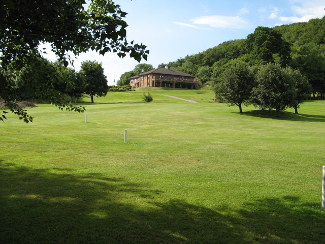
Abergele Golf Club

Abergele Golf Club (Welsh: Clwb Golff Abergele) is a golf club located in Abergele, Conwy, Clwyd, Wales. The 18-hole course was formed in 1910 and established...

Abergele & Pensarn railway station

Abergele & Pensarn railway station is a stop on the North Wales Coast Line, which serves both the town of Abergele and suburb of Pensarn in Conwy County...

Coed y Gopa

Coed y Gopa is a Site of Special Scientific Interest in the preserved county of Clwyd, north Wales. Located on a prominent limestone hillside in the Vale...

Castell Cawr

Castell Cawr, or Tan-y-Gopa as it is known locally, is a heavily forested hill above the town of Abergele in Conwy county borough, Wales. On it is found...

Gwrych Castle

Gwrych Castle (Welsh: Castell Gwrych pronounced [ˌkastɛɬ ˈɡwrɨːχ] meaning "hedged castle") (Originally spelt as 'Gwrŷch') is a Grade I listed 19th-century...

Abergele Hospital

Abergele Hospital (Welsh: Ysbyty Abergele) is a community hospital in Abergele, Wales. It is managed by Betsi Cadwaladr University Health Board. ��2�...

Nearby Amenities

Located within 500m of 53.284373,-3.58296
Crossing
Crossing: yes
Lat/Long: 53.2841477/-3.5775997
Abergele
Is In Country: United Kingdom
Is In Country Code: GB
Is In County: Conwy
Name Cy: Abergele
Place: town
Population: 9208
Postal Code: LL22
Wikidata: Q2771917
Lat/Long: 53.2840692/-3.5810655
Traffic Signals
Lat/Long: 53.2843846/-3.5829021
Traffic Signals
Lat/Long: 53.2843408/-3.5814997
Bus Stop
Bus: yes
Public Transport: platform
Lat/Long: 53.2848068/-3.5879641
Bus Stop
Bus: yes
Public Transport: platform
Lat/Long: 53.2849636/-3.5880516
Crossing
Crossing: traffic_signals
Lat/Long: 53.2881608/-3.5822755
Bus Stop
Bus: yes
Naptan AtcoCode: 5130AWA17161
Naptan NaptanCode: cnwgdap
Public Transport: platform
Lat/Long: 53.2876037/-3.5827334
Bus Stop
Bus: yes
Naptan AtcoCode: 5130CWX02031
Naptan NaptanCode: cnwadam
Public Transport: platform
Lat/Long: 53.2860283/-3.5828045
Crossing
Lat/Long: 53.2848384/-3.585463
Bus Stop
Bus: yes
Naptan AtcoCode: 5130AWA16955
Naptan NaptanCode: cnwadag
Public Transport: platform
Wheelchair: limited
Lat/Long: 53.285102/-3.5860661
Pub
Y Gwindy
Addr City: Abergele
Addr Country: GB
Addr Postcode: LL22 7AG
Addr Street: Market Street
Fhrs Authority: Conwy
Fhrs Id: 492248
Fhrs Local Authority Id: 102335
Name Cy: Y Gwindy
Name En: Y Gwindy
Lat/Long: 53.2842088/-3.5814179
Leisure: swimming_pool
Lat/Long: 53.2854973/-3.5787159
Shop: florist
Lat/Long: 53.2842433/-3.5817967
Crossing
Lat/Long: 53.285554/-3.5862715
Abergele Castle (ruined)
Historic: archaeological_site
Name Cy: Castell Abergele
Lat/Long: 53.2853683/-3.5801117
Shop: vacant
Lat/Long: 53.2845343/-3.5833388
Cafe
Raymonds Cafe
Addr City: Abergele
Addr Country: GB
Addr Housenumber: 30
Addr Postcode: LL22 7AA
Addr Street: Market Street
Fhrs Authority: Conwy
Fhrs Id: 127749
Fhrs Local Authority Id: 57305
Name En: Raymonds Cafe
Lat/Long: 53.2845232/-3.5830759
Bank
Yorkshire Building Society
Atm: no
Brand: Yorkshire Building Society
Brand Wikidata: Q12073381
Lat/Long: 53.2845078/-3.5831765
Diskos
Shop: general
Lat/Long: 53.284499/-3.5829914
Restaurant
Roots Cafe
Addr City: Abergele
Addr Country: GB
Addr Housenumber: 71
Addr Postcode: LL22 7BP
Addr Street: Market Street
Fhrs Authority: Conwy
Fhrs Id: 338835
Fhrs Local Authority Id: 1992
Name Cy: Abergele Grill
Name En: Roots Cafe
Lat/Long: 53.2846786/-3.5862595
Roberts' Garage
Shop: car_repair
Lat/Long: 53.2844478/-3.5843379
Restaurant
Wongs
Addr City: Abergele
Addr Country: GB
Addr Housenumber: 22
Addr Postcode: LL22 7AA
Addr Street: Market Street
Cuisine: chinese
Fhrs Authority: Conwy
Fhrs Id: 128322
Fhrs Local Authority Id: 58250
Name Cy: Bwyty Orchard House
Name En: Wongs
Lat/Long: 53.2844814/-3.5825962
Atm: yes
Shop: vacant
Lat/Long: 53.284413/-3.582014
Restaurant
Wine and Grill DPL
Addr City: Abergele
Addr Country: GB
Addr Housenumber: 9
Addr Postcode: LL22 7AG
Addr Street: Market Street
Fhrs Authority: Conwy
Fhrs Id: 194395
Fhrs Local Authority Id: 55093
Name En: Wine and Grill DPL
Lat/Long: 53.2842504/-3.5819694
Pharmacy
Superdrug
Brand: Superdrug
Brand Wikidata: Q7643261
Healthcare: pharmacy
Lat/Long: 53.2844491/-3.5821334
Cafe
The Jade Leaf Cafe
Addr City: Abergele
Addr Country: GB
Addr Postcode: LL22 7AW
Addr Street: Chapel Street
Fhrs Authority: Conwy
Fhrs Id: 39961
Fhrs Local Authority Id: 100544
Name En: The Jade Leaf Cafe
Lat/Long: 53.2841476/-3.5829876
Restaurant
Spice Merchant
Cuisine: indian
Lat/Long: 53.2840594/-3.5827798
Crossing
Crossing: traffic_signals
Lat/Long: 53.2843431/-3.5817176
Crossing
Crossing: traffic_signals
Lat/Long: 53.2844216/-3.5831393
Power: substation
Lat/Long: 53.2870219/-3.5872033
Fast Food
Red Chilli
Addr City: Abergele
Addr Country: GB
Addr Housename: Crown Bach
Addr Postcode: LL22 7HA
Addr Street: Bridge Street
Cuisine: indian
Fhrs Authority: Conwy
Fhrs Id: 481345
Fhrs Local Authority Id: 55400
Name En: Red Chili
Lat/Long: 53.2842336/-3.5810722
Fast Food
Sunshine House
Addr City: Abergele
Addr Country: GB
Addr Housenumber: 47
Addr Postcode: LL22 7SH
Addr Street: Water Street
Cuisine: chinese
Fhrs Authority: Conwy
Fhrs Id: 40464
Fhrs Local Authority Id: 101279
Name En: Sunshine House
Lat/Long: 53.2863827/-3.5831078
Fast Food
Trawlers
Addr City: Abergele
Addr Country: GB
Addr Postcode: LL22 7HA
Addr Street: Bridge Street
Cuisine: fish_and_chips
Fhrs Authority: Conwy
Fhrs Id: 127251
Fhrs Local Authority Id: 56413
Name En: Trawlers
Lat/Long: 53.2843941/-3.5798919
Fast Food
Great Wall
Addr City: Abergele
Addr Country: GB
Addr Housenumber: 15
Addr Postcode: LL22 7AG
Addr Street: Market Street
Cuisine: chinese
Fhrs Authority: Conwy
Fhrs Id: 40447
Fhrs Local Authority Id: 101252
Name En: Great Wall
Lat/Long: 53.2842779/-3.5822899
Bryan R Allport Opticians
Shop: optician
Lat/Long: 53.2844033/-3.5812607
McCoubrey Cooke
Shop: estate_agent
Lat/Long: 53.2845956/-3.5837475
Power: pole
Lat/Long: 53.2807438/-3.5795775
Power: pole
Lat/Long: 53.2813275/-3.5799745
Crossing
Lat/Long: 53.2853673/-3.5859608
Crossing
Lat/Long: 53.2854842/-3.5856115
Crossing
Lat/Long: 53.2853955/-3.5855664
Historic: memorial
Lat/Long: 53.2849117/-3.5834155
Noexit: yes
Lat/Long: 53.2833267/-3.5780414
Fast Food
Top Wok
Addr City: Abergele
Addr Country: GB
Addr Postcode: LL22 7HH
Addr Street: Rhuddlan Road
Fhrs Authority: Conwy
Fhrs Id: 622225
Fhrs Local Authority Id: 103041
Lat/Long: 53.2840877/-3.5777384
Power: substation
Lat/Long: 53.2853125/-3.5866888
Power: substation
Lat/Long: 53.2860729/-3.5832209
Communication Mobile Phone: yes
Man Made: mast
Operator: Vodafone
Lat/Long: 53.285636/-3.580479
Communication Mobile Phone: yes
Man Made: mast
Operator: O2
Tower Construction: concealed
Tower Type: communication
Lat/Long: 53.284758/-3.5843512
Crossing
Lat/Long: 53.2863095/-3.5855295
Crossing
Lat/Long: 53.2858191/-3.585363
Cumberland House Bakery
Addr City: Abergele
Addr Country: GB
Addr Postcode: LL22 7AG
Addr Street: Market Street
Fhrs Authority: Conwy
Fhrs Id: 104602
Fhrs Local Authority Id: 3571
Name En: Cumberland House Bakery
Shop: bakery
Lat/Long: 53.2842481/-3.5816181
Ice Cream
The Sugar Den
Addr City: Abergele
Addr Country: GB
Addr Housenumber: 17
Addr Postcode: LL22 7AG
Addr Street: Market Street
Fhrs Authority: Conwy
Fhrs Id: 782190
Fhrs Local Authority Id: 26212
Name En: The Sugar Den
Lat/Long: 53.2842769/-3.5823597
Herbs For Everyone
Addr City: Abergele
Addr Country: GB
Addr Housenumber: 25
Addr Postcode: LL22 7AG
Addr Street: Market Street
Fhrs Authority: Conwy
Fhrs Id: 798525
Fhrs Local Authority Id: 3585
Name En: Herbs For Everyone
Shop: kiosk
Lat/Long: 53.2842841/-3.5827781
Fast Food
Abergele Kebab & Pizza
Addr City: Abergele
Addr Country: GB
Addr Housenumber: 41
Addr Postcode: LL22 7AF
Addr Street: Market Street
Fhrs Authority: Conwy
Fhrs Id: 536218
Fhrs Local Authority Id: 102580
Name En: Abergele Kebab & Pizza
Lat/Long: 53.2843763/-3.5834621
Cafe
Crempog
Addr City: Abergele
Addr Country: GB
Addr Housenumber: 67
Addr Postcode: LL22 7AF
Addr Street: Market Street
Fhrs Authority: Conwy
Fhrs Id: 1054192
Fhrs Local Authority Id: 55159
Name En: Crempog
Lat/Long: 53.2846353/-3.5847415
Savers
Addr City: Abergele
Addr Country: GB
Addr Housenumber: 14
Addr Postcode: LL22 7AA
Addr Street: Market Street
Brand: Savers
Brand Wikidata: Q7428189
Brand Wikipedia: en:Savers (UK retailer)
Fhrs Authority: Conwy
Fhrs Id: 782193
Fhrs Local Authority Id: 58977
Name En: Savers Health & Beauty
Official Name: Savers Health & Beauty
Shop: chemist
Lat/Long: 53.2844509/-3.5822336
Premier
Addr City: Abergele
Addr Country: GB
Addr Housenumber: 42
Addr Postcode: LL22 7AA
Addr Street: Market Street
Brand: Premier
Brand Wikidata: Q7240340
Brand Wikipedia: en:Premier Stores
Fhrs Authority: Conwy
Fhrs Id: 499506
Fhrs Local Authority Id: 3610
Name Cy: Cost Cutter
Name En: Premier
Shop: convenience
Lat/Long: 53.2846746/-3.5840803
Nisa
Addr City: Abergele
Addr Country: GB
Addr Housenumber: 16
Addr Postcode: LL22 7AA
Addr Street: Market Street
Brand: Nisa
Brand Wikidata: Q16999069
Brand Wikipedia: en:Nisa (retailer)
Fhrs Authority: Conwy
Fhrs Id: 87120
Fhrs Local Authority Id: 224
Name En: Nisa
Shop: convenience
Lat/Long: 53.2844677/-3.5823838
Natures Way
Addr City: Abergele
Addr Country: GB
Addr Housenumber: 4a
Addr Postcode: LL22 7AA
Addr Street: Market Street
Fhrs Authority: Conwy
Fhrs Id: 782191
Fhrs Local Authority Id: 4535
Name En: Natures Way
Shop: kiosk
Lat/Long: 53.2844485/-3.5818943
Gwalia House
Addr City: Abergele
Addr Country: GB
Addr Housenumber: 36
Addr Postcode: LL22 7AA
Addr Street: Market Street
Fhrs Authority: Conwy
Fhrs Id: 194407
Fhrs Local Authority Id: 2596
Name En: Gwalia House
Shop: butcher
Lat/Long: 53.2845824/-3.583556
Community Centre
Old Peoples Club
Addr City: Abergele
Addr Country: GB
Addr Postcode: LL22 7AN
Addr Street: Church Street
Fhrs Authority: Conwy
Fhrs Local Authority Id: 87496
Name En: Old Peoples Club
Old Fhrs Id: 583365
Lat/Long: 53.2848766/-3.5836163
Community Centre
Abergele Day Care Centre
Addr City: Abergele
Addr Country: GB
Addr Postcode: LL22 7HF
Addr Street: Rhuddlan Road
Fhrs Authority: Conwy
Fhrs Id: 145821
Fhrs Local Authority Id: 87446
Name Cy: Canolfan Gofal Dydd Abergele
Name En: Abergele Day Care Centre
Lat/Long: 53.2842128/-3.5759479
Internet Cafe
Itaca Youth Action
Addr City: Abergele
Addr Country: GB
Addr Housename: Hesketh House
Addr Postcode: LL22 7HA
Addr Street: Bridge Street
Email: info@itaca.org.uk
Fhrs Authority: Conwy
Fhrs Id: 125702
Fhrs Local Authority Id: 54245
Level: 0
Name En: Gweithredu Ieuenctid Itaca
Phone: +44 1745 826 570
Website: https://www.itaca.org.uk
Lat/Long: 53.2843988/-3.5795635
Fast Food
The Butty Box
Addr City: Abergele
Addr Country: GB
Addr Postcode: LL22 7HA
Addr Street: Bridge Street
Fhrs Authority: Conwy
Fhrs Id: 128396
Fhrs Local Authority Id: 58296
Name En: The Butty Box
Lat/Long: 53.2843924/-3.5802206
Cafe
K's Lunch Bar
Addr City: Abergele
Addr Country: GB
Addr Housename: Bridge House
Addr Postcode: LL22 7HA
Addr Street: Bridge Street
Fhrs Authority: Conwy
Fhrs Id: 871620
Fhrs Local Authority Id: 108856
Name En: K's Lunch Bar
Lat/Long: 53.2842416/-3.5812023
Post Office
Abergele Post Office
Addr City: Abergele
Addr Housenumber: 21
Addr Postcode: LL22 7AG
Addr Street: Market Street
Brand: Post Office
Brand Wikidata: Q1783168
Ref Pol Id: 14878
Source: pol_branch_list_2019-03
Lat/Long: 53.2842793/-3.582537
Post Box
Brand: Post Office
Brand Wikidata: Q1783168
Operator: Post Office
Operator Wikidata: Q1783168
Lat/Long: 53.2843067/-3.5824785
Direction: 165
Generator Method: photovoltaic
Generator Output Electricity: yes
Generator Solar Modules: 12
Generator Source: solar
Generator Type: solar_photovoltaic_panel
Location: roof
Power: generator
Lat/Long: 53.2853198/-3.5883177
Direction: 215
Generator Method: photovoltaic
Generator Output Electricity: yes
Generator Solar Modules: 16
Generator Source: solar
Generator Type: solar_photovoltaic_panel
Location: roof
Power: generator
Lat/Long: 53.2865525/-3.5775057
Direction: 215
Generator Method: photovoltaic
Generator Output Electricity: yes
Generator Solar Modules: 16
Generator Source: solar
Generator Type: solar_photovoltaic_panel
Location: roof
Power: generator
Lat/Long: 53.2864314/-3.5771812
Direction: 195
Generator Method: photovoltaic
Generator Output Electricity: yes
Generator Solar Modules: 16
Generator Source: solar
Generator Type: solar_photovoltaic_panel
Location: roof
Power: generator
Lat/Long: 53.2839403/-3.5771497
Direction: SW
Generator Method: thermal
Generator Output Hot Water: yes
Generator Solar Modules: 2
Generator Source: solar
Generator Type: solar_thermal_collector
Location: roof
Power: generator
Lat/Long: 53.2838862/-3.576392
Direction: W
Generator Method: thermal
Generator Output Hot Water: yes
Generator Solar Modules: 2
Generator Source: solar
Generator Type: solar_thermal_collector
Location: roof
Power: generator
Lat/Long: 53.2837788/-3.5764027
Direction: W
Generator Method: thermal
Generator Output Hot Water: yes
Generator Solar Modules: 2
Generator Source: solar
Generator Type: solar_thermal_collector
Location: roof
Power: generator
Lat/Long: 53.2837371/-3.5764027
Direction: W
Generator Method: thermal
Generator Output Hot Water: yes
Generator Solar Modules: 2
Generator Source: solar
Generator Type: solar_thermal_collector
Location: roof
Power: generator
Lat/Long: 53.283774/-3.5760031
Direction: W
Generator Method: thermal
Generator Output Hot Water: yes
Generator Solar Modules: 2
Generator Source: solar
Generator Type: solar_thermal_collector
Location: roof
Power: generator
Lat/Long: 53.2837387/-3.5760003
Direction: S
Generator Method: thermal
Generator Output Hot Water: yes
Generator Solar Modules: 2
Generator Source: solar
Generator Type: solar_thermal_collector
Location: roof
Power: generator
Lat/Long: 53.2834468/-3.5764242
Direction: SW
Generator Method: thermal
Generator Output Hot Water: yes
Generator Solar Modules: 2
Generator Source: solar
Generator Type: solar_thermal_collector
Location: roof
Power: generator
Lat/Long: 53.2834773/-3.5759762
Direction: S
Generator Method: thermal
Generator Output Hot Water: yes
Generator Solar Modules: 2
Generator Source: solar
Generator Type: solar_thermal_collector
Location: roof
Power: generator
Lat/Long: 53.2832213/-3.5757867
Direction: S
Generator Method: thermal
Generator Output Hot Water: yes
Generator Solar Modules: 2
Generator Source: solar
Generator Type: solar_thermal_collector
Location: roof
Power: generator
Lat/Long: 53.2832213/-3.575886
Direction: S
Generator Method: thermal
Generator Output Hot Water: yes
Generator Solar Modules: 2
Generator Source: solar
Generator Type: solar_thermal_collector
Location: roof
Power: generator
Lat/Long: 53.2832309/-3.5764438
Direction: ESE
Generator Method: thermal
Generator Output Hot Water: yes
Generator Solar Modules: 2
Generator Source: solar
Generator Type: solar_thermal_collector
Location: roof
Power: generator
Lat/Long: 53.2834987/-3.5769829
Direction: SSW
Generator Method: thermal
Generator Output Hot Water: yes
Generator Solar Modules: 2
Generator Source: solar
Generator Type: solar_thermal_collector
Location: roof
Power: generator
Lat/Long: 53.2835724/-3.5768489
Direction: SSW
Generator Method: photovoltaic
Generator Output Electricity: yes
Generator Solar Modules: 15
Generator Source: solar
Generator Type: solar_photovoltaic_panel
Location: roof
Power: generator
Lat/Long: 53.2818593/-3.5775923
Direction: SW
Generator Method: photovoltaic
Generator Output Electricity: yes
Generator Solar Modules: 10
Generator Source: solar
Generator Type: solar_photovoltaic_panel
Location: roof
Power: generator
Lat/Long: 53.2828677/-3.5884894
Direction: S
Generator Method: photovoltaic
Generator Output Electricity: yes
Generator Solar Modules: 8
Generator Source: solar
Generator Type: solar_photovoltaic_panel
Location: roof
Power: generator
Lat/Long: 53.2832579/-3.5814128
Communication Mobile Phone: yes
Man Made: mast
Tower Type: communication
Lat/Long: 53.2852324/-3.5777547
Bus Stop
Bus: yes
Naptan AtcoCode: 5130AWD72344
Naptan NaptanCode: cnwadaj
Public Transport: platform
Lat/Long: 53.2860575/-3.5826265
Telephone
Booth: K6
Covered: booth
Listed Status: Grade II
Operator: BT
Lat/Long: 53.284502/-3.5838978
Pub
Hesketh
Lat/Long: 53.2843917/-3.5797406
Indycube Abergele
Addr City: Abergele
Addr Housename: Itaca, Hesketh House
Addr Postcode: LL22 7HA
Addr Street: Bridge Street
Email: hello@indycube.community
Internet Access: yes
Internet Access Fee: customers
Name Cy: Indycube Abergele
Office: coworking
Opening Hours: Mo-Fr 09:00-17:00; Sa off; Su off
Opening Hours Covid19: Mo-Fr 09:00-17:00; Sa Off; Su Off
Operator: Indycube
Phone: +44 2921 690 023
Website: https://www.indycube.community/zoo-zoo/item/abergele-ll22-7ha
Lat/Long: 53.2844047/-3.5794711
Direction: SW
Generator Method: photovoltaic
Generator Output Electricity: yes
Generator Solar Modules: 6
Generator Source: solar
Generator Type: solar_photovoltaic_panel
Location: roof
Power: generator
Lat/Long: 53.2828353/-3.5884282
Direction: 165
Generator Method: photovoltaic
Generator Output Electricity: yes
Generator Solar Modules: 8
Generator Source: solar
Generator Type: solar_photovoltaic_panel
Location: roof
Power: generator
Lat/Long: 53.2853012/-3.5884423
Direction: 255
Generator Method: photovoltaic
Generator Output Electricity: yes
Generator Solar Modules: 8
Generator Source: solar
Generator Type: solar_photovoltaic_panel
Location: roof
Power: generator
Lat/Long: 53.2829861/-3.5845363
Direction: ESE
Generator Method: photovoltaic
Generator Output Electricity: yes
Generator Solar Modules: 5
Generator Source: solar
Generator Type: solar_photovoltaic_panel
Location: roof
Power: generator
Lat/Long: 53.2825547/-3.5786569
Direction: SSE
Generator Method: photovoltaic
Generator Output Electricity: yes
Generator Solar Modules: 16
Generator Source: solar
Generator Type: solar_photovoltaic_panel
Location: roof
Power: generator
Lat/Long: 53.2828241/-3.5791612
Direction: SSE
Generator Method: photovoltaic
Generator Output Electricity: yes
Generator Solar Modules: 12
Generator Source: solar
Generator Type: solar_photovoltaic_panel
Location: roof
Power: generator
Lat/Long: 53.2830374/-3.5793087
Direction: WSW
Generator Method: photovoltaic
Generator Output Electricity: yes
Generator Solar Modules: 8
Generator Source: solar
Generator Type: solar_photovoltaic_panel
Location: roof
Power: generator
Lat/Long: 53.2835441/-3.5795635
Direction: S
Generator Method: photovoltaic
Generator Output Electricity: yes
Generator Solar Modules: 8
Generator Source: solar
Generator Type: solar_photovoltaic_panel
Location: roof
Power: generator
Lat/Long: 53.2862905/-3.5880681
Direction: 170
Generator Method: photovoltaic
Generator Output Electricity: yes
Generator Solar Modules: 14
Generator Source: solar
Generator Type: solar_photovoltaic_panel
Location: roof
Power: generator
Lat/Long: 53.2861995/-3.5891444
Direction: SSW
Generator Method: photovoltaic
Generator Output Electricity: yes
Generator Solar Modules: 8
Generator Source: solar
Generator Type: solar_photovoltaic_panel
Location: roof
Power: generator
Lat/Long: 53.2869516/-3.5813684
Direction: SSW
Generator Method: photovoltaic
Generator Output Electricity: yes
Generator Solar Modules: 8
Generator Source: solar
Generator Type: solar_photovoltaic_panel
Location: roof
Power: generator
Lat/Long: 53.2869227/-3.5812785
Direction: SSW
Generator Method: photovoltaic
Generator Output Electricity: yes
Generator Solar Modules: 11
Generator Source: solar
Generator Type: solar_photovoltaic_panel
Location: roof
Power: generator
Lat/Long: 53.2869932/-3.5814868
Direction: SSW
Generator Method: photovoltaic
Generator Output Electricity: yes
Generator Solar Modules: 11
Generator Source: solar
Generator Type: solar_photovoltaic_panel
Location: roof
Power: generator
Lat/Long: 53.2870156/-3.5815619
Direction: ESE
Generator Method: photovoltaic
Generator Output Electricity: yes
Generator Solar Modules: 13
Generator Source: solar
Generator Type: solar_photovoltaic_panel
Location: roof
Note: bit odd as panel extends across both houses
Power: generator
Lat/Long: 53.2871441/-3.5817622
Direction: ESE
Generator Method: photovoltaic
Generator Output Electricity: yes
Generator Solar Modules: 13
Generator Source: solar
Generator Type: solar_photovoltaic_panel
Location: roof
Note: bit odd as panel extends across both houses
Power: generator
Lat/Long: 53.2870956/-3.5818061
Direction: ESE
Generator Method: photovoltaic
Generator Output Electricity: yes
Generator Solar Modules: 11
Generator Source: solar
Generator Type: solar_photovoltaic_panel
Location: roof
Power: generator
Lat/Long: 53.2870289/-3.5818705
Direction: ESE
Generator Method: photovoltaic
Generator Output Electricity: yes
Generator Solar Modules: 11
Generator Source: solar
Generator Type: solar_photovoltaic_panel
Location: roof
Power: generator
Lat/Long: 53.286984/-3.5819107
Direction: SSE
Generator Method: photovoltaic
Generator Output Electricity: yes
Generator Solar Modules: 13
Generator Source: solar
Generator Type: solar_photovoltaic_panel
Location: roof
Note: bit odd as panel extends across both houses
Power: generator
Lat/Long: 53.2869159/-3.5820249
Direction: SSE
Generator Method: photovoltaic
Generator Output Electricity: yes
Generator Solar Modules: 13
Generator Source: solar
Generator Type: solar_photovoltaic_panel
Location: roof
Note: bit odd as panel extends across both houses
Power: generator
Lat/Long: 53.2868943/-3.582104
Social Facility
Brand: Citizens Advice
Brand Wikidata: Q5122657
Social Facility: outreach
Lat/Long: 53.2842076/-3.5805136
The data included in this document is from www.openstreetmap.org. The data is made available under ODbL.

Have you been to Abergele?

Leave your review of Abergele below (or comments, questions and feedback).