Tollgate Wood

Wood, Forest in Hertfordshire Welwyn Hatfield

England

Tollgate Wood

Cycle path towards Sleapcross Gardens
Cycle path towards Sleapcross Gardens Credit: Mr Ignavy

Tollgate Wood is a picturesque woodland located in Hertfordshire, England. Spread across an area of approximately 50 acres, it offers visitors a tranquil escape from the hustle and bustle of city life. The wood is managed by the local council and is open to the public throughout the year.

The woodland is characterized by its diverse range of tree species, including oak, beech, and silver birch, which create a rich and vibrant canopy. This creates a beautiful landscape, particularly during the autumn months when the leaves change color, offering a stunning display of reds, oranges, and yellows.

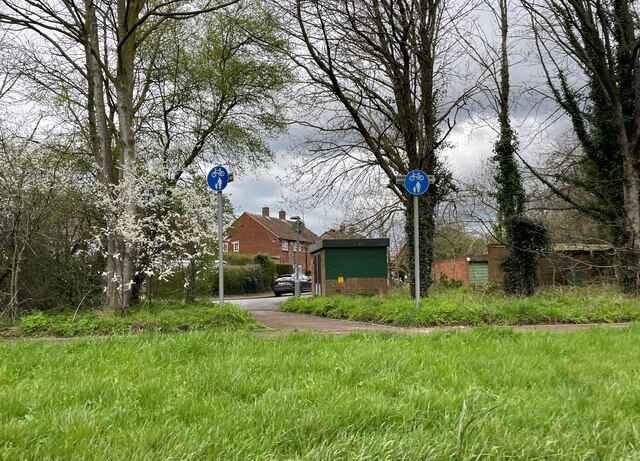
The wood is crisscrossed by a network of well-maintained footpaths, allowing visitors to explore and appreciate the natural beauty of the area. These paths lead to various points of interest, including a small pond and an ancient well, adding to the charm of the woodland.

Tollgate Wood is home to a variety of wildlife, making it an ideal spot for nature enthusiasts. Birdwatchers can often spot species such as woodpeckers, thrushes, and finches, while small mammals like squirrels and rabbits can also be seen scurrying among the undergrowth.

The wood offers a peaceful and serene atmosphere, making it a popular destination for walkers, joggers, and families seeking a tranquil outing. Picnic areas and benches are scattered throughout the woodland, providing visitors with ample opportunities to sit and enjoy the natural surroundings.

Overall, Tollgate Wood in Hertfordshire is a delightful haven for nature lovers, offering a serene escape and the chance to immerse oneself in the beauty of the English countryside.

If you have any feedback on the listing, please let us know in the comments section below.

Tollgate Wood Images

Images are sourced within 2km of 51.735868/-0.23824232 or Grid Reference TL2105. Thanks to Geograph Open Source API. All images are credited.

Cycle path towards Sleapcross Gardens
Byway towards Ellenbrook
The Crooked Billet Pub Beer Garden A place where children play and adults drink seemingly in their separate spheres. A shot in black and white seemed to accentuate the separation of these two worlds.
The Crooked Billet Pub Beer Garden
A place where children play and adults drink seemingly in their separate spheres. A shot in black and white seemed to accentuate the separation of these two worlds.
St Marks Church Colney Heath Wonder if the congregation stays at home and logs on to the sermons
St Marks Church Colney Heath
Wonder if the congregation stays at home and logs on to the sermons
Pumping Station at Colney Heath This is a pumping station extracting water from one or more borehole.
Round the back of the site the North London Society of Model Engineers has a model railway system open on Summer Sunday afternoons.
Pumping Station at Colney Heath
This is a pumping station extracting water from one or more borehole. Round the back of the site the North London Society of Model Engineers has a model railway system open on Summer Sunday afternoons.
River Colne near Colney Heath Viewed looking downstream from the Church Lane road bridge.
River Colne near Colney Heath
Viewed looking downstream from the Church Lane road bridge.
A1(M), north The A1 is the longest numbered road in the UK at 410 miles long. It connects London with Edinburgh, via the east of England. 
For much of its path it follows the Great North Road the old coaching route between London and Edinburgh. Several sections of the route are classified as motorway A1(M). The modern A1 bypasses the towns the Great North Road passed through and is dual carriageway for most of its route through England.
A1(M), north
The A1 is the longest numbered road in the UK at 410 miles long. It connects London with Edinburgh, via the east of England. For much of its path it follows the Great North Road the old coaching route between London and Edinburgh. Several sections of the route are classified as motorway A1(M). The modern A1 bypasses the towns the Great North Road passed through and is dual carriageway for most of its route through England.
A1(M), North Mymms The A1 is the longest numbered road in the UK at 410 miles long. It connects London with Edinburgh, via the east of England. 
For much of its path it follows the Great North Road the old coaching route between London and Edinburgh. Several sections of the route are classified as motorway A1(M). The modern A1 bypasses the towns the Great North Road passed through and is dual carriageway for most of its route through England.
A1(M), North Mymms
The A1 is the longest numbered road in the UK at 410 miles long. It connects London with Edinburgh, via the east of England. For much of its path it follows the Great North Road the old coaching route between London and Edinburgh. Several sections of the route are classified as motorway A1(M). The modern A1 bypasses the towns the Great North Road passed through and is dual carriageway for most of its route through England.
Footbridge, A1(M) The A1 is the longest numbered road in the UK at 410 miles long. It connects London with Edinburgh, via the east of England. 
For much of its path it follows the Great North Road the old coaching route between London and Edinburgh. Several sections of the route are classified as motorway A1(M). The modern A1 bypasses the towns the Great North Road passed through and is dual carriageway for most of its route through England.
Footbridge, A1(M)
The A1 is the longest numbered road in the UK at 410 miles long. It connects London with Edinburgh, via the east of England. For much of its path it follows the Great North Road the old coaching route between London and Edinburgh. Several sections of the route are classified as motorway A1(M). The modern A1 bypasses the towns the Great North Road passed through and is dual carriageway for most of its route through England.
A1001 overbridge, A1(M) The A1 is the longest numbered road in the UK at 410 miles long. It connects London with Edinburgh, via the east of England. 
For much of its path it follows the Great North Road the old coaching route between London and Edinburgh. Several sections of the route are classified as motorway A1(M). The modern A1 bypasses the towns the Great North Road passed through and is dual carriageway for most of its route through England.
A1001 overbridge, A1(M)
The A1 is the longest numbered road in the UK at 410 miles long. It connects London with Edinburgh, via the east of England. For much of its path it follows the Great North Road the old coaching route between London and Edinburgh. Several sections of the route are classified as motorway A1(M). The modern A1 bypasses the towns the Great North Road passed through and is dual carriageway for most of its route through England.
A1(M), north near J3 The A1 is the longest numbered road in the UK at 410 miles long. It connects London with Edinburgh, via the east of England. 
For much of its path it follows the Great North Road the old coaching route between London and Edinburgh. Several sections of the route are classified as motorway A1(M). The modern A1 bypasses the towns the Great North Road passed through and is dual carriageway for most of its route through England.
A1(M), north near J3
The A1 is the longest numbered road in the UK at 410 miles long. It connects London with Edinburgh, via the east of England. For much of its path it follows the Great North Road the old coaching route between London and Edinburgh. Several sections of the route are classified as motorway A1(M). The modern A1 bypasses the towns the Great North Road passed through and is dual carriageway for most of its route through England.
J3, A1(M) The A1 is the longest numbered road in the UK at 410 miles long. It connects London with Edinburgh, via the east of England. 
For much of its path it follows the Great North Road the old coaching route between London and Edinburgh. Several sections of the route are classified as motorway A1(M). The modern A1 bypasses the towns the Great North Road passed through and is dual carriageway for most of its route through England.
J3, A1(M)
The A1 is the longest numbered road in the UK at 410 miles long. It connects London with Edinburgh, via the east of England. For much of its path it follows the Great North Road the old coaching route between London and Edinburgh. Several sections of the route are classified as motorway A1(M). The modern A1 bypasses the towns the Great North Road passed through and is dual carriageway for most of its route through England.
Junction 3 overbridges, A1(M) The A1 is the longest numbered road in the UK at 410 miles long. It connects London with Edinburgh, via the east of England. 
For much of its path it follows the Great North Road the old coaching route between London and Edinburgh. Several sections of the route are classified as motorway A1(M). The modern A1 bypasses the towns the Great North Road passed through and is dual carriageway for most of its route through England.
Junction 3 overbridges, A1(M)
The A1 is the longest numbered road in the UK at 410 miles long. It connects London with Edinburgh, via the east of England. For much of its path it follows the Great North Road the old coaching route between London and Edinburgh. Several sections of the route are classified as motorway A1(M). The modern A1 bypasses the towns the Great North Road passed through and is dual carriageway for most of its route through England.
New station on the ECML, Welham Green 1995 View southward towards London, with a Class 313 EMU leaving on an Up local. The station was only opened on 29/9/86; the line (ex-GNR section of the ECML) was electrified King's Cross - Hitchin 1976-78. Marshmoor Box used to break here the long section between Brookmans Park and Hatfield.
New station on the ECML, Welham Green 1995
View southward towards London, with a Class 313 EMU leaving on an Up local. The station was only opened on 29/9/86; the line (ex-GNR section of the ECML) was electrified King's Cross - Hitchin 1976-78. Marshmoor Box used to break here the long section between Brookmans Park and Hatfield.
Junction 3, A1(M) The A1 is the longest numbered road in the UK at 410 miles long. It connects London with Edinburgh, via the east of England. 
For much of its path it follows the Great North Road the old coaching route between London and Edinburgh. Several sections of the route are classified as motorway A1(M). The modern A1 bypasses the towns the Great North Road passed through and is dual carriageway for most of its route through England.
Junction 3, A1(M)
The A1 is the longest numbered road in the UK at 410 miles long. It connects London with Edinburgh, via the east of England. For much of its path it follows the Great North Road the old coaching route between London and Edinburgh. Several sections of the route are classified as motorway A1(M). The modern A1 bypasses the towns the Great North Road passed through and is dual carriageway for most of its route through England.
Warrengate Lane, Water End
Entrance to industrial site, Water End
View from a Peterborough-London train - Playing field through the trees, South Hatfield
Show me another place!

Tollgate Wood is located at Grid Ref: TL2105 (Lat: 51.735868, Lng: -0.23824232)

Administrative County: Hertfordshire

District: Welwyn Hatfield

Police Authority: Hertfordshire

What 3 Words

///trade.lofts.ideas. Near Hatfield, Hertfordshire

Nearby Locations

Tollgate Wood

Related Wikis

North Mymms

North Mymms is a civil parish in the English county of Hertfordshire. At the 2011 Census the civil parish had a population of 8,921.The village itself...

Colney Heath Mill

Colney Heath Mill is a Grade II listed smock mill at Colney Heath, Hertfordshire, England, which has been converted to residential accommodation. ��2...

Colney Heath

Colney Heath is a large village in Hertfordshire, England. The village became a civil parish in 1947 when the St. Peter Rural parish was split to form...

Welham Green

Welham Green is a village in the parish of North Mymms, Hertfordshire, England. It is situated a mile to the west of the Great North Road coaching route...

Hope and Anchor, Welham Green

The Hope and Anchor was a grade II listed public house Welham Green, Hertfordshire. It is based on a 17th-century timber frame with later additions....

Colney Heath Local Nature Reserve

Colney Heath Local Nature Reserve is a 22.5 hectare Local Nature Reserve in Colney Heath in Hertfordshire. It is owned and managed by Colney Heath Parish...

Colney Heath F.C.

Colney Heath Football Club is a semi-professional football club based in Colney Heath, Hertfordshire, England. Affiliated to the Hertfordshire County Football...

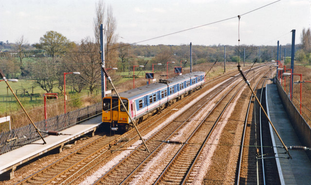
1870 Hatfield rail crash

On a frosty Boxing day in 1870 the driver of the 16:25 from London King's Cross to Peterborough noticed an 'uneasy oscillation' as he passed over Marshmoor...

Nearby Amenities

Located within 500m of 51.735868,-0.23824232
Power: tower
Lat/Long: 51.7372083/-0.2315115
Power: tower
Lat/Long: 51.736713/-0.2340296
Power: tower
Lat/Long: 51.7362756/-0.2362871
Power: tower
Lat/Long: 51.7338946/-0.2411865
Motorway Junction
Roestock
Ref: 2
Lat/Long: 51.7358097/-0.2365274
Note: Motorway regulations end here due to section of road onwards from here was previously two-way and open to farm vehicles for access.
Lat/Long: 51.7389439/-0.2405532
Give Way
Direction: forward
Lat/Long: 51.7373188/-0.2449675
Bus Stop
Tollgate Farm
Bench: no
Bin: no
Bus: yes
Lit: no
Naptan AtcoCode: 210021603220
Naptan Bearing: N
Naptan CommonName: Tollgate Farm
Naptan Crossing: Tollgate Road Farm
Naptan Indicator: opp
Naptan Landmark: Tollgate Road Farm
Naptan NaptanCode: hrtapjwt
Naptan PlusbusZoneRef: HATFILD;STALBCY
Naptan ShortCommonName: NA
Naptan Street: Tollgate Road
Naptan Verified: no
Public Transport: platform
Shelter: no
Source: naptan_import
Tactile Paving: no
Lat/Long: 51.734449/-0.2443242
Bus Stop
Tollgate Farm
Bench: no
Bin: no
Bus: yes
Lit: no
Local Ref: NR
Naptan AtcoCode: 210021604520
Naptan Bearing: S
Naptan CommonName: Tollgate Farm
Naptan Crossing: Tollgate Road Tollgate Farm
Naptan Indicator: nr
Naptan Landmark: Tollgate Road Tollgate Farm
Naptan NaptanCode: hrtapgmd
Naptan PlusbusZoneRef: HATFILD;STALBCY
Naptan ShortCommonName: NA
Naptan Street: Tollgate Road
Naptan Verified: no
Public Transport: platform
Shelter: no
Source: naptan_import
Tactile Paving: no
Lat/Long: 51.7346225/-0.2443134
Power: tower
Lat/Long: 51.7356545/-0.2394622
Power: tower
Lat/Long: 51.7357431/-0.2388721
Power: tower
Lat/Long: 51.7357446/-0.239209
Power: tower
Lat/Long: 51.7357873/-0.2390022
Power: pole
Lat/Long: 51.7360889/-0.2396166
Power: pole
Lat/Long: 51.7361622/-0.2390352
Power: transformer
Lat/Long: 51.7363237/-0.239708
Power: transformer
Lat/Long: 51.736371/-0.2391176
Street Lamp
Lamp Model: Philips MA50
Lamp Type: SOX
Source: Personal memory
Lat/Long: 51.7371674/-0.2378517
Street Lamp
Lamp Model: Philips MA50
Lamp Type: SOX
Source: Personal memory
Lat/Long: 51.7381457/-0.2386027
Street Lamp
Lamp Model: Philips MA50
Lamp Type: SOX
Source: Personal memory
Lat/Long: 51.7369316/-0.2376666
Street Lamp
Lamp Model: Philips MA50
Lamp Type: SOX
Source: Personal memory
Lat/Long: 51.7379235/-0.2376911
Street Lamp
Lamp Model: Philips MA50
Lamp Type: SOX
Source: Personal memory
Lat/Long: 51.736689/-0.2368914
Street Lamp
Lamp Model: Philips MA50
Lamp Type: SOX
Source: Personal memory
Lat/Long: 51.7390758/-0.2410168
Street Lamp
Lamp Model: Philips MA50
Lamp Type: SOX
Source: Personal memory
Lat/Long: 51.735513/-0.2364167
Street Lamp
Lamp Model: Philips MA50
Lamp Type: SOX
Source: Personal memory
Lat/Long: 51.7357406/-0.2366393
Street Lamp
Lamp Model: Philips MA50
Lamp Type: SOX
Source: Personal memory
Lat/Long: 51.7374284/-0.2373961
Street Lamp
Lamp Model: Philips MA50
Lamp Type: SOX
Source: Personal memory
Lat/Long: 51.7387802/-0.2398554
Street Lamp
Lamp Model: Philips MA50
Lamp Type: SOX
Source: Personal memory
Lat/Long: 51.7369332/-0.2370711
Street Lamp
Lamp Model: Philips MA50
Lamp Type: SOX
Source: Personal memory
Lat/Long: 51.7394669/-0.2384605
Street Lamp
Lamp Model: Philips MA50
Lamp Type: SOX
Source: Personal memory
Lat/Long: 51.7389281/-0.2406681
Street Lamp
Lamp Model: Philips MA50
Lamp Type: SOX
Source: Personal memory
Lat/Long: 51.7402756/-0.2383908
Street Lamp
Lamp Model: Philips MA50
Lamp Type: SOX
Source: Personal memory
Lat/Long: 51.7386806/-0.2380797
Street Lamp
Lamp Model: Philips MA50
Lamp Type: SOX
Source: Personal memory
Lat/Long: 51.7376759/-0.2375463
Street Lamp
Lamp Model: Philips MA50
Lamp Type: SOX
Source: Personal memory
Lat/Long: 51.7383948/-0.2388012
Street Lamp
Lamp Model: Philips MA50
Lamp Type: SOX
Source: Personal memory
Lat/Long: 51.7374132/-0.2380421
Street Lamp
Lamp Model: Philips MA50
Lamp Type: SOX
Source: Personal memory
Lat/Long: 51.738174/-0.2378356
Street Lamp
Lamp Model: Philips MA50
Lamp Type: SOX
Source: Personal memory
Lat/Long: 51.7397393/-0.2384686
Street Lamp
Lamp Model: Philips MA50
Lamp Type: SOX
Source: Personal memory
Lat/Long: 51.7379032/-0.238423
Street Lamp
Lamp Model: Philips MA50
Lamp Type: SOX
Source: Personal memory
Lat/Long: 51.7352854/-0.236186
Street Lamp
Lamp Model: Philips MA50
Lamp Type: SOX
Source: Personal memory
Lat/Long: 51.7400099/-0.2384498
Street Lamp
Lamp Model: Philips MA50
Lamp Type: SOX
Source: Personal memory
Lat/Long: 51.7388334/-0.2402631
Street Lamp
Lamp Model: Philips MA50
Lamp Type: SOX
Source: Personal memory
Lat/Long: 51.7392077/-0.2382701
Street Lamp
Lamp Model: Philips MA50
Lamp Type: SOX
Source: Personal memory
Lat/Long: 51.7387271/-0.2394395
Street Lamp
Lamp Model: Philips MA50
Lamp Type: SOX
Source: Personal memory
Lat/Long: 51.7362123/-0.2370738
Street Lamp
Lamp Model: Philips MA50
Lamp Type: SOX
Source: Personal memory
Lat/Long: 51.7371773/-0.2372348
Street Lamp
Lamp Model: Philips MA50
Lamp Type: SOX
Source: Personal memory
Lat/Long: 51.7385942/-0.2390721
Street Lamp
Lamp Model: Philips MA50
Lamp Type: SOX
Source: Personal memory
Lat/Long: 51.7364449/-0.2372804
Street Lamp
Lamp Model: Philips MA50
Lamp Type: SOX
Source: Personal memory
Lat/Long: 51.7384264/-0.237967
Street Lamp
Lamp Model: Philips MA50
Lamp Type: SOX
Source: Personal memory
Lat/Long: 51.7376557/-0.2382299
Street Lamp
Lamp Model: Philips MA50
Lamp Type: SOX
Source: Personal memory
Lat/Long: 51.735978/-0.2368539
Street Lamp
Lamp Model: Philips MA50
Lamp Type: SOX
Source: Personal memory
Lat/Long: 51.736684/-0.2374762
Street Lamp
Lamp Model: Philips MA50
Lamp Type: SOX
Source: Personal memory
Lat/Long: 51.7389413/-0.2381896
Material: wood
Power: pole
Lat/Long: 51.7347413/-0.2322042
Material: wood
Power: pole
Lat/Long: 51.7352944/-0.2334112
Material: wood
Power: pole
Lat/Long: 51.7358343/-0.2345806
Material: wood
Power: pole
Lat/Long: 51.7363592/-0.2357179
Material: wood
Power: pole
Lat/Long: 51.7366848/-0.2364287
Material: wood
Power: pole
Lat/Long: 51.7320021/-0.2390197
Material: wood
Power: pole
Lat/Long: 51.7330553/-0.2393791
Material: wood
Power: pole
Lat/Long: 51.7341533/-0.2397653
Barrier: kissing_gate
Foot: yes
Lat/Long: 51.7371278/-0.2354336
Barrier: kissing_gate
Lat/Long: 51.7344634/-0.2441996
Marker: aerial
Utility: oil
Lat/Long: 51.7333717/-0.2436292
Marker: post
Utility: oil
Lat/Long: 51.7333622/-0.2437739
Man Made: utility_pole
Lat/Long: 51.7326285/-0.2431813
Man Made: utility_pole
Lat/Long: 51.7331015/-0.2434822
Man Made: utility_pole
Lat/Long: 51.7335909/-0.2437657
Man Made: utility_pole
Lat/Long: 51.7340847/-0.244011
Marker: post
Substance: oil
Utility: oil
Lat/Long: 51.7333678/-0.2436265
Marker: aerial
Substance: oil
Utility: oil
Lat/Long: 51.7333587/-0.243772
Give Way
Direction: backward
Lat/Long: 51.7372012/-0.244838
Give Way
Direction: forward
Lat/Long: 51.7372037/-0.2449257
Give Way
Direction: backward
Lat/Long: 51.7372433/-0.2450855
The data included in this document is from www.openstreetmap.org. The data is made available under ODbL.

Have you been to Tollgate Wood?

Leave your review of Tollgate Wood below (or comments, questions and feedback).