Johnson's Spring

Wood, Forest in Hertfordshire St. Albans

England

Johnson's Spring

The Galleria, Hatfield
The Galleria, Hatfield Credit: David Howard

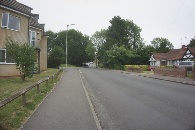
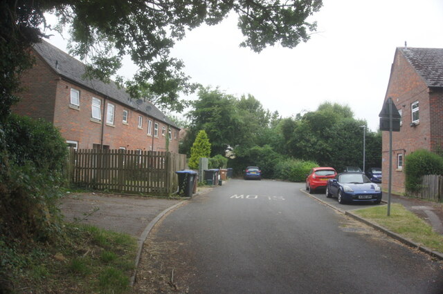
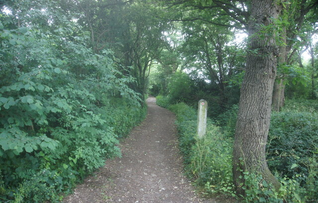
Johnson's Spring is a picturesque woodland located in the county of Hertfordshire, England. Situated near the village of Wood, this enchanting forest covers an area of approximately 100 acres, providing a haven for nature enthusiasts and those seeking tranquility away from the bustling city life.

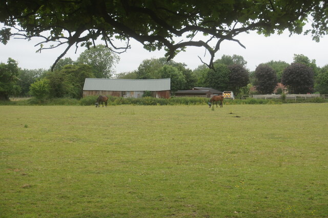
The woodland is named after the renowned naturalist and botanist, Johnson, who extensively explored this area during the 19th century. It is known for its diverse flora and fauna, with a wide array of native trees including oak, beech, and birch, creating a dense and verdant canopy overhead. The forest floor is adorned with a rich carpet of wildflowers, such as bluebells and primroses, adding bursts of color to the serene surroundings.

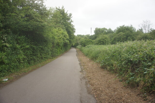
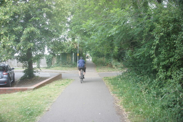
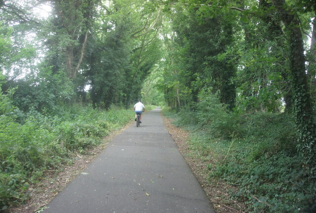
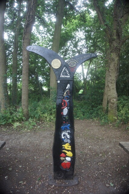
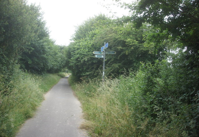
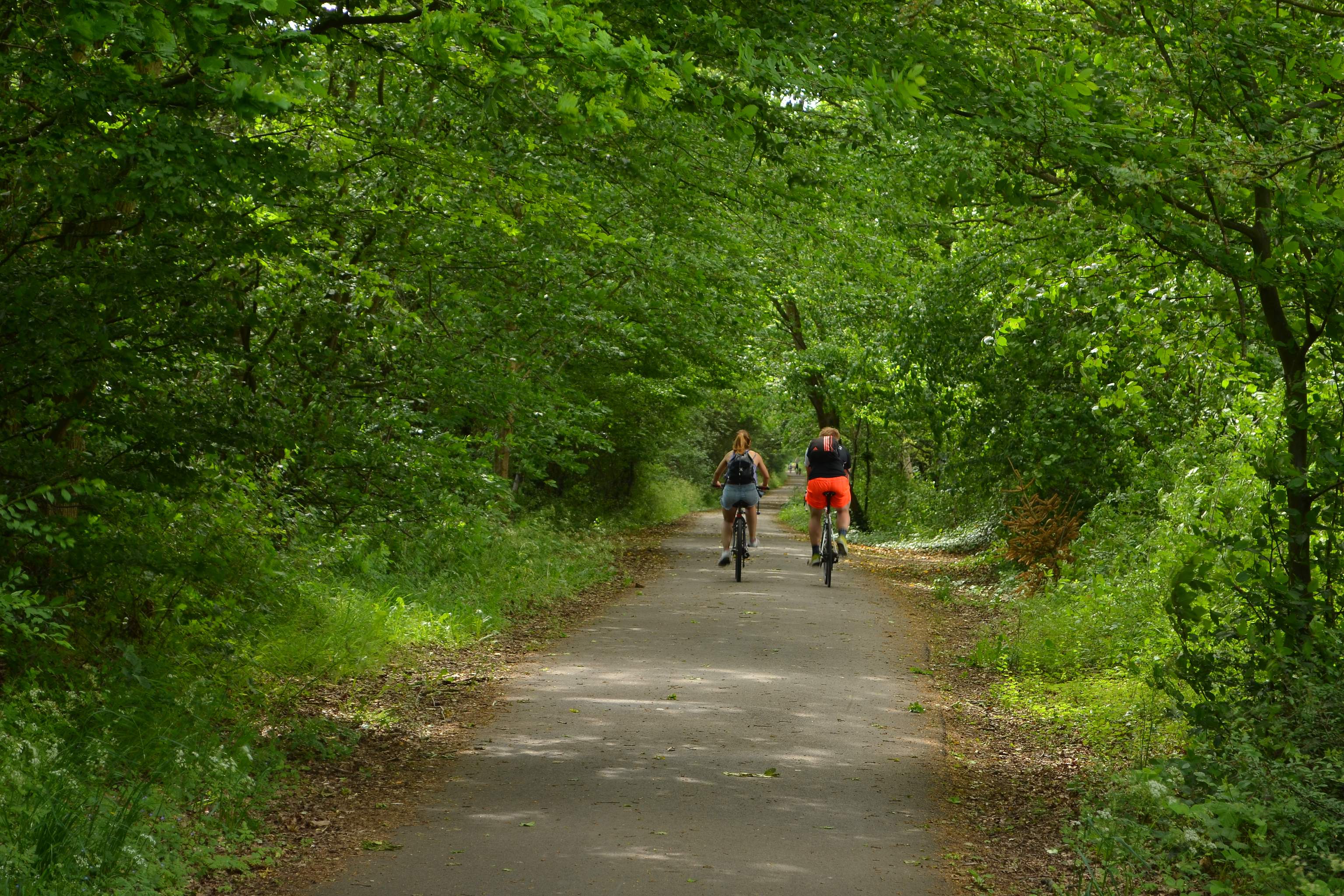
Johnson's Spring is a popular destination for hikers and walkers, offering numerous well-marked trails that wind through the woodland. These pathways lead visitors through different sections of the forest, providing opportunities to admire the various habitats and wildlife that call this place home. Birdwatchers will be delighted by the presence of species such as woodpeckers, owls, and warblers, while lucky visitors may catch a glimpse of deer, foxes, and other woodland creatures.

The spring itself, after which the woodland is named, is a small crystal-clear water source that emerges from underground. It trickles gently through the forest, nourishing the surrounding vegetation and forming peaceful babbling brooks that add to the serene atmosphere of the woodland.

Overall, Johnson's Spring in Hertfordshire is a captivating woodland that offers visitors an escape into nature's tranquility, with its lush greenery, diverse wildlife, and winding trails providing a perfect setting for exploration and relaxation.

If you have any feedback on the listing, please let us know in the comments section below.

Johnson's Spring Images

Images are sourced within 2km of 51.746043/-0.24640763 or Grid Reference TL2106. Thanks to Geograph Open Source API. All images are credited.

The Galleria, Hatfield
The YMCA on Comet Way, Hatfield
The Galleria, Hatfield
Hatfield Central Travelodge
Harpsfield Hall public house A Wetherspoons public house, Hatfield.
Harpsfield Hall public house
A Wetherspoons public house, Hatfield.
St Albans Road West, Hatfield
Inside The Galleria, Hatfield
View from the top floor of Hatfield Travelodge
St Alban Way towards St Albans
St Alban Way goes under Comet Way, Hatfield
St Alban Way at The Sidings
The Sidings, Hatfield
St Alban Way at Nast Hyde Halt
St Alban Way towards St Albans
Building at Nast Hyde Farm
Byway #51 from St Alban Way
National Cycle Network signpost On St Alban Way.
National Cycle Network signpost
On St Alban Way.
St Alban Way towards St Albans
Show me another place!

Johnson's Spring is located at Grid Ref: TL2106 (Lat: 51.746043, Lng: -0.24640763)

Administrative County: Hertfordshire

District: St. Albans

Police Authority: Hertfordshire

What 3 Words

///poetic.pouch.exam. Near Hatfield, Hertfordshire

Related Wikis

University of Hertfordshire

The University of Hertfordshire (UH) is a public university in Hertfordshire, United Kingdom. The university is based largely in Hatfield, Hertfordshire...

Sleapshyde

Sleapshyde is a small village in Hertfordshire, United Kingdom. It is located between Hatfield and St Albans, to the south of Smallford and to the north...

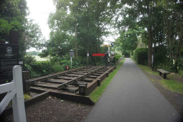
Nast Hyde Halt railway station

Nast Hyde Halt is a disused railway station in Hertfordshire. It was opened in 1910 to serve the new houses being built in the area. It is also said that...

Alban Way

The Alban Way is a traffic free multi-user route along a former railway line in Hertfordshire, England, that has been constructed along the route of the...

Colney Heath F.C.

Colney Heath Football Club is a semi-professional football club based in Colney Heath, Hertfordshire, England. Affiliated to the Hertfordshire County Football...

Torilla (house)

Torilla is a Grade II* listed house in Wilkin's Green Lane in Hatfield, England. It was designed in 1934–35 by F. R. S. Yorke in the modernist style and...

Colney Heath Mill

Colney Heath Mill is a Grade II listed smock mill at Colney Heath, Hertfordshire, England, which has been converted to residential accommodation. ��2...

Colney Heath Local Nature Reserve

Colney Heath Local Nature Reserve is a 22.5 hectare Local Nature Reserve in Colney Heath in Hertfordshire. It is owned and managed by Colney Heath Parish...

Nearby Amenities

Located within 500m of 51.746043,-0.24640763
Motorway Junction
Roehyde
Exit To: St Albans A414
Ref: 3
Lat/Long: 51.7484894/-0.2435652
Bus Stop
Tudor Close
Bus: yes
Naptan AtcoCode: 210021602875
Naptan Bearing: S
Naptan CommonName: Tudor Close
Naptan Indicator: nr
Naptan Landmark: Unknown
Naptan NaptanCode: hrtapmgw
Naptan PlusbusZoneRef: HATFILD
Naptan ShortCommonName: NA
Naptan Street: Roehyde Way
Naptan Verified: no
Public Transport: platform
Source: naptan_import
Lat/Long: 51.7464633/-0.2417281
Bus Stop
Tudor Close
Bus: yes
Naptan AtcoCode: 210021604915
Naptan Bearing: N
Naptan CommonName: Tudor Close
Naptan Indicator: opp
Naptan Landmark: Unknown
Naptan NaptanCode: hrtapgda
Naptan PlusbusZoneRef: HATFILD
Naptan ShortCommonName: NA
Naptan Street: Roehyde Way
Naptan Verified: no
Public Transport: platform
Source: naptan_import
Lat/Long: 51.7464477/-0.2419025
Bus Stop
The Forum
Bus: yes
Local Ref: 1
Naptan AtcoCode: 210021608011
Naptan Bearing: S
Naptan CommonName: The Forum
Naptan Indicator: Stop 1
Naptan Landmark: Unknown
Naptan NaptanCode: hrtjadwp
Naptan ShortCommonName: NA
Naptan Street: The Forum
Naptan Verified: no
Public Transport: platform
Source: naptan_import
Lat/Long: 51.7496898/-0.2423554
Bus Stop
The Forum
Bus: yes
Local Ref: 6
Naptan AtcoCode: 210021608016
Naptan Bearing: N
Naptan CommonName: The Forum
Naptan Indicator: Stop 6
Naptan Landmark: Unknown
Naptan NaptanCode: hrtjagam
Naptan ShortCommonName: NA
Naptan Street: The Forum
Naptan Verified: no
Public Transport: platform
Source: naptan_import
Lat/Long: 51.7496924/-0.2425229
Post Box
Description: In layby, next to electricity substation
Operator: Royal Mail
Operator Wikidata: Q638098
Post Box Type: lamp
Ref: AL10 323
Lat/Long: 51.746616/-0.240766
Traffic Signals
Traffic Signals: traffic_lights
Traffic Signals Direction: both
Lat/Long: 51.7484427/-0.242725
Crossing
Crossing: traffic_signals
Crossing Island: yes
Crossing Markings: dots
Tactile Paving: yes
Lat/Long: 51.7484855/-0.2425653
Post Box
Collection Times: Mo-Fr 09:00; Sa 07:00
Operator: Royal Mail
Operator Wikidata: Q638098
Post Box Mounting: brick_pillar
Post Box Type: wall
Ref: AL4 51D
Royal Cypher: VR
Royal Cypher Wikidata: Q33102356
Lat/Long: 51.7427568/-0.2437226
Crossing
Crossing: marked
Crossing Island: yes
Crossing Markings: zebra
Tactile Paving: yes
Lat/Long: 51.7495375/-0.2424302
Street Lamp
Lamp Model: Philips MA50
Lamp Type: SOX
Source: Personal memory
Lat/Long: 51.7489298/-0.2439937
Street Lamp
Lamp Model: Philips MA50
Lamp Type: SOX
Source: Personal memory
Lat/Long: 51.7504209/-0.2449646
Street Lamp
Lamp Model: Philips MA50
Lamp Type: SOX
Source: Personal memory
Lat/Long: 51.7481726/-0.2435565
Street Lamp
Lamp Model: Philips MA50
Lamp Type: SOX
Source: Personal memory
Lat/Long: 51.7484249/-0.243704
Street Lamp
Lamp Model: Philips MA50
Lamp Type: SOX
Source: Personal memory
Lat/Long: 51.7501702/-0.2448037
Street Lamp
Lamp Model: Philips MA50
Lamp Type: SOX
Source: Personal memory
Lat/Long: 51.7486757/-0.2438435
Street Lamp
Lamp Model: Philips MA50
Lamp Type: SOX
Source: Personal memory
Lat/Long: 51.7494263/-0.2443236
Street Lamp
Lamp Model: Philips MA50
Lamp Type: SOX
Source: Personal memory
Lat/Long: 51.7499178/-0.2446508
Street Lamp
Lamp Model: Philips MA50
Lamp Type: SOX
Source: Personal memory
Lat/Long: 51.7496704/-0.2444979
Street Lamp
Lamp Model: Philips MA50
Lamp Type: SOX
Source: Personal memory
Lat/Long: 51.7491788/-0.2441573
Roehyde
Place: neighbourhood
Lat/Long: 51.7505303/-0.2464187
Crossing
Crossing: unmarked
Crossing Island: yes
Crossing Markings: no
Tactile Paving: yes
Lat/Long: 51.7465753/-0.2418679
Bus Stop
Bullen's Green
Bus: yes
Public Transport: platform
Lat/Long: 51.7426271/-0.2440656
Bus Stop
Bullen's Green
Bus: yes
Public Transport: platform
Lat/Long: 51.7425661/-0.2439972
The data included in this document is from www.openstreetmap.org. The data is made available under ODbL.

Have you been to Johnson's Spring?

Leave your review of Johnson's Spring below (or comments, questions and feedback).