Target Wood

Wood, Forest in Middlesex

England

Target Wood

Edgware: Meadfield Viewed looking northwards.
Edgware: Meadfield Credit: Nigel Cox

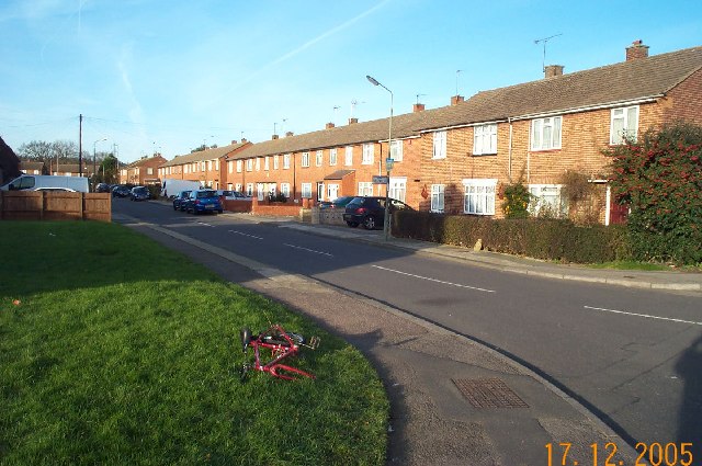
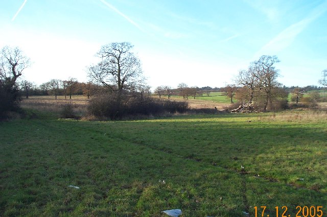
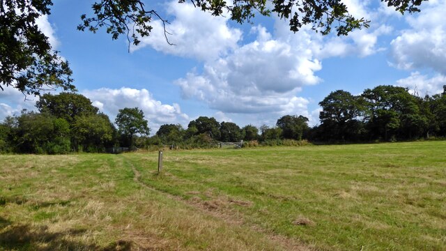
Target Wood is a picturesque woodland located in the county of Middlesex, England. Covering an area of approximately 50 acres, it is situated in the town of Wood, within the larger region known as the Forest of Middlesex. The wood is a popular destination for nature enthusiasts, locals, and visitors looking to immerse themselves in the tranquility of nature.

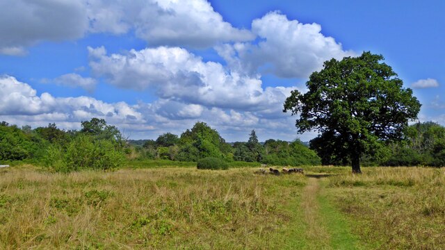
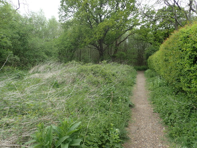
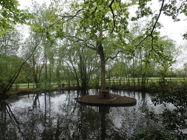
Target Wood is characterized by its diverse ecosystem, featuring a rich variety of flora and fauna. The woodland is predominantly composed of deciduous trees, including oak, beech, and birch, which create a dense and leafy canopy during the summer months. The forest floor is carpeted with a myriad of wildflowers, adding bursts of color to the natural landscape.

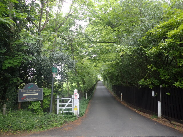
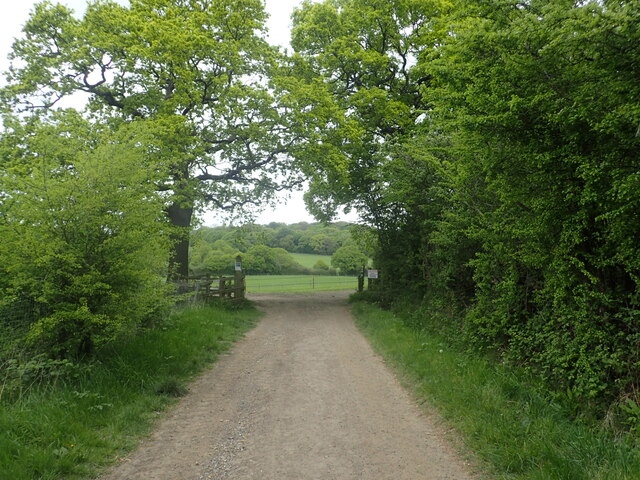
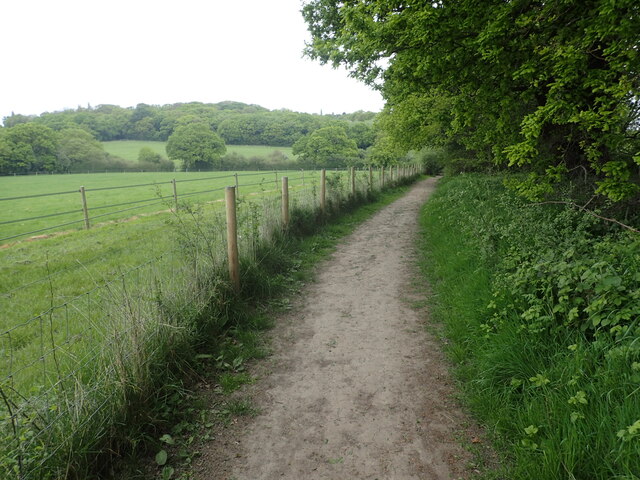
The wood is crisscrossed by a network of well-maintained footpaths, which allow visitors to explore and appreciate its natural beauty. These paths provide opportunities for leisurely walks, jogging, or cycling, making Target Wood a popular spot for outdoor activities. The wood also boasts several picnic areas, providing a perfect setting for families and friends to enjoy a relaxing day out surrounded by nature.

In addition to its recreational value, Target Wood plays a vital role in supporting local wildlife. The forest provides habitats for a range of species, including squirrels, rabbits, and a variety of bird species. Throughout the year, visitors may catch glimpses of woodpeckers, robins, and even deer.

Overall, Target Wood offers a serene and captivating escape from the hustle and bustle of everyday life, showcasing the natural beauty and biodiversity of Middlesex's woodlands.

If you have any feedback on the listing, please let us know in the comments section below.

Target Wood Images

Images are sourced within 2km of 51.634537/-0.25218557 or Grid Reference TQ2194. Thanks to Geograph Open Source API. All images are credited.

Edgware: Meadfield Viewed looking northwards.
Edgware: Meadfield
Viewed looking northwards.
Edgwarebury: Farmland The very northern edge of built-up London here, where the houses end and the countryside begins. This view was taken looking north westwards from the end of Warrens Shawe Lane. There is a large stream flowing in the bottom of the valley which the Ordnance Survey, for some reason, ignores on both the 1:50,000 and 1:25,000 scale maps.
Edgwarebury: Farmland
The very northern edge of built-up London here, where the houses end and the countryside begins. This view was taken looking north westwards from the end of Warrens Shawe Lane. There is a large stream flowing in the bottom of the valley which the Ordnance Survey, for some reason, ignores on both the 1:50,000 and 1:25,000 scale maps.
St Andrew, Lynford Gardens, Edgware
St Andrew, Lynford Gardens, Edgware - East end
St Andrew, Lynford Gardens, Edgware - Doorway
Old pole with new sign, Wolmer Gardens The striped pole is in very good condition, and the sign looks like it was only replaced recently although would need to discover for certain whether the previous one was pre-Worboys.
Old pole with new sign, Wolmer Gardens
The striped pole is in very good condition, and the sign looks like it was only replaced recently although would need to discover for certain whether the previous one was pre-Worboys.
On the London Loop near Brent Lodge Farm
Evening Light, London N14 Liked the colour of the clouds and the vapour trails.
Evening Light, London N14
Liked the colour of the clouds and the vapour trails.
Totteridge Fields The nature reserve covers over 30 fields to the north of Totteridge Common,  stretching between Hendon Wood Lane in the west and Grange Avenue in the east.  It lies along the valley of the Dollis Brook, which flows from west to east through the site, with fields rising gently on either side.

Totteridge Fields once produced hay for London’s horse-traffic. In the early 1990s local people successfully opposed plans for a cemetery covering three fields. This led to the site coming under the management of the London Wildlife Trust from 1993. 

Traditional hay-cutting methods are still used, with volunteers mowing alternative areas each year to help conserve the richly diverse plant and invertebrate population.  This work is supplemented by conservation grazing with traditional breeds of cattle, first introduced in 2014.
Totteridge Fields
The nature reserve covers over 30 fields to the north of Totteridge Common, stretching between Hendon Wood Lane in the west and Grange Avenue in the east. It lies along the valley of the Dollis Brook, which flows from west to east through the site, with fields rising gently on either side. Totteridge Fields once produced hay for London’s horse-traffic. In the early 1990s local people successfully opposed plans for a cemetery covering three fields. This led to the site coming under the management of the London Wildlife Trust from 1993. Traditional hay-cutting methods are still used, with volunteers mowing alternative areas each year to help conserve the richly diverse plant and invertebrate population. This work is supplemented by conservation grazing with traditional breeds of cattle, first introduced in 2014.
Footpath and driveway to Mote End Farm This leads off Nan Clark's Lane here and beyond Mote End Farm it reaches the London Loop.
Footpath and driveway to Mote End Farm
This leads off Nan Clark's Lane here and beyond Mote End Farm it reaches the London Loop.
The entrance to Mote End This is at Mote End Farm. The driveway through the gate leads to Pond Cottage, The Studio and the Coach House. This old horse trough with its flowers made a splash of colour on a rather dull day.
The entrance to Mote End
This is at Mote End Farm. The driveway through the gate leads to Pond Cottage, The Studio and the Coach House. This old horse trough with its flowers made a splash of colour on a rather dull day.
Footpath to Rowley Lane This leads from Barnet Road at Barnet Gate, past Windmill Cottage and through an area of woodland to reach Rowley Lane. This is just past the village hall.
Footpath to Rowley Lane
This leads from Barnet Road at Barnet Gate, past Windmill Cottage and through an area of woodland to reach Rowley Lane. This is just past the village hall.
Nan Clark's Lane Nan Clark's Lane got its name from Nan Clark who worked in the local tavern (the pub is now called The Rising Sun). She was well-liked and had many admirers, but she also had a very jealous husband. One day her husband barged into the pub drunk and started yelling and screaming at Nan as there were whispers going round that she had been having an affair. Nan Clark’s husband dragged Nan out of the tavern, down what is now called Nan Clark’s lane, pulling her hair when she tried to struggle. Nan Clark was then murdered by being drowned in a nearby lake. The lake is seen at <a title="https://www.geograph.org.uk/photo/7158900" href="https://www.geograph.org.uk/photo/7158900">Link</a>

For more about the story see <span class="nowrap"><a title="https://www.times-series.co.uk/news/18003923.mill-hill-road-one-uks-spookiest/" rel="nofollow ugc noopener" href="https://www.times-series.co.uk/news/18003923.mill-hill-road-one-uks-spookiest/">Link</a><img style="margin-left:2px;" alt="External link" title="External link - shift click to open in new window" src="https://s1.geograph.org.uk/img/external.png" width="10" height="10"/></span>  and <span class="nowrap"><a title="https://teaandtakes.com/2013/12/22/the-story-of-nan-clark/" rel="nofollow ugc noopener" href="https://teaandtakes.com/2013/12/22/the-story-of-nan-clark/">Link</a><img style="margin-left:2px;" alt="External link" title="External link - shift click to open in new window" src="https://s1.geograph.org.uk/img/external.png" width="10" height="10"/></span>
Nan Clark's Lane
Nan Clark's Lane got its name from Nan Clark who worked in the local tavern (the pub is now called The Rising Sun). She was well-liked and had many admirers, but she also had a very jealous husband. One day her husband barged into the pub drunk and started yelling and screaming at Nan as there were whispers going round that she had been having an affair. Nan Clark’s husband dragged Nan out of the tavern, down what is now called Nan Clark’s lane, pulling her hair when she tried to struggle. Nan Clark was then murdered by being drowned in a nearby lake. The lake is seen at Link For more about the story see LinkExternal link and LinkExternal link
A pond with a sinister story The nearby Nan Clark's Lane got its name from Nan Clark who worked in the local tavern (the pub is now called The Rising Sun). She was well-liked and had many admirers, but she also had a very jealous husband. One day her husband barged into the pub drunk and started yelling and screaming at Nan Clark as there were whispers going round that Nan had been having an affair. Nan Clark’s husband dragged Nan out of the tavern, down what is now called Nan Clark’s lane, pulling her hair when she tried to struggle. Nan Clark was then murdered by being drowned in this nearby lake. 

For more about the story see <span class="nowrap"><a title="https://www.times-series.co.uk/news/18003923.mill-hill-road-one-uks-spookiest/" rel="nofollow ugc noopener" href="https://www.times-series.co.uk/news/18003923.mill-hill-road-one-uks-spookiest/">Link</a><img style="margin-left:2px;" alt="External link" title="External link - shift click to open in new window" src="https://s1.geograph.org.uk/img/external.png" width="10" height="10"/></span>  and <span class="nowrap"><a title="https://teaandtakes.com/2013/12/22/the-story-of-nan-clark/" rel="nofollow ugc noopener" href="https://teaandtakes.com/2013/12/22/the-story-of-nan-clark/">Link</a><img style="margin-left:2px;" alt="External link" title="External link - shift click to open in new window" src="https://s1.geograph.org.uk/img/external.png" width="10" height="10"/></span>
A pond with a sinister story
The nearby Nan Clark's Lane got its name from Nan Clark who worked in the local tavern (the pub is now called The Rising Sun). She was well-liked and had many admirers, but she also had a very jealous husband. One day her husband barged into the pub drunk and started yelling and screaming at Nan Clark as there were whispers going round that Nan had been having an affair. Nan Clark’s husband dragged Nan out of the tavern, down what is now called Nan Clark’s lane, pulling her hair when she tried to struggle. Nan Clark was then murdered by being drowned in this nearby lake. For more about the story see LinkExternal link and LinkExternal link
At the entrance to Mote End This is at Mote End Farm, next to the driveway which leads to Pond Cottage, The Studio and the Coach House. This old horse trough with its flowers made a splash of colour on a rather dull day. See also <a title="https://www.geograph.org.uk/photo/7158223" href="https://www.geograph.org.uk/photo/7158223">Link</a>
At the entrance to Mote End
This is at Mote End Farm, next to the driveway which leads to Pond Cottage, The Studio and the Coach House. This old horse trough with its flowers made a splash of colour on a rather dull day. See also Link
London Loop ahead This is just past Mote End Farm and the London Loop is joined beyond the gate. Moat Mount and Barnet Gate Wood can be seen in the distance.
London Loop ahead
This is just past Mote End Farm and the London Loop is joined beyond the gate. Moat Mount and Barnet Gate Wood can be seen in the distance.
The London Loop at Moat Mount The London Loop is seen here at Moat Mount with Barnet Gate Wood on the horizon. The path is also followed by the Dollis Valley Greenwalk. The Dollis Brook is a tributary of the River Brent and the infant Dollis Brook is crossed ahead at the foot of the valley which is at the end of the field on the left.
The London Loop at Moat Mount
The London Loop is seen here at Moat Mount with Barnet Gate Wood on the horizon. The path is also followed by the Dollis Valley Greenwalk. The Dollis Brook is a tributary of the River Brent and the infant Dollis Brook is crossed ahead at the foot of the valley which is at the end of the field on the left.
Show me another place!

Target Wood is located at Grid Ref: TQ2194 (Lat: 51.634537, Lng: -0.25218557)

Unitary Authority: Barnet

Police Authority: Metropolitan

What 3 Words

///reveal.shark.fade. Near Borehamwood, Hertfordshire

Related Wikis

Moat Mount Open Space

Moat Mount Open Space is a 110-hectare park and nature reserve in Mill Hill in the London Borough of Barnet. It is part of Moat Mount Open Space and Mote...
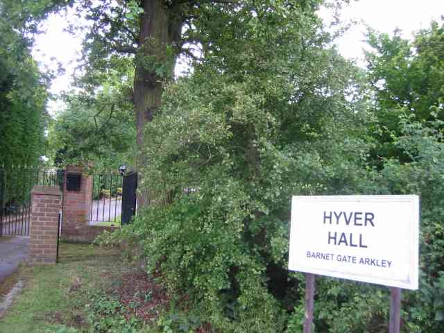
Hyver Hall

Hyver Hall is a grade II listed house in Barnet Road, to the west of Barnet Gate and Arkley, in the London Borough of Barnet.It was purchased by Harpinder...

Mill Hill County High School

Mill Hill County High School is a large secondary school with academy status located in Mill Hill, London, England. It was the first comprehensive school...

Barnet Gate Wood

Barnet Gate Wood is a public open space in Barnet Gate, Barnet, London. It is owned and managed by the London Borough of Barnet, and is part of the Watling...

London Gateway services

London Gateway services is the southernmost motorway service station on the M1 motorway – between Junctions 2 and 4 – north of London, England. It is between...

NW London F.C.

NW London Football Club is a football club based in Arkley, London, England. They are currently members of the Eastern Counties League Division One South...

Hadley F.C.

Hadley Football Club is a football club based in Arkley, Barnet, England. Affiliated to the Hertfordshire County Football Association, they are currently...

Scratchwood

Scratchwood is an extensive, mainly wooded, country park in Mill Hill in the London Borough of Barnet. The 57-hectare site is a Site of Metropolitan Importance...

Nearby Amenities

Located within 500m of 51.634537,-0.25218557
Bus Stop
Moat Mount Park
Bench: no
Bin: no
Bus: yes
Lit: yes
Naptan AtcoCode: 490009960N
Naptan Bearing: N
Naptan CommonName: Moat Mount Park
Naptan Street: BARNET WAY
Naptan Verified: no
Note: no access to Moat Mount Park because there is no street crossing
Public Transport: platform
Ref: 59087
Shelter: no
Source Ref: naptan
Tactile Paving: no
Lat/Long: 51.6317045/-0.2539587
Bus Stop
Moat Mount Park
Bench: yes
Bin: yes
Bus: yes
Naptan AtcoCode: 490009960S
Naptan Bearing: N
Naptan CommonName: Moat Mount Park
Naptan Street: BARNET WAY
Naptan Verified: no
Public Transport: platform
Shelter: yes
Tactile Paving: no
Lat/Long: 51.6319532/-0.2535334
Bus Stop
Scratchwood Park
Bench: yes
Bin: no
Bus: yes
Check Date Shelter: 2022-06-20
Local Ref: H
Naptan AtcoCode: 490011961S
Naptan Bearing: S
Naptan CommonName: Scratchwood Park
Naptan Indicator: Stop H
Naptan Street: BARNET WAY
Naptan Verified: no
Public Transport: platform
Ref: 56985
Shelter: yes
Source Ref: naptan
Tactile Paving: no
Lat/Long: 51.6383803/-0.2551926
Arkley Park
Place: locality
Lat/Long: 51.6383774/-0.2542827
Target Wood
Place: locality
Lat/Long: 51.6349312/-0.2519738
Clump Of Trees Wood
Place: locality
Lat/Long: 51.6361172/-0.2558576
Dollis Valley Greenwalk
Information: map
Tourism: information
Lat/Long: 51.6324293/-0.2530066
Dollis Valley Greenwalk
Hiking: yes
Information: guidepost
Tourism: information
Lat/Long: 51.6330964/-0.2508674
Dollis Valley Greenwalk
Hiking: yes
Information: guidepost
Tourism: information
Lat/Long: 51.6349705/-0.2489929
Bench
Lat/Long: 51.6341742/-0.24991
Bench
Backrest: no
Lat/Long: 51.6342158/-0.2453614
Bench
Backrest: no
Lat/Long: 51.6347679/-0.2475881
Bench
Lat/Long: 51.6348573/-0.2491621
Give Way
Direction: forward
Lat/Long: 51.6324897/-0.2533864
Give Way
Direction: forward
Lat/Long: 51.6325398/-0.2532758
Barrier: swing_gate
Lat/Long: 51.6325172/-0.2532432
Barrier: kissing_gate
Lat/Long: 51.6349439/-0.2489586
Access: customers
Leisure: fitness_station
Sport: fitness
Lat/Long: 51.6346632/-0.2518731
The data included in this document is from www.openstreetmap.org. The data is made available under ODbL.

Have you been to Target Wood?

Leave your review of Target Wood below (or comments, questions and feedback).