Ewood Copse

Wood, Forest in Surrey Mole Valley

England

Ewood Copse

Derelict barn next to public footpath near Blanks Lane
Derelict barn next to public footpath near Blanks Lane Credit: James Insell

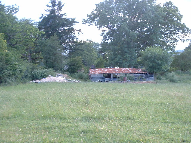
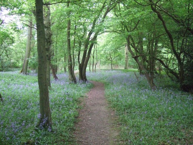
Ewood Copse, located in Surrey, England, is a picturesque wood that boasts an impressive array of plant and animal species. Covering an area of approximately 50 acres, the copse is a haven for nature enthusiasts and those seeking a tranquil escape from the bustling city life.

The woodland, primarily composed of oak and beech trees, creates a dense canopy that provides shade and shelter for a diverse range of wildlife. Ewood Copse is particularly known for its vibrant bird population, with species such as woodpeckers, tits, and finches frequently spotted among the branches. The copse also supports a variety of mammals, including foxes, badgers, and small rodents.

Walking through Ewood Copse, visitors can enjoy the enchanting ambiance created by the rustling leaves and the soothing sounds of birdsong. The woodland floor is blanketed with a rich carpet of bluebells in the spring, creating a breathtaking sight. In addition, the copse is home to a variety of wildflowers, adding bursts of color to the green landscape.

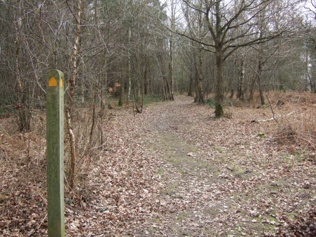
Ewood Copse offers several well-maintained walking trails, allowing visitors to explore the wood at their own pace. These paths wind through the trees and offer glimpses of the surrounding countryside, providing a truly immersive experience in nature.

Ewood Copse is a cherished natural gem in Surrey, offering a peaceful retreat for those seeking solace in the beauty of the British countryside. Its diverse ecosystem and scenic beauty make it a must-visit destination for nature lovers and outdoor enthusiasts alike.

If you have any feedback on the listing, please let us know in the comments section below.

Ewood Copse Images

Images are sourced within 2km of 51.179358/-0.28047177 or Grid Reference TQ2043. Thanks to Geograph Open Source API. All images are credited.

Derelict barn next to public footpath near Blanks Lane
Old cottage as seen from public footpath near Blanks Lane
Hales Bridge on Blanks Lane
Roadside pond at Blank's Farm
The Surrey Oaks pub at Parkgate
Telephone box at Parkgate
The Ali Raj Indian restaurant at Parkgate
Bridge at Ewood Lane
Entrance to the Woodland Trust's Hammond's Copse
Information point at the Woodland Trust's Hammond's Copse
Pond bay at Ewood, near Newdigate, Surrey Ewood was one of the main centres for ironmaking in the 15th century. The works were water-powered, driven by a pond which is thought to have been 200 acres in size. The pond bay (or dam) can still be seen behind a cottage on Ewood Lane.
Pond bay at Ewood, near Newdigate, Surrey
Ewood was one of the main centres for ironmaking in the 15th century. The works were water-powered, driven by a pond which is thought to have been 200 acres in size. The pond bay (or dam) can still be seen behind a cottage on Ewood Lane.
Parkhouse Farm Looking North East from the edge of Hammond's Copse
Parkhouse Farm
Looking North East from the edge of Hammond's Copse
Hammond's Copse Looking North up one of the tracks
Hammond's Copse
Looking North up one of the tracks
Track Junction in Hammond's Copse Looking down the South Eastern track
Track Junction in Hammond's Copse
Looking down the South Eastern track
Narrow Bridge over the brook Looking North towards Shelwood Cross
Narrow Bridge over the brook
Looking North towards Shelwood Cross
Hammond's Copse
Hammond's Copse
Stile and Footbridge Beyond
Farm Track Connects Parkhouse Farm and Mynthurst Farm
Farm Track
Connects Parkhouse Farm and Mynthurst Farm
Show me another place!

Ewood Copse is located at Grid Ref: TQ2043 (Lat: 51.179358, Lng: -0.28047177)

Administrative County: Surrey

District: Mole Valley

Police Authority: Surrey

What 3 Words

///ruins.digs.puns. Near Holmwood, Surrey

Related Wikis

Newdigate

Newdigate is a village and civil parish in the Mole Valley borough of Surrey lying in a relatively flat part of the Weald to the east of the A24 road between...

Newdigate Brickworks

Newdigate Brickworks is a 24-hectare (59-acre) nature reserve in Newdigate in Surrey. It is managed by the Surrey Wildlife Trust.The clay pits of this...

Wotton Hundred

The Hundred of Wotton, Wotton Hundred or Dorking Hundred was a hundred in Surrey, England. The hundred comprised a south-central portion of the county...

Holmwood railway station

Holmwood railway station serves the villages of Beare Green and South Holmwood in Surrey, England, on the Sutton and Mole Valley Lines between Dorking...

Edolph's Copse

Edolph's Copse is a 27.6-hectare (68-acre) Local Nature Reserve west of Horley in Surrey. It is owned and managed by the Woodland Trust.The copse is mainly...

Leigh, Surrey

Leigh is a village and civil parish in Surrey, between Reigate, Dorking and Charlwood in the east of Mole Valley district. The village centre is suburban...

Glover's Wood

Glover's Wood is a 74.5-hectare (184-acre) biological Site of Special Scientific Interest east of Charlwood in Surrey. It is a Nature Conservation Review...

South Holmwood

South Holmwood () is a semi-rural village in Surrey, England. It can be considered cognate with its wider civil parish, which stretches to the east to...

Nearby Amenities

Located within 500m of 51.179358,-0.28047177
Crossing
Crossing: unmarked
Crossing Island: no
Kerb: lowered
Tactile Paving: no
Lat/Long: 51.1769663/-0.2815923
Surrey Oaks
Bus: yes
Public Transport: stop_position
Lat/Long: 51.1791246/-0.2766739
Bus Stop
Surrey Oaks
Bench: no
Bin: no
Bus: yes
Naptan AtcoCode: 40004408011B
Naptan Bearing: W
Naptan CommonName: Surrey Oaks
Naptan Indicator: Opp
Naptan Landmark: Surrey Oaks
Naptan NaptanCode: surawmgw
Naptan Street: Parkgate Road
Naptan Verified: no
Public Transport: platform
Shelter: no
Source: naptan_import
Lat/Long: 51.1789694/-0.2770401
Bus Stop
Mill Lane
Bench: no
Bus: yes
Naptan AtcoCode: 40004408012A
Naptan Bearing: NE
Naptan CommonName: Mill Lane
Naptan Indicator: adj
Naptan Landmark: Mill Lane
Naptan NaptanCode: surawmja
Naptan Street: Broad Lane
Naptan Verified: no
Public Transport: platform
Shelter: no
Source: naptan_import
Tactile Paving: no
Lat/Long: 51.1800945/-0.2751721
Bus Stop
Mill Lane
Bus: yes
Naptan AtcoCode: 40004408012B
Naptan Bearing: S
Naptan CommonName: Mill Lane
Naptan Indicator: Opp
Naptan Landmark: Mill Lane
Naptan NaptanCode: surawmjd
Naptan Street: Broad Lane
Naptan Verified: no
Public Transport: platform
Source: naptan_import
Lat/Long: 51.1798025/-0.2749827
Barrier: stile
Lat/Long: 51.1780621/-0.2740973
Fire Hydrant
Emergency: fire_hydrant
Fire Hydrant Diameter: fixme
Fire Hydrant Position: fixme
Fire Hydrant Type: underground
Lat/Long: 51.1785343/-0.2788679
Defibrillator
Access: yes
Booth: K6
Colour: red
Defibrillator Location: inside red phone box, Parkgate Road, Newdigate
Disused Amenity: telephone
Emergency: defibrillator
Lat/Long: 51.1789724/-0.2771291
Post Box
Post Box Mounting: brick_pillar
Post Box Type: wall
Ref: RH5 29
Source: P170-0144
Lat/Long: 51.1789801/-0.277083
Barrier: stile
Lat/Long: 51.178632/-0.2743457
Barrier: stile
Lat/Long: 51.1794806/-0.2749849
Parkgate
Place: hamlet
Lat/Long: 51.1786537/-0.2781714
Surrey Oaks
Bus: yes
Public Transport: stop_position
Lat/Long: 51.1790406/-0.2770819
Bus Stop
Surrey Oaks
Bench: yes
Bus: yes
Naptan AtcoCode: 40004408011A
Naptan Bearing: E
Naptan CommonName: Surrey Oaks
Naptan Indicator: adj
Naptan Landmark: Surrey Oaks
Naptan NaptanCode: surawmgt
Naptan Street: Parkgate Road
Naptan Verified: no
Public Transport: platform
Shelter: no
Source: naptan_import
Tactile Paving: no
Lat/Long: 51.179154/-0.276714
Mill Lane
Bus: yes
Public Transport: stop_position
Lat/Long: 51.1797969/-0.2750778
Mill Lane
Bus: yes
Public Transport: stop_position
Lat/Long: 51.1800877/-0.2751084
Bench
Lat/Long: 51.1791784/-0.2766174
Advertising: board
Lat/Long: 51.1791986/-0.276545
Forge Farm
Place: isolated_dwelling
Lat/Long: 51.1784863/-0.2767999
Springfield Farm
Place: farm
Lat/Long: 51.1779264/-0.2796516
The data included in this document is from www.openstreetmap.org. The data is made available under ODbL.

Have you been to Ewood Copse?

Leave your review of Ewood Copse below (or comments, questions and feedback).