Horse Pasture Plantation

Wood, Forest in Lincolnshire East Lindsey

England

Horse Pasture Plantation

Hainton Hall: aerial 2021 See <span class="nowrap"><a title="https://www.heritagegateway.org.uk/Gateway/Results_Single.aspx?uid=MLI40365&resourceID=1006" rel="nofollow ugc noopener" href="https://www.heritagegateway.org.uk/Gateway/Results_Single.aspx?uid=MLI40365&resourceID=1006">Link</a><img style="margin-left:2px;" alt="External link" title="External link - shift click to open in new window" src="https://s1.geograph.org.uk/img/external.png" width="10" height="10"/></span>

Hainton Hall dates to the 17th century and is the residence of the Heneage family. The present house was built in 1638 and underwent additions in the 18th and 19th century. The south wing dates from 1729 and the west wing was rebuilt in 1800. The porch of the hall dates from 1875. The Hall was demolished and rebuilt in 1973. There is also a chapel 100 metres to the east of hall which was erected in 1836. The park was landscaped in the mid to late 18th century by Capability Brown.

Regular courtyard with multiple regular yards. The farmhouse is detached from the main working complex. There has been a partial loss (less than 50%) of traditional buildings. Located within a Church and/or Manor farm group.
Hainton Hall: aerial 2021 Credit: Chris

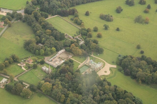
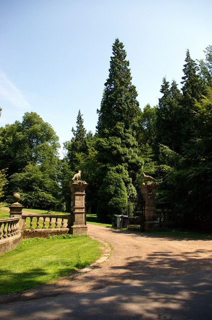
Horse Pasture Plantation is a picturesque woodland area located in Lincolnshire, England. Covering an expansive area of land, this plantation is primarily known for its dense growth of trees and its role in providing a habitat for various wildlife species.

The woodland is characterized by a diverse range of tree species, including oak, beech, birch, and ash. These trees form a dense canopy, creating a serene and secluded environment within the plantation. The undergrowth is rich with a variety of flora, such as bluebells, ferns, and wildflowers, adding to the natural beauty of the area.

Horse Pasture Plantation is home to a diverse range of wildlife, making it a haven for nature enthusiasts and birdwatchers. Visitors can often spot various species of birds, including woodpeckers, owls, and songbirds. The woodland also supports a healthy population of mammals, including deer, squirrels, and foxes.

The plantation offers numerous walking trails and paths, allowing visitors to explore its natural wonders and enjoy the tranquility of the surroundings. These pathways wind through the woodland, offering glimpses of sunlight filtering through the trees and providing a peaceful ambiance.

Horse Pasture Plantation is not only a sanctuary for wildlife but also serves as an important ecological site, contributing to the overall health of the surrounding ecosystem. Its preservation and careful management ensure the continued existence of this beautiful woodland for generations to come.

If you have any feedback on the listing, please let us know in the comments section below.

Horse Pasture Plantation Images

Images are sourced within 2km of 53.353168/-0.20249317 or Grid Reference TF1985. Thanks to Geograph Open Source API. All images are credited.

Hainton Hall: aerial 2021 See <span class="nowrap"><a title="https://www.heritagegateway.org.uk/Gateway/Results_Single.aspx?uid=MLI40365&resourceID=1006" rel="nofollow ugc noopener" href="https://www.heritagegateway.org.uk/Gateway/Results_Single.aspx?uid=MLI40365&resourceID=1006">Link</a><img style="margin-left:2px;" alt="External link" title="External link - shift click to open in new window" src="https://s1.geograph.org.uk/img/external.png" width="10" height="10"/></span>

Hainton Hall dates to the 17th century and is the residence of the Heneage family. The present house was built in 1638 and underwent additions in the 18th and 19th century. The south wing dates from 1729 and the west wing was rebuilt in 1800. The porch of the hall dates from 1875. The Hall was demolished and rebuilt in 1973. There is also a chapel 100 metres to the east of hall which was erected in 1836. The park was landscaped in the mid to late 18th century by Capability Brown.

Regular courtyard with multiple regular yards. The farmhouse is detached from the main working complex. There has been a partial loss (less than 50%) of traditional buildings. Located within a Church and/or Manor farm group.
Hainton Hall: aerial 2021
See LinkExternal link Hainton Hall dates to the 17th century and is the residence of the Heneage family. The present house was built in 1638 and underwent additions in the 18th and 19th century. The south wing dates from 1729 and the west wing was rebuilt in 1800. The porch of the hall dates from 1875. The Hall was demolished and rebuilt in 1973. There is also a chapel 100 metres to the east of hall which was erected in 1836. The park was landscaped in the mid to late 18th century by Capability Brown. Regular courtyard with multiple regular yards. The farmhouse is detached from the main working complex. There has been a partial loss (less than 50%) of traditional buildings. Located within a Church and/or Manor farm group.
Hainton Hall: aerial 2022 See: <span class="nowrap"><a title="https://www.heritagegateway.org.uk/Gateway/Results_Single.aspx?uid=MLI40365&resourceID=1006" rel="nofollow ugc noopener" href="https://www.heritagegateway.org.uk/Gateway/Results_Single.aspx?uid=MLI40365&resourceID=1006">Link</a><img style="margin-left:2px;" alt="External link" title="External link - shift click to open in new window" src="https://s1.geograph.org.uk/img/external.png" width="10" height="10"/></span> and 
<span class="nowrap"><a title="https://heritage-explorer.lincolnshire.gov.uk/Monument/MLI40365" rel="nofollow ugc noopener" href="https://heritage-explorer.lincolnshire.gov.uk/Monument/MLI40365">Link</a><img style="margin-left:2px;" alt="External link" title="External link - shift click to open in new window" src="https://s1.geograph.org.uk/img/external.png" width="10" height="10"/></span>

Hainton Hall dates to the 17th century and is the residence of the Heneage family. The present house was built in 1638 and underwent additions in the 18th and 19th century.
Hainton Hall: aerial 2022
See: LinkExternal link and LinkExternal link Hainton Hall dates to the 17th century and is the residence of the Heneage family. The present house was built in 1638 and underwent additions in the 18th and 19th century.
Looking southwards from Ludford down High Street: aerial 2023
Part of former RAF Ludford: aerial 2023 (1) See: <span class="nowrap"><a title="https://www.bcar.org.uk/ludford-history" rel="nofollow ugc noopener" href="https://www.bcar.org.uk/ludford-history">Link</a><img style="margin-left:2px;" alt="External link" title="External link - shift click to open in new window" src="https://s1.geograph.org.uk/img/external.png" width="10" height="10"/></span>
Part of former RAF Ludford: aerial 2023 (1)
See: LinkExternal link
Hainton: aerial 2019 (1)
Hainton: aerial 2019 (2)
Fields and woodland beside High Street
Burgh on Bain Telephone Exchange Situated on the A157 road at the junction with the B1225 road, this TE is recognisable by its square white BT warning notice by the front windows, and has the code SLBOB. It provides telephone and broadband services to 417 residential and 53 non-residential premises in Burgh on Bain and the surrounding area including Benniworth, Biscathorpe, Gayton Le Wold, Grimblethorpe, Hainton, Ludford and South Willingham. This TE has the numbering range (01507) 313xxx, the (01507) referring to the Alford, Horncastle and Louth group of TEs, and its postcode is LN8 6JX.
Burgh on Bain Telephone Exchange
Situated on the A157 road at the junction with the B1225 road, this TE is recognisable by its square white BT warning notice by the front windows, and has the code SLBOB. It provides telephone and broadband services to 417 residential and 53 non-residential premises in Burgh on Bain and the surrounding area including Benniworth, Biscathorpe, Gayton Le Wold, Grimblethorpe, Hainton, Ludford and South Willingham. This TE has the numbering range (01507) 313xxx, the (01507) referring to the Alford, Horncastle and Louth group of TEs, and its postcode is LN8 6JX.
Barn, High Street House Farm
High Street House Farm On the A157.
High Street House Farm
On the A157.
High Street (B1225) Towards the A631.
High Street (B1225)
Towards the A631.
Farmland off High Street (B1225) On the site of the former Ludford Magna airfield.
Farmland off High Street (B1225)
On the site of the former Ludford Magna airfield.
High Street (B1225) Towards the A631.
High Street (B1225)
Towards the A631.
High Street (B1225) towards the A631
High Street (B1225) approaching the junction with the A157
Oilseed rape crop near Horse Pasture Farm Off the A157.
Oilseed rape crop near Horse Pasture Farm
Off the A157.
A157 towards Hainton
Houses on the A157 near Horse Pasture Farm
Show me another place!

Horse Pasture Plantation is located at Grid Ref: TF1985 (Lat: 53.353168, Lng: -0.20249317)

Administrative County: Lincolnshire

District: East Lindsey

Police Authority: Lincolnshire

What 3 Words

///brambles.comply.unimpeded. Near Market Rasen, Lincolnshire

Related Wikis

Hainton

Hainton is a village and civil parish in the East Lindsey district of Lincolnshire, England. It is situated on the A157 road, 10 miles (16 km) west from...

South Willingham

South Willingham is a village and civil parish in the East Lindsey district of Lincolnshire, England, and partly within the Lincolnshire Wolds Area of...

South Willingham and Hainton railway station

South Willingham and Hainton railway station was a railway station that served the village of South Willingham, Lincolnshire, England between 1874 and...

Girsby, Lincolnshire

Girsby is a hamlet in the East Lindsey district of Lincolnshire, England. It is situated less than 1 mile (2 km) north from the A157 road, 7 miles (11...

Nearby Amenities

Located within 500m of 53.353168,-0.20249317
Horse Pasture Farm
Place: farm
Source: Bing
Lat/Long: 53.3549952/-0.1983554
North Walk Farm
Place: farm
Source: Bing
Lat/Long: 53.3527985/-0.1950193
Power: pole
Lat/Long: 53.3546637/-0.1971303
The data included in this document is from www.openstreetmap.org. The data is made available under ODbL.

Have you been to Horse Pasture Plantation?

Leave your review of Horse Pasture Plantation below (or comments, questions and feedback).