Waterloo Wood

Wood, Forest in Lincolnshire East Lindsey

England

Waterloo Wood

Wellington Monument
Wellington Monument Credit: Alex McGregor

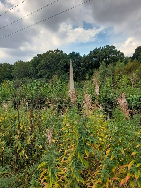
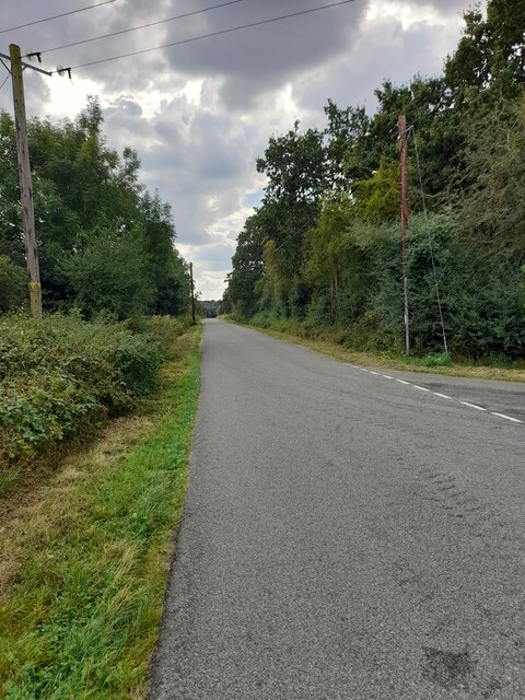
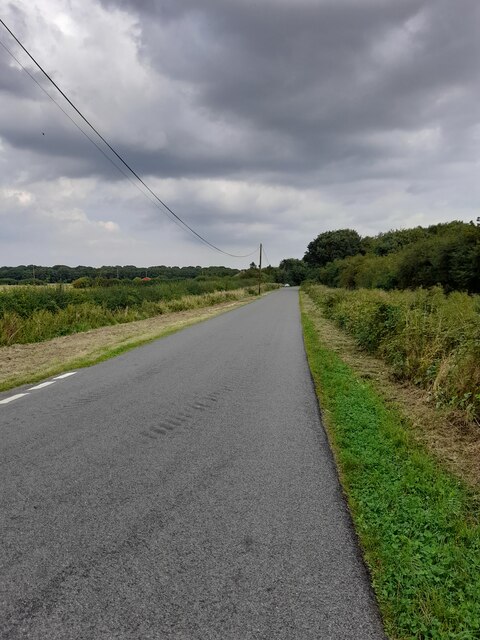
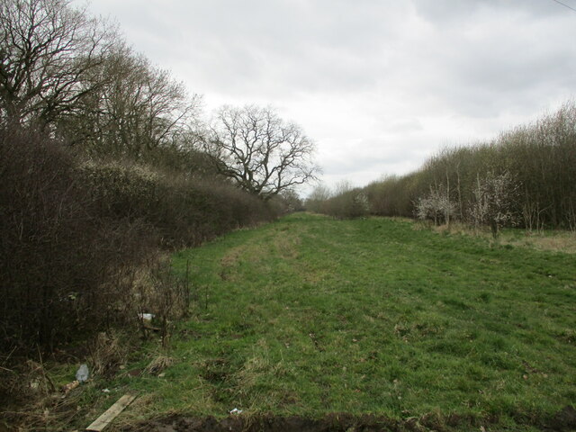
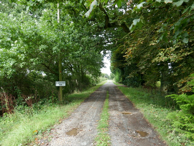
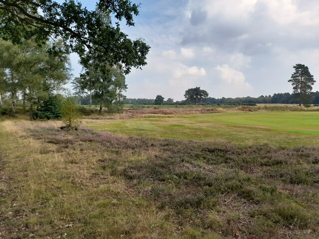
Waterloo Wood is a vast woodland area located in Lincolnshire, England. Situated near the small village of Waterloo, this wood covers an area of approximately 500 hectares. It is a designated Site of Special Scientific Interest (SSSI) due to its rich biodiversity and historical significance.

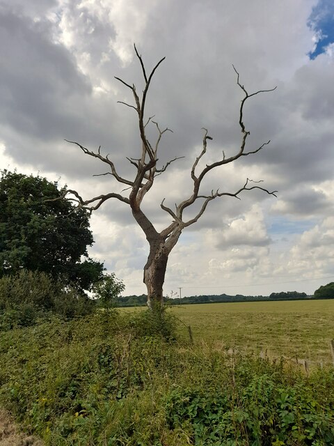
The wood primarily consists of dense deciduous trees, including oak, ash, and beech. These towering trees create a lush canopy that provides a habitat for a variety of wildlife species. Waterloo Wood is renowned for its diverse bird population, with species such as woodpeckers, owls, and warblers regularly spotted in the area. Additionally, the wood is home to mammals like deer, foxes, and badgers.

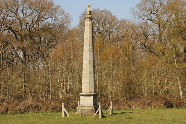
The wood's historical importance stems from its association with the Battle of Waterloo, which took place in 1815. It is believed that the trees in this wood were planted to commemorate the victory of the Duke of Wellington over Napoleon Bonaparte. Many of these trees still stand today, serving as a tangible link to the past.

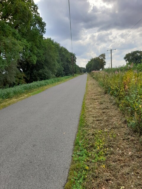
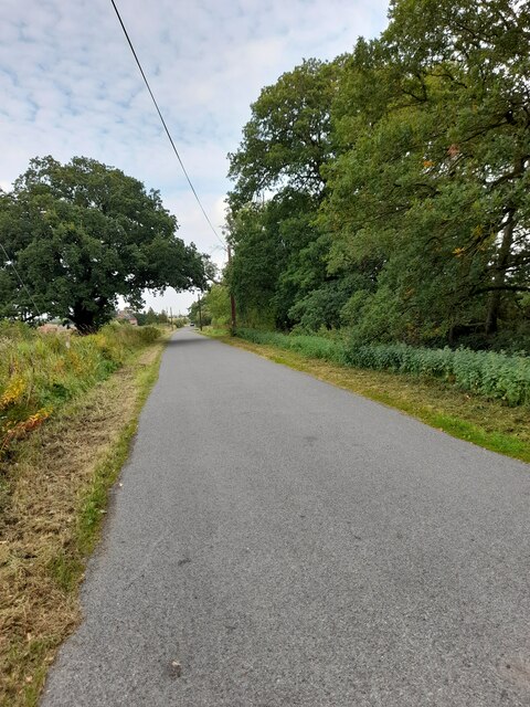
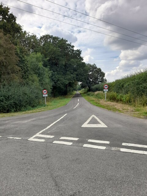
Waterloo Wood offers numerous recreational opportunities for visitors. It has well-maintained walking trails that allow individuals to explore its natural beauty and enjoy the peaceful surroundings. The wood is also popular among photographers and nature enthusiasts who seek to capture its stunning scenery.

Overall, Waterloo Wood in Lincolnshire is a captivating forest that combines natural splendor with historical significance. Its diverse flora and fauna, coupled with its association with the Battle of Waterloo, make it a truly remarkable destination for both locals and tourists alike.

If you have any feedback on the listing, please let us know in the comments section below.

Waterloo Wood Images

Images are sourced within 2km of 53.172098/-0.21126794 or Grid Reference TF1965. Thanks to Geograph Open Source API. All images are credited.

Wellington Monument
Wellington Monument
Monument Road
Monument Road
Monument Road
Monument Road
Dead tree
Dead tree
Monument Road
Monument Road
Road junction
Road junction
Monument Road
Monument Road
Wellington Monument Grade II listed Wellington Monument with Waterloo Wood behind. A 36 ft high obelisk surmounted by a bust of the Duke of Wellington erected in 1844 by Colonel Richard Elmhirst and bears the inscription "This wood was planted with acorns sown immediately after the memorable Battle of Waterloo"
Wellington Monument
Grade II listed Wellington Monument with Waterloo Wood behind. A 36 ft high obelisk surmounted by a bust of the Duke of Wellington erected in 1844 by Colonel Richard Elmhirst and bears the inscription "This wood was planted with acorns sown immediately after the memorable Battle of Waterloo"
Woodland edge A narrow strip of grass between the roadside hedge and the woodland.
Woodland edge
A narrow strip of grass between the roadside hedge and the woodland.
Direction Sign – Signpost opposite Ings Lane in Horsington parish Located southeast of Furze Hill on the southeast side of the T junction on Ings Lane in Horsington parish. 3 arms but no finial.

Milestone Society National ID: LI_TF1966
Direction Sign – Signpost opposite Ings Lane in Horsington parish
Located southeast of Furze Hill on the southeast side of the T junction on Ings Lane in Horsington parish. 3 arms but no finial. Milestone Society National ID: LI_TF1966
Direction Sign – Signpost at Furze Hill, Horsington parish Located at Furze Hill, on the northeast side of the T junction of Moor Lane and Ings Lane in Horsington parish. 3 arms but no finial. See also <a title="https://www.geograph.org.uk/photo/6667948" href="https://www.geograph.org.uk/photo/6667948">Link</a> and <a title="https://www.geograph.org.uk/photo/2439523" href="https://www.geograph.org.uk/photo/2439523">Link</a>.

Milestone Society National ID: LI_TF1967
Direction Sign – Signpost at Furze Hill, Horsington parish
Located at Furze Hill, on the northeast side of the T junction of Moor Lane and Ings Lane in Horsington parish. 3 arms but no finial. See also Link and Link. Milestone Society National ID: LI_TF1967
The Kinema in the Woods, Woodhall Spa This unlikely looking cinema, tucked away in the woodland surrounding Woodhall Spa, dates from 1922. It still shows films and has the distinction of being the only cinema in the UK to employ back projection. Before adopting its present role over 100 years ago, the building had served as a barn, a dance hall and a cricket and tennis pavilion.
The Kinema in the Woods, Woodhall Spa
This unlikely looking cinema, tucked away in the woodland surrounding Woodhall Spa, dates from 1922. It still shows films and has the distinction of being the only cinema in the UK to employ back projection. Before adopting its present role over 100 years ago, the building had served as a barn, a dance hall and a cricket and tennis pavilion.
Drain towards Edlington Moor Off Stixwould Road.
Drain towards Edlington Moor
Off Stixwould Road.
Lane to Horsington Alongside Stixwould Wood.
Lane to Horsington
Alongside Stixwould Wood.
Roadway to Edlington Moor Farm Classified as a bridleway.
Roadway to Edlington Moor Farm
Classified as a bridleway.
Bridleway to Halstead Wood
View from Viking Way
Show me another place!

Waterloo Wood is located at Grid Ref: TF1965 (Lat: 53.172098, Lng: -0.21126794)

Administrative County: Lincolnshire

District: East Lindsey

Police Authority: Lincolnshire

What 3 Words

///bells.bumping.thud. Near Woodhall Spa, Lincolnshire

Related Wikis

Woodhall Spa Golf Club

Woodhall Spa Golf Club is a private golf club in England that is located to the north of Woodhall Spa, Lincolnshire. The club was founded in 1891. In 1995...

Jubilee Park Swimming Pool

Jubilee Park Swimming Pool, Woodhall Spa, Lincolnshire, England is an open air heated lido. == History == Jubilee Park was created for the benefit of the...

Woodhall Spa Cottage Museum

The Woodhall Spa Cottage Museum also known as Woodhall Spa. (Cottage Museum, Woodall Spa,) is a community museum managed by volunteers, and located on...

High Dar Wood

High Dar Wood is a small woodland in the hamlet of Linwood in the parish of Stixwould and Woodhall, Lincolnshire. It is approximately a fifth of a mile...

Highall Wood

Highall Wood is a woodland to the north east of the village of Woodhall Spa, Lincolnshire. It is bordered by Park Plantation to the east and White Hall...

Woodhall Spa railway station

Woodhall Spa railway station was a station in Woodhall Spa, Lincolnshire on a small branch line running north from Woodhall Junction to Horncastle. Both...

Heath's Meadows

Heath's Meadows is a local nature reserve with an area of over 5.5 ha (14 acres) located in Burgh le Marsh, Lincolnshire, England. It was acquired by Lincolnshire...

Stixwould and Woodhall

Stixwould and Woodhall is a civil parish in the East Lindsey district of Lincolnshire, England. The civil parish population (including Langton near Horncastle...

Nearby Amenities

Located within 500m of 53.172098,-0.21126794
Wellington Monument
Historic: monument
Source: Bing
Wikidata: Q26316501
Lat/Long: 53.1707293/-0.2077063
Power: pole
Lat/Long: 53.1737297/-0.2050137
Power: pole
Lat/Long: 53.1691978/-0.2111649
Power: pole
Source: Bing
Lat/Long: 53.1696419/-0.2098215
Power: pole
Lat/Long: 53.1734649/-0.2046176
Power: pole
Lat/Long: 53.1724604/-0.2041353
Power: pole
Lat/Long: 53.1733623/-0.2048702
Power: pole
Source: Bing
Lat/Long: 53.174825/-0.2055725
Power: pole
Source: Bing
Lat/Long: 53.1708783/-0.2069194
Power: pole
Lat/Long: 53.1727832/-0.204167
Power: pole
Lat/Long: 53.1682814/-0.2139303
Power: pole
Source: Bing
Lat/Long: 53.1718141/-0.2065546
Power: pole
Lat/Long: 53.1741404/-0.2051035
Power: pole
Lat/Long: 53.1687428/-0.2125221
Power: pole
Lat/Long: 53.1728607/-0.2061335
Power: pole
Source: Bing
Lat/Long: 53.1701014/-0.2084613
Power: pole
Source: Bing
Lat/Long: 53.1704359/-0.207678
Power: pole
Lat/Long: 53.1728877/-0.2044353
Power: pole
Lat/Long: 53.1733154/-0.2047303
Power: pole
Source: Bing
Lat/Long: 53.1719303/-0.2049422
Power: pole
Lat/Long: 53.1723958/-0.2048966
Power: pole
Lat/Long: 53.1741379/-0.2052958
Power: pole
Source: Bing
Lat/Long: 53.1716742/-0.2044571
Power: pole
Source: Bing
Lat/Long: 53.172198/-0.2043481
Power: pole
Lat/Long: 53.1746063/-0.2056195
Power: pole
Source: Bing
Lat/Long: 53.1750408/-0.2059266
Waterloo Farm
Place: farm
Source: Bing
Lat/Long: 53.1681294/-0.2125785
Reeds Beck Farm
Place: farm
Source: Bing
Lat/Long: 53.1726515/-0.2050225
The data included in this document is from www.openstreetmap.org. The data is made available under ODbL.

Have you been to Waterloo Wood?

Leave your review of Waterloo Wood below (or comments, questions and feedback).