Nower Wood

Wood, Forest in Surrey Mole Valley

England

Nower Wood

Tyrrell's Wood Golf Club The club house is in the distance.
Tyrrell's Wood Golf Club Credit: James Emmans

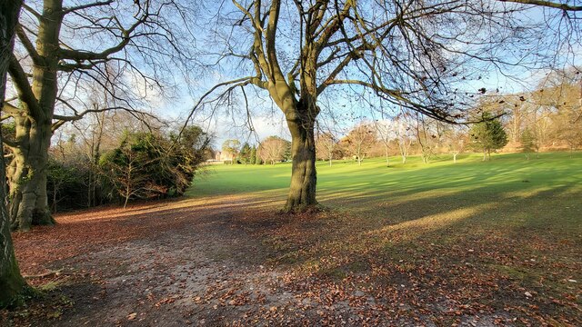
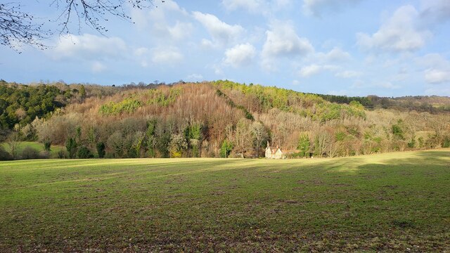
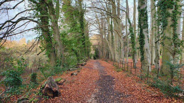
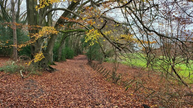
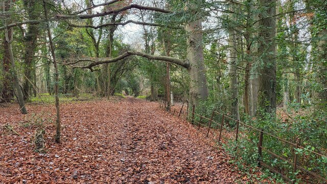
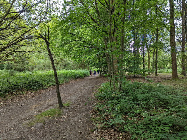
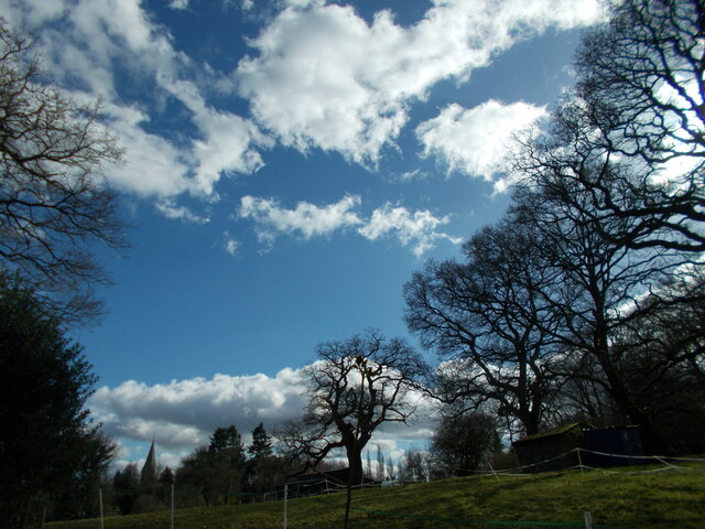
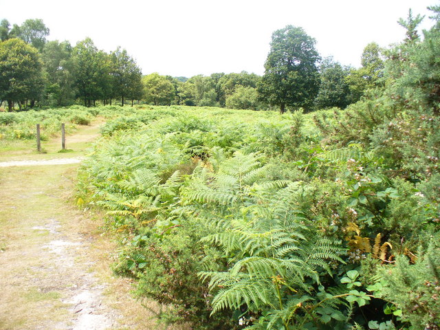
Nower Wood, located in Surrey, England, is a stunning woodland area covering approximately 80 acres. It is managed by the Surrey Wildlife Trust and is renowned for its rich biodiversity and tranquil surroundings. This ancient woodland is predominantly made up of oak and hornbeam trees, which provide a dense canopy and create a unique microclimate.

Nower Wood boasts an impressive variety of flora and fauna, with over 150 species of plants and numerous rare and protected species. The forest floor is adorned with a carpet of bluebells in spring, creating a breathtaking sight. Ferns, mosses, and wildflowers can also be found throughout the wood, adding to its natural beauty.

The woodland is home to an array of wildlife, including several bird species, such as woodpeckers and owls, as well as mammals like badgers, foxes, and deer. It is also a haven for insects, with butterflies, bees, and beetles thriving in this diverse ecosystem.

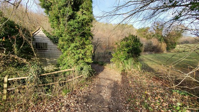
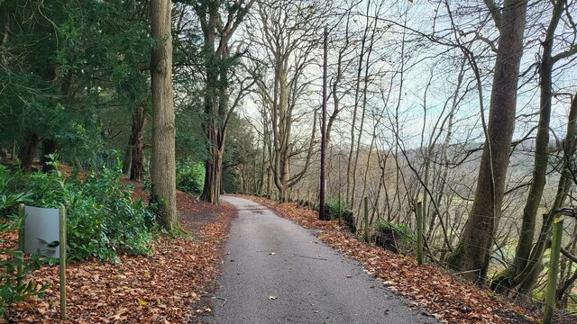
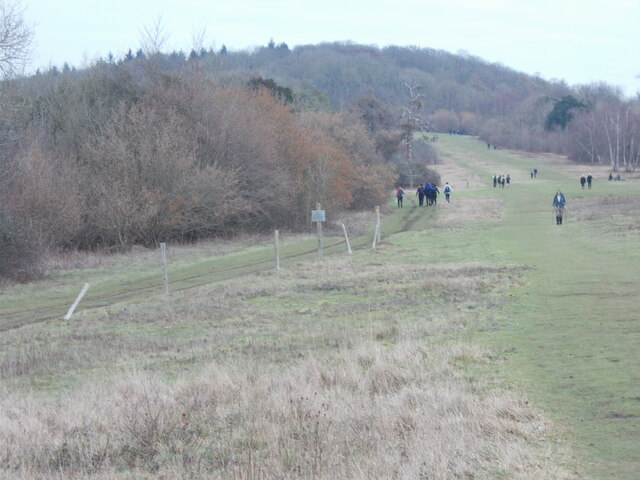
Visitors to Nower Wood can explore the numerous walking trails that wind through the forest, allowing them to immerse themselves in nature and discover its hidden treasures. The Surrey Wildlife Trust offers educational programs and guided walks, providing visitors with the opportunity to learn about the importance of conservation and the unique ecosystem found in Nower Wood.

Overall, Nower Wood is a remarkable natural gem in Surrey, offering both beauty and educational experiences for nature enthusiasts and conservationists alike.

If you have any feedback on the listing, please let us know in the comments section below.

Nower Wood Images

Images are sourced within 2km of 51.280907/-0.28799592 or Grid Reference TQ1954. Thanks to Geograph Open Source API. All images are credited.

Tyrrell's Wood Golf Club The club house is in the distance.
Tyrrell's Wood Golf Club
The club house is in the distance.
Footpath passing Cockshot Cottage Path close to the Cockshot National Trust Car Park.
Footpath passing Cockshot Cottage
Path close to the Cockshot National Trust Car Park.
High Ashurst Estate Council owned outdoor education centre with no public car access.
High Ashurst Estate
Council owned outdoor education centre with no public car access.
Cockshot Cottage Part of the High Ashurst land.
Cockshot Cottage
Part of the High Ashurst land.
Stane Street Route of a Roman Road now used as a bridleway and the Thames Downs Link trail. The official link for the Thames Path and the North Downs Way.
Stane Street
Route of a Roman Road now used as a bridleway and the Thames Downs Link trail. The official link for the Thames Path and the North Downs Way.
Bridleway on the northern edge of Cherkley Woods Beech leaves forming a thick carpet.

The path is near the car park on Mill Way.
Bridleway on the northern edge of Cherkley Woods
Beech leaves forming a thick carpet. The path is near the car park on Mill Way.
Bridleway towards Downside Manor A very old metal fence on its last legs, marks the boundary of the Tyrrell's Wood Golf Club. 

Info - <span class="nowrap"><a title="https://www.tyrrellswoodgolfclub.com/" rel="nofollow ugc noopener" href="https://www.tyrrellswoodgolfclub.com/">Link</a><img style="margin-left:2px;" alt="External link" title="External link - shift click to open in new window" src="https://s1.geograph.org.uk/img/external.png" width="10" height="10"/></span>
Bridleway towards Downside Manor
A very old metal fence on its last legs, marks the boundary of the Tyrrell's Wood Golf Club. Info - LinkExternal link
M25 clockwise - farm accommodation bridge
Headley Heath on the Mickleham Downs
Hopeful Pond, Headley Heath The sign was illegible.
Hopeful Pond, Headley Heath
The sign was illegible.
Bridleway 492. Headley Heath Heading south from by the main car park.
Bridleway 492. Headley Heath
Heading south from by the main car park.
M25 clockwise
M25 clockwise
M25 clockwise - sign gantry Reference 4577A, as stencilled on an upright. 4577B applies to the other carriageway. Deciphering the number using the distance markers at intervals along the road, the 577 seems to locate the feature at 57.7 km from datum, the 4 at a guess the type of feature.
M25 clockwise - sign gantry
Reference 4577A, as stencilled on an upright. 4577B applies to the other carriageway. Deciphering the number using the distance markers at intervals along the road, the 577 seems to locate the feature at 57.7 km from datum, the 4 at a guess the type of feature.
Public footpath across Headley Park
Church spire at Headley A prominent landmark in the area seen from near and far.
Church spire at Headley
A prominent landmark in the area seen from near and far.
Fields beside Pebble Lane (Stane Street) looking south-west towards the M25.
Fields beside Pebble Lane (Stane Street)
looking south-west towards the M25.
Fields beside Headley Road looking north-east
Fields beside Headley Road
looking north-east
Hillside north of Lodgebottom Road looking west
Hillside north of Lodgebottom Road
looking west
Show me another place!

Nower Wood is located at Grid Ref: TQ1954 (Lat: 51.280907, Lng: -0.28799592)

Administrative County: Surrey

District: Mole Valley

Police Authority: Surrey

What 3 Words

///burst.dips.delay. Near Ashtead, Surrey

Nearby Locations

Headley Nower Wood

Related Wikis

Nower Wood

Nower Wood is a 33-hectare (81-acre) nature reserve south-west of Leatherhead in Surrey. It is owned and managed by Surrey Wildlife Trust.Nower Wood is...

Headley Court

Defence Medical Rehabilitation Centre Headley Court (abbreviated to DMRC Headley Court, and more commonly known as Headley Court), formerly RAF Headley...
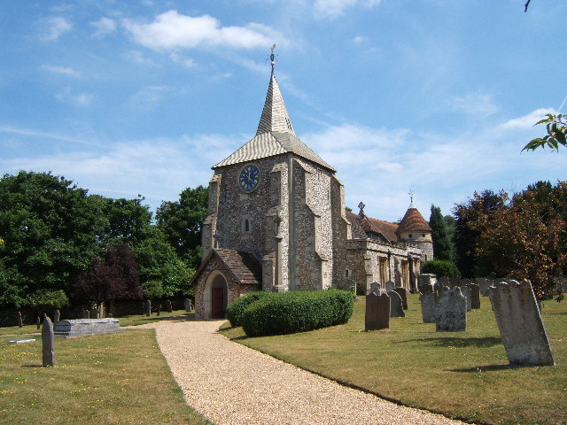
Headley, Surrey

Headley is a village and civil parish in the North Downs in Surrey, England. The nearest settlements are, to the west, Mickleham and Leatherhead; to the...
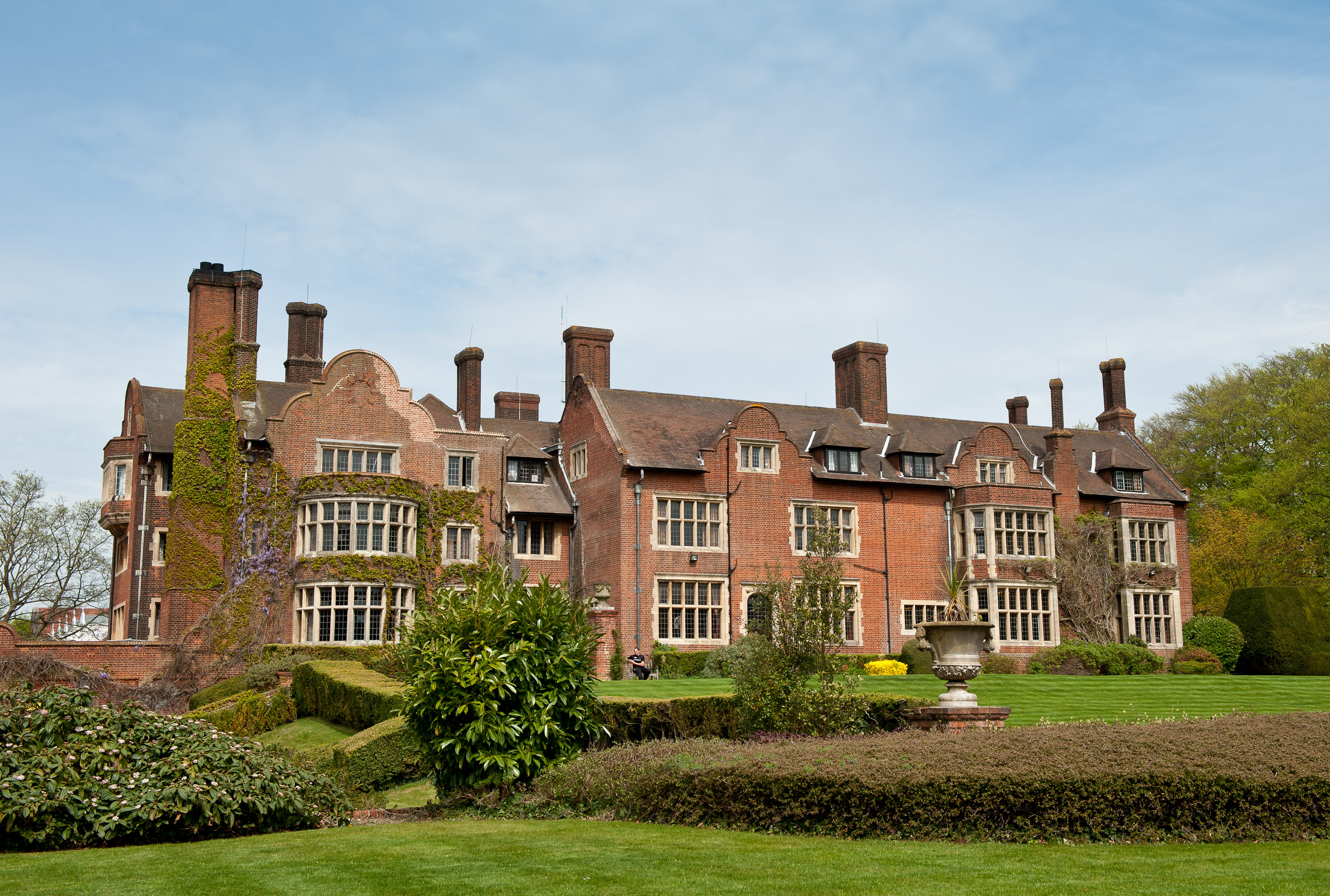
Cherkley Court

Cherkley Court, at the extreme southeast of Leatherhead, Surrey, in England, is a late Victorian neo-classical mansion and estate of 370 acres (1.5 km2...

High Ashurst

High Ashurst is a large natural site of 56 acres of land in an Area of Outstanding Natural Beauty in North Downs, Surrey. The site has been host to many...

Mole Gap to Reigate Escarpment

Mole Gap to Reigate Escarpment is a 1,016.4-hectare (2,512-acre) biological and geological Site of Special Scientific Interest west of Reigate in Surrey...

Langley Vale Wood

Langley Vale Wood is one of four First World War Centenary woods created by the Woodland Trust. It is located in Langley Vale, near Epsom, on the North...

Mickleham, Surrey

Mickleham is a village in south east England, between the towns of Dorking and Leatherhead in Surrey. The civil parish covers 7.31 square kilometres (1...

Nearby Amenities

Located within 500m of 51.280907,-0.28799592
Barrier: stile
Lat/Long: 51.2783253/-0.2834411
Barrier: bollard
Lat/Long: 51.2777782/-0.290606
Barrier: stile
Lat/Long: 51.2783249/-0.2834383
Barrier: bollard
Lat/Long: 51.2777307/-0.29055
Hiking: yes
Information: guidepost
Tourism: information
Lat/Long: 51.2778613/-0.2861702
Barrier: stile
Lat/Long: 51.277846/-0.2861872
The data included in this document is from www.openstreetmap.org. The data is made available under ODbL.

Have you been to Nower Wood?

Leave your review of Nower Wood below (or comments, questions and feedback).