Ash Wood

Wood, Forest in Sussex Horsham

England

Ash Wood

Mockford Farm Mockford Farm, dating back to Medieval times; photo taken looking west from near Parkminster Farm, in Spring 2005
Mockford Farm Credit: Graham Pritchard

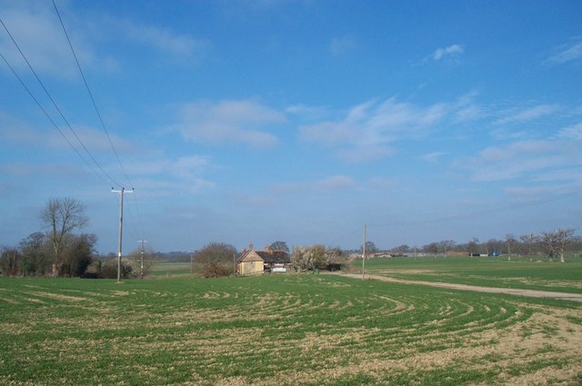
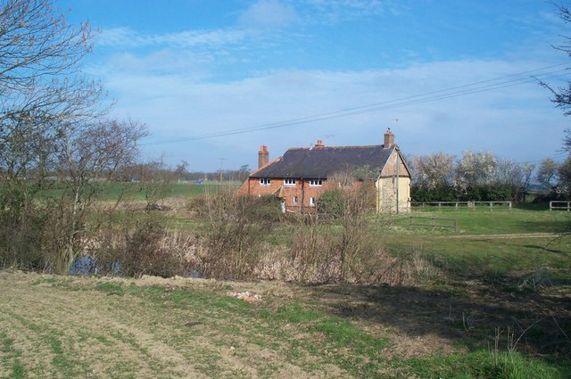
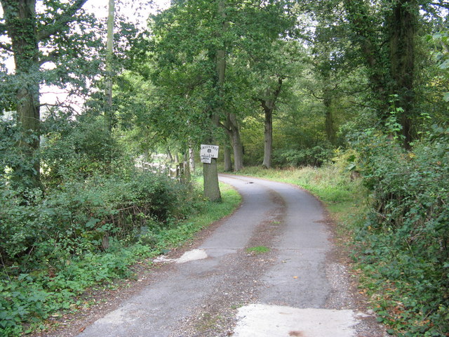
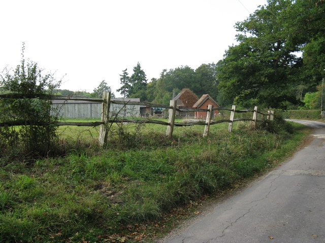
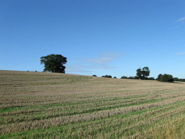
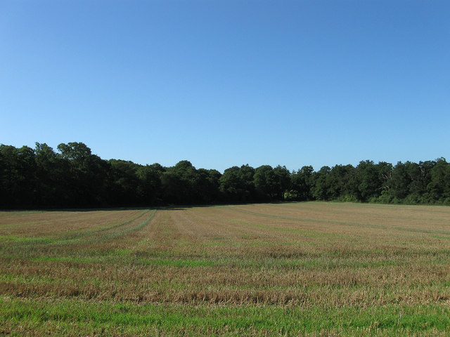
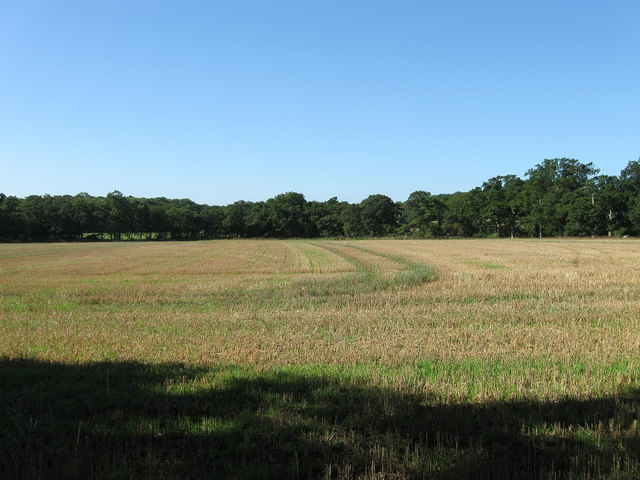
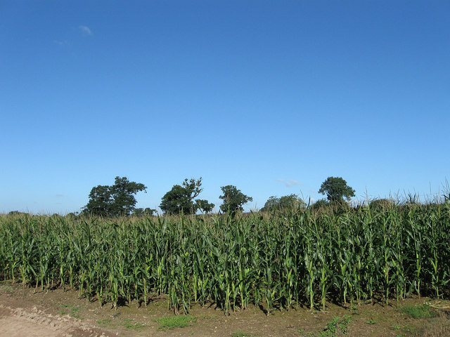
Ash Wood is a picturesque forest located in the county of Sussex, England. Spanning over a vast area of land, the wood is a popular destination for nature enthusiasts and visitors seeking tranquility amidst the stunning natural surroundings.

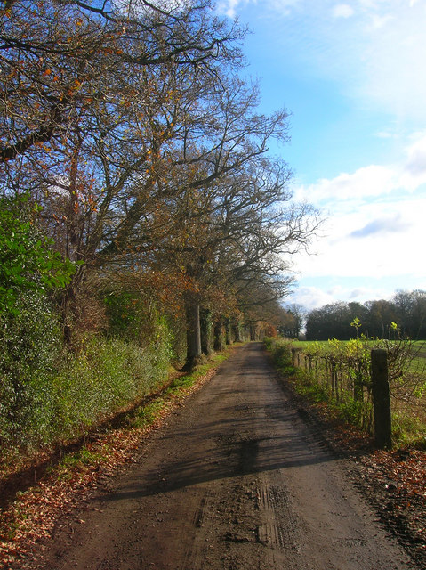
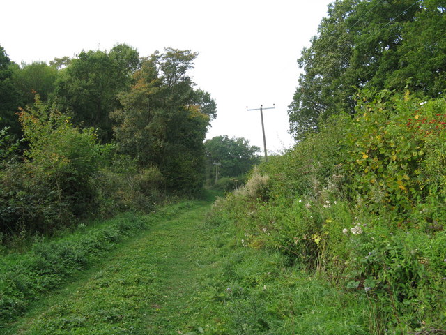
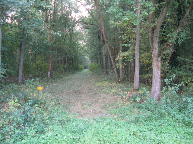
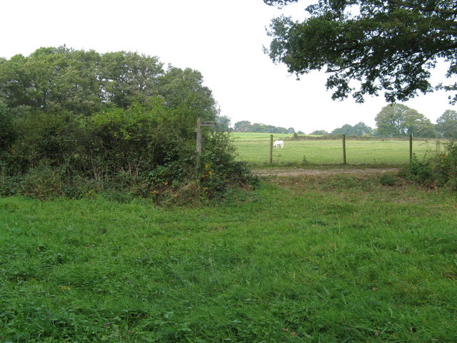
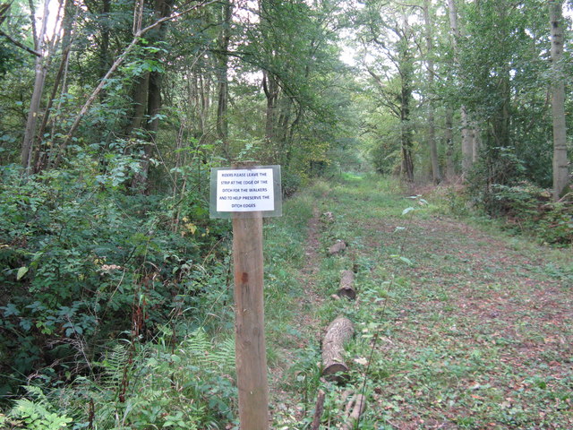
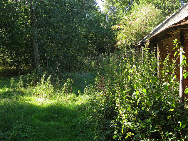
Covered in a dense canopy of ash trees, the woodland provides a serene and peaceful atmosphere. The towering trees create a cool and shaded environment, making it an ideal spot for leisurely walks and picnics. The forest floor is carpeted with a rich layer of fallen leaves and moss, adding to the wood's enchanting appeal.

Ash Wood is home to a diverse array of wildlife, including various bird species, small mammals, and insects. Visitors may catch glimpses of elusive creatures like deer and foxes as they explore the wood's many winding paths. The forest also supports a wide range of plant life, with wildflowers and ferns adorning the forest floor, and ivy and moss clinging to the ancient trees.

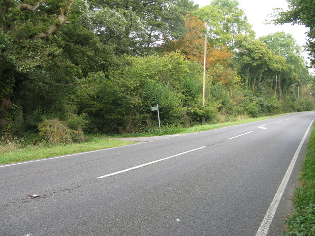
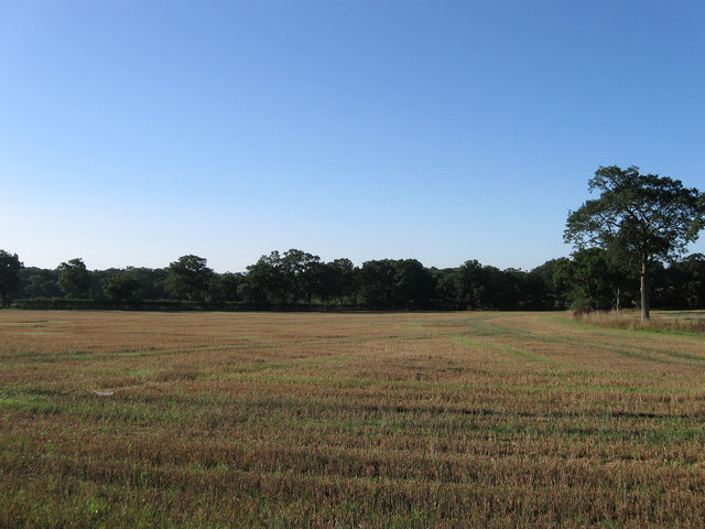
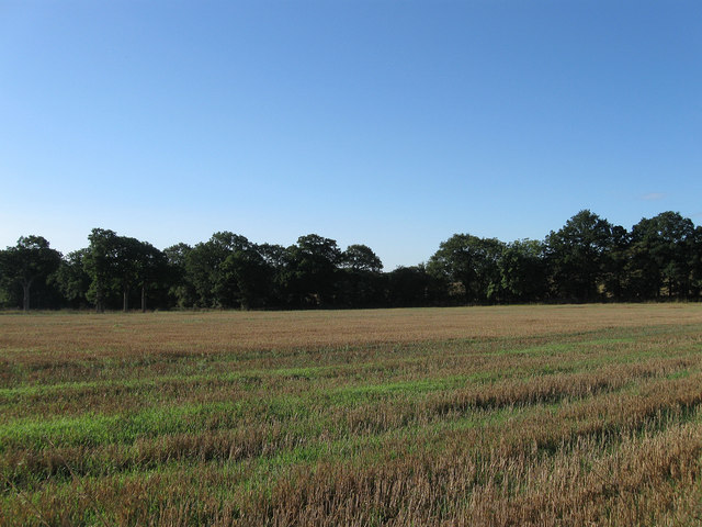
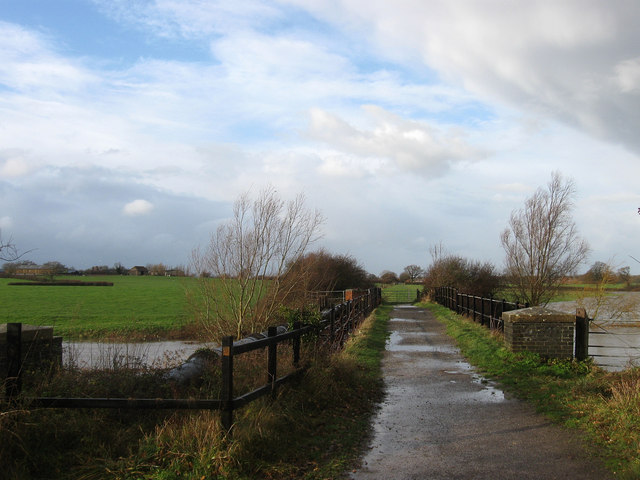
The wood is crisscrossed with a network of trails and footpaths, allowing visitors to explore its beauty at their own pace. These pathways offer breathtaking views of the surrounding countryside, with glimpses of rolling hills and meandering streams. Ash Wood also features a small stream that meanders through its heart, providing a peaceful backdrop to the woodland's natural symphony.

With its idyllic setting and abundant natural beauty, Ash Wood, Sussex, is a must-visit destination for anyone seeking solace in nature. Whether it's for a leisurely stroll, birdwatching, or simply escaping the hustle and bustle of daily life, this woodland offers a truly enchanting experience for all who venture within its borders.

If you have any feedback on the listing, please let us know in the comments section below.

Ash Wood Images

Images are sourced within 2km of 50.95732/-0.30186575 or Grid Reference TQ1918. Thanks to Geograph Open Source API. All images are credited.

Mockford Farm Mockford Farm, dating back to Medieval times; photo taken looking west from near Parkminster Farm, in Spring 2005
Mockford Farm
Mockford Farm, dating back to Medieval times; photo taken looking west from near Parkminster Farm, in Spring 2005
Mockford Farm Mockford Farm, dating back to Medieval times.
Mockford Farm
Mockford Farm, dating back to Medieval times.
Track to Parkminster Farm The main entrance to the farm from the A281. It also carries a public footpath.
Track to Parkminster Farm
The main entrance to the farm from the A281. It also carries a public footpath.
Bridleway leading off the A 281
Bridleway to Greentree Farm Parkminster Wood is on the right
Bridleway to Greentree Farm
Parkminster Wood is on the right
Farm buildings at Greentree Farm
Power lines beside bridleway west of Greentree Farm
Track through Wymarks Wood
Broken waymarker indicating change of direction
Ideal solution for walkers
The Six Acres The name of the field according to the 1840 tithe map. The field boundary at the far end marks the parish boundary between Cowfold and Shermanbury.
The Six Acres
The name of the field according to the 1840 tithe map. The field boundary at the far end marks the parish boundary between Cowfold and Shermanbury.
The Seven Acres The name of the field according to the 1840 tithe map viewed from the footpath that links Henfield Road with Littleworth.
The Seven Acres
The name of the field according to the 1840 tithe map viewed from the footpath that links Henfield Road with Littleworth.
Mares Field/Little Snares Hill The name of the fields according to the 1840 tithe map with Mares Field being closest to the camera. Both have been extended to include a number of other fields that are on or line the northern slope of this small ridge.
Mares Field/Little Snares Hill
The name of the fields according to the 1840 tithe map with Mares Field being closest to the camera. Both have been extended to include a number of other fields that are on or line the northern slope of this small ridge.
Lower Six Acres/Three Corner Field The name of the fields according to the 1840 tithe map that have now been joined together as one. Parkminster Wood is on the left and was previously known as Picknole Wood prior to the Carthusian order acquiring part of the former Picknole estate in 1873. All the Parkminster names in the vicinity date from this time.
Lower Six Acres/Three Corner Field
The name of the fields according to the 1840 tithe map that have now been joined together as one. Parkminster Wood is on the left and was previously known as Picknole Wood prior to the Carthusian order acquiring part of the former Picknole estate in 1873. All the Parkminster names in the vicinity date from this time.
Furze Field The name of the field according to the 1840 tithe map that is beginning to become a small wood with the small outbuilding to the right now becoming overgrown.
Furze Field
The name of the field according to the 1840 tithe map that is beginning to become a small wood with the small outbuilding to the right now becoming overgrown.
The Five Acres/The Four Acres The name of the fields according to the 1840 tithe map that have been joined together into one large field. The hedgerow at the far end of the field marks the parish boundary between Cowfold and Shermanbury.
The Five Acres/The Four Acres
The name of the fields according to the 1840 tithe map that have been joined together into one large field. The hedgerow at the far end of the field marks the parish boundary between Cowfold and Shermanbury.
Mockford Field The name of the field according to the 1840 tithe map which lies next to Mockford which would be visible but for the maize crop.
Mockford Field
The name of the field according to the 1840 tithe map which lies next to Mockford which would be visible but for the maize crop.
Sign for IFI Project The IFI project is an investigation into the rate of vegetation regrowth after cutting back under power lines. It would be helpful if an arrow were added showing the direction of the next sign. At present, a study of the hedgerow concerned makes it pretty clear the next sign must be to the right, but later on it may not be so obvious.
Sign for IFI Project
The IFI project is an investigation into the rate of vegetation regrowth after cutting back under power lines. It would be helpful if an arrow were added showing the direction of the next sign. At present, a study of the hedgerow concerned makes it pretty clear the next sign must be to the right, but later on it may not be so obvious.
Show me another place!

Ash Wood is located at Grid Ref: TQ1918 (Lat: 50.95732, Lng: -0.30186575)

Administrative County: West Sussex

District: Horsham

Police Authority: Sussex

What 3 Words

///valued.wizards.automatic. Near Partridge Green, West Sussex

Nearby Locations

Ash Wood

Related Wikis

Dark Star Brewing Company

Dark Star is a brewery in Partridge Green, Sussex, England. == History == Dark Star Brewery was established in 1994, brewing in the cellar of the Evening...

Partridge Green railway station

Partridge Green was a railway station on the Steyning Line which served the village of Partridge Green. The station closed as a result of the Beeching...

Partridge Green

Partridge Green is a village in the Horsham District of West Sussex, England. It lies on the B2135 road 2.5 miles (4 km) north-west of Henfield. It is...

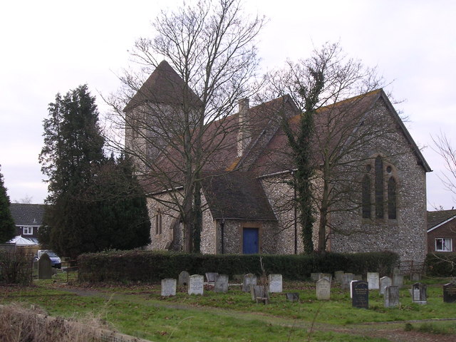
St Michael and All Angels Church, Partridge Green

St Michael and All Angels Church is a late nineteenth-century church in the settlement of Partridge Green in the parish of West Grinstead in West Sussex...

Henfield (electoral division)

Henfield is an electoral division of West Sussex in the United Kingdom and returns one member to sit on West Sussex County Council. The current County...

Shermanbury

Shermanbury is a village and civil parish in the Horsham District of West Sussex, England. It lies on the A281 road approximately 2 miles (3 km) north...

Littleworth, West Sussex

Littleworth is a hamlet in the Horsham District of West Sussex, England. It lies on the Partridge Green to Maplehurst road 2.9 miles (4.7 km) north of...

Betley Bridge

Betley Bridge is a disused railway bridge, now a rail trail bridge, which crosses the confluence of the East and West Adur rivers North of Henfield in...

Nearby Amenities

Located within 500m of 50.95732,-0.30186575
Partridge Green
Place: village
Source: npe
Wikidata: Q7140820
Lat/Long: 50.9590378/-0.3080391
Mini Roundabout
Lat/Long: 50.960495/-0.3019752
Bus Stop
High Street
Naptan AtcoCode: 4400HR0368
Naptan Bearing: W
Naptan CommonName: High Street
Naptan Indicator: The Partridge
Naptan Landmark: Meyer's Wood
Naptan NaptanCode: wsxawgag
Naptan Street: High Street
Naptan Verified: no
Public Transport: platform
Source: naptan_import
Toilets Wheelchair: no
Lat/Long: 50.9590415/-0.3071038
Bus Stop
High Street
Naptan AtcoCode: 4400HR0369
Naptan Bearing: E
Naptan CommonName: High Street
Naptan Indicator: The Partridge
Naptan Landmark: Little Oak
Naptan NaptanCode: wsxawgaj
Naptan Street: High Street
Naptan Verified: no
Public Transport: platform
Source: naptan_import
Lat/Long: 50.9592531/-0.3068113
Bus Stop
Post Office
Naptan AtcoCode: 4400HR0370
Naptan Bearing: W
Naptan CommonName: Post Office
Naptan Indicator: opp
Naptan Landmark: Littleworth Lane
Naptan NaptanCode: wsxawgam
Naptan ShortCommonName: Partridge Green PO
Naptan Street: High Street
Naptan Verified: no
Public Transport: platform
Source: naptan_import
Lat/Long: 50.9605523/-0.3015236
Bus Stop
Post Office
Naptan AtcoCode: 4400HR0371
Naptan Bearing: E
Naptan CommonName: Post Office
Naptan Indicator: adj
Naptan Landmark: Littleworth Lane
Naptan NaptanCode: wsxawgap
Naptan ShortCommonName: Partridge Green PO
Naptan Street: High Street
Naptan Verified: no
Public Transport: platform
Source: naptan_import
Lat/Long: 50.960711/-0.3013042
Bus Stop
The Partridge PH
Naptan AtcoCode: 4400HR1117
Naptan Bearing: N
Naptan CommonName: The Partridge PH
Naptan Indicator: The Partridge
Naptan Landmark: High Street
Naptan NaptanCode: wsxdtawj
Naptan Street: Church Rd
Naptan Verified: yes
Public Transport: platform
Source: naptan_import
Lat/Long: 50.9591663/-0.3082669
The Partridge PH
Naptan AtcoCode: 4400HR1128
Naptan Bearing: S
Naptan BusStopType: CUS
Naptan CommonName: The Partridge PH
Naptan Indicator: The Partridge PH
Naptan Landmark: High St
Naptan Street: Church Rd
Naptan Verified: no
Source: naptan_import
Lat/Long: 50.9591629/-0.3081202
Upgrade Bikes
Shop: bicycle
Lat/Long: 50.9574165/-0.303354
Fuel
Pretty's Garage
Addr City: Horsham
Addr Locality: Partridge Green
Addr Postcode: RH13 8JS
Addr Street: Church Road
Fhrs Id: 427142
Source Addr: FHRS Open Data
Lat/Long: 50.9589956/-0.3082394
The Bakery
Addr City: Horsham
Addr Housenumber: 3
Addr Locality: Partridge Green
Addr Postcode: RH13 8RX
Addr Street: Wilton Close
Fhrs Id: 187326
Shop: bakery
Source Addr: FHRS Open Data
Lat/Long: 50.9593532/-0.3048381
Fast Food
Potters Fish and Chips
Addr City: Horsham
Addr Housenumber: 5
Addr Locality: Partridge Green
Addr Postcode: RH13 8RX
Addr Street: Wilton Close
Cuisine: fish_and_chips
Fhrs Id: 187335
Source Addr: FHRS Open Data
Lat/Long: 50.9593335/-0.3049326
Post Office
Partridge Green Post Office
Addr City: Horsham
Addr Locality: Partridge Green
Addr Postcode: RH13 8HR
Addr Street: High Street
Brand: Post Office
Brand Wikidata: Q1783168
Opening Hours: Mo-Su 06:00-22:00
Ref Pol Id: 1325
Source: pol_branch_list_2018-02
Website: https://www.postoffice.co.uk/branch-finder/1029126/partridge-green
Lat/Long: 50.959911/-0.3045799
Power: pole
Lat/Long: 50.9550118/-0.3011196
Toilets
Lat/Long: 50.9588896/-0.3057888
Toilets
Lat/Long: 50.9582726/-0.3060531
Post Box
Post Box Type: wall
Ref: RH13 168D
Royal Cypher: GR
Royal Cypher Wikidata: Q33102273
Lat/Long: 50.9602864/-0.3025012
Defibrillator
Emergency: defibrillator
Indoor: no
Ref GB The Circuit: 395CAB57-FD9A-4611-BF14-B12B00ED45C4
Lat/Long: 50.9601111/-0.2994737
Leisure: pitch
Sport: table_tennis
Lat/Long: 50.9598132/-0.3000037
Power: pole
Lat/Long: 50.9535999/-0.2993772
Power: pole
Lat/Long: 50.9545414/-0.2998583
Batts Cottages
Addr Postcode: RH13 8EQ
Addr Street: Bines Road
Lat/Long: 50.9550074/-0.307969
Bench
Lat/Long: 50.958773/-0.3076592
Bench
Lat/Long: 50.958878/-0.3073955
Bench
Lat/Long: 50.9588494/-0.3074359
Cafe
The Bikeside ltd
Lat/Long: 50.9584574/-0.3055826
Louisa Jayne Unisex Hair Salon
Addr City: Horsham
Addr Housenumber: 1
Addr Locality: Partridge Green
Addr Postcode: RH13 8RX
Addr Street: Wilton Close
Shop: hairdresser
Lat/Long: 50.9593701/-0.3047571
DCT Accounting
Addr City: Horsham
Addr Housenumber: 7
Addr Locality: Partridge Green
Addr Postcode: RH13 8RX
Addr Street: Wilton Close
Office: accountant
Lat/Long: 50.9593173/-0.3050102
Power: pole
Lat/Long: 50.957888/-0.3011147
Power: pole
Lat/Long: 50.9572735/-0.3010758
Power: pole
Lat/Long: 50.9557795/-0.3005901
Post Box
Brand: Royal Mail
Brand Wikidata: Q638098
Collection Times: Mo-Fr 17:00; Sa 10:30
Operator: Royal Mail
Operator Wikidata: Q638098
Post Box Type: pillar
Ref: RH13 148
Royal Cypher: EIIR
Royal Cypher Wikidata: Q33102113
Lat/Long: 50.959874/-0.3044964
Give Way
Direction: forward
Lat/Long: 50.9575679/-0.3034213
Give Way
Direction: forward
Lat/Long: 50.9582685/-0.3035241
Give Way
Direction: forward
Lat/Long: 50.9602392/-0.3027153
Give Way
Direction: forward
Lat/Long: 50.9611551/-0.3043535
Give Way
Direction: forward
Lat/Long: 50.9589029/-0.3079087
Entrance: yes
Lat/Long: 50.9561285/-0.3067635
The data included in this document is from www.openstreetmap.org. The data is made available under ODbL.

Have you been to Ash Wood?

Leave your review of Ash Wood below (or comments, questions and feedback).