Bullen Wood

Wood, Forest in Surrey Mole Valley

England

Bullen Wood

Bridleway through Juniperhill Wood Part of Mickleham Downs near Headley Lane.
Bridleway through Juniperhill Wood Credit: James Emmans

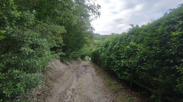
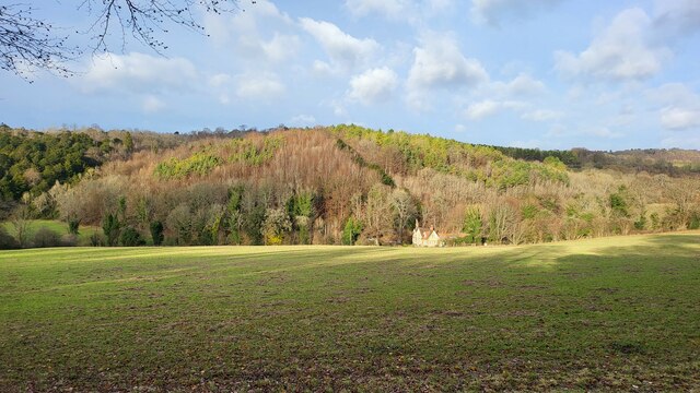
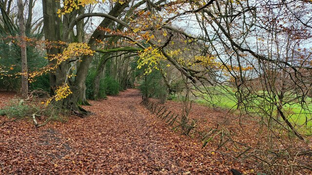
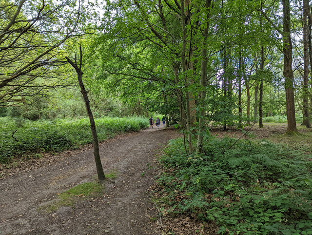
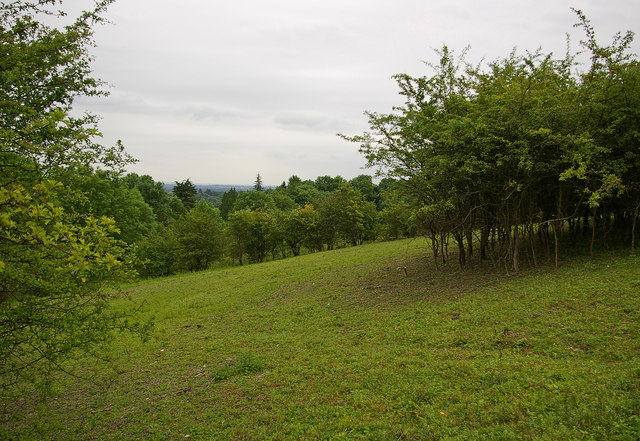
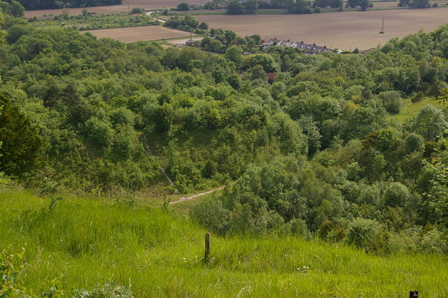
Bullen Wood is a picturesque woodland area located in Surrey, England. Situated near the village of Godstone, the wood covers an expansive area of approximately 150 acres. It is known for its natural beauty and diverse range of flora and fauna.

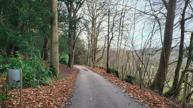
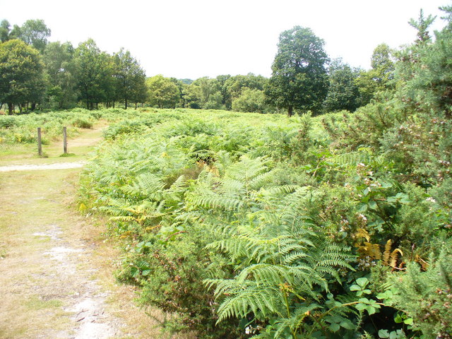
The wood is predominantly composed of broadleaf trees such as oak, beech, and birch, creating a dense canopy that provides ample shade and habitat for various species. The forest floor is adorned with a lush carpet of bluebells and wildflowers during the spring, adding a burst of color to the landscape.

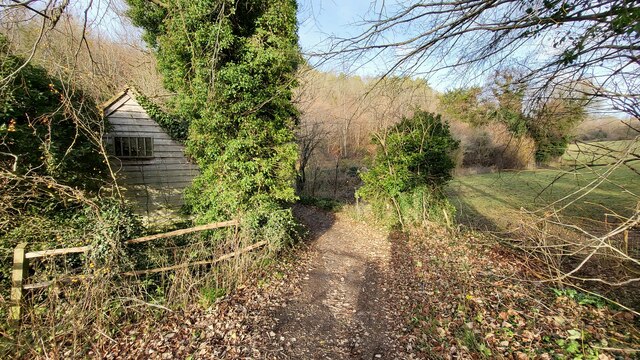
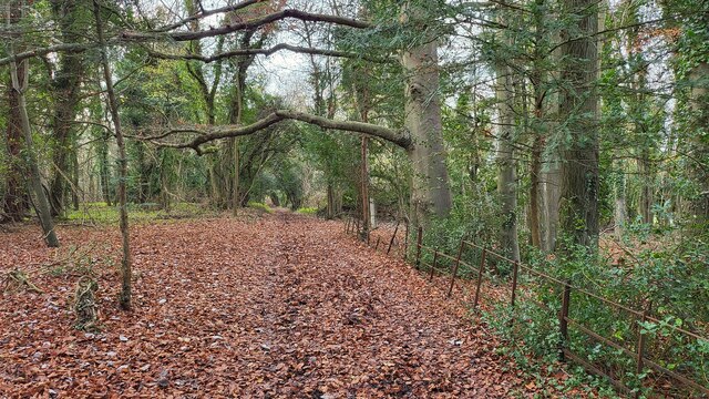
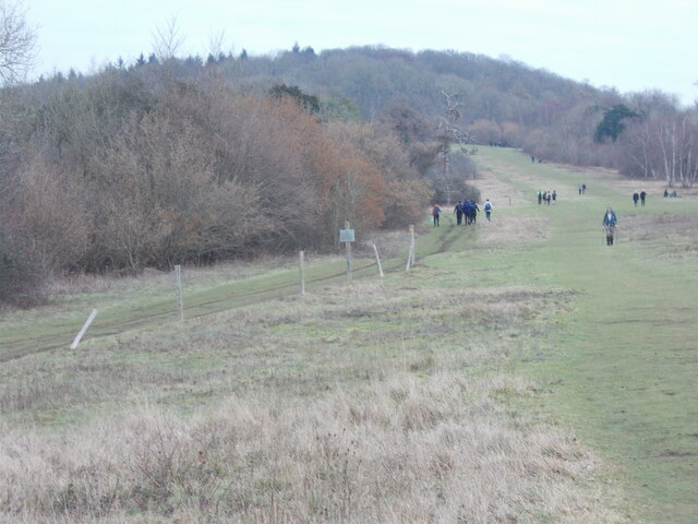
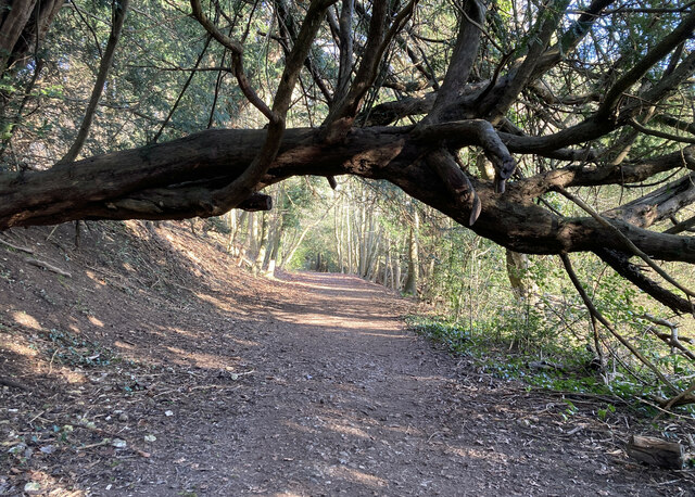
Bullen Wood is a popular destination for nature enthusiasts and hikers due to its well-maintained paths that wind through the woods, allowing visitors to explore the area at their own pace. The tranquil atmosphere and peaceful surroundings make it an ideal spot for relaxation and contemplation.

Wildlife thrives in Bullen Wood, with sightings of deer, foxes, and an array of bird species being common occurrences. The wood is also home to a diverse range of insects, including butterflies, bees, and beetles.

The wood is managed by a local conservation group, ensuring the preservation of its natural beauty and the protection of its inhabitants. They also organize educational programs and guided walks to raise awareness about the importance of woodland conservation.

Overall, Bullen Wood is a haven of tranquility and natural beauty, offering visitors a chance to immerse themselves in the peacefulness of nature and enjoy the wonders of Surrey's woodland ecosystem.

If you have any feedback on the listing, please let us know in the comments section below.

Bullen Wood Images

Images are sourced within 2km of 51.262214/-0.2937644 or Grid Reference TQ1952. Thanks to Geograph Open Source API. All images are credited.

Bridleway through Juniperhill Wood Part of Mickleham Downs near Headley Lane.
Bridleway through Juniperhill Wood
Part of Mickleham Downs near Headley Lane.
Woodland path on the Brockham Hills National Trust maintenance crew working hard.
Woodland path on the Brockham Hills
National Trust maintenance crew working hard.
South easterly view from Box Hill On the southerly escarpment near Oak Wood.
South easterly view from Box Hill
On the southerly escarpment near Oak Wood.
Footpath passing Cockshot Cottage Path close to the Cockshot National Trust Car Park.
Footpath passing Cockshot Cottage
Path close to the Cockshot National Trust Car Park.
High Ashurst Estate Council owned outdoor education centre with no public car access.
High Ashurst Estate
Council owned outdoor education centre with no public car access.
Cockshot Cottage Part of the High Ashurst land.
Cockshot Cottage
Part of the High Ashurst land.
Landscaped lake near Middlehill Wood
Bullen Wood Land near the historic Bellasis House.
Bullen Wood
Land near the historic Bellasis House.
Bridleway on the northern edge of Cherkley Woods Beech leaves forming a thick carpet.

The path is near the car park on Mill Way.
Bridleway on the northern edge of Cherkley Woods
Beech leaves forming a thick carpet. The path is near the car park on Mill Way.
Bridleway towards Downside Manor A very old metal fence on its last legs, marks the boundary of the Tyrrell's Wood Golf Club. 

Info - <span class="nowrap"><a title="https://www.tyrrellswoodgolfclub.com/" rel="nofollow ugc noopener" href="https://www.tyrrellswoodgolfclub.com/">Link</a><img style="margin-left:2px;" alt="External link" title="External link - shift click to open in new window" src="https://s1.geograph.org.uk/img/external.png" width="10" height="10"/></span>
Bridleway towards Downside Manor
A very old metal fence on its last legs, marks the boundary of the Tyrrell's Wood Golf Club. Info - LinkExternal link
Surrey public footpath 38, Box Hill Along the top of the downs, parallel with Zig Zag Road.
Surrey public footpath 38, Box Hill
Along the top of the downs, parallel with Zig Zag Road.
Headley Heath on the Mickleham Downs
Carriage Drive to Oakwood House This track is the former carriage drive to Oakwood House at the top of the hill. The drive begins at the public road at Boxhurst, about 1km to the west, and ascends at a very gentle average gradient of about 1:15, before arriving at a now disused gate into Oakwood House. This section here is the best preserved, now briefly forming part of the North Downs Way as footpath Brockham 583. It is still noticeably metalled (i.e. having a stone surface).
Carriage Drive to Oakwood House
This track is the former carriage drive to Oakwood House at the top of the hill. The drive begins at the public road at Boxhurst, about 1km to the west, and ascends at a very gentle average gradient of about 1:15, before arriving at a now disused gate into Oakwood House. This section here is the best preserved, now briefly forming part of the North Downs Way as footpath Brockham 583. It is still noticeably metalled (i.e. having a stone surface).
Looking northwest from Zig Zag Road
Hopeful Pond, Headley Heath The sign was illegible.
Hopeful Pond, Headley Heath
The sign was illegible.
Bridleway 492. Headley Heath Heading south from by the main car park.
Bridleway 492. Headley Heath
Heading south from by the main car park.
St Michael's Church, Mickleham An earlier church on this site was mentioned in the Domesday Book. 

See <span class="nowrap"><a title="http://www.leatherheadweb.org.uk/mickleham/history_m.html" rel="nofollow ugc noopener" href="http://www.leatherheadweb.org.uk/mickleham/history_m.html">Link</a><img style="margin-left:2px;" alt="External link" title="External link - shift click to open in new window" src="https://s1.geograph.org.uk/img/external.png" width="10" height="10"/></span> for further information.
St Michael's Church, Mickleham
An earlier church on this site was mentioned in the Domesday Book. See LinkExternal link for further information.
A24 Services Picnic area and facilities East of A24
A24 Services
Picnic area and facilities East of A24
Show me another place!

Bullen Wood is located at Grid Ref: TQ1952 (Lat: 51.262214, Lng: -0.2937644)

Administrative County: Surrey

District: Mole Valley

Police Authority: Surrey

What 3 Words

///curry.takes.tribal. Near Dorking, Surrey

Related Wikis

High Ashurst

High Ashurst is a large natural site of 56 acres of land in an Area of Outstanding Natural Beauty in North Downs, Surrey. The site has been host to many...

Mole Gap to Reigate Escarpment

Mole Gap to Reigate Escarpment is a 1,016.4-hectare (2,512-acre) biological and geological Site of Special Scientific Interest west of Reigate in Surrey...

Box Hill, Surrey

Box Hill is a summit of the North Downs in Surrey, approximately 31 km (19 mi) south-west of London. The hill gets its name from the ancient box woodland...

Nower Wood

Nower Wood is a 33-hectare (81-acre) nature reserve south-west of Leatherhead in Surrey. It is owned and managed by Surrey Wildlife Trust.Nower Wood is...

Juniper Hall

Juniper Hall FSC Field Centre is an 18th-century country house, leased from the National Trust, on the east slopes of Mickleham in the deep Mole Gap of...

Fraser Down

Fraser Down is a 10-hectare (25-acre) nature reserve north of Betchworth in Surrey. It is managed by the Surrey Wildlife Trust. It is part of the Mole...

Mickleham, Surrey

Mickleham is a village in south east England, between the towns of Dorking and Leatherhead in Surrey. The civil parish covers 7.31 square kilometres (1...

Brockham Limeworks

Brockham Limeworks is a 45-hectare (110-acre) nature reserve north of Brockham in Surrey. It is owned by Surrey County Council. Part of it is a Scheduled...

Nearby Amenities

Located within 500m of 51.262214,-0.2937644
The data included in this document is from www.openstreetmap.org. The data is made available under ODbL.

Have you been to Bullen Wood?

Leave your review of Bullen Wood below (or comments, questions and feedback).