Ash Holt

Wood, Forest in Lincolnshire West Lindsey

England

Ash Holt

Beelsby Road Junction
Beelsby Road Junction Credit: David Brown

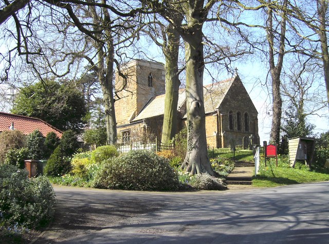
Ash Holt is a small village located in the county of Lincolnshire, England. Situated in the heart of the Lincolnshire Wolds, it is surrounded by picturesque woodlands and forests, hence its name. The village is known for its natural beauty and tranquil atmosphere, making it a popular destination for nature lovers and those seeking a peaceful retreat.

The woodlands surrounding Ash Holt are home to a diverse range of flora and fauna, including ancient oak and beech trees, carpeted with bluebells during the springtime. The dense forest provides a habitat for various wildlife species, such as deer, foxes, and a wide array of bird species, making it a haven for nature enthusiasts and birdwatchers.

The village itself is characterized by its charming cottages made from local stone, giving it a quaint and traditional feel. The community in Ash Holt is close-knit, with a warm and welcoming atmosphere for both residents and visitors alike. The village boasts a small but well-maintained village green, where locals often gather for events and community activities.

Ash Holt is also known for its historical significance, with the nearby Ash Holt House being a focal point of interest. The house dates back to the 17th century and has a rich history, having been home to various notable families throughout the years.

Overall, Ash Holt, Lincolnshire is a picturesque village nestled within a beautiful natural setting, offering a peaceful and idyllic retreat for those seeking solace in nature or a glimpse into the region's rich history.

If you have any feedback on the listing, please let us know in the comments section below.

Ash Holt Images

Images are sourced within 2km of 53.493329/-0.20974614 or Grid Reference TA1801. Thanks to Geograph Open Source API. All images are credited.

Beelsby Road Junction
Mog's Hollow
Mog's Hollow
Direction Sign – Signpost on Beelsby Road, Swallow Located on the north side of the junction of Beelsby Road and a minor road to Thorganby in Swallow parish. 3 arms and no finial. Repainted since <a title="https://www.geograph.org.uk/photo/6523911" href="https://www.geograph.org.uk/photo/6523911">Link</a>. See also <a title="https://www.geograph.org.uk/photo/4348864" href="https://www.geograph.org.uk/photo/4348864">Link</a>.

Milestone Society National ID: LI_TA1802
Direction Sign – Signpost on Beelsby Road, Swallow
Located on the north side of the junction of Beelsby Road and a minor road to Thorganby in Swallow parish. 3 arms and no finial. Repainted since Link. See also Link. Milestone Society National ID: LI_TA1802
Cuxwold Hall: aerial 2022
Road to Cuxwold
Road to Cuxwold
No doubt it's not this way!
Crossroads at Thatches
St Nicholas' church and Commonwealth War Grave site, Cuxwold, Lincs Norman or Anglo-Saxon tower and a James Fowler restoration of 1862.

Now undergoing maintenance.
St Nicholas' church and Commonwealth War Grave site, Cuxwold, Lincs
Norman or Anglo-Saxon tower and a James Fowler restoration of 1862. Now undergoing maintenance.
Grave of J W Baxter, RAF Flight Engineer, St Nicholas' church, Cuxwold, Lincs
St Nicholas' church, Cuxwold, Lincs (1) Norman or Anglo-Saxon tower and a James Fowler restoration of 1862.

Now undergoing maintenance.
St Nicholas' church, Cuxwold, Lincs (1)
Norman or Anglo-Saxon tower and a James Fowler restoration of 1862. Now undergoing maintenance.
St Nicholas' church, Cuxwold, Lincs (2) Norman or Anglo-Saxon tower and a James Fowler restoration of 1862.

Now undergoing maintenance.
St Nicholas' church, Cuxwold, Lincs (2)
Norman or Anglo-Saxon tower and a James Fowler restoration of 1862. Now undergoing maintenance.
St Nicholas' church, Cuxwold, Lincs (3) Norman or Anglo-Saxon tower and a James Fowler restoration of 1862.

Now undergoing maintenance.
St Nicholas' church, Cuxwold, Lincs (3)
Norman or Anglo-Saxon tower and a James Fowler restoration of 1862. Now undergoing maintenance.
St Nicholas' church, Cuxwold, Lincs (4) Norman or Anglo-Saxon tower and a James Fowler restoration of 1862.

Looks to have had a North aisle.
St Nicholas' church, Cuxwold, Lincs (4)
Norman or Anglo-Saxon tower and a James Fowler restoration of 1862. Looks to have had a North aisle.
Witch's Broom in Birch near Cuxwold Hall Taphrina betulina.
Witch's Broom in Birch near Cuxwold Hall
Taphrina betulina.
Sheep near Cuxwold Hall (1)
Memorial to Lieut. Sydney Bryant in St Nicholas' Church, Cuxwold Royal Ulster Rifles, No. 5 Commando S.E.A.C., died of wounds received in action at the Kangaw Bridgehead (Hill 170) in Burma in 1945.
Memorial to Lieut. Sydney Bryant in St Nicholas' Church, Cuxwold
Royal Ulster Rifles, No. 5 Commando S.E.A.C., died of wounds received in action at the Kangaw Bridgehead (Hill 170) in Burma in 1945.
Farm buildings, Cuxwold Hall Farm (1)
Farm buildings, Cuxwold Hall Farm (2)
Show me another place!

Ash Holt is located at Grid Ref: TA1801 (Lat: 53.493329, Lng: -0.20974614)

Administrative County: Lincolnshire

District: West Lindsey

Police Authority: Lincolnshire

What 3 Words

///defectors.hooked.contact. Near Laceby, Lincolnshire

Nearby Locations

Ash Holt

Related Wikis

Cuxwold

Cuxwold is a village and former civil parish, now in the parish of Swallow, in the West Lindsey district of Lincolnshire, England. It lies in the Lincolnshire...

Beelsby

Beelsby is a village in North East Lincolnshire, England. The village is situated approximately 6 miles (10 km) south-west from Grimsby. Beelsby population...

Swallow, Lincolnshire

Swallow is a small village and civil parish in the West Lindsey district of Lincolnshire, England, on the A46 road 4 miles (6.4 km) north-east from Caistor...

Hatcliffe

Hatcliffe is a small village and civil parish in rural North East Lincolnshire, England. It is situated 6 miles (10 km) south-west from Grimsby and 1.5...

Croxby

Croxby is a hamlet and former civil parish, now in the parish of Thoresway, in the West Lindsey district of Lincolnshire, England. It is situated approximately...

East Riding County Football Association

The East Riding County Football Association is the governing body of football in the historic East Riding of Yorkshire (pre-1974), England. It runs a number...

Irby upon Humber

Irby upon Humber or Irby-on-Humber is a small village and (as just Irby) a civil parish in North East Lincolnshire, England. The village is situated on...

West Ravendale Priory

West Ravendale Priory was a Premonstratensian priory in North East Lincolnshire, England and one of nine within the historical county. The site of the...

Nearby Amenities

Located within 500m of 53.493329,-0.20974614
Power Dismantled: tower
Source: NPE
Lat/Long: 53.4928901/-0.2140157
Power Dismantled: tower
Source: NPE
Lat/Long: 53.4945772/-0.2114122
Power Dismantled: tower
Source: NPE
Lat/Long: 53.4962292/-0.2088702
Power: pole
Lat/Long: 53.4939819/-0.2035318
Power: pole
Lat/Long: 53.4940974/-0.2047444
Power: pole
Lat/Long: 53.4942194/-0.2058689
Power: pole
Lat/Long: 53.4942811/-0.2067748
Power: pole
Lat/Long: 53.4944426/-0.2075628
Power: pole
Lat/Long: 53.4944503/-0.2082311
Power: pole
Lat/Long: 53.4944873/-0.2084953
Power: pole
Lat/Long: 53.4945921/-0.2098655
Power: pole
Lat/Long: 53.4947092/-0.2111036
Power: pole
Lat/Long: 53.494854/-0.2125231
Power: pole
Lat/Long: 53.4949958/-0.2139736
Power: pole
Lat/Long: 53.4951422/-0.2154786
The data included in this document is from www.openstreetmap.org. The data is made available under ODbL.

Have you been to Ash Holt?

Leave your review of Ash Holt below (or comments, questions and feedback).