Bell's Belt

Wood, Forest in Lincolnshire East Lindsey

England

Bell's Belt

Ridge and Furrow at Hatton, Lincs: aerial 2022 (1) East, West and Northwest and of the village centre.

See: <span class="nowrap"><a title="https://www.heritagegateway.org.uk/Gateway/Results_Single.aspx?uid=MLI42953&resourceID=1006," rel="nofollow ugc noopener" href="https://www.heritagegateway.org.uk/Gateway/Results_Single.aspx?uid=MLI42953&resourceID=1006,">Link</a><img style="margin-left:2px;" alt="External link" title="External link - shift click to open in new window" src="https://s1.geograph.org.uk/img/external.png" width="10" height="10"/></span> <span class="nowrap"><a title="https://www.heritagegateway.org.uk/Gateway/Results_Single.aspx?uid=MLI42952&resourceID=1006" rel="nofollow ugc noopener" href="https://www.heritagegateway.org.uk/Gateway/Results_Single.aspx?uid=MLI42952&resourceID=1006">Link</a><img style="margin-left:2px;" alt="External link" title="External link - shift click to open in new window" src="https://s1.geograph.org.uk/img/external.png" width="10" height="10"/></span> and <span class="nowrap"><a title="https://www.heritagegateway.org.uk/Gateway/Results_Single.aspx?uid=MLI42954&resourceID=1006" rel="nofollow ugc noopener" href="https://www.heritagegateway.org.uk/Gateway/Results_Single.aspx?uid=MLI42954&resourceID=1006">Link</a><img style="margin-left:2px;" alt="External link" title="External link - shift click to open in new window" src="https://s1.geograph.org.uk/img/external.png" width="10" height="10"/></span>
Ridge and Furrow at Hatton, Lincs: aerial 2022 (1) Credit: Chris

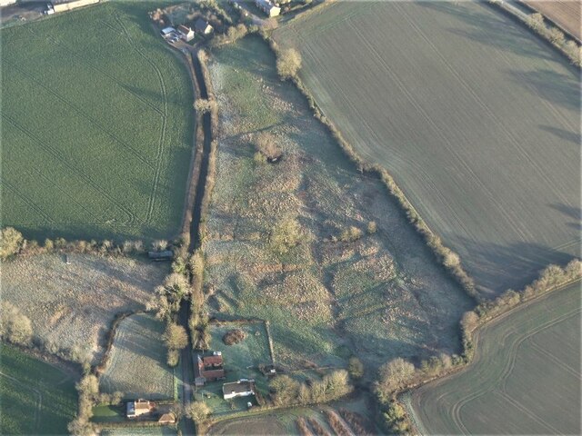
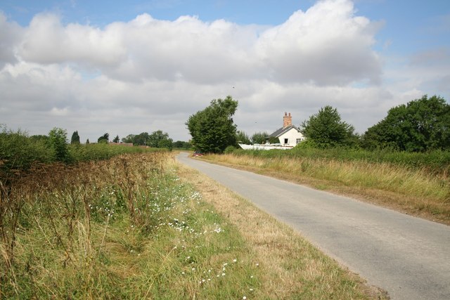
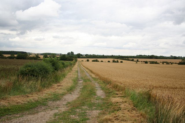
Bell's Belt is a wood located in the county of Lincolnshire, England. It is situated in the heart of the Lincolnshire Wolds, a designated Area of Outstanding Natural Beauty. The wood covers an area of approximately 50 hectares and is known for its dense forested areas and diverse range of flora and fauna.

The woodland is named after its founder, Joseph Bell, who planted the first trees in the late 19th century. Bell's Belt is primarily composed of native broadleaf trees such as oak, ash, and beech, which provide a rich habitat for a variety of wildlife. The wood is especially renowned for its impressive bluebell displays during the spring season, attracting visitors from far and wide.

The terrain of Bell's Belt is undulating, with numerous footpaths and trails winding through the woodland. These paths offer visitors the opportunity to explore the wood and enjoy its tranquil atmosphere. The wood is also a popular destination for birdwatchers, as it is home to a wide range of bird species including woodpeckers, owls, and finches.

Bell's Belt is managed by the Lincolnshire Wildlife Trust, who ensure the preservation and conservation of the wood's natural beauty. They regularly organize educational events and guided walks, providing visitors with the opportunity to learn more about the local wildlife and the importance of woodland conservation.

Overall, Bell's Belt is a picturesque woodland that offers a peaceful retreat for nature enthusiasts and those seeking a break from the hustle and bustle of everyday life.

If you have any feedback on the listing, please let us know in the comments section below.

Bell's Belt Images

Images are sourced within 2km of 53.283131/-0.22010472 or Grid Reference TF1877. Thanks to Geograph Open Source API. All images are credited.

Ridge and Furrow at Hatton, Lincs: aerial 2022 (1) East, West and Northwest and of the village centre.

See: <span class="nowrap"><a title="https://www.heritagegateway.org.uk/Gateway/Results_Single.aspx?uid=MLI42953&resourceID=1006," rel="nofollow ugc noopener" href="https://www.heritagegateway.org.uk/Gateway/Results_Single.aspx?uid=MLI42953&resourceID=1006,">Link</a><img style="margin-left:2px;" alt="External link" title="External link - shift click to open in new window" src="https://s1.geograph.org.uk/img/external.png" width="10" height="10"/></span> <span class="nowrap"><a title="https://www.heritagegateway.org.uk/Gateway/Results_Single.aspx?uid=MLI42952&resourceID=1006" rel="nofollow ugc noopener" href="https://www.heritagegateway.org.uk/Gateway/Results_Single.aspx?uid=MLI42952&resourceID=1006">Link</a><img style="margin-left:2px;" alt="External link" title="External link - shift click to open in new window" src="https://s1.geograph.org.uk/img/external.png" width="10" height="10"/></span> and <span class="nowrap"><a title="https://www.heritagegateway.org.uk/Gateway/Results_Single.aspx?uid=MLI42954&resourceID=1006" rel="nofollow ugc noopener" href="https://www.heritagegateway.org.uk/Gateway/Results_Single.aspx?uid=MLI42954&resourceID=1006">Link</a><img style="margin-left:2px;" alt="External link" title="External link - shift click to open in new window" src="https://s1.geograph.org.uk/img/external.png" width="10" height="10"/></span>
Ridge and Furrow at Hatton, Lincs: aerial 2022 (1)
East, West and Northwest and of the village centre. See: LinkExternal link LinkExternal link and LinkExternal link
Ridge and Furrow at Hatton, Lincs: aerial 2022 (2) East, West and Northwest and of the village centre.

See: <span class="nowrap"><a title="https://www.heritagegateway.org.uk/Gateway/Results_Single.aspx?uid=MLI42953&resourceID=1006," rel="nofollow ugc noopener" href="https://www.heritagegateway.org.uk/Gateway/Results_Single.aspx?uid=MLI42953&resourceID=1006,">Link</a><img style="margin-left:2px;" alt="External link" title="External link - shift click to open in new window" src="https://s1.geograph.org.uk/img/external.png" width="10" height="10"/></span> <span class="nowrap"><a title="https://www.heritagegateway.org.uk/Gateway/Results_Single.aspx?uid=MLI42952&resourceID=1006" rel="nofollow ugc noopener" href="https://www.heritagegateway.org.uk/Gateway/Results_Single.aspx?uid=MLI42952&resourceID=1006">Link</a><img style="margin-left:2px;" alt="External link" title="External link - shift click to open in new window" src="https://s1.geograph.org.uk/img/external.png" width="10" height="10"/></span> and <span class="nowrap"><a title="https://www.heritagegateway.org.uk/Gateway/Results_Single.aspx?uid=MLI42954&resourceID=1006" rel="nofollow ugc noopener" href="https://www.heritagegateway.org.uk/Gateway/Results_Single.aspx?uid=MLI42954&resourceID=1006">Link</a><img style="margin-left:2px;" alt="External link" title="External link - shift click to open in new window" src="https://s1.geograph.org.uk/img/external.png" width="10" height="10"/></span>

The earthworks are picked out by the early January morning frost.
Ridge and Furrow at Hatton, Lincs: aerial 2022 (2)
East, West and Northwest and of the village centre. See: LinkExternal link LinkExternal link and LinkExternal link The earthworks are picked out by the early January morning frost.
Shrunken Medieval Village of Sotby: aerial 2022 <span class="nowrap"><a title="https://www.heritagegateway.org.uk/Gateway/Results_Single.aspx?uid=MLI89137&resourceID=1006" rel="nofollow ugc noopener" href="https://www.heritagegateway.org.uk/Gateway/Results_Single.aspx?uid=MLI89137&resourceID=1006">Link</a><img style="margin-left:2px;" alt="External link" title="External link - shift click to open in new window" src="https://s1.geograph.org.uk/img/external.png" width="10" height="10"/></span>

The earthworks are picked out by the early January morning frost.
Shrunken Medieval Village of Sotby: aerial 2022
LinkExternal link The earthworks are picked out by the early January morning frost.
Sotby: aerial 2023
Sotby: aerial 2023
Warren Farm View north to Warren Farm from Warren Hill
Warren Farm
View north to Warren Farm from Warren Hill
View from Warren Hill trig point View across a field of borage and the Wolds beyond from Warren Hill trig point
View from Warren Hill trig point
View across a field of borage and the Wolds beyond from Warren Hill trig point
October Cottage Between Sotby and Panton, the owners of October Cottage appear to be restoring a large boat - an unusual thing to find in the Lincolnshire Wolds.
October Cottage
Between Sotby and Panton, the owners of October Cottage appear to be restoring a large boat - an unusual thing to find in the Lincolnshire Wolds.
Corner Farm Marked Sturton Harden on some old maps
Corner Farm
Marked Sturton Harden on some old maps
Bridleway to Wass Lane To Wass Lane via Moor Farm
Bridleway to Wass Lane
To Wass Lane via Moor Farm
Park House & Park Farm Cottages Near Hatton
Park House & Park Farm Cottages
Near Hatton
St.Stephen's church, Hatton, Lincs. By James Fowler in 1870-4
St.Stephen's church, Hatton, Lincs.
By James Fowler in 1870-4
Hatton Village Hall Former schoolroom, now Hatton Village Hall
Hatton Village Hall
Former schoolroom, now Hatton Village Hall
Victorian postbox At Hatton Village Hall <a title="https://www.geograph.org.uk/photo/208095" href="https://www.geograph.org.uk/photo/208095">Link</a>
Victorian postbox
At Hatton Village Hall Link
Beware of the bull A handsome bull with his harem of cows and their calves near Hatton
Beware of the bull
A handsome bull with his harem of cows and their calves near Hatton
The road to Pants ? Some malicious rearrangement of the letters on this fingerpost suggest a nearby village of 'Pants'. It should read Panton, E Barkwith and Sturton.
The road to Pants ?
Some malicious rearrangement of the letters on this fingerpost suggest a nearby village of 'Pants'. It should read Panton, E Barkwith and Sturton.
Grange Beck Bridge On the road north of Hatton
Grange Beck Bridge
On the road north of Hatton
Cop Hills Wood Managed woodland, part of Sotby Wood
Cop Hills Wood
Managed woodland, part of Sotby Wood
Show me another place!

Bell's Belt is located at Grid Ref: TF1877 (Lat: 53.283131, Lng: -0.22010472)

Administrative County: Lincolnshire

District: East Lindsey

Police Authority: Lincolnshire

What 3 Words

///rooks.boards.brightens. Near Wragby, Lincolnshire

Related Wikis

Hatton, Lincolnshire

Hatton is a small village and civil parish in the East Lindsey district of Lincolnshire, England. It is situated 3 miles (5 km) east of the town of Wragby...

Panton, Lincolnshire

Panton is a village in the civil parish of East Barkwith, in the East Lindsey of district, Lincolnshire, England. It is situated approximately 13 miles...

Sotby

Sotby is a village and civil parish in the East Lindsey district of Lincolnshire, England. It is situated 15 miles (24 km) north-east from the city and...

Hanby Hall

Hanby Hall is a Grade II* listed early 18th-century building in Alford, Lincolnshire. Hanby Hall was built by John Andrews. It is situated opposite St...

Great Sturton

Great Sturton is a hamlet and civil parish in the East Lindsey district of Lincolnshire, England. It is situated approximately 7 miles (11 km) from the...

East Barkwith railway station

East Barkwith railway station was a railway station that served the village of East Barkwith, Lincolnshire, England between 1874 and 1958, on the Louth...

West Barkwith

West Barkwith is a village and civil parish in the East Lindsey district of Lincolnshire, England. It is situated on the A157 road and about 2.5 miles...

Langton by Wragby

Langton by Wragby is a small village and civil parish in the East Lindsey district of Lincolnshire, England. It lies approximately 1 mile (1.6 km) south...

Have you been to Bell's Belt?

Leave your review of Bell's Belt below (or comments, questions and feedback).