Ash Holt

Wood, Forest in Lincolnshire West Lindsey

England

Ash Holt

Footpath past Binbrook Top
Footpath past Binbrook Top Credit: David Brown

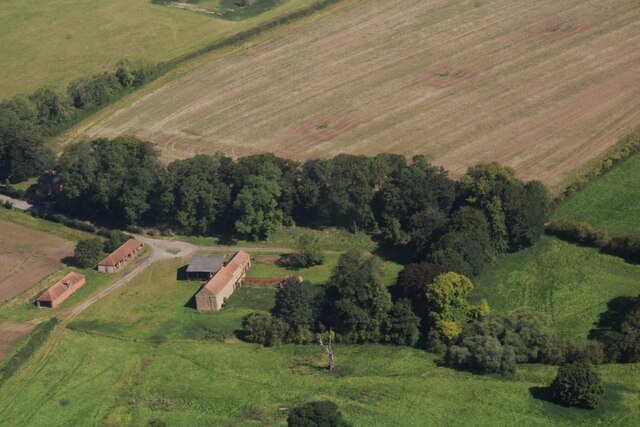
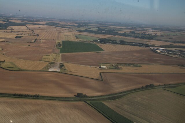
Ash Holt is a small village located in the county of Lincolnshire, England. Situated in the district of North Kesteven, this rural settlement is known for its picturesque woodlands and forested areas. The village is nestled amidst the scenic landscape of Lincolnshire, offering residents and visitors a tranquil environment away from the hustle and bustle of city life.

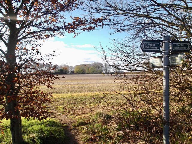
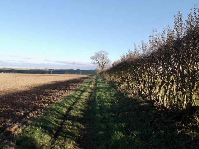
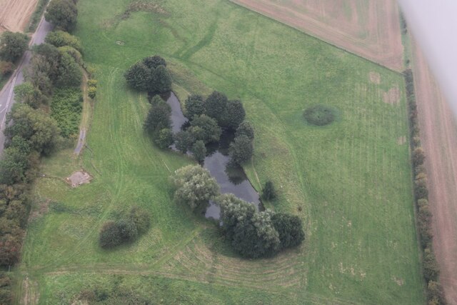
The woodlands in Ash Holt are a prominent feature of the village, providing ample opportunities for nature lovers and outdoor enthusiasts. The forested areas are home to a diverse range of wildlife, including various species of birds, mammals, and flora. The woodlands also offer several walking trails, making it an ideal destination for hikers and nature walkers.

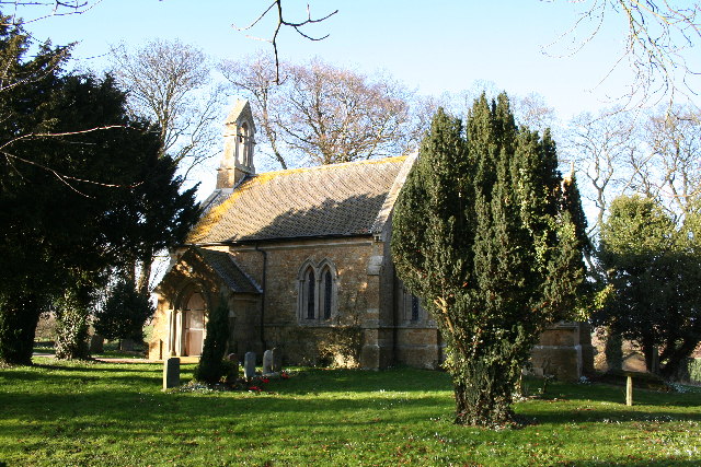
The village itself is characterized by a small, close-knit community. The population of Ash Holt is relatively small, with a few hundred residents. The village is served by a primary school, a village hall, and a church, which acts as a social hub for the community.

In terms of amenities, Ash Holt has limited facilities. However, nearby towns and villages provide access to essential services such as shops, supermarkets, and healthcare facilities. The village is well-connected to the surrounding areas via a network of roads, making it easily accessible by car.

Overall, Ash Holt, Lincolnshire, offers a peaceful and natural setting for residents and visitors alike, with its woodlands and forested areas providing a serene escape from urban life.

If you have any feedback on the listing, please let us know in the comments section below.

Ash Holt Images

Images are sourced within 2km of 53.43085/-0.21514271 or Grid Reference TF1894. Thanks to Geograph Open Source API. All images are credited.

Footpath past Binbrook Top
Part of site of Orford Priory and DMV: aerial 2022 See: <span class="nowrap"><a title="https://www.heritagegateway.org.uk/Gateway/Results_Single.aspx?uid=MLI50709&resourceID=1006" rel="nofollow ugc noopener" href="https://www.heritagegateway.org.uk/Gateway/Results_Single.aspx?uid=MLI50709&resourceID=1006">Link</a><img style="margin-left:2px;" alt="External link" title="External link - shift click to open in new window" src="https://s1.geograph.org.uk/img/external.png" width="10" height="10"/></span> (Premonstratensian Nunnery) and 
<span class="nowrap"><a title="https://www.heritagegateway.org.uk/Gateway/Results_Single.aspx?uid=MLI50708&resourceID=1006" rel="nofollow ugc noopener" href="https://www.heritagegateway.org.uk/Gateway/Results_Single.aspx?uid=MLI50708&resourceID=1006">Link</a><img style="margin-left:2px;" alt="External link" title="External link - shift click to open in new window" src="https://s1.geograph.org.uk/img/external.png" width="10" height="10"/></span> (DMV).
Part of site of Orford Priory and DMV: aerial 2022
See: LinkExternal link (Premonstratensian Nunnery) and LinkExternal link (DMV).
Priory Farm and site of Orford Priory: aerial 2022 See: <a href="https://www.geograph.org.uk/photo/7281818">TF1994 : Part of site of Orford Priory and DMV: aerial 2022</a>.
Priory Farm and site of Orford Priory: aerial 2022
Across Orford to Binbrook disused aerodrome: aerial 2022 Aerodrome in <a href="https://www.geograph.org.uk/gridref/TF1996">TF1996</a>, is now restored to agricultural use.

Site of Orford Priory left, in <a href="https://www.geograph.org.uk/gridref/TF1994">TF1994</a>. See <span class="nowrap"><a title="https://www.british-history.ac.uk/vch/lincs/vol2/p209" rel="nofollow ugc noopener" href="https://www.british-history.ac.uk/vch/lincs/vol2/p209">Link</a><img style="margin-left:2px;" alt="External link" title="External link - shift click to open in new window" src="https://s1.geograph.org.uk/img/external.png" width="10" height="10"/></span>
Across Orford to Binbrook disused aerodrome: aerial 2022
Aerodrome in TF1996, is now restored to agricultural use. Site of Orford Priory left, in TF1994. See LinkExternal link
Soilmarks near the threshold of former RAF Binbrook runway: aerial 2023 (1)
Soilmarks near the threshold of former RAF Binbrook runway: aerial 2023 (2)
English Electric Lightning at former RAF Binbrook: aerial 2023 English Electric Lightning F.6 XR724, now at former RAF Binbrook, was the first to be retired of the five Lightnings allocated by the MoD to British Aerospace at Warton as chase aircraft in the Tornado Foxhunter radar development trials. Her Fatigue Index (FI) was coming perilously close to zero, and so she was flown to RAF Shawbury for storage while she still had some FI left on the airframe. Once below zero she would not have been able to fly again under any circumstances. 

See: <span class="nowrap"><a title="https://www.lightningassociation.co.uk/our-aircraft" rel="nofollow ugc noopener" href="https://www.lightningassociation.co.uk/our-aircraft">Link</a><img style="margin-left:2px;" alt="External link" title="External link - shift click to open in new window" src="https://s1.geograph.org.uk/img/external.png" width="10" height="10"/></span> and <a href="https://www.geograph.org.uk/photo/3496421">TF1995 : Lightning Association at former R.A.F. Binbrook</a>.
English Electric Lightning at former RAF Binbrook: aerial 2023
English Electric Lightning F.6 XR724, now at former RAF Binbrook, was the first to be retired of the five Lightnings allocated by the MoD to British Aerospace at Warton as chase aircraft in the Tornado Foxhunter radar development trials. Her Fatigue Index (FI) was coming perilously close to zero, and so she was flown to RAF Shawbury for storage while she still had some FI left on the airframe. Once below zero she would not have been able to fly again under any circumstances. See: LinkExternal link and TF1995 : Lightning Association at former R.A.F. Binbrook.
Orford Priory Farm and earthworks: aerial 2023 Farm built on part of the site of Irford or Orford Priory, a house of Premonstratensian nuns founded in the mid 12th century and dissolved 1539.

See <span class="nowrap"><a title="https://www.heritagegateway.org.uk/Gateway/Results_Single.aspx?uid=MLI50709&resourceID=1006" rel="nofollow ugc noopener" href="https://www.heritagegateway.org.uk/Gateway/Results_Single.aspx?uid=MLI50709&resourceID=1006">Link</a><img style="margin-left:2px;" alt="External link" title="External link - shift click to open in new window" src="https://s1.geograph.org.uk/img/external.png" width="10" height="10"/></span>
Orford Priory Farm and earthworks: aerial 2023
Farm built on part of the site of Irford or Orford Priory, a house of Premonstratensian nuns founded in the mid 12th century and dissolved 1539. See LinkExternal link
Farm at Stainton le Vale: aerial 2023 South Farm.
Farm at Stainton le Vale: aerial 2023
South Farm.
Earthworks on a field at Stainton le Vale: aerial 2023 (1)
Earthworks on a field at Stainton le Vale: aerial 2023 (2)
Site of runways, former RAF Binbrook: aerial 2023
Votive offerings at Lud's Well, Stainton-le-Vale
The decline of the "tin tabernacle" in Stainton le Vale, 2023 (1) A former Primitive Methodist chapel, it can be seen in slightly happier times (2009) in <a href="https://www.geograph.org.uk/photo/1497384">TF1794 : The 'tin tabernacle'</a>. In 2015 it looked like <a href="https://www.geograph.org.uk/photo/4437141">TF1794 : The old village hall in Stainton-le-Vale</a>, when it seemed to have enjoyed a brief revival as a village hall.

Sadly, very few such buildings remain.
The decline of the "tin tabernacle" in Stainton le Vale, 2023 (1)
A former Primitive Methodist chapel, it can be seen in slightly happier times (2009) in TF1794 : The 'tin tabernacle'. In 2015 it looked like TF1794 : The old village hall in Stainton-le-Vale, when it seemed to have enjoyed a brief revival as a village hall. Sadly, very few such buildings remain.
The decline of the "tin tabernacle" in Stainton le Vale, 2023 (2) A former Primitive Methodist chapel, it can be seen in slightly happier times (2009) in <a href="https://www.geograph.org.uk/photo/1497384">TF1794 : The 'tin tabernacle'</a>. In 2015 it looked like <a href="https://www.geograph.org.uk/photo/4437141">TF1794 : The old village hall in Stainton-le-Vale</a>, when it seemed to have enjoyed a brief revival as a village hall.

Sadly, very few such buildings remain.
The decline of the "tin tabernacle" in Stainton le Vale, 2023 (2)
A former Primitive Methodist chapel, it can be seen in slightly happier times (2009) in TF1794 : The 'tin tabernacle'. In 2015 it looked like TF1794 : The old village hall in Stainton-le-Vale, when it seemed to have enjoyed a brief revival as a village hall. Sadly, very few such buildings remain.
Path to Binbrook
Path to Binbrook
Pond by Orford Bridge: aerial 2023
Show me another place!

Ash Holt is located at Grid Ref: TF1894 (Lat: 53.43085, Lng: -0.21514271)

Administrative County: Lincolnshire

District: West Lindsey

Police Authority: Lincolnshire

What 3 Words

///beep.adjusting.slice. Near Wold Newton, Lincolnshire

Nearby Locations

Ash Holt

Related Wikis

Orford Priory

Orford Priory was a priory of Premonstratensian canonesses in Stainton le Vale, Lincolnshire, England, and one of nine within the historical county. The...

Stainton le Vale

Stainton le Vale is a village in the civil parish of Thoresway in the West Lindsey district of Lincolnshire, England. It is situated about 6 miles (9...

Kirmond le Mire

Kirmond le Mire is a small village and civil parish in the West Lindsey district of Lincolnshire, England. It is situated on the B1203 road, 6 miles (10...

RAF Binbrook

Royal Air Force Binbrook or RAF Binbrook is a former Royal Air Force station located near Binbrook, Lincolnshire, England. The old domestic site (married...

Brookenby

Brookenby is a village and civil parish in the West Lindsey district of Lincolnshire, England. The village is situated 7 miles (11 km) north-east from...

Brookenby Church

Brookenby Church is located in Brookenby, Lincolnshire, England. A member of the Church of England, it forms part of the Walesby group of churches, which...

Parts of Lindsey

The Parts of Lindsey are a traditional division of Lincolnshire, England, covering the northern part of the county. The Isle of Axholme, which is on the...

Binbrook

Binbrook is a village and civil parish in the East Lindsey district of Lincolnshire, England. It is situated on the B1203 road, and 8 miles (13 km) north...

Related Videos

Binbrook, Lincolnshire, UK

This walk of about 7 miles starts by heading south from Binbrook towards Low Farm. It returns via the fishing lakes of Thorpe Le ...

STAINTON LE VALE: West Lindsey Parish #122 of 128

WEST LINDSEY PARISH #122: STAINTON LE VALE Welcome back to the Wolds again everyone and this is Stainton le Vale, ...

Barefoot Chronicles 057 - St Mary's Church, Thoresway - Sunday Special (Part 1) 👣✝️⛪️☀️🌩

This weeks Sunday Special Barefoot Chronicles features Part 1 of the tour of the picturesque St Mary's Church in Thoresway, ...

KIRMOND LE MIRE: West Lindsey Parish #121 of 128

WEST LINDSEY PARISH #121: KIRMOND LE MIRE Welcome to Kirmond le Mire, a tiny place situated between Tealby and ...

Nearby Amenities

Located within 500m of 53.43085,-0.21514271
Power: pole
Lat/Long: 53.4290147/-0.2217592
Power: pole
Lat/Long: 53.4290942/-0.2208155
Power: pole
Lat/Long: 53.4291822/-0.2198765
Power: pole
Lat/Long: 53.4292561/-0.2189876
Power: pole
Lat/Long: 53.4293384/-0.2181297
Power: pole
Lat/Long: 53.4294208/-0.2172669
Power: pole
Lat/Long: 53.429506/-0.2163113
Power: pole
Lat/Long: 53.4295869/-0.2153747
Power: pole
Lat/Long: 53.4296764/-0.2143619
Power: pole
Lat/Long: 53.4297658/-0.2133633
Power: pole
Lat/Long: 53.4298624/-0.2123505
Power: pole
Lat/Long: 53.4299504/-0.2113567
Power: pole
Lat/Long: 53.4300413/-0.2103581
Power: pole
Lat/Long: 53.4301336/-0.2093572
Power: pole
Lat/Long: 53.4302287/-0.2083277
The data included in this document is from www.openstreetmap.org. The data is made available under ODbL.

Have you been to Ash Holt?

Leave your review of Ash Holt below (or comments, questions and feedback).