Holme Wood

Wood, Forest in Huntingdonshire Huntingdonshire

England

Holme Wood

Woodland north of Conington
Woodland north of Conington Credit: Jonathan Thacker

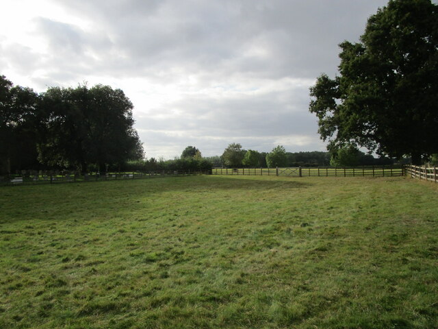
Holme Wood, located in the historic county of Huntingdonshire, is a picturesque forested area renowned for its natural beauty and diverse wildlife. Covering an expansive area of approximately 500 acres, Holme Wood is a popular destination for nature enthusiasts and outdoor adventurers alike.

The wood is primarily composed of a mix of deciduous and coniferous trees, creating a rich and vibrant landscape throughout the year. The dense canopy provides shelter and habitat for a wide range of flora and fauna, including various species of birds, mammals, and insects.

Visitors to Holme Wood can enjoy a variety of recreational activities, such as walking, hiking, and birdwatching. The well-maintained trails winding through the wood offer stunning views of the surrounding countryside and provide opportunities to spot rare and indigenous wildlife.

The wood is also home to several ancient burial mounds and historical sites, adding a touch of intrigue and history to the area. These archaeological remnants serve as a reminder of the long-standing human presence in the region.

In addition to its natural and historical significance, Holme Wood plays a vital role in ecosystem conservation and management. Efforts are made to preserve the forest's delicate ecological balance, ensuring its sustainability for future generations.

Overall, Holme Wood in Huntingdonshire is a captivating destination for nature lovers, offering a serene and enriching experience amidst its tranquil surroundings. Whether one seeks adventure or simply wishes to immerse oneself in the beauty of the natural world, Holme Wood is a place that promises to captivate and inspire.

If you have any feedback on the listing, please let us know in the comments section below.

Holme Wood Images

Images are sourced within 2km of 52.476172/-0.25835424 or Grid Reference TL1887. Thanks to Geograph Open Source API. All images are credited.

Woodland north of Conington
Former taxiway, RAF Glatton RAF Glatton opened as a USAF base in 1943. It closed in 1948 <span class="nowrap"><a title="https://en.wikipedia.org/wiki/RAF_Glatton" rel="nofollow ugc noopener" href="https://en.wikipedia.org/wiki/RAF_Glatton">Link</a><img style="margin-left:2px;" alt="External link" title="External link - shift click to open in new window" src="https://s1.geograph.org.uk/img/external.png" width="10" height="10"/></span>
Despite its short life it has had a major impact on the surroundings of Conington with many roads clearly having originally been part of the base. Concrete beneath the tarmac is the giveaway.
Former taxiway, RAF Glatton
RAF Glatton opened as a USAF base in 1943. It closed in 1948 LinkExternal link Despite its short life it has had a major impact on the surroundings of Conington with many roads clearly having originally been part of the base. Concrete beneath the tarmac is the giveaway.
Holme Brook Rather overgrown.  The brook is passing beneath a Network Rail access track adjacent to the East Coast Main Line.
Holme Brook
Rather overgrown. The brook is passing beneath a Network Rail access track adjacent to the East Coast Main Line.
Church Street, Holme
Tree lined track off Glatton Lane Not a public right of way.
Tree lined track off Glatton Lane
Not a public right of way.
Grass field at Conington
Horses and sheep, Conington
Track towards Moor Close Spinney, Conington
Track and Moor Close Spinney, Conington
Cut through a wheat field, Conington
Stubble field at Conington Looking towards Home Farm.
Stubble field at Conington
Looking towards Home Farm.
Sewage works at Holme The East Coast Main Line railway in the background.
Sewage works at Holme
The East Coast Main Line railway in the background.
Stubble field at Holme The buildings of Peterborough Business Airport in the distance.
Stubble field at Holme
The buildings of Peterborough Business Airport in the distance.
Holme Church of England Primary School
St Giles' church, Holme Designed in 1862 by Edward Browning <span class="nowrap"><a title="https://en.wikipedia.org/wiki/Edward_Browning" rel="nofollow ugc noopener" href="https://en.wikipedia.org/wiki/Edward_Browning">Link</a><img style="margin-left:2px;" alt="External link" title="External link - shift click to open in new window" src="https://s1.geograph.org.uk/img/external.png" width="10" height="10"/></span> partly using old materials <span class="nowrap"><a title="https://historicengland.org.uk/listing/the-list/list-entry/1215533?section=official-list-entry" rel="nofollow ugc noopener" href="https://historicengland.org.uk/listing/the-list/list-entry/1215533?section=official-list-entry">Link</a><img style="margin-left:2px;" alt="External link" title="External link - shift click to open in new window" src="https://s1.geograph.org.uk/img/external.png" width="10" height="10"/></span>
St Giles' church, Holme
Designed in 1862 by Edward Browning LinkExternal link partly using old materials LinkExternal link
Roadside trees, Glatton Lane
A1(M) southbound, south of Stilton The A1 is the longest numbered road in the UK at 410 miles long. It connects London with Edinburgh, via the east of England. 
For much of its path it follows the Great North Road the old coaching route between London and Edinburgh. Several sections of the route are classified as motorway A1(M). The modern A1 bypasses the towns the Great North Road passed through and is dual carriageway for most of its route through England.
A1(M) southbound, south of Stilton
The A1 is the longest numbered road in the UK at 410 miles long. It connects London with Edinburgh, via the east of England. For much of its path it follows the Great North Road the old coaching route between London and Edinburgh. Several sections of the route are classified as motorway A1(M). The modern A1 bypasses the towns the Great North Road passed through and is dual carriageway for most of its route through England.
Peterborough Business Airport
Show me another place!

Holme Wood is located at Grid Ref: TL1887 (Lat: 52.476172, Lng: -0.25835424)

Administrative County: Cambridgeshire

District: Huntingdonshire

Police Authority: Cambridgeshire

What 3 Words

///barn.gratitude.wheat. Near Stilton, Cambridgeshire

Nearby Locations

Holme Holme Wood

Related Wikis

Holme, Cambridgeshire

Holme is a village and civil parish in Cambridgeshire, England. Holme lies approximately 7 miles (11 km) south of Peterborough, near Conington and Yaxley...

Peterborough Business Airport

Peterborough Business Airport (ICAO: EGSF) is a privately owned airfield in the English county of Cambridgeshire near the villages of Holme and Conington...

Battle of the Holme

The Battle of the Holme took place in East Anglia on 13 December 902 where the Anglo-Saxon men of Wessex and Kent fought against the Danelaw and East Anglian...
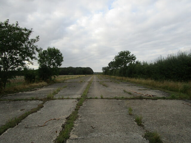
RAF Glatton

Royal Air Force Glatton or more simply RAF Glatton is a former Royal Air Force station located 10 miles (16 km) north of Huntingdon, Cambridgeshire, England...

Related Videos

Jet Ranger II aka AGUSTA AB206B starting

Jet Ranger II starting up and taxiing out. wind your sound up!

Conington EGSF Landing a C42

Landing out at EGSF Conington runway 28. A nice long hard runway makes a nice change from grass!

Landing at Peterborough (Conington) Airfield

Approach and landing at Peterborough (Conington) Airfield in a C42 microlight. The video shows an overhead join, deadside ...

Are You Better Landing on Grass, or Tarmac ? - EuroFox 912is

After getting away by the skin of my teeth, and averting a ground loop at Conington, I was a little concerned that my landing at my ...

Nearby Amenities

Located within 500m of 52.476172,-0.25835424
Power: pole
Lat/Long: 52.4737529/-0.2532407
Crossing
Lat/Long: 52.477488/-0.2536107
The data included in this document is from www.openstreetmap.org. The data is made available under ODbL.

Have you been to Holme Wood?

Leave your review of Holme Wood below (or comments, questions and feedback).