Elliston

Settlement in Roxburghshire

Scotland

Elliston
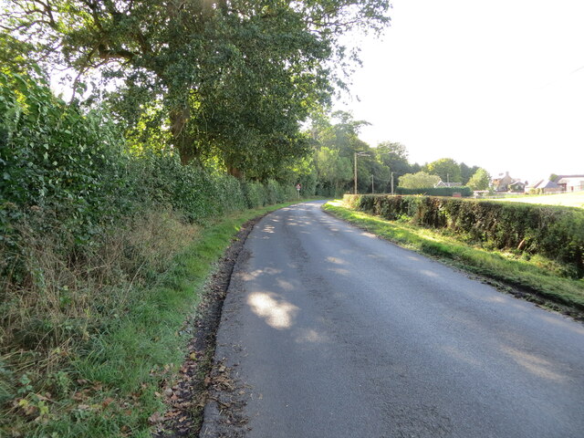
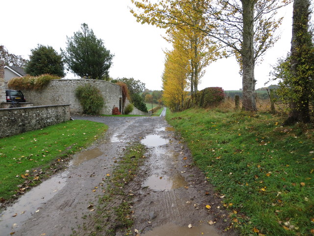
Road approaching Northfield Farm Looking south-westward.
Road approaching Northfield Farm Credit: Peter Wood

The requested URL returned error: 429 Too Many Requests

If you have any feedback on the listing, please let us know in the comments section below.

Elliston Images

Images are sourced within 2km of 55.543714/-2.6988422 or Grid Reference NT5628. Thanks to Geograph Open Source API. All images are credited.
Road approaching Northfield Farm Looking south-westward.
Road approaching Northfield Farm
Looking south-westward.
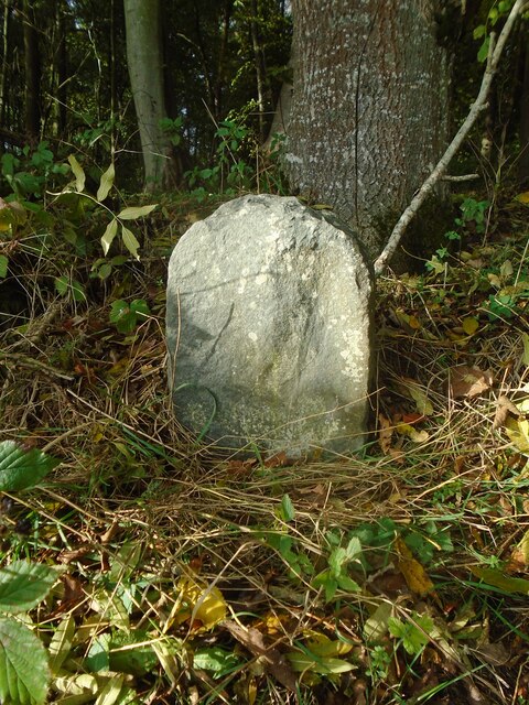
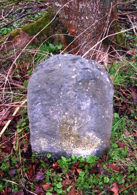
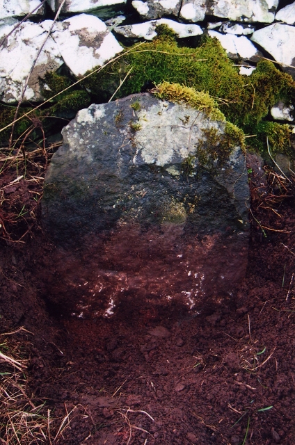
Old milestone Vegetation cleared from around the old, worn milestone which may once have had a 2 inscribed or painted on as it is 2 miles from St Boswells on the minor road towards Lilliesleaf.
Old milestone
Vegetation cleared from around the old, worn milestone which may once have had a 2 inscribed or painted on as it is 2 miles from St Boswells on the minor road towards Lilliesleaf.
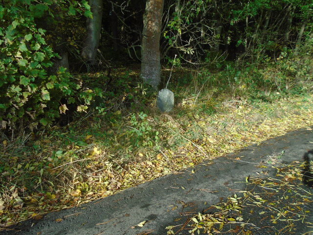
Old milestone The milestone on the narrow verge just after a left-hand bend when approaching from St Boswells.   The small Arniesyde plantation is behind the stone.   This lane joins the B6359 just over a mile further southwest.
Old milestone
The milestone on the narrow verge just after a left-hand bend when approaching from St Boswells. The small Arniesyde plantation is behind the stone. This lane joins the B6359 just over a mile further southwest.
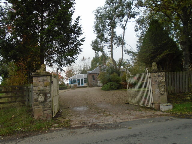
Old toll house The entrance to the old tollhouse, Bowden Toll.
Old toll house
The entrance to the old tollhouse, Bowden Toll.
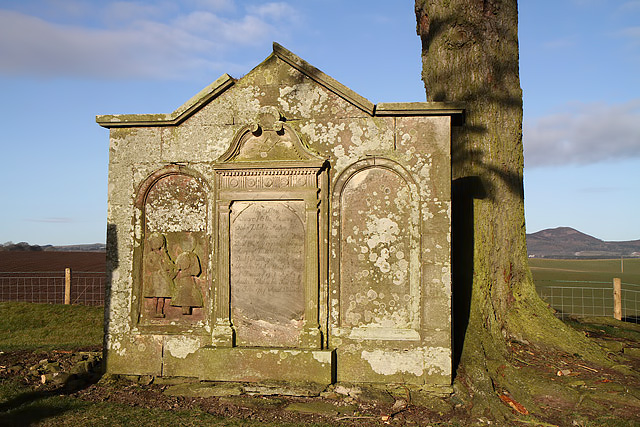
A gravestone at Longnewton Burial Ground This grand stone in the small burial ground is for the Blackie family and is inscribed as follows:

This ston is
Sacred to the Memory of
John Blackie, mason, late
Farmer in Ancrum Mill who
Died 31st May 1772 Aged 66 years
Margrat Riddel his Spouse
Died 9th April 1786 Aged 70 years
Francis Blackie his son died
25th January 1746 Aged 3 yr
Andrew Blackie his Son died
14th June 1747 Aged 5 Months
A gravestone at Longnewton Burial Ground
This grand stone in the small burial ground is for the Blackie family and is inscribed as follows: This ston is Sacred to the Memory of John Blackie, mason, late Farmer in Ancrum Mill who Died 31st May 1772 Aged 66 years Margrat Riddel his Spouse Died 9th April 1786 Aged 70 years Francis Blackie his son died 25th January 1746 Aged 3 yr Andrew Blackie his Son died 14th June 1747 Aged 5 Months
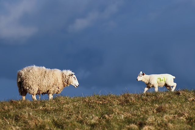
A ewe with lamb at Kippilaw This evening view was taken against a threatening sky.
A ewe with lamb at Kippilaw
This evening view was taken against a threatening sky.
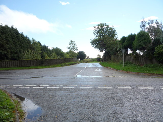
Road junction near Hillview The B6359 meets the A699.
Road junction near Hillview
The B6359 meets the A699.
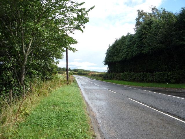
A699 towards Kelso Looking north east.
A699 towards Kelso
Looking north east.
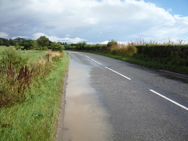
Water beside the A699 Just after a heavy downpour.
Water beside the A699
Just after a heavy downpour.
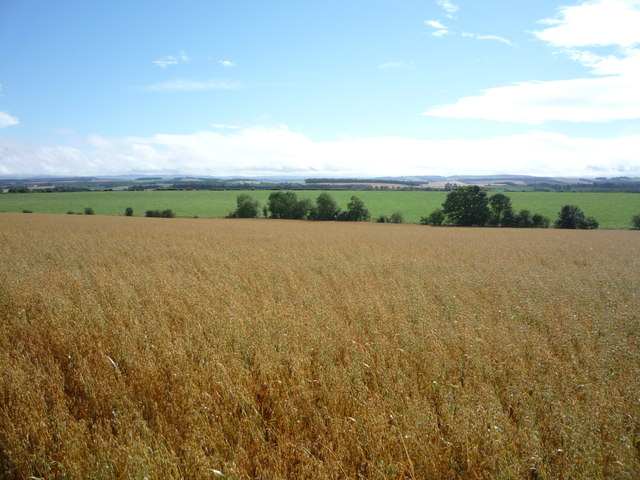
Crop field near Northfield
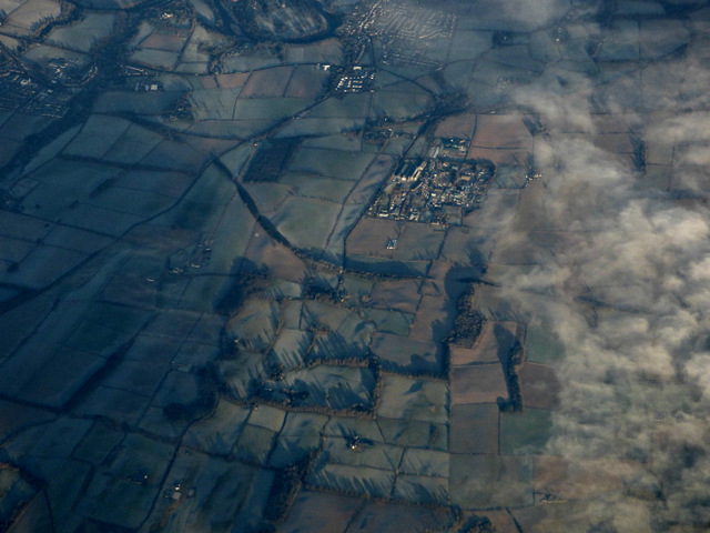
Charlesfield industrial estate from the air Whinfield and Elliston are in the foreground, St Boswells is in the distance.
Charlesfield industrial estate from the air
Whinfield and Elliston are in the foreground, St Boswells is in the distance.
Salters Ford Salters Ford is found on Ale Water near Bewlie. The ford in Autumnal colours can be seen at:<a title="https://www.geograph.org.uk/photo/4218139" href="https://www.geograph.org.uk/photo/4218139">Link</a>
Salters Ford
Salters Ford is found on Ale Water near Bewlie. The ford in Autumnal colours can be seen at:Link
Track at Birseslees Looking northward.
Track at Birseslees
Looking northward.
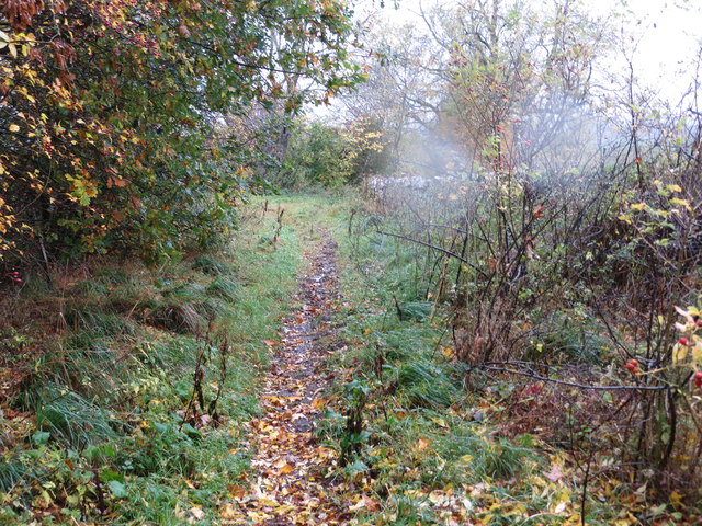
A somewhat overgrown, wet and muddy track near Camp Knowes Looking north-westward. The picture was taken on a day when the Met Office had given a 'Yellow' warning of heavy and continuous rain. This proved correct hence the rain spots.
A somewhat overgrown, wet and muddy track near Camp Knowes
Looking north-westward. The picture was taken on a day when the Met Office had given a 'Yellow' warning of heavy and continuous rain. This proved correct hence the rain spots.
Old Milestone by Arniesyde Plantation, near Thornielaw Milestone by the UC road, in parish of St Boswells (Roxburgh District), Northwest of Thornielaw, on verge by Arniesyde Plantation, North side of road.

Inscription once read:-
ST. BOSWELLS
2

Surveyed

Milestone Society National ID: BD_SBLL02
Old Milestone by Arniesyde Plantation, near Thornielaw
Milestone by the UC road, in parish of St Boswells (Roxburgh District), Northwest of Thornielaw, on verge by Arniesyde Plantation, North side of road. Inscription once read:- ST. BOSWELLS 2 Surveyed Milestone Society National ID: BD_SBLL02
Old Milestone near Langside, Bowden parish Milestone by the UC road, in parish of Bowden (Roxburgh District), Langside, on verge in front of drystone wall.

Inscription once read:-
(Newtown)
(3)

Surveyed

Milestone Society National ID: BD_SBLL03
Old Milestone near Langside, Bowden parish
Milestone by the UC road, in parish of Bowden (Roxburgh District), Langside, on verge in front of drystone wall. Inscription once read:- (Newtown) (3) Surveyed Milestone Society National ID: BD_SBLL03
Former tollhouse Surveyed by the Milestone Society.   On the A699, Selkirk to Kelso, cross roads with the B6359, Hawick to Melrose, at the south west corner.   Known as Bowden Stand Dam, a George Brown was the toll keeper sometime in the mid 1800s.  He was an ancestor of the photographer. This picture shows the blocked up hatch where the tolls were taken.
Former tollhouse
Surveyed by the Milestone Society. On the A699, Selkirk to Kelso, cross roads with the B6359, Hawick to Melrose, at the south west corner. Known as Bowden Stand Dam, a George Brown was the toll keeper sometime in the mid 1800s. He was an ancestor of the photographer. This picture shows the blocked up hatch where the tolls were taken.
Green lane to Midlem
Show me another place!

Elliston is located at Grid Ref: NT5628 (Lat: 55.543714, Lng: -2.6988422)

Unitary Authority: The Scottish Borders

Police Authority: The Lothians and Scottish Borders

What 3 Words

///clashing.regress.lies. Near Newtown St Boswells, Scottish Borders

Related Wikis

Charlesfield Halt railway station

Charlesfield Halt railway station served the village of Charlesfield, Melrose, Scotland, from 1942 to 1961 on the Waverley Route. == History == The station...

Bowden, Scottish Borders

Bowden is a village in the Roxburghshire area of the Scottish Borders, situated 3 miles (5 kilometres) south of Melrose, 2 miles (3 kilometres) west of...

Belses

Belses is a village on the Ale Water, in the Scottish Borders area of Scotland the former Selkirkshire. It is situated close to Old Belses, and lies south...

Belses railway station

Belses railway station served the village of Belses, Scottish Borders, Scotland from 1849 to 1969 on the Waverley Route. == History == The station opened...

Nearby Amenities

Located within 500m of 55.543714,-2.6988422
Power: pole
Lat/Long: 55.5399685/-2.7031358
Power: pole
Lat/Long: 55.539872/-2.702016
Power: pole
Lat/Long: 55.5397756/-2.7007995
Power: pole
Lat/Long: 55.5396935/-2.699392
Power: pole
Lat/Long: 55.5396171/-2.6981449
Power: pole
Lat/Long: 55.5395394/-2.6968673
Power: pole
Lat/Long: 55.5454232/-2.7061174
Power: pole
Lat/Long: 55.5460078/-2.7051783
Power: pole
Lat/Long: 55.5464527/-2.7044427
Power: pole
Lat/Long: 55.5427248/-2.7054531
Power: pole
Lat/Long: 55.5435095/-2.7035927
Power: pole
Lat/Long: 55.5443116/-2.7016711
Power: pole
Lat/Long: 55.545645/-2.7008542
Power: pole
Lat/Long: 55.546578/-2.6990573
Power: pole
Lat/Long: 55.5474419/-2.6973343
Give Way
Direction: forward
Lat/Long: 55.5467496/-2.7037641
The data included in this document is from www.openstreetmap.org. The data is made available under ODbL.

Have you been to Elliston?

Leave your review of Elliston below (or comments, questions and feedback).