Brookhurst Wood

Wood, Forest in Sussex Horsham

England

Brookhurst Wood

Old Milepost by A24, Durfold, a mile North of Warnham The Milepost is located by fence at back of verge on the East of the road.  Parish of Warnham (Horsham District). Cast iron post, Horsham post design, erected by the Horsham & Dorking turnpike trust in the 19th Century. 

Inscription reads:-  
25 MILES / TO / BRIGHTON / 3½ / TO / HORSHAM : : 33 MILES / TO / LONDON / 10 / MILES TO / DORKING : : WARNHAM

Milestone Society National ID: SX_LA33
Old Milepost by A24, Durfold, a mile North of Warnham Credit: Andrew Knorpel

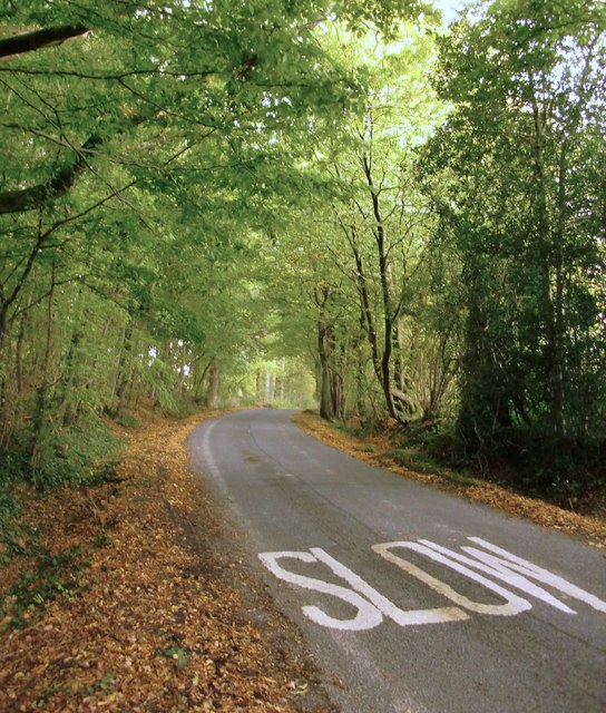
Brookhurst Wood is a picturesque woodland located in Sussex, England. It covers a vast area of approximately 100 acres and is a popular destination for nature lovers and outdoor enthusiasts. The wood is situated near the town of Horsham and is easily accessible from nearby towns and cities.

The woodland is predominantly made up of native broadleaf trees, including oak, beech, ash, and birch. These trees create a dense canopy, allowing only dappled sunlight to filter through to the forest floor. This creates a tranquil and enchanting atmosphere for visitors to explore.

Brookhurst Wood is home to a diverse range of wildlife, making it an ideal spot for birdwatching and wildlife observation. Visitors may be fortunate enough to spot species such as woodpeckers, owls, deer, and various small mammals. The wood also boasts a rich variety of plant life, with bluebells carpeting the forest floor in the spring, creating a stunning floral display.

There are several well-marked walking trails that wind their way through the wood, offering visitors the opportunity to fully immerse themselves in the natural beauty of the surroundings. These trails cater to different levels of ability, from gentle strolls to more challenging hikes.

The wood is managed by the local conservation authority, ensuring its preservation and protection. It provides a valuable habitat for wildlife and contributes to the overall biodiversity of the region. Whether visitors are seeking a peaceful retreat, a nature-filled adventure, or simply a break from the hustle and bustle of daily life, Brookhurst Wood is a perfect destination to reconnect with nature.

If you have any feedback on the listing, please let us know in the comments section below.

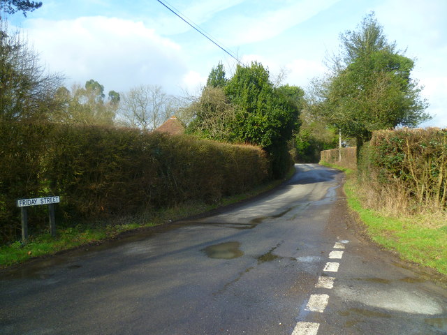
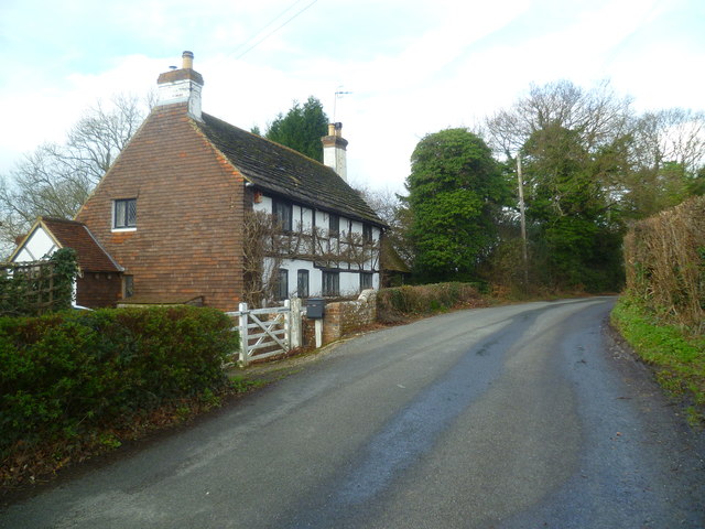
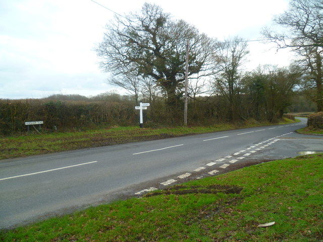
Brookhurst Wood Images

Images are sourced within 2km of 51.104866/-0.32104794 or Grid Reference TQ1735. Thanks to Geograph Open Source API. All images are credited.

Old Milepost by A24, Durfold, a mile North of Warnham The Milepost is located by fence at back of verge on the East of the road.  Parish of Warnham (Horsham District). Cast iron post, Horsham post design, erected by the Horsham & Dorking turnpike trust in the 19th Century. 

Inscription reads:-  
25 MILES / TO / BRIGHTON / 3½ / TO / HORSHAM : : 33 MILES / TO / LONDON / 10 / MILES TO / DORKING : : WARNHAM

Milestone Society National ID: SX_LA33
Old Milepost by A24, Durfold, a mile North of Warnham
The Milepost is located by fence at back of verge on the East of the road.  Parish of Warnham (Horsham District). Cast iron post, Horsham post design, erected by the Horsham & Dorking turnpike trust in the 19th Century.  Inscription reads:- 25 MILES / TO / BRIGHTON / 3½ / TO / HORSHAM : : 33 MILES / TO / LONDON / 10 / MILES TO / DORKING : : WARNHAM Milestone Society National ID: SX_LA33
Mayes Lane near Joanlands Farm Dave Spicer was here before me, but at a less colourful, leafless time of year : <a href="https://www.geograph.org.uk/photo/2845209">TQ1535 : Mayes Lane south to Warnham</a>
Mayes Lane near Joanlands Farm
Dave Spicer was here before me, but at a less colourful, leafless time of year : TQ1535 : Mayes Lane south to Warnham
Footpath to Wattlehurst Farm from the A24 On the right is a builders' merchant's premises.
Footpath to Wattlehurst Farm from the A24
On the right is a builders' merchant's premises.
Derelict structure by footpath
Dorking Road looking northwards north of Kingsfold
Old Barn Cottage on the A24
The A24 in Kingsfold
Looking northwards on Foxwood
Footpath junction east of Kingsfold
Sign at footpath junction east of Kingsfold
Junction at the west end of Green Lane A view of this junction from the south is at <a title="https://www.geograph.org.uk/photo/1779327" href="https://www.geograph.org.uk/photo/1779327">Link</a>.
Junction at the west end of Green Lane
A view of this junction from the south is at Link.
The southern end of Friday Street
Cottage on Friday Street An image from 2004 is at <a title="https://www.geograph.org.uk/photo/643369" href="https://www.geograph.org.uk/photo/643369">Link</a>.
Cottage on Friday Street
An image from 2004 is at Link.
Weatherride at Great Benhams
"The Royal Oak" PH on Friday Street A similar view from 2010 is at <a title="https://www.geograph.org.uk/photo/1779318" href="https://www.geograph.org.uk/photo/1779318">Link</a>.
"The Royal Oak" PH on Friday Street
A similar view from 2010 is at Link.
Entrance to Nelsons Farm
Signpost at junction of Horsham Road and Green Lane See also <a title="https://www.geograph.org.uk/photo/60707" href="https://www.geograph.org.uk/photo/60707">Link</a> from 2005.
Signpost at junction of Horsham Road and Green Lane
See also Link from 2005.
Looking across Green Lane from footpath to Old Holbrook See also <a title="https://www.geograph.org.uk/photo/60710" href="https://www.geograph.org.uk/photo/60710">Link</a> from 2005.
Looking across Green Lane from footpath to Old Holbrook
See also Link from 2005.
Show me another place!

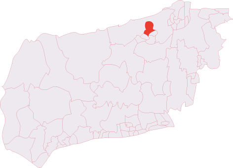
Brookhurst Wood is located at Grid Ref: TQ1735 (Lat: 51.104866, Lng: -0.32104794)

Administrative County: West Sussex

District: Horsham

Police Authority: Sussex

What 3 Words

///turns.grounding.trailer. Near Warnham, West Sussex

Related Wikis

Warnham SSSI

Warnham SSSI is a 28.5-hectare (70-acre) geological Site of Special Scientific Interest north of Horsham in West Sussex. It is a Geological Conservation...

Warnham railway station

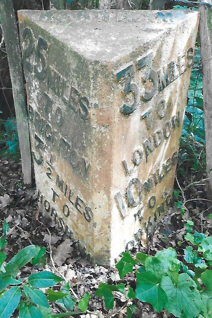
Warnham railway station serves the village of Warnham in West Sussex, England. It is 33 miles 46 chains (54.0 km) measured from London Waterloo (although...

Graylands

Graylands is a hamlet in the Horsham district of West Sussex, England. The largely rural hamlet is located north of Holbrook beyond the A264. It is bordered...

Old Holbrook

Old Holbrook (formerly known as Northlands) is a hamlet in the Horsham district of West Sussex, England. This rural hamlet is located north of the Horsham...

Holbrook (electoral division)

Holbrook is an electoral division of West Sussex in the United Kingdom and returns one member to sit on West Sussex County Council. The current County...

Warnham & Rusper (electoral division)

Warnham & Rusper is an electoral division of West Sussex in the United Kingdom and returns one member to sit on West Sussex County Council. The current...

Bohunt Horsham

Bohunt Horsham is a coeducational all-through school located in Horsham, West Sussex, England. The school opened to 120 students in Year 7 in 2019 in temporary...

Warnham

Warnham is a village and civil parish in the Horsham district of West Sussex, England. The village is centred 2 miles (3.2 km) north-northwest of Horsham...

Nearby Amenities

Located within 500m of 51.104866,-0.32104794
Barrier: lift_gate
Foot: yes
Motor Vehicle: private
Lat/Long: 51.1007326/-0.3232743
Fountain
Lat/Long: 51.106908/-0.32354
Ford: yes
Lat/Long: 51.1033842/-0.3202772
The data included in this document is from www.openstreetmap.org. The data is made available under ODbL.

Have you been to Brookhurst Wood?

Leave your review of Brookhurst Wood below (or comments, questions and feedback).