Blackberrymead Copse

Wood, Forest in Sussex Horsham

England

Blackberrymead Copse

Old Milepost by A24, Durfold, a mile North of Warnham The Milepost is located by fence at back of verge on the East of the road.  Parish of Warnham (Horsham District). Cast iron post, Horsham post design, erected by the Horsham & Dorking turnpike trust in the 19th Century. 

Inscription reads:-  
25 MILES / TO / BRIGHTON / 3½ / TO / HORSHAM : : 33 MILES / TO / LONDON / 10 / MILES TO / DORKING : : WARNHAM

Milestone Society National ID: SX_LA33
Old Milepost by A24, Durfold, a mile North of Warnham Credit: Andrew Knorpel

Blackberrymead Copse is a picturesque woodland located in Sussex, England. Spread over an area of approximately 50 acres, it is a captivating destination for nature enthusiasts and outdoor lovers. The copse is characterized by its dense canopy of trees, predominantly consisting of oak, beech, and birch species.

The woodland is renowned for its tranquil atmosphere and diverse wildlife. Walking through the copse, visitors can observe a myriad of native bird species nesting in the treetops, including the great spotted woodpecker, chiffchaff, and tawny owl. Additionally, small mammals like squirrels and rabbits can be spotted scurrying about, adding to the copse's lively ecosystem.

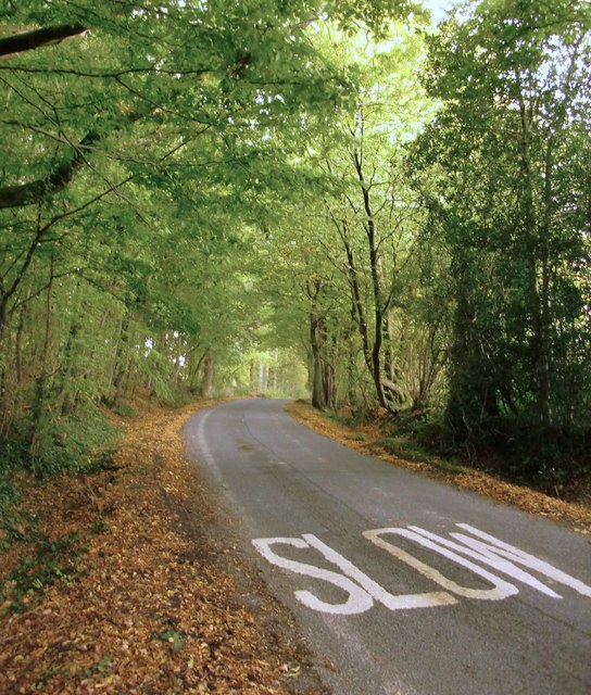
Blackberrymead Copse offers a network of well-maintained walking trails, allowing visitors to explore the beauty of the woodland at their own pace. These paths lead to hidden clearings and open glades, where wildflowers such as bluebells and primroses bloom during the spring months.

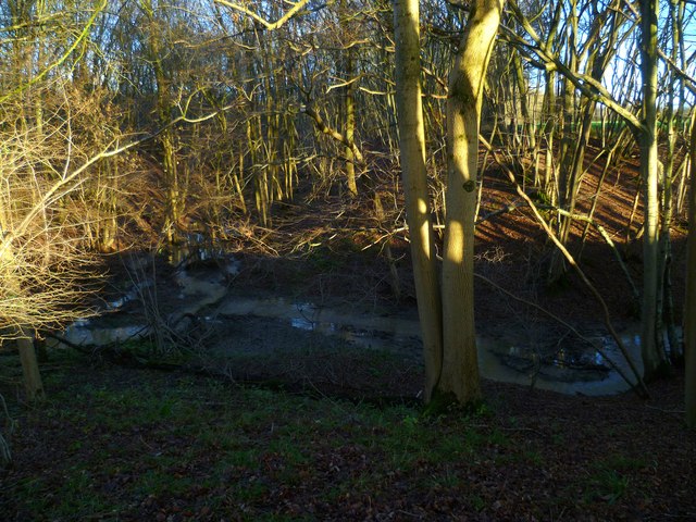
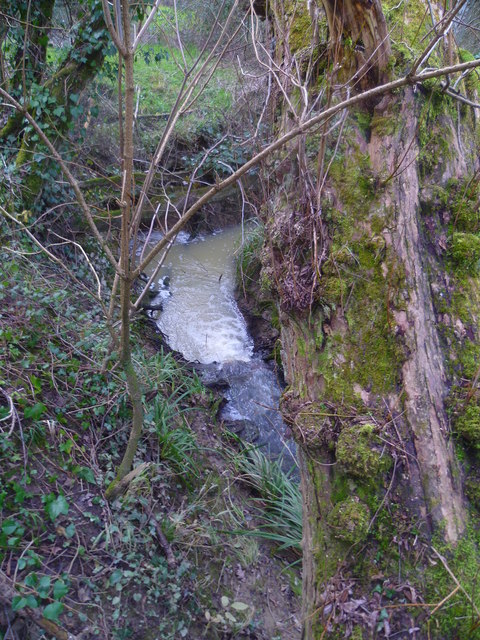
The copse also boasts a small stream that meanders its way through the trees, providing a serene backdrop and attracting various species of dragonflies and butterflies. The stream offers a peaceful spot for visitors to sit and enjoy the soothing sounds of nature.

Blackberrymead Copse is a haven for nature lovers, offering a tranquil escape from the hustle and bustle of everyday life. Its idyllic setting and rich biodiversity make it a must-visit destination for those seeking solace and a deeper connection with the natural world.

If you have any feedback on the listing, please let us know in the comments section below.

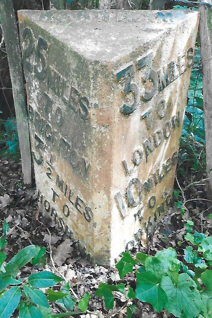
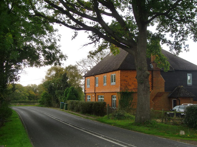
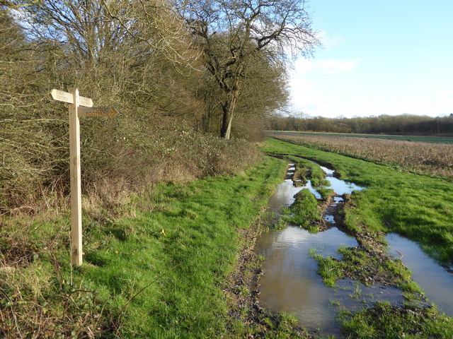
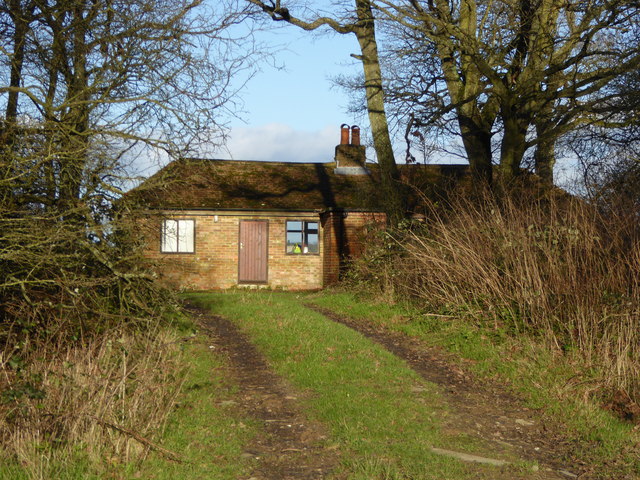
Blackberrymead Copse Images

Images are sourced within 2km of 51.118937/-0.33148304 or Grid Reference TQ1636. Thanks to Geograph Open Source API. All images are credited.

Old Milepost by A24, Durfold, a mile North of Warnham The Milepost is located by fence at back of verge on the East of the road.  Parish of Warnham (Horsham District). Cast iron post, Horsham post design, erected by the Horsham & Dorking turnpike trust in the 19th Century. 

Inscription reads:-  
25 MILES / TO / BRIGHTON / 3½ / TO / HORSHAM : : 33 MILES / TO / LONDON / 10 / MILES TO / DORKING : : WARNHAM

Milestone Society National ID: SX_LA33
Old Milepost by A24, Durfold, a mile North of Warnham
The Milepost is located by fence at back of verge on the East of the road.  Parish of Warnham (Horsham District). Cast iron post, Horsham post design, erected by the Horsham & Dorking turnpike trust in the 19th Century.  Inscription reads:- 25 MILES / TO / BRIGHTON / 3½ / TO / HORSHAM : : 33 MILES / TO / LONDON / 10 / MILES TO / DORKING : : WARNHAM Milestone Society National ID: SX_LA33
Marches Farmhouse, Marches Road The date 1877 appears as a pattern of blue brickwork (so called 'diapering') between the middle and left-hand ground-floor windows.  No longer a working farm.
Marches Farmhouse, Marches Road
The date 1877 appears as a pattern of blue brickwork (so called 'diapering') between the middle and left-hand ground-floor windows. No longer a working farm.
Mayes Lane near Joanlands Farm Dave Spicer was here before me, but at a less colourful, leafless time of year : <a href="https://www.geograph.org.uk/photo/2845209">TQ1535 : Mayes Lane south to Warnham</a>
Mayes Lane near Joanlands Farm
Dave Spicer was here before me, but at a less colourful, leafless time of year : TQ1535 : Mayes Lane south to Warnham
Footpath junction at Woodbarn
Woodbarn seen from footpath This building has been restored since <a title="https://www.geograph.org.uk/photo/536917" href="https://www.geograph.org.uk/photo/536917">Link</a>.
Woodbarn seen from footpath
This building has been restored since Link.
Stonefarm Gill and tributary
Looking north on the east bank of North River to tributary The tributary from the east is Tickfold Gill and here the river and the gill define the boundary between West Sussex and Surrey.  The camera is in West Sussex.
Looking north on the east bank of North River to tributary
The tributary from the east is Tickfold Gill and here the river and the gill define the boundary between West Sussex and Surrey. The camera is in West Sussex.
Waterfall in Tickfold Gill Here the gill defines the boundary between Surrey and West Sussex.  The camera is in West Sussex.  The gill is about to join North River.
Waterfall in Tickfold Gill
Here the gill defines the boundary between Surrey and West Sussex. The camera is in West Sussex. The gill is about to join North River.
Derelict farm bridge across Tickfold Gill At least I hope it's not used any longer!
Derelict farm bridge across Tickfold Gill
At least I hope it's not used any longer!
Waterfall on Tickfold Gill seen from the top For a view the other way see <a href="https://www.geograph.org.uk/photo/4824050">TQ1537 : Waterfall in Tickfold Gill</a>.
Waterfall on Tickfold Gill seen from the top
For a view the other way see TQ1537 : Waterfall in Tickfold Gill.
Looking across stile near pond on Smugglers Lane This is in Surrey.
Looking across stile near pond on Smugglers Lane
This is in Surrey.
Footbridge over Letts Gill This is in Surrey.
Footbridge over Letts Gill
This is in Surrey.
Footpath south of Smugglers Lane with obstacle ahead This is in Surrey.
Footpath south of Smugglers Lane with obstacle ahead
This is in Surrey.
Looking north on footpath leading to Smugglers Lane The obstacle seems to have been there for some time judging by the route which gets round it.  See <a href="https://www.geograph.org.uk/photo/4824083">TQ1536 : Footpath south of Smugglers Lane with obstacle ahead</a> for a view the other way.  This is in Surrey.
Looking north on footpath leading to Smugglers Lane
The obstacle seems to have been there for some time judging by the route which gets round it. See TQ1536 : Footpath south of Smugglers Lane with obstacle ahead for a view the other way. This is in Surrey.
Woodland stile
Woodland stile
Public footbridge over Tickfold Gill A view from July 2010 is at <a title="https://www.geograph.org.uk/photo/1972116" href="https://www.geograph.org.uk/photo/1972116">Link</a>.
Public footbridge over Tickfold Gill
A view from July 2010 is at Link.
Oakdale Farm seen from Smugglers Lane A closer view from 2010 is at <a title="https://www.geograph.org.uk/photo/1972108" href="https://www.geograph.org.uk/photo/1972108">Link</a>.
This is in Surrey.
Oakdale Farm seen from Smugglers Lane
A closer view from 2010 is at Link. This is in Surrey.
Junction of Smugglers Lane with Weare Street Smugglers Lane is a public bridleway.  An earlier view from a different angle is at <a title="https://www.geograph.org.uk/photo/4127596" href="https://www.geograph.org.uk/photo/4127596">Link</a>.  This is in Surrey.
Junction of Smugglers Lane with Weare Street
Smugglers Lane is a public bridleway. An earlier view from a different angle is at Link. This is in Surrey.
Show me another place!

Blackberrymead Copse is located at Grid Ref: TQ1636 (Lat: 51.118937, Lng: -0.33148304)

Administrative County: West Sussex

District: Horsham

Police Authority: Sussex

What 3 Words

///tacky.laminate.pies. Near Capel, Surrey

Related Wikis

Shiremark Mill, Capel

Shiremark Mill, also known as Kingsfold Mill or Capel Mill was a listed Smock mill at Capel, Surrey, England, which was burnt down in 1972. == History... ==

Warnham SSSI

Warnham SSSI is a 28.5-hectare (70-acre) geological Site of Special Scientific Interest north of Horsham in West Sussex. It is a Geological Conservation...

Clock House Brickworks

Clock House Brickworks is a 35.9-hectare (89-acre) geological Site of Special Scientific Interest south of Capel in Surrey. It is a Geological Conservation...

Auclaye

Auclaye is a 0.6-hectare (1.5-acre) geological Site of Special Scientific Interest south of Capel in Surrey. It is a Geological Conservation Review site...

Vann Lake and Ockley Woods

Vann Lake and Ockley Woods is a 57.8-hectare (143-acre) biological Site of Special Scientific Interest south of Ockley in Surrey. Vann Lake is part of...

Warnham & Rusper (electoral division)

Warnham & Rusper is an electoral division of West Sussex in the United Kingdom and returns one member to sit on West Sussex County Council. The current...

Warnham railway station

Warnham railway station serves the village of Warnham in West Sussex, England. It is 33 miles 46 chains (54.0 km) measured from London Waterloo (although...

Graylands

Graylands is a hamlet in the Horsham district of West Sussex, England. The largely rural hamlet is located north of Holbrook beyond the A264. It is bordered...

Nearby Amenities

Located within 500m of 51.118937,-0.33148304
Wattlehurst Farm
Place: farm
Source: npe
Lat/Long: 51.1226437/-0.3319227
Barrier: stile
Lat/Long: 51.1193291/-0.3269848
Bus Stop
The Wise Old Owl
Bench: yes
Bus: yes
Naptan AtcoCode: 4400HR0032
Naptan Bearing: S
Naptan CommonName: The Wise Old
Naptan Indicator: opp. The Wise Old Owl P.H.
Naptan Landmark: A29
Naptan NaptanCode: wsxatgdw
Naptan Street: Dorking Road
Naptan Verified: no
Public Transport: platform
Shelter: yes
Source: naptan_import
Lat/Long: 51.1154953/-0.3315762
Bus Stop
The Wise Old Owl
Bus: yes
Naptan AtcoCode: 4400HR0033
Naptan Bearing: N
Naptan BusStopType: CUS
Naptan CommonName: The Wise Old
Naptan Indicator: adj The Wise Old Owl P.H.
Naptan Landmark: A29
Naptan NaptanCode: wsxatgja
Naptan Street: Dorking Road
Naptan Verified: no
Public Transport: platform
Lat/Long: 51.1154754/-0.331752
The Wise Old Owl
Bus: yes
Public Transport: stop_position
Lat/Long: 51.1154878/-0.3316836
Tickfold Farm
Place: farm
Lat/Long: 51.1168809/-0.3372592
Kingsfold
Place: village
Lat/Long: 51.1157451/-0.3315293
Ford: yes
Lat/Long: 51.1197079/-0.3257758
Post Box
Collection Times: Mo-Fr 17:15; Sa 09:00
Operator: Royal Mail
Post Box Mounting: pier
Post Box Type: lamp
Ref: RH12 15
Royal Cypher: EIIR
Royal Cypher Wikidata: Q33102113
Lat/Long: 51.115719/-0.3316236
Man Made: mast
Tower Type: communication
Lat/Long: 51.1189185/-0.3313465
The data included in this document is from www.openstreetmap.org. The data is made available under ODbL.

Have you been to Blackberrymead Copse?

Leave your review of Blackberrymead Copse below (or comments, questions and feedback).