Buck Wood

Wood, Forest in Sussex Horsham

England

Buck Wood

McDonald's restaurant, A24 near West Grinstead
McDonald's restaurant, A24 near West Grinstead Credit: Stacey Harris

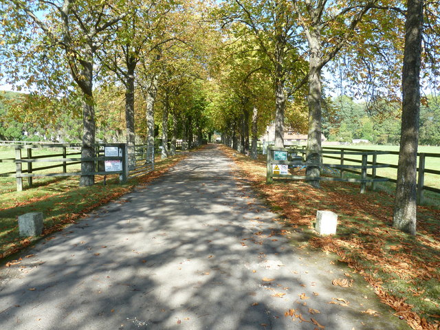
Buck Wood, Sussex is a picturesque woodland located in the county of Sussex, England. Spread across a vast area, this woodland is known for its natural beauty and serene atmosphere. It is situated near the village of Buckhurst Hill, making it easily accessible for visitors and locals alike.

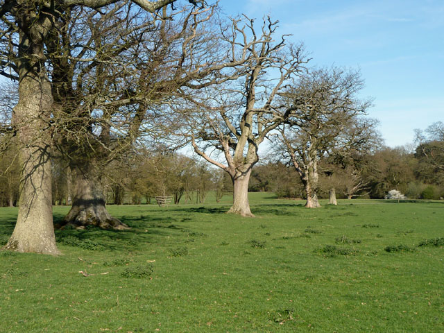
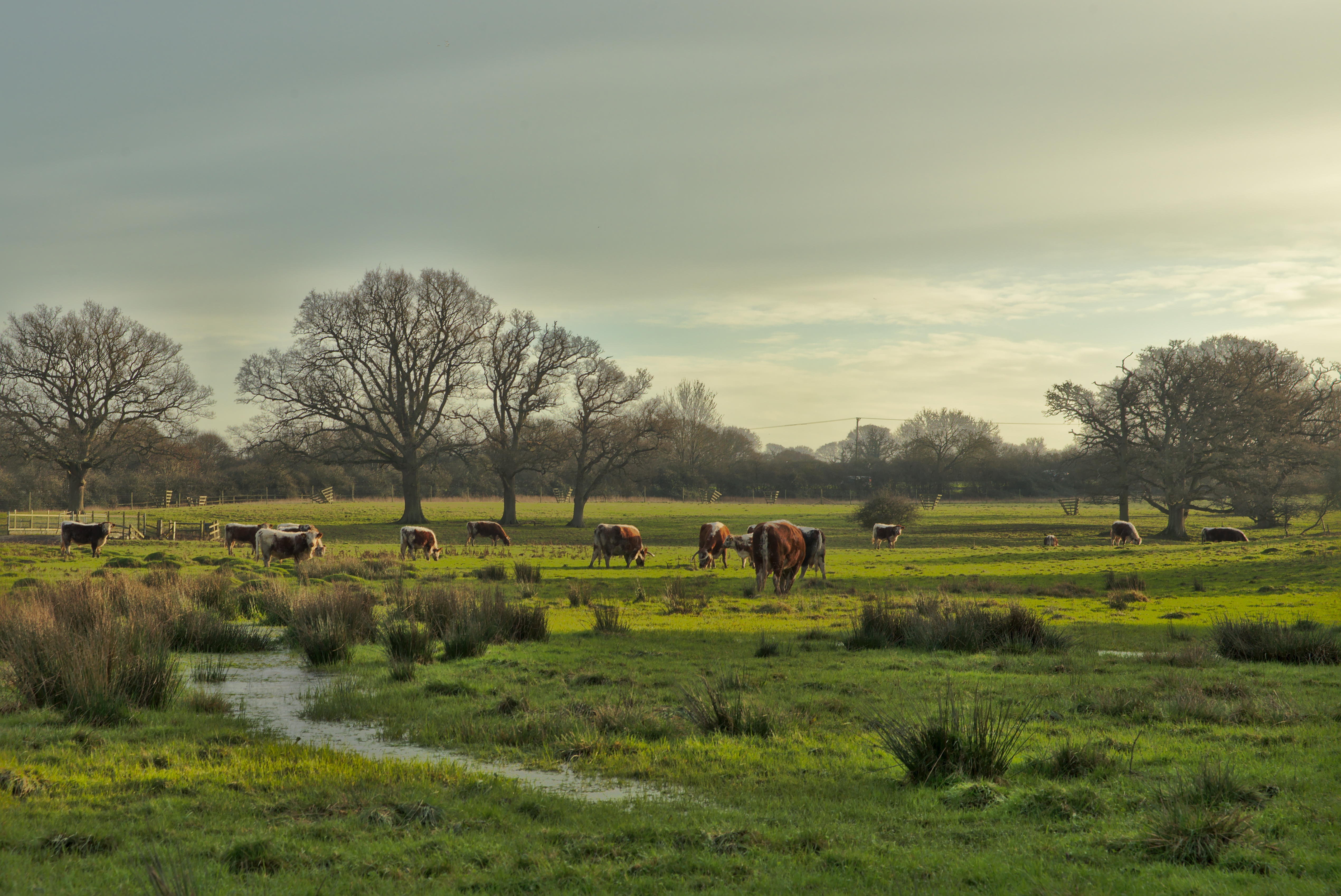
Buck Wood is primarily characterized by its dense forest cover, consisting of a wide variety of trees such as oak, beech, and birch. These trees create a lush green canopy, providing shade and shelter for numerous species of wildlife. The wood is home to an array of animals including deer, squirrels, rabbits, and various bird species, making it a haven for nature enthusiasts and wildlife photographers.

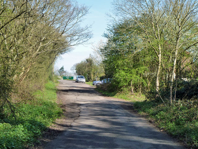
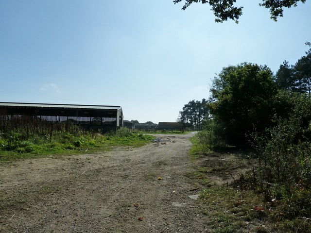
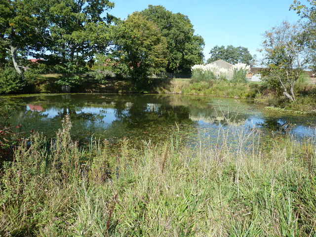
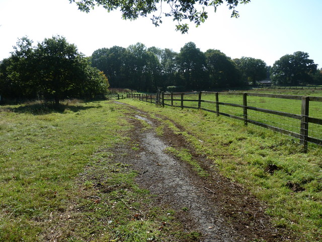
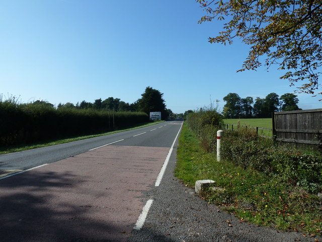
There are several well-marked trails and footpaths that wind through Buck Wood, allowing visitors to explore the area at their own pace. These paths lead to hidden clearings, tranquil ponds, and babbling brooks, enhancing the overall charm of the woodland. The scenic beauty of Buck Wood is especially enchanting during spring when the forest floor is carpeted with vibrant wildflowers.

The woodland has a rich history dating back centuries, with remnants of ancient settlements and archaeological sites scattered throughout. It is believed that Buck Wood was once used for hunting by the nobility due to its abundance of wildlife. Today, it is a protected area and managed by local authorities to ensure its preservation and conservation.

Overall, Buck Wood, Sussex is a captivating natural haven that offers a peaceful retreat from the hustle and bustle of everyday life. Its diverse flora and fauna, coupled with its tranquil ambience, make it a popular destination for nature lovers and those seeking a quiet escape in the heart of Sussex.

If you have any feedback on the listing, please let us know in the comments section below.

Buck Wood Images

Images are sourced within 2km of 50.995347/-0.33848446 or Grid Reference TQ1623. Thanks to Geograph Open Source API. All images are credited.

McDonald's restaurant, A24 near West Grinstead
A24 near West Grinstead
Worthing Road - old course A small loop off the A24 dual carriageway serving a few houses. This was the original course of the road, but the width may have been reduced, as the road is mapped coming this way when it was already classified as an A road.
Worthing Road - old course
A small loop off the A24 dual carriageway serving a few houses. This was the original course of the road, but the width may have been reduced, as the road is mapped coming this way when it was already classified as an A road.
Scollier's Bridge This carries the B2135 over the stream that used to feed the Baybridge Canal basin and top pound. The arch looks big enough to take a boat, but it was never navigated this far up and there is little depth of water under the bridge.
Scollier's Bridge
This carries the B2135 over the stream that used to feed the Baybridge Canal basin and top pound. The arch looks big enough to take a boat, but it was never navigated this far up and there is little depth of water under the bridge.
Knepp Castle The hub of a well kept estate.
Knepp Castle
The hub of a well kept estate.
Row of oaks, Knepp Castle parkland A public footpath runs along the row. In front of the blooming blackthorn on the right is a fingerpost directing walkers along the castle approach drive.
Row of oaks, Knepp Castle parkland
A public footpath runs along the row. In front of the blooming blackthorn on the right is a fingerpost directing walkers along the castle approach drive.
Level crossing gate at West Grinstead One of the few railway artefacts by the car park at the former West Grinstead station.
Level crossing gate at West Grinstead
One of the few railway artefacts by the car park at the former West Grinstead station.
Track and platform on the former Shoreham to Horsham line Most of the track now forms part of the Downs Link path which was opened in 1984.
Track and platform on the former Shoreham to Horsham line
Most of the track now forms part of the Downs Link path which was opened in 1984.
Railway by the Downs Link path at West Grinstead There is information about the dismantled line and the Downs Link path.
Railway by the Downs Link path at West Grinstead
There is information about the dismantled line and the Downs Link path.
Shaggy Ink Caps at the footpath and bridleway junction in Freeman's Wood
Bridleway in Freeman's Wood
Mixed woodland trees on the edge of Freeman's Wood
Farm bridge on footpath 1819 The stream below is one of the main tributaries of the western arm of the River Adur.
Farm bridge on footpath 1819
The stream below is one of the main tributaries of the western arm of the River Adur.
Out buildings at Newhouse Farm
Pond at Newhouse Farm
Footpath 1793 to Model Farm
Driveway to Model Farm Although I couldn't see a name, the name on the WSCC map is Model Farm.
Driveway to Model Farm
Although I couldn't see a name, the name on the WSCC map is Model Farm.
View west on the A272 towards Buckbarn Crossroads
Show me another place!

Buck Wood is located at Grid Ref: TQ1623 (Lat: 50.995347, Lng: -0.33848446)

Administrative County: West Sussex

District: Horsham

Police Authority: Sussex

What 3 Words

///galleries.reduction.upwards. Near Southwater, West Sussex

Nearby Locations

Buck Wood Coate's Wood

Related Wikis

West Grinstead railway station

West Grinstead was a railway station on the Steyning Line which served the village of West Grinstead. It had a goods yard with a cattle loading bay and...

Copsale

Copsale is a hamlet in the civil parish of Nuthurst, and the Horsham District of West Sussex, England. It lies on the Southwater to Maplehurst road 3.5...

Shrine of Our Lady of Consolation

The Shrine of Our Lady of Consolation or Church of Our Lady of Consolation and Saint Francis is a Roman Catholic parish church in West Grinstead, in West...
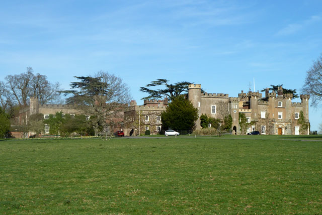
Knepp Castle

The medieval Knepp Castle (sometimes referred to as 'Old Knepp Castle', to distinguish it from the nearby 19th-century mansion) is to the west of the village...

Knepp Wildland

Knepp Wildland is the first major lowland rewilding project in England. It comprises 1,400 hectares (3,500 acres; 5.4 square miles) of former arable and...

West Grinstead

West Grinstead is a village and civil parish in the Horsham District of West Sussex, England. It lies just off the B2135 road four miles (6.3 km) northwest...

Dragon's Green

Dragon's Green is a hamlet in the civil parish of Shipley, and the Horsham district of West Sussex, England. The hamlet is 5 miles (8 km) south from the...

St George's Church, West Grinstead

St George's Church is an Anglican church in West Grinstead, West Sussex, England. It is in the Diocese of Chichester, occupying a rural position in the...

Nearby Amenities

Located within 500m of 50.995347,-0.33848446
Fast Food
McDonald's
Addr City: Horsham
Addr Postcode: RH13 8LW
Addr Street: Worthing Road
Addr Suburb: West Grinstead
Brand: McDonald's
Brand Wikidata: Q38076
Brand Wikipedia: en:McDonald's
Check Date: 2023-07-05
Contact Website: https://www.mcdonalds.com/gb/en-gb/location/horsham/buck-barn-a24--a272/buck-barn-worthing-road/8261269.html
Cuisine: burger
Drive Through: yes
Takeaway: yes
Lat/Long: 50.9917949/-0.3412943
Bus Stop
Buckbarn Crossroads
Bench: yes
Bus: yes
Naptan AtcoCode: 4400HR0306
Naptan Bearing: N
Naptan CommonName: Buckbarn Crossroads
Naptan Indicator: opp Model Farm
Naptan Landmark: A272
Naptan NaptanCode: wsxawatg
Naptan Street: A24
Naptan Verified: no
Public Transport: platform
Shelter: yes
Source: naptan_import
Wheelchair: no
Lat/Long: 50.9929991/-0.3405247
Bus Stop
Copsale Turn
Bus: yes
Naptan AtcoCode: 4400HR0307
Naptan Bearing: S
Naptan CommonName: Copsale Turn
Naptan Indicator: opp
Naptan Landmark: Bar Lane
Naptan NaptanCode: wsxawatj
Naptan Street: Worthing Road
Naptan Verified: no
Public Transport: platform
Source: naptan_import
Lat/Long: 50.9984651/-0.3376248
Bus Stop
Copsale Turn
Bus: yes
Naptan AtcoCode: 4400HR0308
Naptan Bearing: N
Naptan CommonName: Copsale Turn
Naptan Indicator: opp Cosale turn off
Naptan Landmark: The Bar
Naptan NaptanCode: wsxawatm
Naptan Street: A24
Naptan Verified: no
Public Transport: platform
Source: naptan_import
Lat/Long: 50.999229/-0.3397181
Bus Stop
Buckbarn Crossroads
Bus: yes
Naptan AtcoCode: 4400HR0309
Naptan Bearing: S
Naptan CommonName: Buckbarn Crossroads
Naptan Indicator: o/s The Sussex Stud
Naptan Landmark: A24
Naptan NaptanCode: wsxawatp
Naptan Street: Buckbarn crossroads
Naptan Verified: no
Public Transport: platform
Source: naptan_import
Wheelchair: limited
Lat/Long: 50.9913666/-0.3405048
Toilets
Service Station
Lat/Long: 50.9916909/-0.3413737
Give Way
Direction: forward
Lat/Long: 50.9923859/-0.3406483
Give Way
Direction: forward
Lat/Long: 50.9916923/-0.3404447
Post Box
Brand: Royal Mail
Brand Wikidata: Q638098
Last Checked: 2022-05-28
Operator: Royal Mail
Operator Wikidata: Q638098
Post Box Type: lamp
Ref: RH13 154D
Royal Cypher: EIIR
Royal Cypher Wikidata: Q33102113
Source: survey
Lat/Long: 50.9922743/-0.3412802
Atm
Cash Zone
Brand: Cashzone
Brand Wikidata: Q110738461
Currency GBP: yes
Drive Through: no
Network: Allpoint
Network Wikidata: Q4733264
Lat/Long: 50.9916552/-0.3413753
Co-op Food
Addr City: Horsham
Addr Country: GB
Addr Postcode: RH13 8LW
Addr Street: Worthing Road
Addr Suburb: West Grinstead
Brand: Co-op Food
Brand Wikidata: Q3277439
Check Date: 2023-07-05
Fhrs Id: 185892
Opening Hours: 24/7
Operator: The Co-operative Group
Operator Wikidata: Q117202
Shop: convenience
Website: https://www.coop.co.uk/store-finder/RH13-8LW/worthing-road
Lat/Long: 50.9916608/-0.3411706
Traffic Signals
Traffic Signals: signal
Traffic Signals Direction: forward
Lat/Long: 50.9917978/-0.3406187
Traffic Signals
Traffic Signals: signal
Traffic Signals Direction: forward
Lat/Long: 50.992353/-0.3404432
Traffic Signals
Traffic Signals: signal
Traffic Signals Direction: forward
Lat/Long: 50.992182/-0.3406209
Give Way
Direction: forward
Lat/Long: 50.9922261/-0.3407841
Give Way
Direction: forward
Lat/Long: 50.9919445/-0.3402323
Traffic Signals
Traffic Signals: signal
Traffic Signals Direction: forward
Lat/Long: 50.9922793/-0.3408002
Traffic Signals
Traffic Signals: signal
Traffic Signals Direction: forward
Lat/Long: 50.9923434/-0.3403619
Traffic Signals
Traffic Signals: signal
Traffic Signals Direction: forward
Lat/Long: 50.9919916/-0.3404441
Traffic Signals
Traffic Signals: signal
Traffic Signals Direction: backward
Lat/Long: 50.9918947/-0.3403384
Traffic Signals
Traffic Signals: signal
Traffic Signals Direction: forward
Lat/Long: 50.9918087/-0.3407143
Partridge Motor Cars
Shop: car_repair
Lat/Long: 50.9926264/-0.3381107
Noexit: yes
Lat/Long: 50.9924304/-0.3425054
Barrier: kissing_gate
Lat/Long: 50.9944133/-0.3319685
The Bar
Place: hamlet
Lat/Long: 50.9988015/-0.3378651
New House Farm
Place: farm
Lat/Long: 50.9958974/-0.3327881
Model Farm
Place: farm
Lat/Long: 50.9928038/-0.3375412
Traffic Signals
Traffic Signals: junction
Traffic Signals Direction: forward
Lat/Long: 50.9922847/-0.3415867
Post Box
Collection Times: Mo-Fr 16:00; Sa 09:30
Operator: Royal Mail
Operator Wikidata: Q638098
Post Box Mounting: pier
Post Box Type: lamp
Ref: RH13 41
Royal Cypher: EIIR
Royal Cypher Wikidata: Q33102113
Lat/Long: 50.9987525/-0.337326
Traffic Signals
Traffic Signals: signal
Traffic Signals Direction: forward
Lat/Long: 50.9923364/-0.3402929
Traffic Signals
Traffic Signals: signal
Traffic Signals Direction: forward
Lat/Long: 50.9918139/-0.3407934
Traffic Signals
Traffic Signals: junction
Traffic Signals Direction: backward
Lat/Long: 50.9923553/-0.3413992
Traffic Signals
Traffic Signals: junction
Traffic Signals Direction: forward
Lat/Long: 50.9923965/-0.3417056
The data included in this document is from www.openstreetmap.org. The data is made available under ODbL.

Have you been to Buck Wood?

Leave your review of Buck Wood below (or comments, questions and feedback).