Furze Field

Wood, Forest in Sussex Horsham

England

Furze Field

Old Milepost by A24, Durfold, a mile North of Warnham The Milepost is located by fence at back of verge on the East of the road.  Parish of Warnham (Horsham District). Cast iron post, Horsham post design, erected by the Horsham & Dorking turnpike trust in the 19th Century. 

Inscription reads:-  
25 MILES / TO / BRIGHTON / 3½ / TO / HORSHAM : : 33 MILES / TO / LONDON / 10 / MILES TO / DORKING : : WARNHAM

Milestone Society National ID: SX_LA33
Old Milepost by A24, Durfold, a mile North of Warnham Credit: Andrew Knorpel

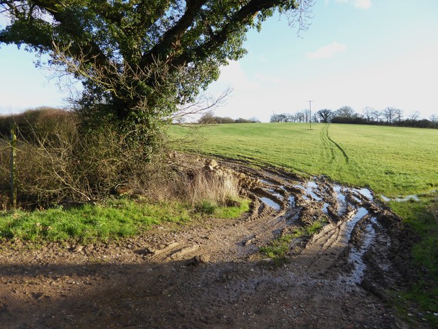
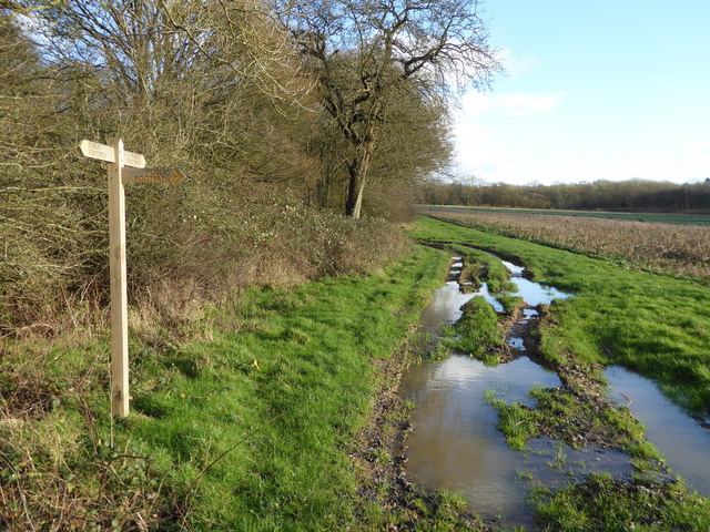
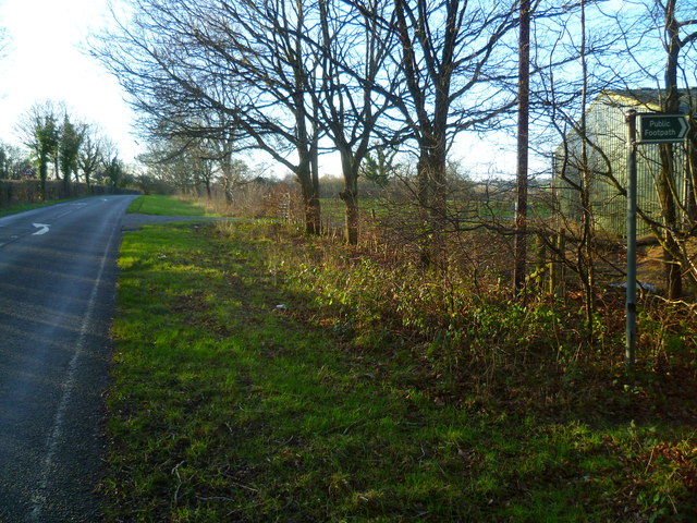
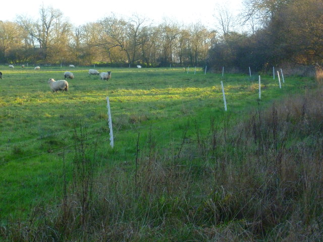
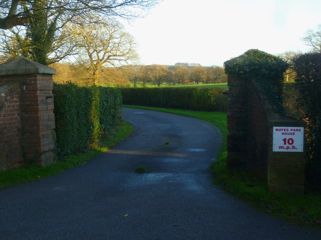
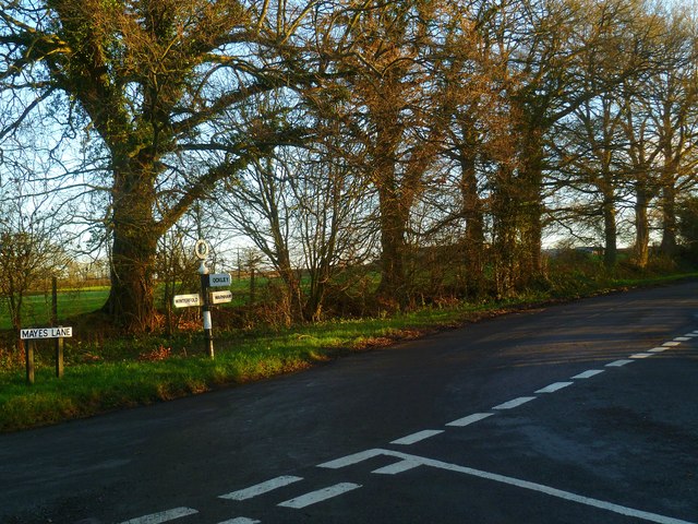
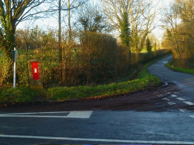
Furze Field, located in Sussex, England, is a picturesque woodland area known for its abundant furze or gorse plants. Spanning over a vast expanse, it is often referred to as a forest due to its dense vegetation and tall trees. The field is situated in a rural setting, surrounded by rolling hills and meadows, providing a tranquil escape from the hustle and bustle of city life.

The prominent feature of Furze Field is undoubtedly the presence of furze plants, also known as gorse. These evergreen shrubs dominate the landscape, with their vibrant yellow flowers adding a splash of color to the surroundings. The furze plants also serve as a habitat for various bird species, making the area a popular destination for birdwatchers.

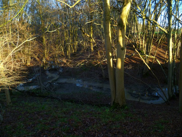
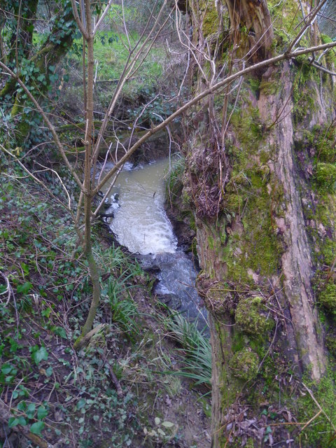
The woodland itself is a haven for nature enthusiasts, offering a diverse range of flora and fauna. From ancient oak trees to delicate wildflowers, there is an abundance of plant life to explore and admire. The forest floor is covered in a thick carpet of ferns and mosses, creating a magical ambiance as sunlight filters through the canopy above.

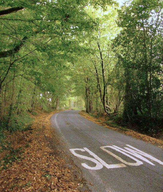
Tranquil walking trails wind their way through Furze Field, allowing visitors to explore the area at their own pace. These paths offer breathtaking views of the surrounding countryside and provide opportunities to spot wildlife such as deer, rabbits, and squirrels.

Furze Field is a cherished natural gem in Sussex, offering a serene and enchanting escape for those seeking solace in nature's embrace.

If you have any feedback on the listing, please let us know in the comments section below.

Furze Field Images

Images are sourced within 2km of 51.109869/-0.33759535 or Grid Reference TQ1635. Thanks to Geograph Open Source API. All images are credited.

Old Milepost by A24, Durfold, a mile North of Warnham The Milepost is located by fence at back of verge on the East of the road.  Parish of Warnham (Horsham District). Cast iron post, Horsham post design, erected by the Horsham & Dorking turnpike trust in the 19th Century. 

Inscription reads:-  
25 MILES / TO / BRIGHTON / 3½ / TO / HORSHAM : : 33 MILES / TO / LONDON / 10 / MILES TO / DORKING : : WARNHAM

Milestone Society National ID: SX_LA33
Old Milepost by A24, Durfold, a mile North of Warnham
The Milepost is located by fence at back of verge on the East of the road.  Parish of Warnham (Horsham District). Cast iron post, Horsham post design, erected by the Horsham & Dorking turnpike trust in the 19th Century.  Inscription reads:- 25 MILES / TO / BRIGHTON / 3½ / TO / HORSHAM : : 33 MILES / TO / LONDON / 10 / MILES TO / DORKING : : WARNHAM Milestone Society National ID: SX_LA33
Marches Farmhouse, Marches Road The date 1877 appears as a pattern of blue brickwork (so called 'diapering') between the middle and left-hand ground-floor windows.  No longer a working farm.
Marches Farmhouse, Marches Road
The date 1877 appears as a pattern of blue brickwork (so called 'diapering') between the middle and left-hand ground-floor windows. No longer a working farm.
Mayes Lane near Joanlands Farm Dave Spicer was here before me, but at a less colourful, leafless time of year : <a href="https://www.geograph.org.uk/photo/2845209">TQ1535 : Mayes Lane south to Warnham</a>
Mayes Lane near Joanlands Farm
Dave Spicer was here before me, but at a less colourful, leafless time of year : TQ1535 : Mayes Lane south to Warnham
Weatherpig at Denne Farm
Footpath across field at Denne Farm The path on the ground does not quite agree with the OS map.
Footpath across field at Denne Farm
The path on the ground does not quite agree with the OS map.
Footpath junction at Woodbarn
Woodbarn seen from footpath This building has been restored since <a title="https://www.geograph.org.uk/photo/536917" href="https://www.geograph.org.uk/photo/536917">Link</a>.
Woodbarn seen from footpath
This building has been restored since Link.
Stonefarm Gill and tributary
Looking west along Marches Road at footpath junction
Field edge path at Winterfold
Entrance to Mayes Park House
Road junction at Pound Corner For another view see <a title="https://www.geograph.org.uk/photo/1852989" href="https://www.geograph.org.uk/photo/1852989">Link</a>.
Road junction at Pound Corner
For another view see Link.
Junction at Pound Corner with pillar box For a better view of the post box see <a title="https://www.geograph.org.uk/photo/1853267" href="https://www.geograph.org.uk/photo/1853267">Link</a>.
Junction at Pound Corner with pillar box
For a better view of the post box see Link.
Looking north on the east bank of North River to tributary The tributary from the east is Tickfold Gill and here the river and the gill define the boundary between West Sussex and Surrey.  The camera is in West Sussex.
Looking north on the east bank of North River to tributary
The tributary from the east is Tickfold Gill and here the river and the gill define the boundary between West Sussex and Surrey. The camera is in West Sussex.
Waterfall in Tickfold Gill Here the gill defines the boundary between Surrey and West Sussex.  The camera is in West Sussex.  The gill is about to join North River.
Waterfall in Tickfold Gill
Here the gill defines the boundary between Surrey and West Sussex. The camera is in West Sussex. The gill is about to join North River.
Derelict farm bridge across Tickfold Gill At least I hope it's not used any longer!
Derelict farm bridge across Tickfold Gill
At least I hope it's not used any longer!
Waterfall on Tickfold Gill seen from the top For a view the other way see <a href="https://www.geograph.org.uk/photo/4824050">TQ1537 : Waterfall in Tickfold Gill</a>.
Waterfall on Tickfold Gill seen from the top
For a view the other way see TQ1537 : Waterfall in Tickfold Gill.
Looking across stile near pond on Smugglers Lane This is in Surrey.
Looking across stile near pond on Smugglers Lane
This is in Surrey.
Show me another place!

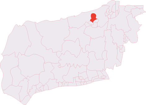
Furze Field is located at Grid Ref: TQ1635 (Lat: 51.109869, Lng: -0.33759535)

Administrative County: West Sussex

District: Horsham

Police Authority: Sussex

What 3 Words

///facing.that.autumn. Near Warnham, West Sussex

Related Wikis

Warnham SSSI

Warnham SSSI is a 28.5-hectare (70-acre) geological Site of Special Scientific Interest north of Horsham in West Sussex. It is a Geological Conservation...

Warnham & Rusper (electoral division)

Warnham & Rusper is an electoral division of West Sussex in the United Kingdom and returns one member to sit on West Sussex County Council. The current...

Shiremark Mill, Capel

Shiremark Mill, also known as Kingsfold Mill or Capel Mill was a listed Smock mill at Capel, Surrey, England, which was burnt down in 1972. == History... ==

Warnham railway station

Warnham railway station serves the village of Warnham in West Sussex, England. It is 33 miles 46 chains (54.0 km) measured from London Waterloo (although...

Warnham

Warnham is a village and civil parish in the Horsham district of West Sussex, England. The village is centred 2 miles (3.2 km) north-northwest of Horsham...

Graylands

Graylands is a hamlet in the Horsham district of West Sussex, England. The largely rural hamlet is located north of Holbrook beyond the A264. It is bordered...

Old Holbrook

Old Holbrook (formerly known as Northlands) is a hamlet in the Horsham district of West Sussex, England. This rural hamlet is located north of the Horsham...

Holbrook (electoral division)

Holbrook is an electoral division of West Sussex in the United Kingdom and returns one member to sit on West Sussex County Council. The current County...

Nearby Amenities

Located within 500m of 51.109869,-0.33759535
Pub
Dog & Duck
Addr City: Kingsfold
Addr Country: GB
Addr Postcode: RH12 3SA
Addr Street: Dorking Road
Brand: Hall & Woodhouse
Brand Wikidata: Q5642555
Brand Wikipedia: en:Hall & Woodhouse
Fhrs Id: 193986
Source Addr: FHRS Open Data
Lat/Long: 51.1060623/-0.3342239
Bus Stop
Dog & Duck
Bus: yes
Naptan AtcoCode: 4400HR0035
Naptan Bearing: NE
Naptan CommonName: Dog & Duck
Naptan Indicator: adj The Dog & Duck P.H.
Naptan Landmark: Dog and Duck
Naptan NaptanCode: wsxatgjg
Naptan Street: Dorking Road
Naptan Verified: no
Public Transport: platform
Lat/Long: 51.1062211/-0.3339961
Dog & Duck
Bus: yes
Public Transport: stop_position
Lat/Long: 51.1062056/-0.3339028
Trueloves Farm
Place: farm
Lat/Long: 51.1133432/-0.3398069
Upper Chickens
Place: farm
Lat/Long: 51.1082324/-0.3340562
Bearsden Pet Supplies
Shop: pet
Lat/Long: 51.1081241/-0.3334283
The Vale Stud
Place: farm
Lat/Long: 51.1073095/-0.3342908
Wood Farm
Place: farm
Lat/Long: 51.1083839/-0.3321182
Power: pole
Lat/Long: 51.1065879/-0.3421373
Power: pole
Lat/Long: 51.1075674/-0.3406755
Power: pole
Lat/Long: 51.1084852/-0.3401793
Power: pole
Lat/Long: 51.108561/-0.3372825
Power: pole
Lat/Long: 51.1086126/-0.3351591
Power: pole
Lat/Long: 51.1073341/-0.3327619
The data included in this document is from www.openstreetmap.org. The data is made available under ODbL.

Have you been to Furze Field?

Leave your review of Furze Field below (or comments, questions and feedback).