Cox's Shaw

Wood, Forest in Sussex Horsham

England

Cox's Shaw

Bridleway past Pear Tree Farm The bridleway is up to 15 metres wide between long-established hedge banks and ditches, and must be ancient in origin, probably an old cart road. Pear Tree Farm, on the south side of the track, is quite recent, but Maltmayes, at the eastern end, is C14 in origin, and the track surely is much older still. Fortunately, this western end is no longer used by vehicles, perhaps because the junction with the Bognor Road (A29) is less than satisfactory (and distinctly hazardous if approaching from the opposite direction).
Bridleway past Pear Tree Farm Credit: Hugh Craddock

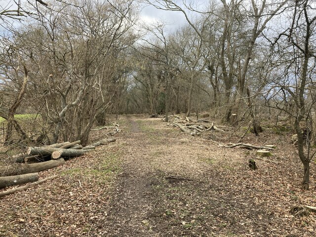
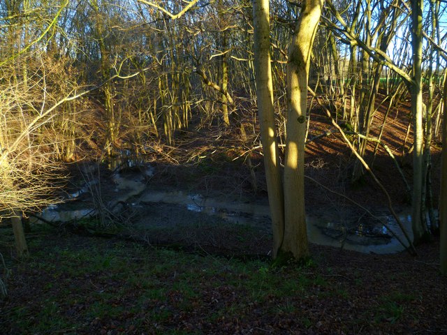
Cox's Shaw, located in Sussex, England, is a picturesque woodland area that showcases the region's natural beauty and rich biodiversity. This enchanting forest is known for its dense canopy of trees, which creates a serene and tranquil atmosphere for visitors to explore and appreciate. The wood is primarily composed of a variety of native tree species, including oak, beech, and birch, which contribute to the area's vibrant and diverse ecosystem.

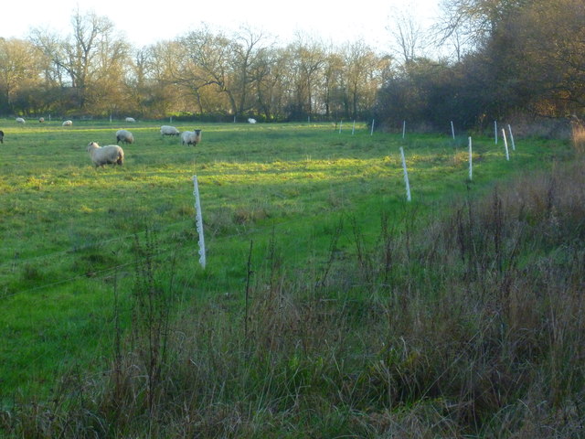
Cox's Shaw offers visitors an opportunity to immerse themselves in nature and enjoy a wide range of outdoor activities. Walking trails wind their way through the forest, allowing hikers and nature enthusiasts to discover hidden treasures and observe the local wildlife that call this area home. Birdwatching is particularly popular here, as the woodland provides a sanctuary for numerous bird species, including woodpeckers and various songbirds.

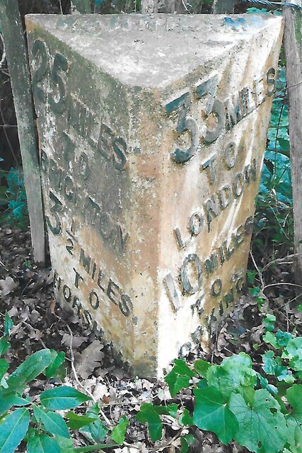
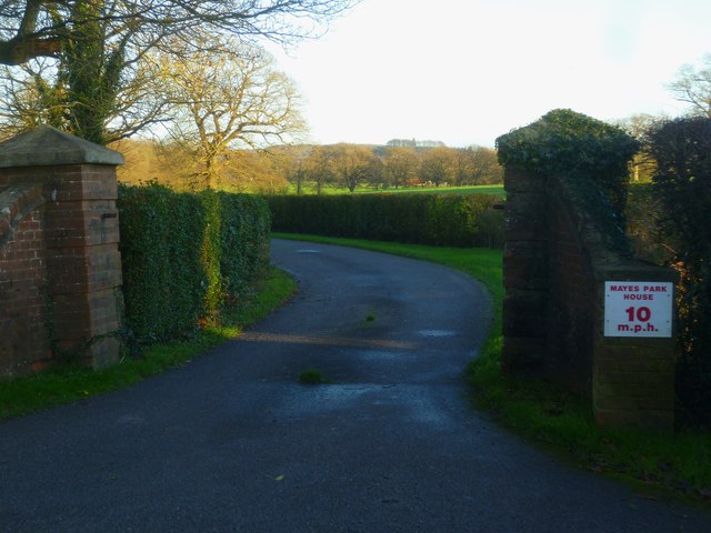
In addition to its natural beauty, Cox's Shaw also holds historical significance. It is believed to have been part of a larger medieval hunting forest, and remnants of this past can still be seen, such as ancient boundary markers and the occasional deer sighting.

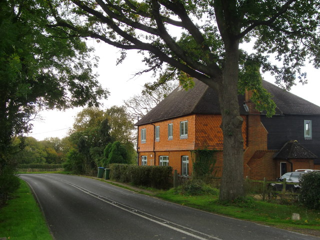
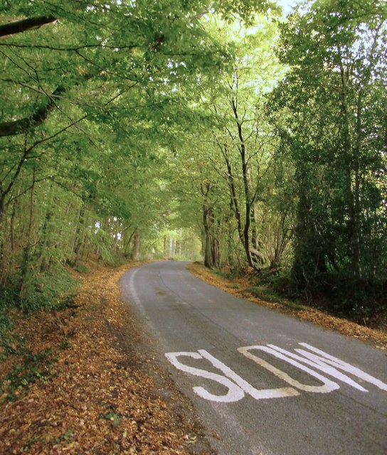
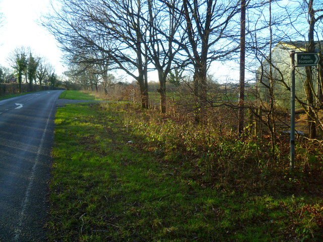
Cox's Shaw is easily accessible, with well-maintained paths and ample parking available for visitors. The wood is open year-round, providing a delightful experience no matter the season. Whether one seeks a peaceful stroll, a family picnic, or simply a chance to connect with nature, Cox's Shaw in Sussex is a must-visit destination for anyone looking to escape the hustle and bustle of everyday life.

If you have any feedback on the listing, please let us know in the comments section below.
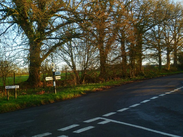
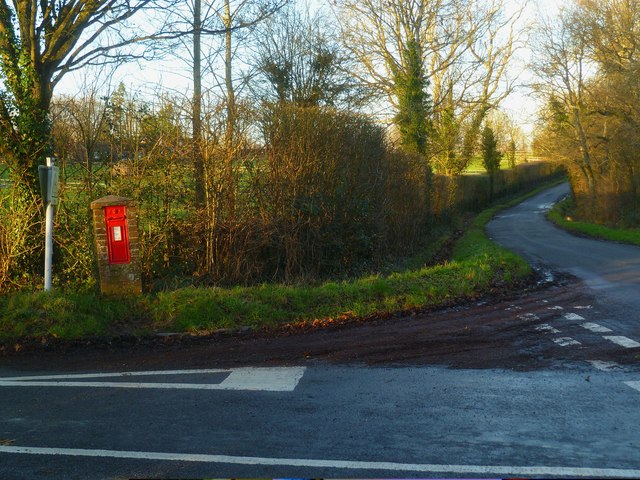
Cox's Shaw Images

Images are sourced within 2km of 51.106919/-0.34074386 or Grid Reference TQ1635. Thanks to Geograph Open Source API. All images are credited.

Bridleway past Pear Tree Farm The bridleway is up to 15 metres wide between long-established hedge banks and ditches, and must be ancient in origin, probably an old cart road. Pear Tree Farm, on the south side of the track, is quite recent, but Maltmayes, at the eastern end, is C14 in origin, and the track surely is much older still. Fortunately, this western end is no longer used by vehicles, perhaps because the junction with the Bognor Road (A29) is less than satisfactory (and distinctly hazardous if approaching from the opposite direction).
Bridleway past Pear Tree Farm
The bridleway is up to 15 metres wide between long-established hedge banks and ditches, and must be ancient in origin, probably an old cart road. Pear Tree Farm, on the south side of the track, is quite recent, but Maltmayes, at the eastern end, is C14 in origin, and the track surely is much older still. Fortunately, this western end is no longer used by vehicles, perhaps because the junction with the Bognor Road (A29) is less than satisfactory (and distinctly hazardous if approaching from the opposite direction).
New bridleway off Bell Lane The footpath leading south-east off Bell Lane to the old Dorking Road (now sequestered by the A24 dual carriageway) has recently been upgraded to bridleway, no. 3647_1.
New bridleway off Bell Lane
The footpath leading south-east off Bell Lane to the old Dorking Road (now sequestered by the A24 dual carriageway) has recently been upgraded to bridleway, no. 3647_1.
Old Milepost by A24, Durfold, a mile North of Warnham The Milepost is located by fence at back of verge on the East of the road.  Parish of Warnham (Horsham District). Cast iron post, Horsham post design, erected by the Horsham & Dorking turnpike trust in the 19th Century. 

Inscription reads:-  
25 MILES / TO / BRIGHTON / 3½ / TO / HORSHAM : : 33 MILES / TO / LONDON / 10 / MILES TO / DORKING : : WARNHAM

Milestone Society National ID: SX_LA33
Old Milepost by A24, Durfold, a mile North of Warnham
The Milepost is located by fence at back of verge on the East of the road.  Parish of Warnham (Horsham District). Cast iron post, Horsham post design, erected by the Horsham & Dorking turnpike trust in the 19th Century.  Inscription reads:- 25 MILES / TO / BRIGHTON / 3½ / TO / HORSHAM : : 33 MILES / TO / LONDON / 10 / MILES TO / DORKING : : WARNHAM Milestone Society National ID: SX_LA33
School Hill, Warnham School Hill in the village of Warnham, in West Sussex
School Hill, Warnham
School Hill in the village of Warnham, in West Sussex
Former school, by Warnham village green A Victorian school building, overlooking the village green from the east.
Former school, by Warnham village green
A Victorian school building, overlooking the village green from the east.
Marches Farmhouse, Marches Road The date 1877 appears as a pattern of blue brickwork (so called 'diapering') between the middle and left-hand ground-floor windows.  No longer a working farm.
Marches Farmhouse, Marches Road
The date 1877 appears as a pattern of blue brickwork (so called 'diapering') between the middle and left-hand ground-floor windows. No longer a working farm.
Mayes Lane near Joanlands Farm Dave Spicer was here before me, but at a less colourful, leafless time of year : <a href="https://www.geograph.org.uk/photo/2845209">TQ1535 : Mayes Lane south to Warnham</a>
Mayes Lane near Joanlands Farm
Dave Spicer was here before me, but at a less colourful, leafless time of year : TQ1535 : Mayes Lane south to Warnham
Mid-18th century tombstone, Warnham churchyard The name is JOHN AGATE (if I've read it correctly) and the date July 1748.  The jawless skull is pretty typical of the rather heartless imagery to be found on 18th century tombstones.
Mid-18th century tombstone, Warnham churchyard
The name is JOHN AGATE (if I've read it correctly) and the date July 1748. The jawless skull is pretty typical of the rather heartless imagery to be found on 18th century tombstones.
Weatherpig at Denne Farm
Footpath across field at Denne Farm The path on the ground does not quite agree with the OS map.
Footpath across field at Denne Farm
The path on the ground does not quite agree with the OS map.
Footpath junction at Woodbarn
Woodbarn seen from footpath This building has been restored since <a title="https://www.geograph.org.uk/photo/536917" href="https://www.geograph.org.uk/photo/536917">Link</a>.
Woodbarn seen from footpath
This building has been restored since Link.
Stonefarm Gill and tributary
Looking west along Marches Road at footpath junction
Field edge path at Winterfold
Entrance to Mayes Park House
Road junction at Pound Corner For another view see <a title="https://www.geograph.org.uk/photo/1852989" href="https://www.geograph.org.uk/photo/1852989">Link</a>.
Road junction at Pound Corner
For another view see Link.
Junction at Pound Corner with pillar box For a better view of the post box see <a title="https://www.geograph.org.uk/photo/1853267" href="https://www.geograph.org.uk/photo/1853267">Link</a>.
Junction at Pound Corner with pillar box
For a better view of the post box see Link.
Show me another place!

Cox's Shaw is located at Grid Ref: TQ1635 (Lat: 51.106919, Lng: -0.34074386)

Administrative County: West Sussex

District: Horsham

Police Authority: Sussex

What 3 Words

///rally.marketing.agents. Near Warnham, West Sussex

Related Wikis

Warnham & Rusper (electoral division)

Warnham & Rusper is an electoral division of West Sussex in the United Kingdom and returns one member to sit on West Sussex County Council. The current...

Warnham SSSI

Warnham SSSI is a 28.5-hectare (70-acre) geological Site of Special Scientific Interest north of Horsham in West Sussex. It is a Geological Conservation...

Warnham railway station

Warnham railway station serves the village of Warnham in West Sussex, England. It is 33 miles 46 chains (54.0 km) measured from London Waterloo (although...

Warnham

Warnham is a village and civil parish in the Horsham district of West Sussex, England. The village is centred 2 miles (3.2 km) north-northwest of Horsham...

Graylands

Graylands is a hamlet in the Horsham district of West Sussex, England. The largely rural hamlet is located north of Holbrook beyond the A264. It is bordered...

Old Holbrook

Old Holbrook (formerly known as Northlands) is a hamlet in the Horsham district of West Sussex, England. This rural hamlet is located north of the Horsham...

Shiremark Mill, Capel

Shiremark Mill, also known as Kingsfold Mill or Capel Mill was a listed Smock mill at Capel, Surrey, England, which was burnt down in 1972. == History... ==

E. Tredcroft's Ground

E. Tredcroft's Ground was a cricket ground at the Warnham Court estate, located at Horsham, Sussex. The first recorded match on the ground was in 1851...

Nearby Amenities

Located within 500m of 51.106919,-0.34074386
Pub
Dog & Duck
Addr City: Kingsfold
Addr Country: GB
Addr Postcode: RH12 3SA
Addr Street: Dorking Road
Brand: Hall & Woodhouse
Brand Wikidata: Q5642555
Brand Wikipedia: en:Hall & Woodhouse
Fhrs Id: 193986
Source Addr: FHRS Open Data
Lat/Long: 51.1060623/-0.3342239
Post Box
Operator: Royal Mail
Ref: RH12 117
Lat/Long: 51.1039503/-0.3366364
Bus Stop
Dog & Duck
Bus: yes
Naptan AtcoCode: 4400HR0034
Naptan Bearing: SW
Naptan CommonName: Dog & Duck
Naptan Indicator: opp. The Dog & Duck P.H.
Naptan Landmark: Dog and Duck
Naptan NaptanCode: wsxatgjd
Naptan Street: Dorking Road
Naptan Verified: no
Public Transport: platform
Source: naptan_import
Lat/Long: 51.1050627/-0.3349025
Bus Stop
Dog & Duck
Bus: yes
Naptan AtcoCode: 4400HR0035
Naptan Bearing: NE
Naptan CommonName: Dog & Duck
Naptan Indicator: adj The Dog & Duck P.H.
Naptan Landmark: Dog and Duck
Naptan NaptanCode: wsxatgjg
Naptan Street: Dorking Road
Naptan Verified: no
Public Transport: platform
Lat/Long: 51.1062211/-0.3339961
Bus Stop
War Museum
Bus: yes
Naptan AtcoCode: 4400HR0036
Naptan Bearing: N
Naptan CommonName: War Museum
Naptan Indicator: opp Auction House
Naptan Landmark: Tylden House
Naptan NaptanCode: wsxatgjm
Naptan Street: Dorking Road
Naptan Verified: no
Public Transport: platform
Lat/Long: 51.1028892/-0.3376712
Barrier: stile
Lat/Long: 51.1047758/-0.3389489
Dog & Duck
Bus: yes
Public Transport: stop_position
Lat/Long: 51.1050866/-0.334959
Dog & Duck
Bus: yes
Public Transport: stop_position
Lat/Long: 51.1062056/-0.3339028
War Museum
Bus: yes
Public Transport: stop_position
Lat/Long: 51.1028779/-0.337622
Upper Chickens
Place: farm
Lat/Long: 51.1082324/-0.3340562
Durfold
Place: isolated_dwelling
Lat/Long: 51.1052559/-0.3419037
The Vale Stud
Place: farm
Lat/Long: 51.1073095/-0.3342908
Power: pole
Lat/Long: 51.106237/-0.3473631
Power: pole
Lat/Long: 51.1063198/-0.3460243
Power: pole
Lat/Long: 51.1064545/-0.34376
Power: pole
Lat/Long: 51.1065879/-0.3421373
Power: pole
Lat/Long: 51.1075674/-0.3406755
Power: pole
Lat/Long: 51.1084852/-0.3401793
Power: pole
Lat/Long: 51.108561/-0.3372825
Power: pole
Lat/Long: 51.1086126/-0.3351591
The data included in this document is from www.openstreetmap.org. The data is made available under ODbL.

Have you been to Cox's Shaw?

Leave your review of Cox's Shaw below (or comments, questions and feedback).