Greatwood Copse

Wood, Forest in Surrey Mole Valley

England

Greatwood Copse

Looking north on the east bank of North River to tributary The tributary from the east is Tickfold Gill and here the river and the gill define the boundary between West Sussex and Surrey.  The camera is in West Sussex.
Looking north on the east bank of North River to tributary Credit: Shazz

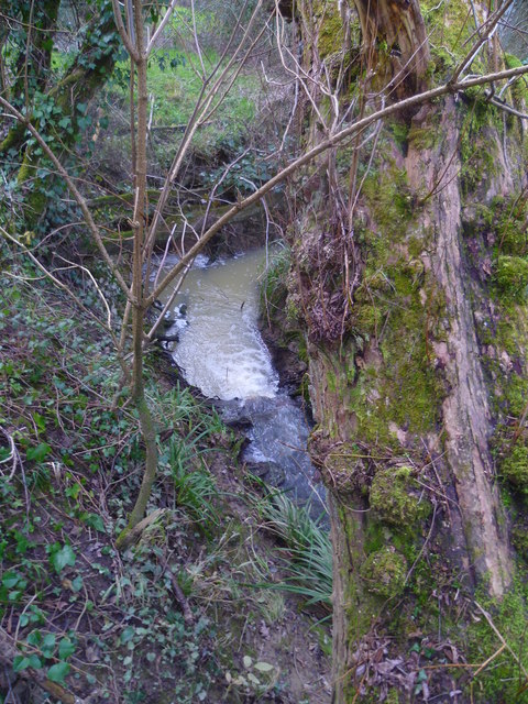
Greatwood Copse is a small but picturesque woodland located in Surrey, England. Covering an area of approximately 20 acres, it is known for its rich biodiversity and tranquil atmosphere. The copse is situated just a few miles outside the town of Guildford, making it easily accessible for both locals and visitors.

This woodland is predominantly made up of native broadleaf trees, including oak, beech, and ash, which create a dense canopy overhead. The forest floor is covered with a variety of plants, such as bluebells, wood anemones, and wild garlic, adding to the natural beauty of the area.

Greatwood Copse is home to a diverse range of wildlife. Numerous bird species can be spotted here, including woodpeckers, tawny owls, and song thrushes. The copse also provides a suitable habitat for small mammals like squirrels, foxes, and hedgehogs.

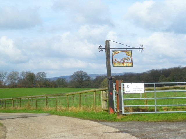
The woodland offers several walking trails, allowing visitors to explore its peaceful surroundings. These trails are well-maintained and provide excellent opportunities for nature enthusiasts and photographers to capture the beauty of the woodland. Additionally, the copse is a popular spot for families to enjoy picnics and spend quality time together in a serene environment.

Greatwood Copse is an important ecological site, providing a haven for wildlife and contributing to the overall biodiversity of the region. Its natural beauty and accessibility make it a beloved destination for locals and tourists alike, seeking a peaceful retreat in the heart of Surrey.

If you have any feedback on the listing, please let us know in the comments section below.

Greatwood Copse Images

Images are sourced within 2km of 51.129171/-0.33846022 or Grid Reference TQ1637. Thanks to Geograph Open Source API. All images are credited.

Looking north on the east bank of North River to tributary The tributary from the east is Tickfold Gill and here the river and the gill define the boundary between West Sussex and Surrey.  The camera is in West Sussex.
Looking north on the east bank of North River to tributary
The tributary from the east is Tickfold Gill and here the river and the gill define the boundary between West Sussex and Surrey. The camera is in West Sussex.
Waterfall in Tickfold Gill Here the gill defines the boundary between Surrey and West Sussex.  The camera is in West Sussex.  The gill is about to join North River.
Waterfall in Tickfold Gill
Here the gill defines the boundary between Surrey and West Sussex. The camera is in West Sussex. The gill is about to join North River.
Derelict farm bridge across Tickfold Gill At least I hope it's not used any longer!
Derelict farm bridge across Tickfold Gill
At least I hope it's not used any longer!
Waterfall on Tickfold Gill seen from the top For a view the other way see <a href="https://www.geograph.org.uk/photo/4824050">TQ1537 : Waterfall in Tickfold Gill</a>.
Waterfall on Tickfold Gill seen from the top
For a view the other way see TQ1537 : Waterfall in Tickfold Gill.
Looking across stile near pond on Smugglers Lane This is in Surrey.
Looking across stile near pond on Smugglers Lane
This is in Surrey.
Footbridge over Letts Gill This is in Surrey.
Footbridge over Letts Gill
This is in Surrey.
Footpath south of Smugglers Lane with obstacle ahead This is in Surrey.
Footpath south of Smugglers Lane with obstacle ahead
This is in Surrey.
Looking north on footpath leading to Smugglers Lane The obstacle seems to have been there for some time judging by the route which gets round it.  See <a href="https://www.geograph.org.uk/photo/4824083">TQ1536 : Footpath south of Smugglers Lane with obstacle ahead</a> for a view the other way.  This is in Surrey.
Looking north on footpath leading to Smugglers Lane
The obstacle seems to have been there for some time judging by the route which gets round it. See TQ1536 : Footpath south of Smugglers Lane with obstacle ahead for a view the other way. This is in Surrey.
Woodland stile
Woodland stile
Public footbridge over Tickfold Gill A view from July 2010 is at <a title="https://www.geograph.org.uk/photo/1972116" href="https://www.geograph.org.uk/photo/1972116">Link</a>.
Public footbridge over Tickfold Gill
A view from July 2010 is at Link.
Oakdale Farm seen from Smugglers Lane A closer view from 2010 is at <a title="https://www.geograph.org.uk/photo/1972108" href="https://www.geograph.org.uk/photo/1972108">Link</a>.
This is in Surrey.
Oakdale Farm seen from Smugglers Lane
A closer view from 2010 is at Link. This is in Surrey.
Junction of Smugglers Lane with Weare Street Smugglers Lane is a public bridleway.  An earlier view from a different angle is at <a title="https://www.geograph.org.uk/photo/4127596" href="https://www.geograph.org.uk/photo/4127596">Link</a>.  This is in Surrey.
Junction of Smugglers Lane with Weare Street
Smugglers Lane is a public bridleway. An earlier view from a different angle is at Link. This is in Surrey.
Cottages on Weare Street A different view is at <a title="https://www.geograph.org.uk/photo/4127470" href="https://www.geograph.org.uk/photo/4127470">Link</a>.
Cottages on Weare Street
A different view is at Link.
Footpath to Wattlehurst Farm from the A24 On the right is a builders' merchant's premises.
Footpath to Wattlehurst Farm from the A24
On the right is a builders' merchant's premises.
Derelict structure by footpath
Sign with a view The skyline is in the Surrey Hills.  The camera is in West Sussex.
Sign with a view
The skyline is in the Surrey Hills. The camera is in West Sussex.
Dorking Road looking northwards north of Kingsfold
Old Barn Cottage on the A24
Show me another place!

Greatwood Copse is located at Grid Ref: TQ1637 (Lat: 51.129171, Lng: -0.33846022)

Administrative County: Surrey

District: Mole Valley

Police Authority: Surrey

What 3 Words

///clouds.wreck.spacing. Near Capel, Surrey

Related Wikis

Shiremark Mill, Capel

Shiremark Mill, also known as Kingsfold Mill or Capel Mill was a listed Smock mill at Capel, Surrey, England, which was burnt down in 1972. == History... ==

Auclaye

Auclaye is a 0.6-hectare (1.5-acre) geological Site of Special Scientific Interest south of Capel in Surrey. It is a Geological Conservation Review site...

Clock House Brickworks

Clock House Brickworks is a 35.9-hectare (89-acre) geological Site of Special Scientific Interest south of Capel in Surrey. It is a Geological Conservation...

Vann Lake and Ockley Woods

Vann Lake and Ockley Woods is a 57.8-hectare (143-acre) biological Site of Special Scientific Interest south of Ockley in Surrey. Vann Lake is part of...

Nearby Amenities

Located within 500m of 51.129171,-0.33846022
Holbrook Farm
Place: farm
Lat/Long: 51.1318742/-0.3433491
Fountain
Lat/Long: 51.1319389/-0.3433517
The data included in this document is from www.openstreetmap.org. The data is made available under ODbL.

Have you been to Greatwood Copse?

Leave your review of Greatwood Copse below (or comments, questions and feedback).