The Magical Wood

Wood, Forest in Hertfordshire St. Albans

England

The Magical Wood

The Green Man, Sandridge
The Green Man, Sandridge Credit: David Howard

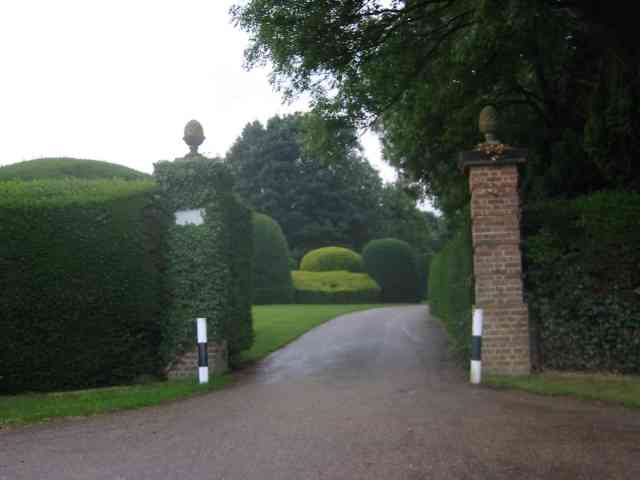
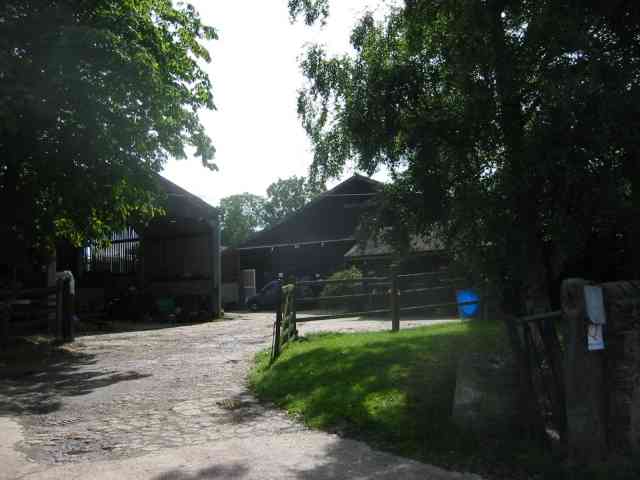
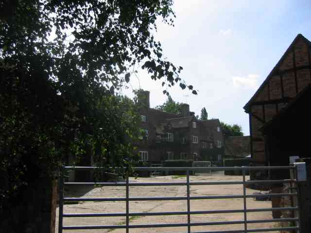
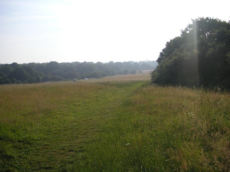
The Magical Wood is a captivating forest located in Hertfordshire, England. Spanning across a vast area, this woodland is renowned for its enchanting beauty and mystical atmosphere. The wood is situated amidst the rolling countryside, creating a serene and peaceful environment for visitors to immerse themselves in.

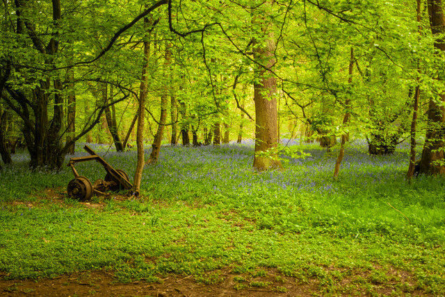
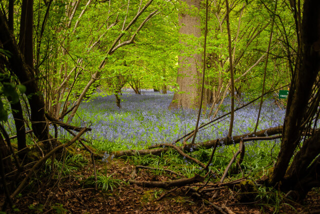
The Magical Wood boasts a rich variety of flora and fauna, making it a haven for nature lovers and wildlife enthusiasts. The dense canopy of ancient oak, beech, and ash trees creates a magical ambiance, with dappled sunlight filtering through the leaves and casting dancing shadows on the forest floor. The wood is also home to an abundance of wildflowers, including bluebells, primroses, and violets, which paint the forest with vibrant colors during the spring months.

As its name suggests, The Magical Wood exudes an otherworldly charm that has captivated the imaginations of locals and visitors alike for centuries. Legends and folklore surround the wood, with tales of fairies, goblins, and woodland spirits. Many believe that the wood possesses an energy that can rejuvenate and heal the soul, making it a popular destination for those seeking solace and tranquility.

Visitors to The Magical Wood can explore its numerous walking trails and discover hidden nooks and crannies, each with its own unique charm. The wood also features a small lake, where visitors can enjoy a picnic or simply sit and admire the breathtaking scenery.

Overall, The Magical Wood in Hertfordshire is a truly enchanting destination that offers a magical and ethereal experience for all who venture into its depths.

If you have any feedback on the listing, please let us know in the comments section below.

The Magical Wood Images

Images are sourced within 2km of 51.78887/-0.31894115 or Grid Reference TL1611. Thanks to Geograph Open Source API. All images are credited.

The Green Man, Sandridge
High Street, Sandridge
Sandridge : Heartwood Forest
Sandridge : Heartwood Forest bluebells
Sandridge : "Green Man" public house
Sandridge : village shop Grade II listed - <span class="nowrap"><a title="https://historicengland.org.uk/listing/the-list/list-entry/1308275?section=official-list-entry" rel="nofollow ugc noopener" href="https://historicengland.org.uk/listing/the-list/list-entry/1308275?section=official-list-entry">Link</a><img style="margin-left:2px;" alt="External link" title="External link - shift click to open in new window" src="https://s1.geograph.org.uk/img/external.png" width="10" height="10"/></span>.
Sandridge : village shop
Grade II listed - LinkExternal link.
Sandridge : "Queens Head" public house Grade II listed - <span class="nowrap"><a title="https://historicengland.org.uk/listing/the-list/list-entry/1102874?section=official-list-entry" rel="nofollow ugc noopener" href="https://historicengland.org.uk/listing/the-list/list-entry/1102874?section=official-list-entry">Link</a><img style="margin-left:2px;" alt="External link" title="External link - shift click to open in new window" src="https://s1.geograph.org.uk/img/external.png" width="10" height="10"/></span>.
Sandridge : "Queens Head" public house
Grade II listed - LinkExternal link.
Sandridge : Queens Head and flag
Sandridge : Church of St Leonard Grade II* listed church : description at this <span class="nowrap"><a title="https://historicengland.org.uk/listing/the-list/list-entry/1308298?section=official-list-entry" rel="nofollow ugc noopener" href="https://historicengland.org.uk/listing/the-list/list-entry/1308298?section=official-list-entry">Link</a><img style="margin-left:2px;" alt="External link" title="External link - shift click to open in new window" src="https://s1.geograph.org.uk/img/external.png" width="10" height="10"/></span>.
Sandridge : Church of St Leonard
Grade II* listed church : description at this LinkExternal link.
Sandridge : lych-gate to Church of St Leonard "Built 1920, dedicated as a war memorial 1921" - <span class="nowrap"><a title="https://historicengland.org.uk/listing/the-list/list-entry/1102872?section=official-list-entry" rel="nofollow ugc noopener" href="https://historicengland.org.uk/listing/the-list/list-entry/1102872?section=official-list-entry">Link</a><img style="margin-left:2px;" alt="External link" title="External link - shift click to open in new window" src="https://s1.geograph.org.uk/img/external.png" width="10" height="10"/></span>.
Sandridge : lych-gate to Church of St Leonard
"Built 1920, dedicated as a war memorial 1921" - LinkExternal link.
St Leonard's church, Sandridge Looking East from TL171106 to St Leonard's church (with a steeple).
St Leonard's church, Sandridge
Looking East from TL171106 to St Leonard's church (with a steeple).
Fairshot Court in Woodcockhill Sandridge The gates were shut and barred but with no fence alongside the gate posts.
Fairshot Court in Woodcockhill Sandridge
The gates were shut and barred but with no fence alongside the gate posts.
Entrance gates, Sandridgebury Entrance gate on the lane leading to Sandridgebury Farm, though not the entrance to the farm.
Entrance gates, Sandridgebury
Entrance gate on the lane leading to Sandridgebury Farm, though not the entrance to the farm.
Cross Farm  Harpenden There seemed to be a fair amount of pony riding activity in the yard. The sun always seems to be wrong hey ho.
Cross Farm Harpenden
There seemed to be a fair amount of pony riding activity in the yard. The sun always seems to be wrong hey ho.
The house at Cross Farm Harpenden This design seems to be Elizabethan
The house at Cross Farm Harpenden
This design seems to be Elizabethan
West End Farm near Ayres End The farm buildings are a motley mix in all states of disrepair. There are builders in the yard
West End Farm near Ayres End
The farm buildings are a motley mix in all states of disrepair. There are builders in the yard
Cottages at Ayres End My mind is struggling with the concept of those huge structures as cottages
Cottages at Ayres End
My mind is struggling with the concept of those huge structures as cottages
Nomansland: Stubble field Viewed looking westwards, with Ferrers Lane to the right and Hillend Farm on the horizon.
Nomansland: Stubble field
Viewed looking westwards, with Ferrers Lane to the right and Hillend Farm on the horizon.
Show me another place!

The Magical Wood is located at Grid Ref: TL1611 (Lat: 51.78887, Lng: -0.31894115)

Administrative County: Hertfordshire

District: St. Albans

Police Authority: Hertfordshire

What 3 Words

///scars.valley.slave. Near Wheathampstead, Hertfordshire

Related Wikis

Heartwood Forest

Heartwood Forest is a planned forest (woodland creation site) in Hertfordshire, England. The site covers 347 hectares (860 acres), the largest continuous...

St Albans City and District

St Albans (), commonly known as the City and District of St Albans, is a local government district with city status in Hertfordshire, England. Its council...

Sandridge Rovers F.C.

Sandridge Rovers Football Club is an English football club based in Sandridge, Hertfordshire. They currently compete in the Herts County League Premier...

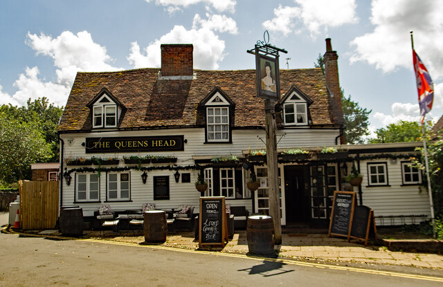
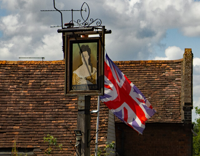
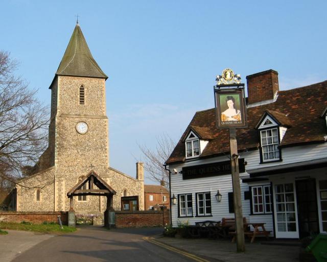
The Queen's Head, Sandridge

The Queens Head is a public house in the village of Sandridge to the north of St Albans, Hertfordshire, England. The timber framed building is weather...
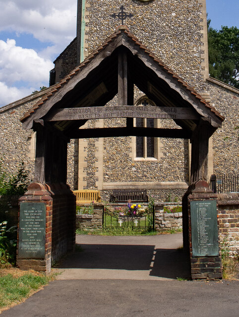
Sandridge Lychgate

Sandridge Lychgate is a war memorial in the village of Sandridge, Hertfordshire, England. The timber lychgate with its flanking walls is listed Grade II...

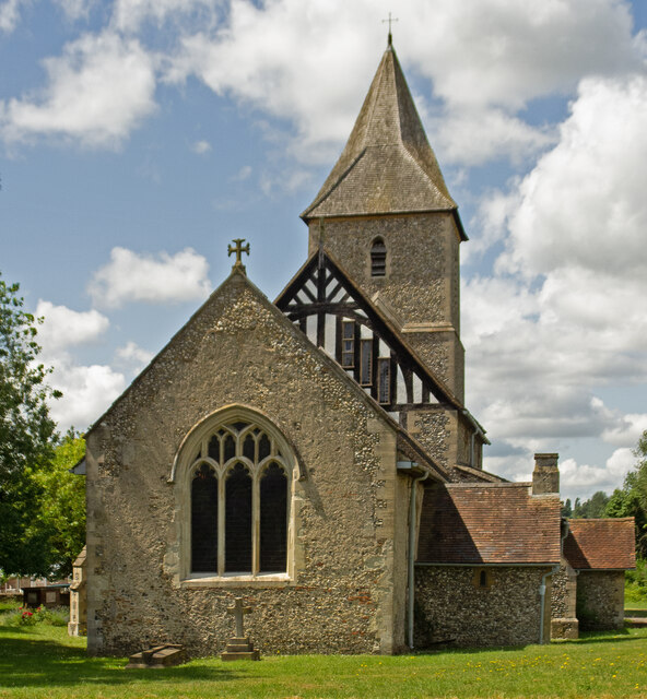
St Leonard's Church, Sandridge

St Leonard's Church is in Sandridge, a village in Hertfordshire, England. It is an active Anglican parish church. The building is Grade II* listed: notable...

Sandridge

Sandridge is a village and civil parish between the city centre of St Albans (2.5 miles (4.0 km) to the south-west) and Wheathampstead in Hertfordshire...

Nomansland Common

Nomansland Common (sometimes simply called No Man's Land) is an area of common land in Hertfordshire, England to the south of Harpenden and the south-west...

Nearby Amenities

Located within 500m of 51.78887,-0.31894115
The Magical Wood
Check Date: 2024-05-12
Information: board
Tourism: information
Lat/Long: 51.7865681/-0.3175986
Source: GPS, Bing, observation
Tourism: picnic_site
Lat/Long: 51.7886339/-0.3180805
Fixme: Wooden carved archway over path, but what tagging to use?
Lat/Long: 51.7890362/-0.3148525
Bench
Backrest: yes
Material: wood
Source: GPS, observation
Lat/Long: 51.7876927/-0.3121568
Barrier: kissing_gate
Lat/Long: 51.7920059/-0.3143938
The data included in this document is from www.openstreetmap.org. The data is made available under ODbL.

Have you been to The Magical Wood?

Leave your review of The Magical Wood below (or comments, questions and feedback).