Fir Spring

Wood, Forest in Hertfordshire Hertsmere

England

Fir Spring

Radlett Cricket Club How strange that the Ordnance Survey map makes no mention of this long-established club, which regularly hosts Middlesex matches.  And it seems that this is the first photo of the ground posted on Geograph.

Radlett Cricket Club was established in 1884.  This ground, Cobden Hill, has been the club's home since 1938 when it was bought by benefactor Miles Brunton on a 99-year lease.

Middlesex CCC have used Radlett as their main outground since 2013 and it is also their training ground.

From 1975 to 2013 the ground was used by Hertfordshire to host six Minor Counties matches and two MCCA Knockout Trophy matches.

To the south of the main pitch lies an additional nursery ground known as Salter's Field.
Radlett Cricket Club Credit: Mark Percy

Fir Spring, located in Hertfordshire, is a picturesque woodland area known for its dense fir trees and tranquil surroundings. Nestled in the heart of the county, this forested region covers a vast expanse, providing visitors with ample opportunities for outdoor activities and nature exploration.

The woodland is characterized by its towering fir trees, which create a majestic canopy overhead, offering shade and shelter to various fauna and flora. The forest floor is carpeted with a lush layer of moss, ferns, and wildflowers, adding to the enchanting ambiance of the area. The babbling of a nearby spring can be heard throughout the woodland, contributing to the serene atmosphere.

Fir Spring is a haven for nature enthusiasts, offering several walking trails and paths that wind through the woods, allowing visitors to immerse themselves in the natural beauty of the surroundings. Wildlife is abundant here, with sightings of deer, squirrels, and a variety of bird species being common.

The forest is also home to a diverse range of plant life, including bluebells, foxgloves, and primroses, which bloom vibrantly during the spring season, adding bursts of color to the already picturesque landscape.

For those seeking a peaceful retreat away from the hustle and bustle of daily life, Fir Spring offers a sanctuary for relaxation and contemplation. The tranquil setting and untouched beauty of this woodland make it an ideal destination for nature lovers and those looking to reconnect with the natural world.

If you have any feedback on the listing, please let us know in the comments section below.

Fir Spring Images

Images are sourced within 2km of 51.680069/-0.3241306 or Grid Reference TQ1599. Thanks to Geograph Open Source API. All images are credited.

Radlett Cricket Club How strange that the Ordnance Survey map makes no mention of this long-established club, which regularly hosts Middlesex matches.  And it seems that this is the first photo of the ground posted on Geograph.

Radlett Cricket Club was established in 1884.  This ground, Cobden Hill, has been the club's home since 1938 when it was bought by benefactor Miles Brunton on a 99-year lease.

Middlesex CCC have used Radlett as their main outground since 2013 and it is also their training ground.

From 1975 to 2013 the ground was used by Hertfordshire to host six Minor Counties matches and two MCCA Knockout Trophy matches.

To the south of the main pitch lies an additional nursery ground known as Salter's Field.
Radlett Cricket Club
How strange that the Ordnance Survey map makes no mention of this long-established club, which regularly hosts Middlesex matches. And it seems that this is the first photo of the ground posted on Geograph. Radlett Cricket Club was established in 1884. This ground, Cobden Hill, has been the club's home since 1938 when it was bought by benefactor Miles Brunton on a 99-year lease. Middlesex CCC have used Radlett as their main outground since 2013 and it is also their training ground. From 1975 to 2013 the ground was used by Hertfordshire to host six Minor Counties matches and two MCCA Knockout Trophy matches. To the south of the main pitch lies an additional nursery ground known as Salter's Field.
In-carriage ThamesLink routes map The map is displayed above every carriage door; north is to the left, south to the right. Photographed during a stop at Radlett on a southbound service.
In-carriage ThamesLink routes map
The map is displayed above every carriage door; north is to the left, south to the right. Photographed during a stop at Radlett on a southbound service.
The Radlett Centre, Aldenham Avenue
Radlett Village Institute, Watling Street
Red House Surgery entrance, Watling Street
Radlett Gardens, Watling Street
Watling Street/Theobald Street roundabout
Watling Street, Radlett
Direction signs, Watling Street
Red House Surgery, Watling Street
Watling Street roundabout, Radlett
Radlett Members Club, Watling Street
Gail's bakery, Watling Street
Radlett Reform Synagogue, Watling Street
Radlett Library, Aldenham Avenue
Aldenham Parish Council, The Radlett Centre
Aldenham parish footpath map
Show me another place!

Fir Spring is located at Grid Ref: TQ1599 (Lat: 51.680069, Lng: -0.3241306)

Administrative County: Hertfordshire

District: Hertsmere

Police Authority: Hertfordshire

What 3 Words

///desk.weds.grabs. Near Radlett, Hertfordshire

Nearby Locations

Fir Spring The Folly

Related Wikis

Radlett Reform Synagogue

Radlett Reform Synagogue is a synagogue in Radlett, Hertfordshire, England. It is affiliated to the Movement for Reform Judaism. Its current Senior Rabbi...
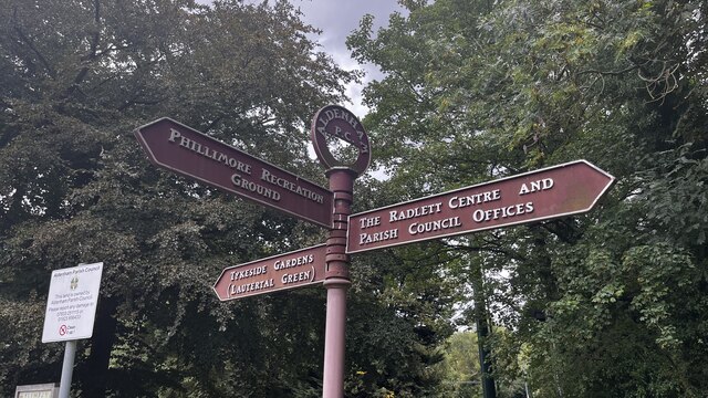
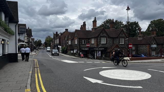
Radlett

Radlett is a village in Hertfordshire, England, between Elstree and St Albans on Watling Street, with a population of 10,060. It is in the council district...

Radlett railway station

Radlett railway station is on the Midland Main Line in England, serving the village of Radlett, Hertfordshire. It is 15 miles 17 chains (24.5 km) down...

Brunton Memorial Ground

Brunton Memorial Ground is a cricket ground at Radlett in Hertfordshire. The ground is the home of Radlett Cricket Club and, since 2013, has been used...

Edge Grove School

Edge Grove School, simply Edge Grove, is a 3–13 mixed, private, day preparatory school in Aldenham, Watford, Hertfordshire, England. It was established...

Letchmore Heath

Letchmore Heath is a village in Hertfordshire in England, situated about three miles east of Watford. == General == The village, consisting of about 150...

Bhaktivedanta Manor

Bhaktivedanta Manor is a Gaudiya Vaishnava Hindu temple set in the Hertfordshire countryside of England, in the village of Letchmore Heath near Watford...
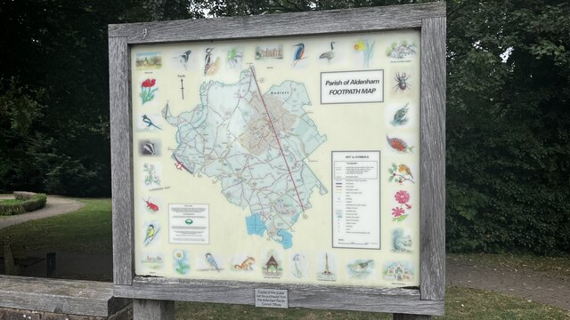
Aldenham School

Aldenham School is a co-educational independent school for pupils aged eleven to eighteen, located between Elstree and the village of Aldenham in Hertfordshire...

Nearby Amenities

Located within 500m of 51.680069,-0.3241306
Turning Circle
Lat/Long: 51.6797052/-0.3276953
Turning Circle
Lat/Long: 51.6803206/-0.3265206
Turning Circle
Lat/Long: 51.6815476/-0.3299432
Turning Circle
Lat/Long: 51.6812152/-0.3294562
Turning Circle
Lat/Long: 51.6806675/-0.3225273
Mini Roundabout
Direction: clockwise
Lat/Long: 51.6773843/-0.3238617
Crossing
Crossing: unmarked
Lat/Long: 51.6775814/-0.3297937
Traffic Calming: hump
Lat/Long: 51.6758521/-0.3221146
Bus Stop
Shops
Naptan AtcoCode: 210021007510
Naptan Bearing: SW
Naptan CommonName: Shops
Naptan Crossing: Willow Way
Naptan Indicator: SW-bound
Naptan Landmark: Willow Way
Naptan NaptanCode: hrtgmpgw
Naptan ShortCommonName: NA
Naptan Street: Battlers Green Drive
Naptan Verified: no
Public Transport: platform
Shelter: yes
Source: naptan_import
Lat/Long: 51.6799196/-0.3307104
Bus Stop
Shops
Naptan AtcoCode: 210021007680
Naptan Bearing: NE
Naptan CommonName: Shops
Naptan Crossing: Phillimore Place
Naptan Indicator: NE-bound
Naptan Landmark: Phillimore Place
Naptan NaptanCode: hrtgmjtw
Naptan ShortCommonName: NA
Naptan Street: Battlers Green Drive
Naptan Verified: no
Public Transport: platform
Source: naptan_import
Lat/Long: 51.6801551/-0.3306083
Post Office
Batlers Green Post Office
Brand: Post Office
Brand Wikidata: Q1783168
Check Date: 2023-09-27
Ref Pol Id: 18721
Source: OS OpenData StreetView
Website: https://www.postoffice.co.uk/branch-finder/1070339/batlers-green
Lat/Long: 51.6799265/-0.3310658
Post Box
Ref: WD7 149
Lat/Long: 51.6829314/-0.3219731
Post Box
Ref: WD7 110
Lat/Long: 51.6807549/-0.3195648
Post Box
Ref: WD7 74
Lat/Long: 51.6779602/-0.3234628
Power: substation
Lat/Long: 51.6799753/-0.3228581
Barrier: bollard
Bicycle: no
Foot: yes
Lat/Long: 51.6805629/-0.3226408
Barrier: bollard
Bicycle: yes
Bollard: fixed
Foot: yes
Lat/Long: 51.6785954/-0.3241455
Barrier: kissing_gate
Foot: yes
Lat/Long: 51.6804055/-0.3230315
Barrier: bollard
Bicycle: no
Foot: yes
Lat/Long: 51.6801464/-0.3227114
Crossing
Crossing: unmarked
Lat/Long: 51.6794901/-0.322031
Give Way
Lat/Long: 51.6769658/-0.3277666
Fast Food
Taj Mahal take Away
Cuisine: indian
Lat/Long: 51.6798077/-0.3307319
Costcutter
Brand: Costcutter
Brand Wikidata: Q5175072
Shop: convenience
Lat/Long: 51.6797463/-0.3308261
Battlers Green
Place: quarter
Lat/Long: 51.6796551/-0.3311641
Fast Food
Sea Shells Fish and Chips
Cuisine: fish_and_chips
Lat/Long: 51.6798877/-0.3311249
Noexit: yes
Lat/Long: 51.6789022/-0.3306198
Radlett Bowls Club
Addr City: Radlett
Addr Housename: Phillimore Recreation Ground
Addr Postcode: WD7 8AL
Addr Street: Gills Hill Lane
Lat/Long: 51.6811161/-0.3264217
Barrier: kissing_gate
Foot: designated
Lat/Long: 51.681739/-0.3246441
Traffic Calming: table
Lat/Long: 51.6818746/-0.3270458
Direction: 225
Generator Method: photovoltaic
Generator Output Electricity: yes
Generator Solar Modules: 3
Generator Source: solar
Generator Type: solar_photovoltaic_panel
Location: roof
Power: generator
Lat/Long: 51.6780015/-0.3285731
Direction: 140
Generator Method: photovoltaic
Generator Output Electricity: yes
Generator Solar Modules: 13
Generator Source: solar
Generator Type: solar_photovoltaic_panel
Location: roof
Power: generator
Lat/Long: 51.6781695/-0.3303196
Direction: 220
Generator Method: photovoltaic
Generator Output Electricity: yes
Generator Solar Modules: 10
Generator Source: solar
Generator Type: solar_photovoltaic_panel
Location: roof
Power: generator
Lat/Long: 51.6797133/-0.329763
Generator Method: photovoltaic
Generator Output Electricity: yes
Generator Solar Modules: 10
Generator Source: solar
Generator Type: solar_photovoltaic_panel
Location: roof
Power: generator
Tilted: no
Lat/Long: 51.6806834/-0.3281798
Generator Method: photovoltaic
Generator Output Electricity: yes
Generator Solar Modules: 9
Generator Source: solar
Generator Type: solar_photovoltaic_panel
Location: roof
Power: generator
Tilted: no
Lat/Long: 51.6794304/-0.327662
Direction: 210
Generator Method: photovoltaic
Generator Output Electricity: yes
Generator Solar Modules: 12
Generator Source: solar
Generator Type: solar_photovoltaic_panel
Location: roof
Power: generator
Lat/Long: 51.6802243/-0.3261782
Direction: 180
Generator Method: photovoltaic
Generator Output Electricity: yes
Generator Solar Modules: 6
Generator Source: solar
Generator Type: solar_photovoltaic_panel
Location: roof
Power: generator
Lat/Long: 51.6802959/-0.3261085
Generator Method: photovoltaic
Generator Output Electricity: yes
Generator Solar Modules: 12
Generator Source: solar
Generator Type: solar_photovoltaic_panel
Location: roof
Power: generator
Tilted: no
Lat/Long: 51.6804162/-0.3261682
Direction: 225
Generator Method: photovoltaic
Generator Output Electricity: yes
Generator Solar Modules: 7
Generator Source: solar
Generator Type: solar_photovoltaic_panel
Location: roof
Power: generator
Lat/Long: 51.6803617/-0.3268004
Direction: 45
Generator Method: photovoltaic
Generator Output Electricity: yes
Generator Solar Modules: 6
Generator Source: solar
Generator Type: solar_photovoltaic_panel
Location: roof
Power: generator
Lat/Long: 51.6803817/-0.3267725
Direction: 135
Generator Method: photovoltaic
Generator Output Electricity: yes
Generator Solar Modules: 3
Generator Source: solar
Generator Type: solar_photovoltaic_panel
Location: roof
Power: generator
Lat/Long: 51.6804126/-0.326779
Direction: 110
Generator Method: photovoltaic
Generator Output Electricity: yes
Generator Solar Modules: 8
Generator Source: solar
Generator Type: solar_photovoltaic_panel
Location: roof
Power: generator
Lat/Long: 51.6813823/-0.3290879
Direction: 290
Generator Method: photovoltaic
Generator Output Electricity: yes
Generator Solar Modules: 8
Generator Source: solar
Generator Type: solar_photovoltaic_panel
Location: roof
Power: generator
Lat/Long: 51.6813539/-0.329176
Direction: 290
Generator Method: photovoltaic
Generator Output Electricity: yes
Generator Solar Modules: 8
Generator Source: solar
Generator Type: solar_photovoltaic_panel
Location: roof
Power: generator
Lat/Long: 51.6815482/-0.3302902
Direction: 200
Generator Method: photovoltaic
Generator Output Electricity: yes
Generator Solar Modules: 3
Generator Source: solar
Generator Type: solar_photovoltaic_panel
Location: roof
Power: generator
Lat/Long: 51.6815838/-0.3303054
Traffic Calming: island
Lat/Long: 51.682415/-0.3256081
Direction: 155
Generator Method: photovoltaic
Generator Output Electricity: yes
Generator Solar Modules: 16
Generator Source: solar
Generator Type: solar_photovoltaic_panel
Location: roof
Power: generator
Lat/Long: 51.6775127/-0.3263647
Traffic Calming: island
Lat/Long: 51.677426/-0.3238149
Direction: 150
Generator Method: photovoltaic
Generator Output Electricity: yes
Generator Solar Modules: 12
Generator Source: solar
Generator Type: solar_photovoltaic_panel
Location: roof
Power: generator
Lat/Long: 51.6826066/-0.3230828
Direction: 155
Generator Method: photovoltaic
Generator Output Electricity: yes
Generator Solar Modules: 14
Generator Source: solar
Generator Type: solar_photovoltaic_panel
Location: roof
Power: generator
Lat/Long: 51.6805215/-0.3173092
Direction: 245
Generator Method: photovoltaic
Generator Output Electricity: yes
Generator Solar Modules: 8
Generator Source: solar
Generator Type: solar_photovoltaic_panel
Location: roof
Power: generator
Lat/Long: 51.6832189/-0.319943
Direction: 145
Generator Method: photovoltaic
Generator Output Electricity: yes
Generator Solar Modules: 8
Generator Source: solar
Generator Type: solar_photovoltaic_panel
Location: roof
Power: generator
Tilt: 10
Lat/Long: 51.6823041/-0.3181747
Noexit: yes
Lat/Long: 51.6803936/-0.3225765
Give Way
Direction: backward
Lat/Long: 51.6820102/-0.3181195
Give Way
Direction: backward
Lat/Long: 51.6819299/-0.31806
Noexit: yes
Lat/Long: 51.6779554/-0.3280529
Noexit: yes
Lat/Long: 51.6793812/-0.3214755
Give Way
Direction: forward
Lat/Long: 51.6816677/-0.318904
Noexit: yes
Lat/Long: 51.6799865/-0.3216948
Noexit: yes
Lat/Long: 51.6801042/-0.321216
Noexit: yes
Lat/Long: 51.6800244/-0.3214695
Noexit: yes
Lat/Long: 51.6799579/-0.3219241
Noexit: yes
Lat/Long: 51.6809067/-0.3197736
Noexit: yes
Lat/Long: 51.6808709/-0.3198326
Noexit: yes
Lat/Long: 51.6812297/-0.3192057
Noexit: yes
Lat/Long: 51.6799209/-0.3221682
Noexit: yes
Lat/Long: 51.6814779/-0.3230976
Noexit: yes
Lat/Long: 51.6822321/-0.3235924
Direction: 135
Generator Method: photovoltaic
Generator Output Electricity: yes
Generator Solar Modules: 3
Generator Source: solar
Generator Type: solar_photovoltaic_panel
Location: roof
Power: generator
Lat/Long: 51.6804387/-0.3267182
Noexit: yes
Lat/Long: 51.6775509/-0.3246774
The data included in this document is from www.openstreetmap.org. The data is made available under ODbL.

Have you been to Fir Spring?

Leave your review of Fir Spring below (or comments, questions and feedback).