Askrigg

Settlement in Yorkshire Richmondshire

England

Askrigg

Footpath through wood below Brough Scar
Footpath through wood below Brough Scar Credit: Roger Templeman

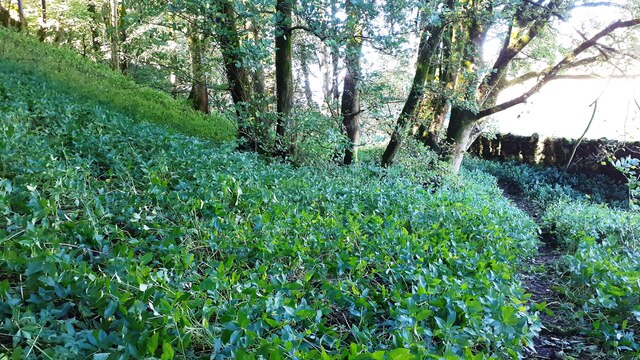
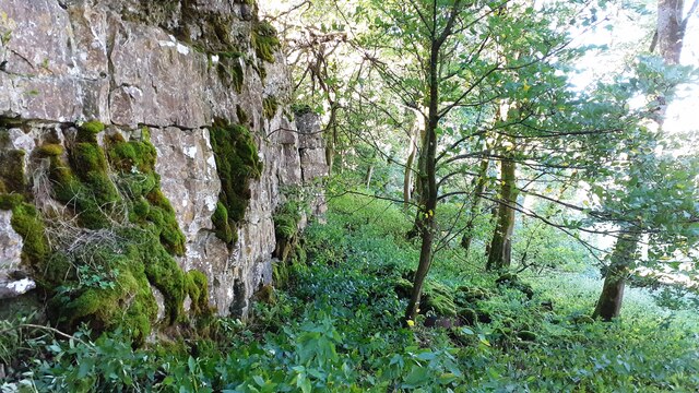
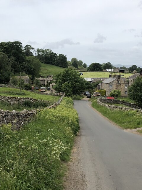
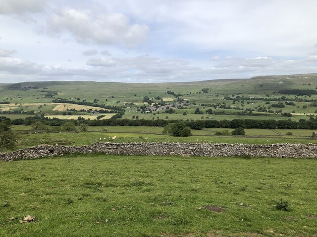
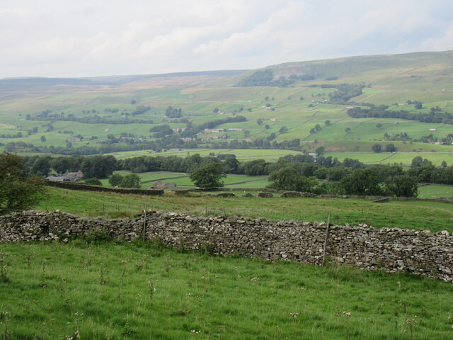
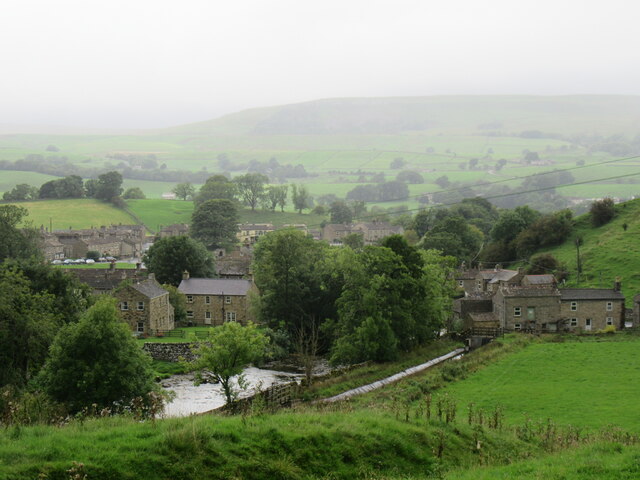
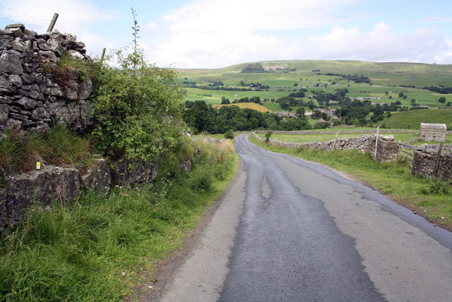
Askrigg is a picturesque village located in the heart of the Yorkshire Dales National Park, in the county of North Yorkshire, England. Situated approximately 5 miles east of Hawes, it is surrounded by stunning countryside and rolling hills, making it a popular destination for nature lovers and hikers.

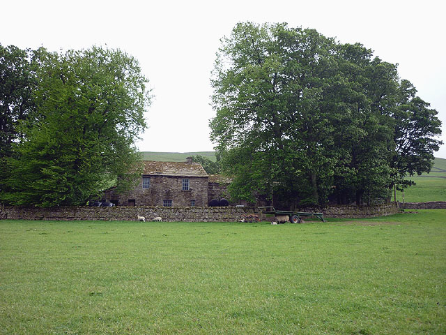
The village itself is known for its charming, traditional stone-built houses, many of which date back to the 17th and 18th centuries. The main street is lined with quaint shops, cafes, and pubs, adding to its idyllic atmosphere. Askrigg is particularly famous for being the filming location of the fictional village of Darrowby in the popular TV series "All Creatures Great and Small," based on the books by James Herriot.

One of the main attractions in Askrigg is St Oswald's Church, a beautiful medieval church that dates back to the 15th century. It features stunning stained glass windows and a peaceful churchyard with ancient gravestones. Visitors can also explore the nearby Askrigg Wensleydale Railway Station, which has been converted into a museum showcasing the history of the railway in the area.

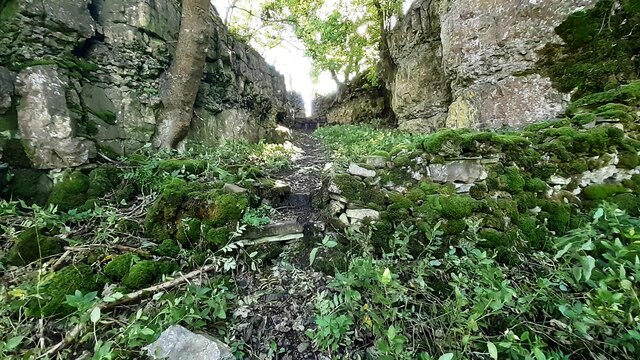
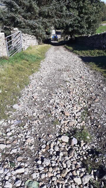
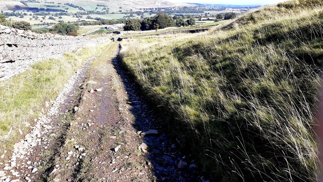
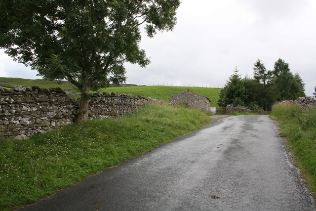
For outdoor enthusiasts, Askrigg offers plenty of opportunities for hiking, with numerous trails that showcase the natural beauty of the Yorkshire Dales. The nearby Aysgarth Falls, a series of stunning waterfalls on the River Ure, is also a popular attraction.

Overall, Askrigg is a charming village that offers a peaceful retreat in the heart of the Yorkshire Dales, combining natural beauty with rich history and a warm community atmosphere.

If you have any feedback on the listing, please let us know in the comments section below.
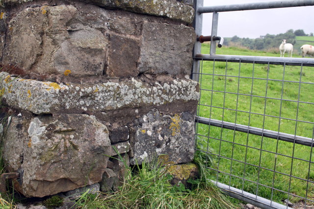
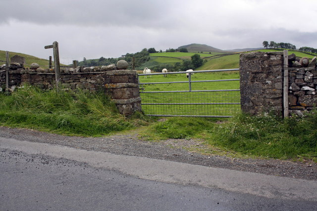
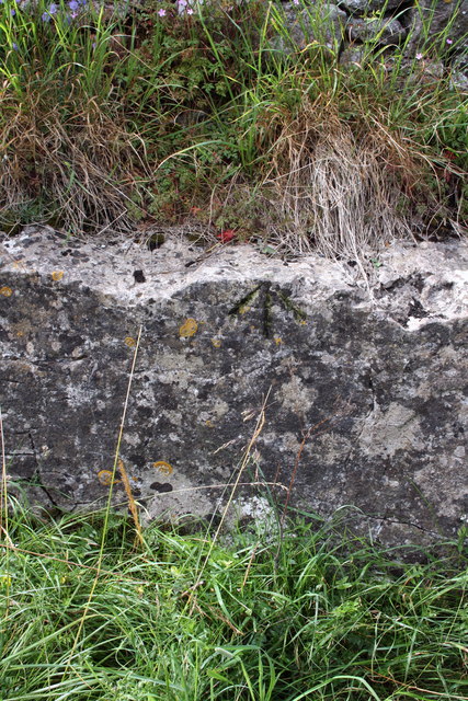
Askrigg Images

Images are sourced within 2km of 54.314797/-2.081175 or Grid Reference SD9491. Thanks to Geograph Open Source API. All images are credited.

Footpath through wood below Brough Scar
Footpath passing through gap in Brough Scar
Bridleway approaching Cubeck from SW
Looking west along Brough Scar
Bridleway from Worton Pasture towards Cubeck
Wensleydale View of Wensleydale from lower slopes of Addlebrough. The treeline in the middle distance is Worton Scar, and the small town of Askrigg can be seen in the centre of the image.
Wensleydale
View of Wensleydale from lower slopes of Addlebrough. The treeline in the middle distance is Worton Scar, and the small town of Askrigg can be seen in the centre of the image.
Near Cubeck Looking across Wensleydale near Cubeck.
Near Cubeck
Looking across Wensleydale near Cubeck.
Bainbridge Looking north to Bainbridge.
Bainbridge
Looking north to Bainbridge.
Scar Top The house does not seem to be occupied - slates are sliding off the roof.
Scar Top
The house does not seem to be occupied - slates are sliding off the roof.
Benchmark on stone of Carpley Green Road Ordnance Survey pivot benchmark described on the Bench Mark Database at <span class="nowrap"><a title="http://www.bench-marks.org.uk/bm39075" rel="nofollow ugc noopener" href="http://www.bench-marks.org.uk/bm39075">Link</a><img style="margin-left:2px;" alt="External link" title="External link - shift click to open in new window" src="https://s1.geograph.org.uk/img/external.png" width="10" height="10"/></span>
Benchmark on stone of Carpley Green Road
Ordnance Survey pivot benchmark described on the Bench Mark Database at LinkExternal link
Carpley Green Road south from Bainbridge There is an OS benchmark <a href="https://www.geograph.org.uk/photo/2719675">SD9389 : Benchmark on stone of Carpley Green Road</a> on the wall on the left side of the road
Carpley Green Road south from Bainbridge
There is an OS benchmark SD9389 : Benchmark on stone of Carpley Green Road on the wall on the left side of the road
Benchmark on gateway on Carpley Green Road Ordnance Survey cut mark benchmark described on the Bench Mark Database at <span class="nowrap"><a title="http://www.bench-marks.org.uk/bm39076" rel="nofollow ugc noopener" href="http://www.bench-marks.org.uk/bm39076">Link</a><img style="margin-left:2px;" alt="External link" title="External link - shift click to open in new window" src="https://s1.geograph.org.uk/img/external.png" width="10" height="10"/></span>
Benchmark on gateway on Carpley Green Road
Ordnance Survey cut mark benchmark described on the Bench Mark Database at LinkExternal link
Gateway to field from Carpley Green Road There is an OS benchmark <a href="https://www.geograph.org.uk/photo/2719755">SD9389 : Benchmark on gateway on Carpley Green Road</a> on the inside face of the wall end at the left hand side of the gateway.
Gateway to field from Carpley Green Road
There is an OS benchmark SD9389 : Benchmark on gateway on Carpley Green Road on the inside face of the wall end at the left hand side of the gateway.
Benchmark on outcrop by road near Out Brough Ordnance Survey pivot benchmark described on the Bench Mark Database at <span class="nowrap"><a title="http://www.bench-marks.org.uk/bm39077" rel="nofollow ugc noopener" href="http://www.bench-marks.org.uk/bm39077">Link</a><img style="margin-left:2px;" alt="External link" title="External link - shift click to open in new window" src="https://s1.geograph.org.uk/img/external.png" width="10" height="10"/></span>
Benchmark on outcrop by road near Out Brough
Ordnance Survey pivot benchmark described on the Bench Mark Database at LinkExternal link
Outcrop beside the road to Bainbridge There is an OS benchmark <a href="https://www.geograph.org.uk/photo/2720599">SD9389 : Benchmark on outcrop by road near Out Brough</a> on the outcrop ledge on the left side of the road, by the green GPS instrument.
Outcrop beside the road to Bainbridge
There is an OS benchmark SD9389 : Benchmark on outcrop by road near Out Brough on the outcrop ledge on the left side of the road, by the green GPS instrument.
Benchmark on A684 gatepost Ordnance Survey cut mark described on the Bench Mark Database at <span class="nowrap"><a title="http://www.bench-marks.org.uk/bm27871" rel="nofollow ugc noopener" href="http://www.bench-marks.org.uk/bm27871">Link</a><img style="margin-left:2px;" alt="External link" title="External link - shift click to open in new window" src="https://s1.geograph.org.uk/img/external.png" width="10" height="10"/></span>
Benchmark on A684 gatepost
Ordnance Survey cut mark described on the Bench Mark Database at LinkExternal link
Gateway beside A684 There is an OS benchmark <a href="https://www.geograph.org.uk/photo/2722279">SD9389 : Benchmark on A684 gatepost</a> at ground level on the right hand gatepost
Gateway beside A684
There is an OS benchmark SD9389 : Benchmark on A684 gatepost at ground level on the right hand gatepost
Show me another place!

Askrigg is located at Grid Ref: SD9491 (Lat: 54.314797, Lng: -2.081175)

Division: North Riding

Administrative County: North Yorkshire

District: Richmondshire

Police Authority: North Yorkshire

What 3 Words

///package.positive.recorders. Near Leyburn, North Yorkshire

Related Wikis

Cringley House

Cringley House (also known as Skeldale House) is an historic building in the English village of Askrigg, North Yorkshire. Standing on the south side of...

Askrigg

Askrigg is a small village and civil parish in Wensleydale in the Yorkshire Dales National Park. It was formerly a part of the Richmondshire district of...
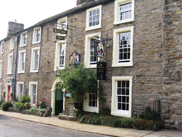
Kings Arms Hotel

The Kings Arms Hotel is a public house and inn in the English village of Askrigg, North Yorkshire. A Grade II listed building, standing on the northern...

St Oswald's Church, Askrigg

St Oswald's Church is a Grade I listed parish church in the Church of England in Askrigg, North Yorkshire. == History == The church dates largely from...

Askrigg railway station

Askrigg railway station is a disused railway station in North Yorkshire, England and served the village of Askrigg. It was part of the Wensleydale Railway...

Newbiggin, Askrigg

Newbiggin is a hamlet very close to Askrigg, North Yorkshire, England. Another Newbiggin is only about 7 miles (11 km) away. The hamlet consists of eight...

Worton, North Yorkshire

Worton is a hamlet in Wensleydale in the Yorkshire Dales in the Richmondshire district of North Yorkshire, England. It lies 1-mile (1.6 km) east of Bainbridge...

River Bain, North Yorkshire

The River Bain is a river in North Yorkshire, England. As a tributary of the River Ure, it is one of the shortest, named rivers in England. The river...

Nearby Amenities

Located within 500m of 54.314797,-2.081175
Askrigg
Place: village
Source: NPE
Wikidata: Q3695978
Wikipedia: en:Askrigg
Lat/Long: 54.3149081/-2.0811403
Pub
The King's Arms
Addr City: Hawes
Addr Postcode: DL8 3HQ
Addr Street: Main Street
Image: https://www.geograph.org.uk/photo/54330
Source Addr: website
Website: https://www.kingsarmsaskrigg.com/
Wikidata: Q26451114
Lat/Long: 54.3151181/-2.0804022
Post Box
Collection Times: Mo-Fr 16:00; Sa 10:00
Post Box Type: pillar
Royal Cypher: EIIR
Royal Cypher Wikidata: Q33102113
Lat/Long: 54.3149483/-2.080583
Askrigg Market Cross
Bus: yes
Public Transport: stop_position
Lat/Long: 54.314864/-2.0811055
Market Cross
Heritage: 2
Heritage Operator: Historic England
Heritage Website: https://historicengland.org.uk/listing/the-list/list-entry/1131188
Historic: wayside_cross
Image: https://www.geograph.org.uk/photo/2008795
Inscription Date: 1952-01-16
Listed Status: Grade II
Ref GB Nhle: 1131188
Wikidata: Q26424146
Lat/Long: 54.3148271/-2.0813349
Bus Stop
Askrigg Market Cross
Bench: no
Bin: no
Bus: yes
Public Transport: platform
Shelter: no
Tactile Paving: no
Lat/Long: 54.3148859/-2.0809312
Cafe
Askrigg Village Kitchen - Deli and Bakery
Lat/Long: 54.3149106/-2.0806741
Entrance: yes
Lat/Long: 54.31478/-2.0821145
Askrigg Market Cross
Bus: yes
Public Transport: stop_position
Lat/Long: 54.3149155/-2.0809529
Toilets
Check Date: 2022-09-24
Fee: no
Wheelchair: yes
Lat/Long: 54.3140732/-2.081767
Sykes Country Store
Shop: newsagent
Lat/Long: 54.3146345/-2.081216
Post Box
Post Box Type: lamp
Source: survey
Lat/Long: 54.3162913/-2.0790376
Barrier: cattle_grid
Lat/Long: 54.3129638/-2.0876852
Noexit: yes
Lat/Long: 54.3130908/-2.0820841
Telephone
Booth: K6
Covered: booth
Listed Status: Grade II
Wikidata: Q26603190
Lat/Long: 54.3145861/-2.081605
Barrier: stile
Foot: yes
Lat/Long: 54.3174713/-2.0835874
Barrier: stile
Material: stone
Source: survey;gps
Stile: squeezer
Lat/Long: 54.315384/-2.0786184
Barrier: stile
Material: stone
Source: survey;gps
Stile: squeezer
Lat/Long: 54.3152144/-2.0749894
Barrier: stile
Lat/Long: 54.3156133/-2.074898
Barrier: stile
Material: stone
Source: survey;gps
Stile: squeezer
Lat/Long: 54.3174204/-2.0849992
Barrier: stile
Material: stone
Source: survey;gps
Stile: squeezer
Lat/Long: 54.317452/-2.0813468
Barrier: stile
Material: stone
Source: survey;gps
Stile: squeezer
Lat/Long: 54.3178168/-2.0811354
Barrier: stile
Material: stone
Source: survey;gps
Stile: stepover
Lat/Long: 54.3180649/-2.0855171
Barrier: stile
Material: stone
Source: survey;gps
Stile: squeezer
Lat/Long: 54.3186236/-2.0803806
Barrier: stile
Lat/Long: 54.317716/-2.0768061
Natural: peak
Note: position estimated
Lat/Long: 54.3145889/-2.0775037
Askrigg Camping
Addr City: Hawes
Addr Housename: Lowlands Farm
Addr Postcode: DL8 3HZ
Addr Street: Station Road
Addr Suburb: Askrigg
Phone: +447811851584
Tourism: camp_site
Website: https://askrigg-camping.com/
Lat/Long: 54.3135949/-2.0836159
Parking
Access: customers
Parking: surface
Lat/Long: 54.3158513/-2.0797393
Drinking Water: no
Heritage: 2
Heritage Operator: Historic England
Heritage Website: https://historicengland.org.uk/listing/the-list/list-entry/1301601
Inscription Date: 1986-07-09
Listed Status: Grade II
Man Made: water_well
Pump: manual
Ref GB Nhle: 1301601
Wikidata: Q26588838
Lat/Long: 54.3148851/-2.0812306
Parking
Access: customers
Parking: surface
Lat/Long: 54.3148663/-2.0795167
Barrier: stile
Lat/Long: 54.3161551/-2.0811474
Barrier: stile
Foot: yes
Stile: squeezer
Lat/Long: 54.3166335/-2.0827624
Barrier: stile
Foot: yes
Stile: squeezer
Lat/Long: 54.3174421/-2.0835842
Cafe
Sykes House
Cuisine: coffee_shop
Lat/Long: 54.3146246/-2.0811903
Turning Circle
Lat/Long: 54.3162299/-2.0760312
Power: pole
Lat/Long: 54.313547/-2.0810931
Power: pole
Lat/Long: 54.3135567/-2.0800129
Power: pole
Lat/Long: 54.3135442/-2.0790312
Power: pole
Lat/Long: 54.3135474/-2.077387
Power: pole
Lat/Long: 54.3133862/-2.0754222
Power: pole
Lat/Long: 54.313297/-2.0741764
Power: pole
Lat/Long: 54.3107715/-2.0819843
Power: pole
Lat/Long: 54.3123077/-2.0819347
Power: pole
Lat/Long: 54.3125319/-2.0819588
Power: pole
Lat/Long: 54.3137109/-2.0821077
Power: pole
Lat/Long: 54.3117104/-2.0818904
Power: pole
Lat/Long: 54.3118309/-2.0832717
Power: pole
Lat/Long: 54.3119529/-2.0845699
Power: pole
Lat/Long: 54.3122581/-2.0859996
Power: pole
Lat/Long: 54.3125742/-2.0875056
Power: pole
Lat/Long: 54.3127263/-2.0819889
Power: pole
Lat/Long: 54.3139398/-2.0811484
Material: wood
Power: pole
Lat/Long: 54.3152106/-2.0787549
Power: pole
Lat/Long: 54.3146496/-2.0796172
Power: pole
Lat/Long: 54.3144384/-2.0796065
Power: pole
Lat/Long: 54.3143672/-2.0801201
Power: pole
Lat/Long: 54.314307/-2.0805185
Power: pole
Lat/Long: 54.3136592/-2.0815685
Barrier: stile
Description: Barrier is small "squeeze" in wall with wooden gate.
Material: stone
Source: survey;gps
Stile: squeezer
Lat/Long: 54.3186925/-2.0784878
Power: pole
Lat/Long: 54.3175683/-2.0781152
Power: pole
Lat/Long: 54.31716/-2.0782225
Power: pole
Lat/Long: 54.3168714/-2.0782895
Power: pole
Lat/Long: 54.3164419/-2.0784062
Power: pole
Transformer: distribution
Lat/Long: 54.3125718/-2.086709
Power: pole
Transformer: distribution
Lat/Long: 54.3121618/-2.0867372
Power: pole
Transformer: distribution
Lat/Long: 54.313049/-2.0856509
Power: pole
Transformer: distribution
Lat/Long: 54.3130326/-2.0879924
Power: pole
Transformer: distribution
Lat/Long: 54.3129176/-2.0866647
Material: wood
Power: pole
Lat/Long: 54.313556/-2.0832798
Material: wood
Power: pole
Lat/Long: 54.3134738/-2.0838746
Material: wood
Power: pole
Lat/Long: 54.3132782/-2.0849193
Power: pole
Lat/Long: 54.3128855/-2.0861752
Power: pole
Lat/Long: 54.3163633/-2.0791318
Power: pole
Lat/Long: 54.3160261/-2.0796829
Power: pole
Lat/Long: 54.3155352/-2.0806526
Power: pole
Lat/Long: 54.3153615/-2.0815136
Power: pole
Lat/Long: 54.3153533/-2.0819286
Power: pole
Lat/Long: 54.31534/-2.0826039
Power: pole
Lat/Long: 54.3153357/-2.0831443
Power: pole
Lat/Long: 54.3144725/-2.0743561
Power: pole
Lat/Long: 54.3141537/-2.0751768
Power: pole
Lat/Long: 54.3135301/-2.075382
Low Mill Outdoor Centre
Addr Housename: low mill outdoor centre
Addr Street: Station Road
Building: dormitory
Building Levels: 2
Building Material: stone
Roof Shape: gabled
Smoking: outside
Lat/Long: 54.3134328/-2.0850874
Bench
Backrest: yes
Material: wood
Lat/Long: 54.3148642/-2.0812173
Bench
Backrest: yes
Material: wood
Lat/Long: 54.314896/-2.0812143
Bench
Backrest: yes
Material: wood
Lat/Long: 54.3148926/-2.0812494
Bench
Access: yes
Backrest: no
Direction: 198
Inscription: For Niall who loved this dale
Material: wood
Seats: 3
Lat/Long: 54.3139978/-2.0792062
Bus Stop
Askrigg Market Cross
Bench: no
Bin: no
Bus: yes
Public Transport: platform
Shelter: no
Tactile Paving: no
Lat/Long: 54.3148836/-2.081134
The data included in this document is from www.openstreetmap.org. The data is made available under ODbL.

Have you been to Askrigg?

Leave your review of Askrigg below (or comments, questions and feedback).