Birch Wood

Wood, Forest in Sussex Horsham

England

Birch Wood

Old Milestone by the former A24, Mill Straight, Southwater parish Carved stone post by the UC road (was A24), in parish of Southwater (Horsham District), Mill Straight, West of Fieldings, against fence, on South side of road at end of bus lay-by. Steyning stone, erected by the Horsham & Steyning turnpike trust in the 19th century. Painted and re-engraved by Lionel Joseph in about 2011.

Inscription reads:-
40
MILES
FROM
LONDON
Carved benchmark upper centre, rivet on top.

West Sussex HER.
HER Ref: MWS8538 <span class="nowrap"><a title="https://www.heritagegateway.org.uk/Gateway/Results_Single.aspx?uid=MWS8538&resourceID=1032" rel="nofollow ugc noopener" href="https://www.heritagegateway.org.uk/Gateway/Results_Single.aspx?uid=MWS8538&resourceID=1032">Link</a><img style="margin-left:2px;" alt="External link" title="External link - shift click to open in new window" src="https://s1.geograph.org.uk/img/external.png" width="10" height="10"/></span>

Milestone Society National ID: SX_LA40
Old Milestone by the former A24, Mill Straight, Southwater parish Credit: Lionel Joseph

Birch Wood is a picturesque forest located in Sussex, England. It covers an area of approximately 200 acres and is known for its dense population of birch trees, from which it derives its name. The wood is a haven for nature enthusiasts and offers a tranquil retreat from the hustle and bustle of city life.

The forest boasts a diverse range of flora and fauna, with wildflowers carpeting the forest floor during spring and summer months. The towering birch trees create a beautiful canopy, providing shade and shelter for various woodland creatures, including deer, squirrels, and a variety of bird species.

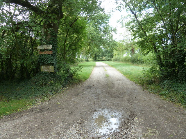
Birch Wood is a popular destination for hikers, joggers, and walkers, as it offers a network of well-marked trails winding through the forest. These trails cater to different fitness levels, making it accessible for individuals of all ages and abilities. Along the way, visitors can admire the scenic beauty of the wood, with its meandering streams, moss-covered rocks, and vibrant foliage in the autumn months.

The forest also has designated picnic areas and benches, allowing visitors to relax and take in the peaceful surroundings. Additionally, there is a small visitor center that provides information about the wood's history, wildlife, and conservation efforts.

Birch Wood truly offers a serene escape into nature, where one can connect with the beauty and tranquility of the Sussex countryside. Whether you are a nature lover, a photography enthusiast, or simply seeking solace in the great outdoors, Birch Wood is a must-visit destination.

If you have any feedback on the listing, please let us know in the comments section below.
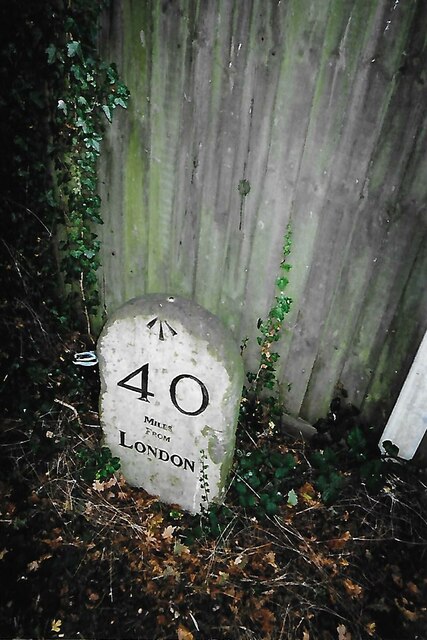
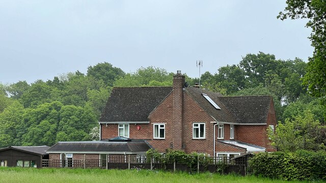
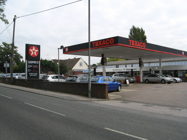
Birch Wood Images

Images are sourced within 2km of 51.018527/-0.36687006 or Grid Reference TQ1425. Thanks to Geograph Open Source API. All images are credited.

Old Milestone by the former A24, Mill Straight, Southwater parish Carved stone post by the UC road (was A24), in parish of Southwater (Horsham District), Mill Straight, West of Fieldings, against fence, on South side of road at end of bus lay-by. Steyning stone, erected by the Horsham & Steyning turnpike trust in the 19th century. Painted and re-engraved by Lionel Joseph in about 2011.

Inscription reads:-
40
MILES
FROM
LONDON
Carved benchmark upper centre, rivet on top.

West Sussex HER.
HER Ref: MWS8538 <span class="nowrap"><a title="https://www.heritagegateway.org.uk/Gateway/Results_Single.aspx?uid=MWS8538&resourceID=1032" rel="nofollow ugc noopener" href="https://www.heritagegateway.org.uk/Gateway/Results_Single.aspx?uid=MWS8538&resourceID=1032">Link</a><img style="margin-left:2px;" alt="External link" title="External link - shift click to open in new window" src="https://s1.geograph.org.uk/img/external.png" width="10" height="10"/></span>

Milestone Society National ID: SX_LA40
Old Milestone by the former A24, Mill Straight, Southwater parish
Carved stone post by the UC road (was A24), in parish of Southwater (Horsham District), Mill Straight, West of Fieldings, against fence, on South side of road at end of bus lay-by. Steyning stone, erected by the Horsham & Steyning turnpike trust in the 19th century. Painted and re-engraved by Lionel Joseph in about 2011. Inscription reads:- 40 MILES FROM LONDON Carved benchmark upper centre, rivet on top. West Sussex HER. HER Ref: MWS8538 LinkExternal link Milestone Society National ID: SX_LA40
Rear of house on Marlpost Road The house is called "Woodlands" according to the large-scale map. This is also a cross-grid shot. The camera was just in the square to the west.
Rear of house on Marlpost Road
The house is called "Woodlands" according to the large-scale map. This is also a cross-grid shot. The camera was just in the square to the west.
View north across fields west of Madgeland Farm It had begun to rain lightly when I took this shot.
View north across fields west of Madgeland Farm
It had begun to rain lightly when I took this shot.
Godfreys of Horsham
Godfreys of Horsham
Footpath 1904/2 to Emms Farm and Courtlands Farm
Downs Link in Nutham Wood
Nutham Wood
Nutham Wood
Nutham Wood
Nutham Wood
Footpath sign, Nutham Wood
Sewage farm building
Signpost, Downs Link The Downs Link is a 37-mile (59 km) footpath and bridleway linking the North Downs Way <a title="https://www.geograph.org.uk/snippet/174" href="https://www.geograph.org.uk/snippet/174">Link</a>  at St. Martha's Hill in Surrey with the South Downs Way <a title="https://www.geograph.org.uk/snippet/1186" href="https://www.geograph.org.uk/snippet/1186">Link</a>  near Steyning in West Sussex and on via the Coastal Link to Shoreham-by-Sea. Most of the route follows two dismantled railway lines, both closed by the Beeching cuts in the 1960s. The Shoreham-On-Sea to Christ’s Hospital line and the Christ’s Hospital to Shalford Junction line. The link opened in 1984. 
Cycle Route 223 follows the Downs link from Guildford to Shoreham.
The logo for the walk is the viaduct across the River Arun <a href="https://www.geograph.org.uk/photo/1870646">TQ0932 : Double Viaduct over the River Arun</a>.
A full history of the Cranleigh line (Christ’s Hospital to Shalford Junction) can be read at <span class="nowrap"><a title="http://en.wikipedia.org/wiki/Cranleigh_Line" rel="nofollow ugc noopener" href="http://en.wikipedia.org/wiki/Cranleigh_Line">Link</a><img style="margin-left:2px;" alt="External link" title="External link - shift click to open in new window" src="https://s1.geograph.org.uk/img/external.png" width="10" height="10"/></span>
Signpost, Downs Link
The Downs Link is a 37-mile (59 km) footpath and bridleway linking the North Downs Way Link at St. Martha's Hill in Surrey with the South Downs Way Link near Steyning in West Sussex and on via the Coastal Link to Shoreham-by-Sea. Most of the route follows two dismantled railway lines, both closed by the Beeching cuts in the 1960s. The Shoreham-On-Sea to Christ’s Hospital line and the Christ’s Hospital to Shalford Junction line. The link opened in 1984. Cycle Route 223 follows the Downs link from Guildford to Shoreham. The logo for the walk is the viaduct across the River Arun TQ0932 : Double Viaduct over the River Arun. A full history of the Cranleigh line (Christ’s Hospital to Shalford Junction) can be read at LinkExternal link
Downs Link
Downs Link
Downs Link under the A24 The Downs Link is a 37-mile (59 km) footpath and bridleway linking the North Downs Way <a title="https://www.geograph.org.uk/snippet/174" href="https://www.geograph.org.uk/snippet/174">Link</a>  at St. Martha's Hill in Surrey with the South Downs Way <a title="https://www.geograph.org.uk/snippet/1186" href="https://www.geograph.org.uk/snippet/1186">Link</a>  near Steyning in West Sussex and on via the Coastal Link to Shoreham-by-Sea. Most of the route follows two dismantled railway lines, both closed by the Beeching cuts in the 1960s. The Shoreham-On-Sea to Christ’s Hospital line and the Christ’s Hospital to Shalford Junction line. The link opened in 1984. 
Cycle Route 223 follows the Downs link from Guildford to Shoreham.
The logo for the walk is the viaduct across the River Arun <a href="https://www.geograph.org.uk/photo/1870646">TQ0932 : Double Viaduct over the River Arun</a>.
A full history of the Cranleigh line (Christ’s Hospital to Shalford Junction) can be read at <span class="nowrap"><a title="http://en.wikipedia.org/wiki/Cranleigh_Line" rel="nofollow ugc noopener" href="http://en.wikipedia.org/wiki/Cranleigh_Line">Link</a><img style="margin-left:2px;" alt="External link" title="External link - shift click to open in new window" src="https://s1.geograph.org.uk/img/external.png" width="10" height="10"/></span>
Downs Link under the A24
The Downs Link is a 37-mile (59 km) footpath and bridleway linking the North Downs Way Link at St. Martha's Hill in Surrey with the South Downs Way Link near Steyning in West Sussex and on via the Coastal Link to Shoreham-by-Sea. Most of the route follows two dismantled railway lines, both closed by the Beeching cuts in the 1960s. The Shoreham-On-Sea to Christ’s Hospital line and the Christ’s Hospital to Shalford Junction line. The link opened in 1984. Cycle Route 223 follows the Downs link from Guildford to Shoreham. The logo for the walk is the viaduct across the River Arun TQ0932 : Double Viaduct over the River Arun. A full history of the Cranleigh line (Christ’s Hospital to Shalford Junction) can be read at LinkExternal link
Bridleway sign, Downs Link The Downs Link is a 37-mile (59 km) footpath and bridleway linking the North Downs Way <a title="https://www.geograph.org.uk/snippet/174" href="https://www.geograph.org.uk/snippet/174">Link</a>  at St. Martha's Hill in Surrey with the South Downs Way <a title="https://www.geograph.org.uk/snippet/1186" href="https://www.geograph.org.uk/snippet/1186">Link</a>  near Steyning in West Sussex and on via the Coastal Link to Shoreham-by-Sea. Most of the route follows two dismantled railway lines, both closed by the Beeching cuts in the 1960s. The Shoreham-On-Sea to Christ’s Hospital line and the Christ’s Hospital to Shalford Junction line. The link opened in 1984. 
Cycle Route 223 follows the Downs link from Guildford to Shoreham.
The logo for the walk is the viaduct across the River Arun <a href="https://www.geograph.org.uk/photo/1870646">TQ0932 : Double Viaduct over the River Arun</a>.
A full history of the Cranleigh line (Christ’s Hospital to Shalford Junction) can be read at <span class="nowrap"><a title="http://en.wikipedia.org/wiki/Cranleigh_Line" rel="nofollow ugc noopener" href="http://en.wikipedia.org/wiki/Cranleigh_Line">Link</a><img style="margin-left:2px;" alt="External link" title="External link - shift click to open in new window" src="https://s1.geograph.org.uk/img/external.png" width="10" height="10"/></span>
Bridleway sign, Downs Link
The Downs Link is a 37-mile (59 km) footpath and bridleway linking the North Downs Way Link at St. Martha's Hill in Surrey with the South Downs Way Link near Steyning in West Sussex and on via the Coastal Link to Shoreham-by-Sea. Most of the route follows two dismantled railway lines, both closed by the Beeching cuts in the 1960s. The Shoreham-On-Sea to Christ’s Hospital line and the Christ’s Hospital to Shalford Junction line. The link opened in 1984. Cycle Route 223 follows the Downs link from Guildford to Shoreham. The logo for the walk is the viaduct across the River Arun TQ0932 : Double Viaduct over the River Arun. A full history of the Cranleigh line (Christ’s Hospital to Shalford Junction) can be read at LinkExternal link
Telecommunications station, Southwater
Downs Link approaching Southwater
Woodland by Downs Link
Show me another place!

Birch Wood is located at Grid Ref: TQ1425 (Lat: 51.018527, Lng: -0.36687006)

Administrative County: West Sussex

District: Horsham

Police Authority: Sussex

What 3 Words

///veal.buckling.showering. Near Southwater, West Sussex

Related Wikis

Holy Innocents Church, Southwater

Holy Innocents Church is the Anglican parish church of Southwater, a village in the Horsham District of West Sussex, England. Built in 1849, the church...

Southwater

Southwater is a large village and civil parish in the Horsham District of West Sussex, England, with a population of roughly 10,000. It is administered...

Southwater railway station

Southwater was a railway station on the Steyning Line which served the village of Southwater. A goods siding allowed for the transportation of coal and...

Newbuildings Place

Newbuildings Place is a 17th-century Artisan Mannerist house near Shipley, West Sussex. The house is a former home of Wilfrid Scawen Blunt, who is buried...

Brooks Green

Brooks Green is a hamlet in the Shipley civil parish of the Horsham District of West Sussex, England. It is in the north-west of the parish, approximately...

Downs Link

The Downs Link is a 36.7 miles (59.1 km) footpath and bridleway linking the North Downs Way at St. Martha's Hill in Surrey with the South Downs Way near...

Dragon's Green

Dragon's Green is a hamlet in the civil parish of Shipley, and the Horsham district of West Sussex, England. The hamlet is 5 miles (8 km) south from the...

Barns Green

Barns Green is a village in the Horsham district of West Sussex, England. It lies on the Billingshurst to Itchingfield road 2+1⁄2 miles (4.0 km) north...

Nearby Amenities

Located within 500m of 51.018527,-0.36687006
Birchwood Farm
Place: farm
Lat/Long: 51.0183693/-0.363861
Chase Farm
Place: farm
Lat/Long: 51.021821/-0.3631139
Woodland Farm
Place: farm
Lat/Long: 51.0195038/-0.3629261
The data included in this document is from www.openstreetmap.org. The data is made available under ODbL.

Have you been to Birch Wood?

Leave your review of Birch Wood below (or comments, questions and feedback).