Fish Pond Plantation

Wood, Forest in Lincolnshire East Lindsey

England

Fish Pond Plantation

West Torrington Medieval Settlement: aerial 2021 (1) See: <span class="nowrap"><a title="https://www.heritagegateway.org.uk/Gateway/Results_Single.aspx?uid=MLI85630&resourceID=1006" rel="nofollow ugc noopener" href="https://www.heritagegateway.org.uk/Gateway/Results_Single.aspx?uid=MLI85630&resourceID=1006">Link</a><img style="margin-left:2px;" alt="External link" title="External link - shift click to open in new window" src="https://s1.geograph.org.uk/img/external.png" width="10" height="10"/></span>
West Torrington Medieval Settlement: aerial 2021 (1) Credit: Chris

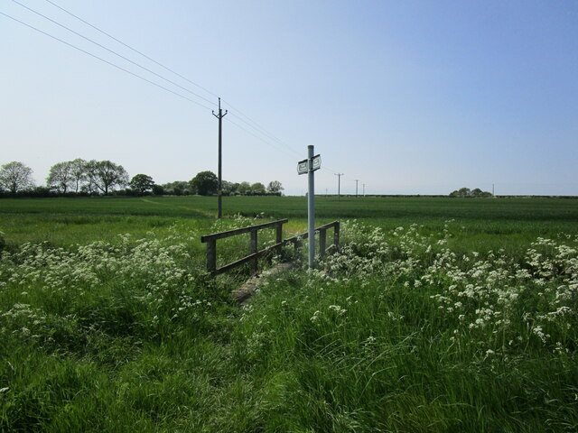
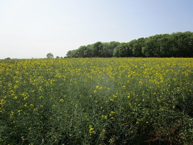
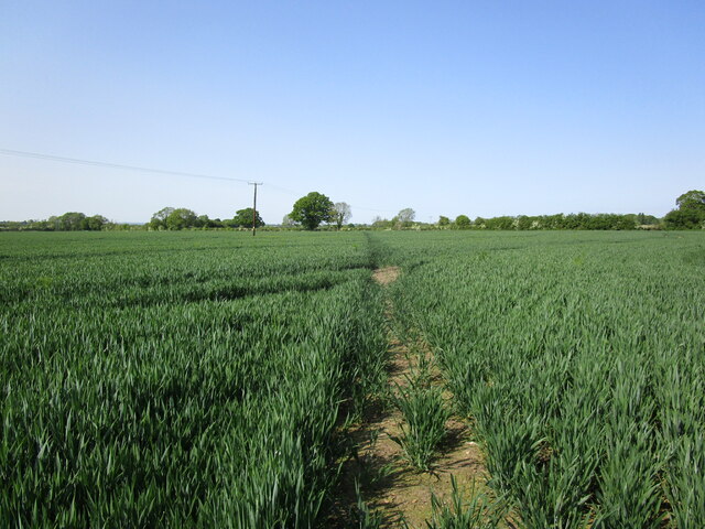
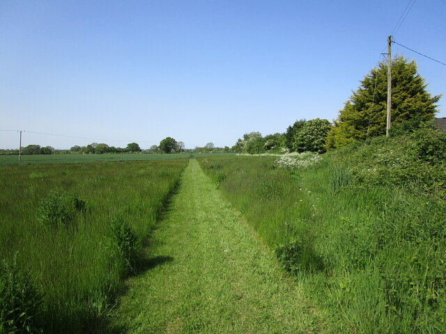
Fish Pond Plantation is a picturesque woodland area located in Lincolnshire, England. Spanning over a vast expanse of land, it is known for its dense forest and tranquil atmosphere. The plantation is adorned with a variety of trees, including oak, beech, and birch, which create a captivating canopy overhead.

As the name suggests, Fish Pond Plantation features several ponds scattered throughout the area. These ponds are home to a diverse range of aquatic life, including fish and various waterfowl species. The presence of these ponds adds to the natural beauty of the plantation and provides opportunities for wildlife enthusiasts to observe and appreciate the local ecosystem.

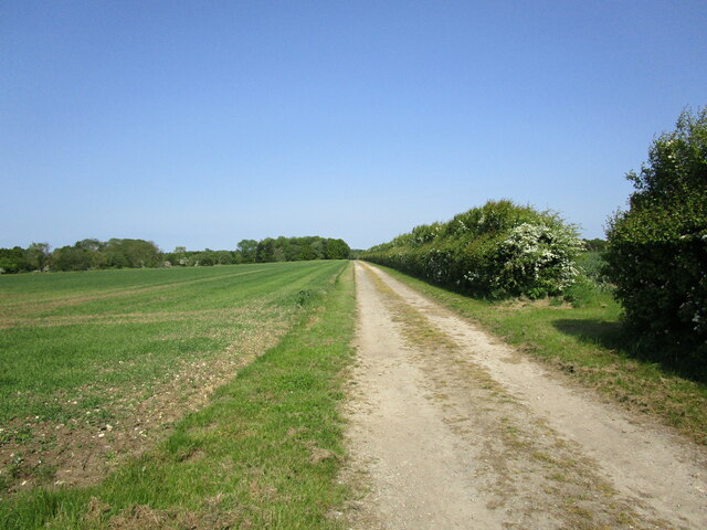
The plantation is a popular destination for nature lovers and outdoor enthusiasts. Its well-maintained trails offer visitors the chance to explore the woodland and observe the abundant wildlife that thrives within it. The tranquility and peace found in Fish Pond Plantation make it an ideal spot for those seeking solace and relaxation away from the hustle and bustle of city life.

Furthermore, the plantation provides a haven for numerous bird species, making it a paradise for birdwatchers. Rare and migratory birds can often be spotted within the woodland, making it a noteworthy location for ornithologists and bird enthusiasts.

Overall, Fish Pond Plantation in Lincolnshire is a captivating woodland area that offers an escape to nature lovers. With its diverse flora and fauna, serene ambiance, and picturesque ponds, it is a destination that showcases the beauty of the natural world.

If you have any feedback on the listing, please let us know in the comments section below.

Fish Pond Plantation Images

Images are sourced within 2km of 53.31333/-0.28089015 or Grid Reference TF1480. Thanks to Geograph Open Source API. All images are credited.

West Torrington Medieval Settlement: aerial 2021 (1) See: <span class="nowrap"><a title="https://www.heritagegateway.org.uk/Gateway/Results_Single.aspx?uid=MLI85630&resourceID=1006" rel="nofollow ugc noopener" href="https://www.heritagegateway.org.uk/Gateway/Results_Single.aspx?uid=MLI85630&resourceID=1006">Link</a><img style="margin-left:2px;" alt="External link" title="External link - shift click to open in new window" src="https://s1.geograph.org.uk/img/external.png" width="10" height="10"/></span>
West Torrington Medieval Settlement: aerial 2021 (1)
See: LinkExternal link
West Torrington Medieval Settlement: aerial 2021 (2) See: <span class="nowrap"><a title="https://www.heritagegateway.org.uk/Gateway/Results_Single.aspx?uid=MLI85630&resourceID=1006" rel="nofollow ugc noopener" href="https://www.heritagegateway.org.uk/Gateway/Results_Single.aspx?uid=MLI85630&resourceID=1006">Link</a><img style="margin-left:2px;" alt="External link" title="External link - shift click to open in new window" src="https://s1.geograph.org.uk/img/external.png" width="10" height="10"/></span> and <span class="nowrap"><a title="https://www.heritagegateway.org.uk/Gateway/Results_Single.aspx?uid=MLI53279&resourceID=1006" rel="nofollow ugc noopener" href="https://www.heritagegateway.org.uk/Gateway/Results_Single.aspx?uid=MLI53279&resourceID=1006">Link</a><img style="margin-left:2px;" alt="External link" title="External link - shift click to open in new window" src="https://s1.geograph.org.uk/img/external.png" width="10" height="10"/></span>.
West Torrington Medieval Settlement: aerial 2021 (2)
See: LinkExternal link and LinkExternal link.
West Torrington Medieval Settlement: aerial 2021 (2) See <span class="nowrap"><a title="https://www.heritagegateway.org.uk/Gateway/Results_Single.aspx?uid=MLI85630&resourceID=1006" rel="nofollow ugc noopener" href="https://www.heritagegateway.org.uk/Gateway/Results_Single.aspx?uid=MLI85630&resourceID=1006">Link</a><img style="margin-left:2px;" alt="External link" title="External link - shift click to open in new window" src="https://s1.geograph.org.uk/img/external.png" width="10" height="10"/></span> and <span class="nowrap"><a title="https://www.heritagegateway.org.uk/Gateway/Results_Single.aspx?uid=MLI53279&resourceID=1006" rel="nofollow ugc noopener" href="https://www.heritagegateway.org.uk/Gateway/Results_Single.aspx?uid=MLI53279&resourceID=1006">Link</a><img style="margin-left:2px;" alt="External link" title="External link - shift click to open in new window" src="https://s1.geograph.org.uk/img/external.png" width="10" height="10"/></span>.
West Torrington Medieval Settlement: aerial 2021 (2)
See LinkExternal link and LinkExternal link.
Medieval settlement of West Torrington: aerial 2022 See <span class="nowrap"><a title="https://www.heritagegateway.org.uk/Gateway/Results_Single.aspx?uid=MLI85630&resourceID=1006" rel="nofollow ugc noopener" href="https://www.heritagegateway.org.uk/Gateway/Results_Single.aspx?uid=MLI85630&resourceID=1006">Link</a><img style="margin-left:2px;" alt="External link" title="External link - shift click to open in new window" src="https://s1.geograph.org.uk/img/external.png" width="10" height="10"/></span>
Medieval settlement of West Torrington: aerial 2022
See LinkExternal link
Medieval settlement of West Torrington: aerial 2022
West Torrington: aerial 2023 (1) Village and site of medieval settlement

See: <span class="nowrap"><a title="https://www.heritagegateway.org.uk/Gateway/Results_Single.aspx?uid=MLI85630&resourceID=1006" rel="nofollow ugc noopener" href="https://www.heritagegateway.org.uk/Gateway/Results_Single.aspx?uid=MLI85630&resourceID=1006">Link</a><img style="margin-left:2px;" alt="External link" title="External link - shift click to open in new window" src="https://s1.geograph.org.uk/img/external.png" width="10" height="10"/></span>
West Torrington: aerial 2023 (1)
Village and site of medieval settlement See: LinkExternal link
West Torrington: aerial 2023 (2) Village and site of medieval settlement

See: <span class="nowrap"><a title="https://www.heritagegateway.org.uk/Gateway/Results_Single.aspx?uid=MLI85630&resourceID=1006" rel="nofollow ugc noopener" href="https://www.heritagegateway.org.uk/Gateway/Results_Single.aspx?uid=MLI85630&resourceID=1006">Link</a><img style="margin-left:2px;" alt="External link" title="External link - shift click to open in new window" src="https://s1.geograph.org.uk/img/external.png" width="10" height="10"/></span>
West Torrington: aerial 2023 (2)
Village and site of medieval settlement See: LinkExternal link
Farm near West Torrington: aerial 2023 (1) Ings Farm.
Farm near West Torrington: aerial 2023 (1)
Ings Farm.
Footbridge over a drain The footpath runs from East Barkwith to West Torrington.
Footbridge over a drain
The footpath runs from East Barkwith to West Torrington.
Farm track off Torrington Lane
Farm track near West Torrington
Oilseed rape and Fish Pond Plantation
Churchyard and site of All Saints' church, West Barkwith The church was demolished in 1983.
Churchyard and site of All Saints' church, West Barkwith
The church was demolished in 1983.
Footpath to East Barkwith Near Glebe Farm.
Footpath to East Barkwith
Near Glebe Farm.
Footpath to East Barkwith Near Glebe Farm.
Footpath to East Barkwith
Near Glebe Farm.
Field edge off Torrington Lane Torrington Lane behind the hedge on the right.
Field edge off Torrington Lane
Torrington Lane behind the hedge on the right.
Footpath to West Torrington
Drain with hawthorn bush near East Barkwith
Show me another place!

Fish Pond Plantation is located at Grid Ref: TF1480 (Lat: 53.31333, Lng: -0.28089015)

Administrative County: Lincolnshire

District: East Lindsey

Police Authority: Lincolnshire

What 3 Words

///spinners.debate.assess. Near Wragby, Lincolnshire

Nearby Locations

Fish Pond Plantation

Related Wikis

West Barkwith

West Barkwith is a village and civil parish in the East Lindsey district of Lincolnshire, England. It is situated on the A157 road and about 2.5 miles...

West Torrington

West Torrington is a small hamlet in the East Lindsey district of Lincolnshire, England. It is situated on the edge of Bleasby Moor and 3 miles (4.8 km...

East Barkwith

East Barkwith is a village and civil parish in the East Lindsey district of Lincolnshire, England. It is situated on the A157, and approximately 13 miles...

East Barkwith railway station

East Barkwith railway station was a railway station that served the village of East Barkwith, Lincolnshire, England between 1874 and 1958, on the Louth...

Holton cum Beckering

Holton cum Beckering is a small village and civil parish in West Lindsey, Lincolnshire, England. It is situated 6 miles (10 km) south from Market Rasen...

Wragby railway station

Wragby railway station was a railway station that served the town of Wragby, Lincolnshire, England between 1874 and 1960, on the Louth to Bardney line...

Wragby

Wragby ( RAG-bee) is a town and civil parish in the East Lindsey district of Lincolnshire, England. It is situated at the junction of the A157 and A158...

Panton, Lincolnshire

Panton is a village in the civil parish of East Barkwith, in the East Lindsey of district, Lincolnshire, England. It is situated approximately 13 miles...

Nearby Amenities

Located within 500m of 53.31333,-0.28089015
Allens Farm
Place: farm
Source: Bing
Lat/Long: 53.3100074/-0.2828146
Archaeological Site: fortification
Historic: archaeological_site
Source: Bing
Lat/Long: 53.310189/-0.2839732
West Torrington Grange
Place: farm
Source: Bing
Lat/Long: 53.3165775/-0.2856107
The data included in this document is from www.openstreetmap.org. The data is made available under ODbL.

Have you been to Fish Pond Plantation?

Leave your review of Fish Pond Plantation below (or comments, questions and feedback).