Brambly Copse

Wood, Forest in Surrey Mole Valley

England

Brambly Copse

Leith Hill - Rhododendron A common shrub on Leith Hill, part of the Greensand Ridge.
Leith Hill - Rhododendron Credit: Colin Smith

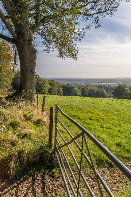
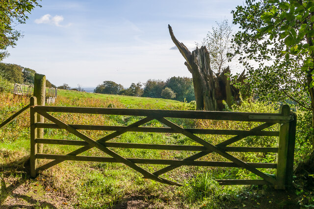
Brambly Copse is a picturesque woodland located in Surrey, England. Covering an area of approximately 50 acres, this enchanting forest is a haven for nature lovers and outdoor enthusiasts alike. The copse is situated on the outskirts of a small rural village, surrounded by rolling hills and meandering streams.

The woodland is predominantly composed of a diverse mix of deciduous trees, including oak, beech, and birch. The canopy of leaves provides shade in the summer months, creating a cool and tranquil atmosphere. Underneath the towering trees, the forest floor is carpeted with a rich tapestry of wildflowers, ferns, and mosses, adding to the copse's ethereal beauty.

Brambly Copse offers a variety of walking trails, allowing visitors to explore its natural wonders. The paths meander through the woodland, leading to hidden clearings and secluded spots, perfect for picnics or quiet contemplation. The peaceful ambiance of the copse is occasionally interrupted by the delightful melodies of birdsong, while squirrels and rabbits can be spotted darting amongst the undergrowth.

The copse is also home to a diverse range of wildlife, including deer, foxes, and badgers. Nature enthusiasts can often catch glimpses of these creatures in their natural habitat. Moreover, the woodland is an important breeding ground for various bird species, making it a popular destination for birdwatching enthusiasts.

Brambly Copse truly offers a serene escape from the hustle and bustle of everyday life. Its natural beauty and abundant wildlife make it a must-visit destination for those seeking solace in nature's embrace.

If you have any feedback on the listing, please let us know in the comments section below.

Brambly Copse Images

Images are sourced within 2km of 51.169183/-0.3648585 or Grid Reference TQ1442. Thanks to Geograph Open Source API. All images are credited.

Leith Hill - Rhododendron A common shrub on Leith Hill, part of the Greensand Ridge.
Leith Hill - Rhododendron
A common shrub on Leith Hill, part of the Greensand Ridge.
South from near Tanhurst Looking south from near Tanhurst, on the western slopes of Leith Hill.  In the far distance are the South Downs.
South from near Tanhurst
Looking south from near Tanhurst, on the western slopes of Leith Hill. In the far distance are the South Downs.
South from above Tanhurst Looking south from above Tanhurst, on the western slopes of Leith Hill.
South from above Tanhurst
Looking south from above Tanhurst, on the western slopes of Leith Hill.
Drinking trough Drinking trough and fountain near the summit of Leith Hill.  Originally installed in Roehampton Vale, Wandsworth, by the Metropolitan Drinking Fountain and Cattle Trough Association, it was moved here in July 2018 with the support of the charity (now known as The Drinking Fountain Association).
Drinking trough
Drinking trough and fountain near the summit of Leith Hill. Originally installed in Roehampton Vale, Wandsworth, by the Metropolitan Drinking Fountain and Cattle Trough Association, it was moved here in July 2018 with the support of the charity (now known as The Drinking Fountain Association).
Leith Hill Tower Tower on the summit of Leith Hill, built in 1774-5 with the stair turret added in 1864.  Grade II listed - see <span class="nowrap"><a title="www.historicengland.org.uk/listing/the-list/list-entry/1028808" rel="nofollow ugc noopener" href="http://www.historicengland.org.uk/listing/the-list/list-entry/1028808">Link</a><img style="margin-left:2px;" alt="External link" title="External link - shift click to open in new window" src="https://s1.geograph.org.uk/img/external.png" width="10" height="10"/></span>.
Leith Hill Tower
Tower on the summit of Leith Hill, built in 1774-5 with the stair turret added in 1864. Grade II listed - see LinkExternal link.
Leith Hill summit The summit of Leith Hill, with the drinking trough installed in 2018 on the left (see <a href="https://www.geograph.org.uk/photo/6994981">TQ1343 : Drinking trough</a> and Leith Hill Tower in the background (see <a href="https://www.geograph.org.uk/photo/6994999">TQ1343 : Leith Hill Tower</a>).
Leith Hill summit
The summit of Leith Hill, with the drinking trough installed in 2018 on the left (see TQ1343 : Drinking trough and Leith Hill Tower in the background (see TQ1343 : Leith Hill Tower).
Driveway Driveway for The Coach House, Tanhurst.
Driveway
Driveway for The Coach House, Tanhurst.
The Coach House The Coach House is on the left of the photo and was formerly the coach house to Tanhurst, a late 18th Century mansion.  For some years, Tanhurst was the home of Sir Edward and Lady Jane Vaughan Williams, grandparents to Ralph Vaughan Williams.  The Coach House was converted into its present form in 1960.  The building on the right, a former barn, was converted to holiday accommodation in the late 2010s.
The Coach House
The Coach House is on the left of the photo and was formerly the coach house to Tanhurst, a late 18th Century mansion. For some years, Tanhurst was the home of Sir Edward and Lady Jane Vaughan Williams, grandparents to Ralph Vaughan Williams. The Coach House was converted into its present form in 1960. The building on the right, a former barn, was converted to holiday accommodation in the late 2010s.
The Coach House The Coach House is in the centre of the photo and was formerly the coach house to Tanhurst, a late 18th Century mansion.  For some years, Tanhurst was the home of Sir Edward and Lady Jane Vaughan Williams, grandparents to Ralph Vaughan Williams.  The Coach House was converted into its present form in 1960.  The building on the right, a former barn, was converted to holiday accommodation in the late 2010s.
The Coach House
The Coach House is in the centre of the photo and was formerly the coach house to Tanhurst, a late 18th Century mansion. For some years, Tanhurst was the home of Sir Edward and Lady Jane Vaughan Williams, grandparents to Ralph Vaughan Williams. The Coach House was converted into its present form in 1960. The building on the right, a former barn, was converted to holiday accommodation in the late 2010s.
Leith Hill Place This property is now administered by the National Trust and previously has been home to Wedgwood, Darwin and Vaughan Williams families.
Leith Hill Place
This property is now administered by the National Trust and previously has been home to Wedgwood, Darwin and Vaughan Williams families.
Leith Hill Place - Graffiti Colourful graffiti in the cellar created probably in the 1960s when this house was a school.
Leith Hill Place - Graffiti
Colourful graffiti in the cellar created probably in the 1960s when this house was a school.
Leith Hill Place - Mural Schoolboy artwork, probably 1960s, in the cellar in this former school.
Leith Hill Place - Mural
Schoolboy artwork, probably 1960s, in the cellar in this former school.
Leith Hill Place - "The Lark Ascending" Detail from the Ralph Vaughan Williams timeline displayed in his former home - now a National Trust property.
Leith Hill Place - "The Lark Ascending"
Detail from the Ralph Vaughan Williams timeline displayed in his former home - now a National Trust property.
Leith Hill Place - Wedgwood Fireplace Wedgwood design on the fireplace with Darwinian exhibits above.
Leith Hill Place was home to Wedgwood, Darwin and Vaughan Williams families and is now administered by the National Trust.
Leith Hill Place - Wedgwood Fireplace
Wedgwood design on the fireplace with Darwinian exhibits above. Leith Hill Place was home to Wedgwood, Darwin and Vaughan Williams families and is now administered by the National Trust.
Leith Hill Place - Vaughan Williams Tryptych Three faces of Ralph Vaughan Williams, celebrated composer, in his former home near Dorking.
Leith Hill Place - Vaughan Williams Tryptych
Three faces of Ralph Vaughan Williams, celebrated composer, in his former home near Dorking.
Leith Hill Place This Palladian style house near Dorking has an Elizabethan kernel and has had a varied history - it has been home to Wedgwood, Darwin and Vaughan Williams families.
Leith Hill Place
This Palladian style house near Dorking has an Elizabethan kernel and has had a varied history - it has been home to Wedgwood, Darwin and Vaughan Williams families.
Leith Hill Place - Earthenware Exhibits in the kitchen - note the "stone pig" which was used as a bed warmer - it carries a maker's name, Pierson & Co of Dorking.
The house is now administered by the National Trust.
Leith Hill Place - Earthenware
Exhibits in the kitchen - note the "stone pig" which was used as a bed warmer - it carries a maker's name, Pierson & Co of Dorking. The house is now administered by the National Trust.
Leith Hill Place - Ralph Vaughan Williams Violin and bust of the celebrated composer in his former home SW of Dorking. This is now a National Trust property.
Leith Hill Place - Ralph Vaughan Williams
Violin and bust of the celebrated composer in his former home SW of Dorking. This is now a National Trust property.
Show me another place!

Brambly Copse is located at Grid Ref: TQ1442 (Lat: 51.169183, Lng: -0.3648585)

Administrative County: Surrey

District: Mole Valley

Police Authority: Surrey

What 3 Words

///flap.margin.even. Near Holmwood, Surrey

Related Wikis

Greensand Ridge

The Greensand Ridge, also known as the Wealden Greensand, is an extensive, prominent, often wooded, mixed greensand/sandstone escarpment in south-east...
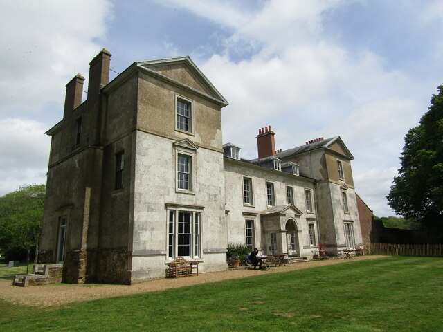
Broome Hall

Broome Hall is a Grade II-listed country house with grounds including cottages and outhouses on the wooded, upper southern slopes of the Greensand Ridge...

Leith Hill

Leith Hill in southern England is the highest summit of the Greensand Ridge, approximately 6.7 km (4 mi) southwest of Dorking, Surrey and 40.5 km (30 mi...

Leith Hill multiple aircraft accident

On 26 November 1944, four C-47 transport aircraft of the 442nd Operations Group departed from Advanced Landing Ground "A-4 in Pays de la Loire, northern...

Coldharbour, Surrey

Coldharbour is a hamlet in the Mole Valley district, in the English county of Surrey. It is on a minor road from Dorking to Leith Hill Place. == Description... ==

Leith Hill SSSI

Leith Hill SSSI is a 337.9-hectare (835-acre) biological Site of Special Scientific Interest south-east of Dorking in Surrey. The SSSI consists of four...

Ockley

Ockley is a rural village in Surrey. It lies astride the A29, the modern road using the alignment of Stane Street (Chichester). The A29 diverges from the...

Ockley railway station

Ockley railway station serves the villages of Ockley and Capel in Surrey, England and is 1.4 miles (2.3 km) from Ockley village and 0.5 miles (0.80 km...

Nearby Amenities

Located within 500m of 51.169183,-0.3648585
Hartshurst Farm
Place: farm
Source: npe
Lat/Long: 51.1669002/-0.3709863
Post Box
Operator: Royal Mail
Ref: RH5 133
Lat/Long: 51.1710162/-0.3611856
Broome Hall Farm
Bus: yes
Public Transport: stop_position
Lat/Long: 51.1705508/-0.3609555
Barrier: stile
Lat/Long: 51.173017/-0.3621736
Barrier: stile
Stile: stepover
Lat/Long: 51.1677477/-0.3682505
Power: pole
Source: gps;Bing
Lat/Long: 51.1680751/-0.3707584
Power: pole
Source: gps;Bing
Lat/Long: 51.1697099/-0.3691819
Power: pole
Source: gps;Bing
Lat/Long: 51.1683737/-0.3692409
Power: pole
Source: gps;Bing
Lat/Long: 51.1674506/-0.3693048
Power: pole
Source: gps;Bing
Lat/Long: 51.1667737/-0.3613083
Power: pole
Source: gps;Bing
Lat/Long: 51.1650725/-0.3620214
Broome Hall Farm
Place: farm
Lat/Long: 51.171273/-0.3592685
Power: pole
Lat/Long: 51.1673208/-0.3708018
Power: pole
Lat/Long: 51.1675703/-0.367838
Power: pole
Lat/Long: 51.1673811/-0.3661907
Power: pole
Lat/Long: 51.1671821/-0.3645881
Bus Stop
Broomehall Farm
Naptan AtcoCode: 40004408803F
Naptan NaptanCode: surdawjm
Physically Present: no
Public Transport: platform
Lat/Long: 51.1705911/-0.3610267
Bus Stop
Broomehall Farm
Naptan AtcoCode: 40004408803E
Naptan NaptanCode: surdawjg
Physically Present: no
Public Transport: platform
Lat/Long: 51.1705265/-0.3608734
The data included in this document is from www.openstreetmap.org. The data is made available under ODbL.

Have you been to Brambly Copse?

Leave your review of Brambly Copse below (or comments, questions and feedback).