Beasleys Copse

Wood, Forest in Sussex Horsham

England

Beasleys Copse

Bridleway past Pear Tree Farm The bridleway is up to 15 metres wide between long-established hedge banks and ditches, and must be ancient in origin, probably an old cart road. Pear Tree Farm, on the south side of the track, is quite recent, but Maltmayes, at the eastern end, is C14 in origin, and the track surely is much older still. Fortunately, this western end is no longer used by vehicles, perhaps because the junction with the Bognor Road (A29) is less than satisfactory (and distinctly hazardous if approaching from the opposite direction).
Bridleway past Pear Tree Farm Credit: Hugh Craddock

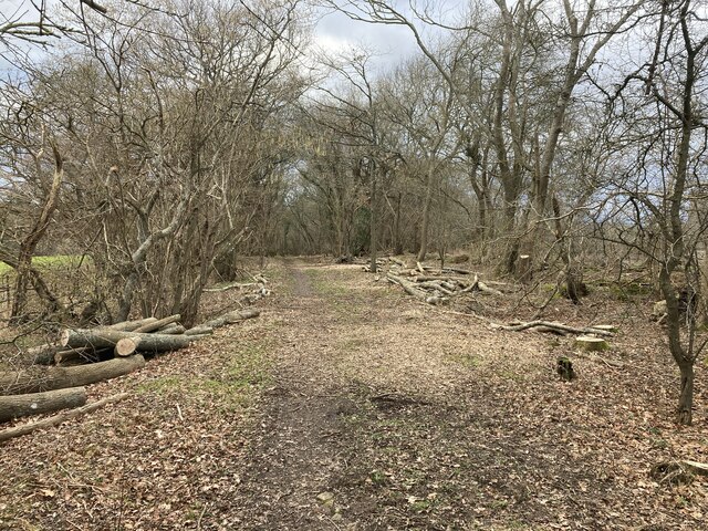
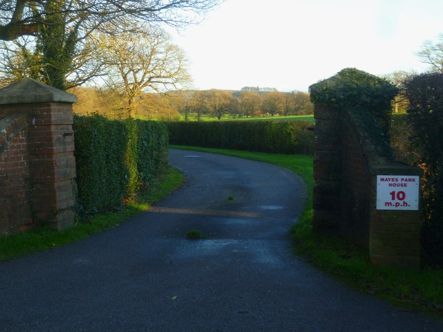
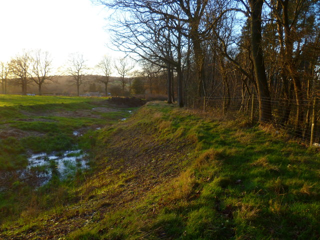
Beasleys Copse is a picturesque woodland located in Sussex, England. Covering an area of approximately 50 acres, this ancient forest is nestled in the heart of the South Downs National Park. The copse is renowned for its dense tree cover, predominantly composed of native species such as oak, beech, and ash, which create a stunning canopy that provides a habitat for a diverse range of flora and fauna.

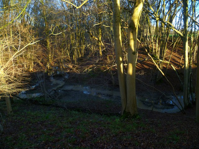
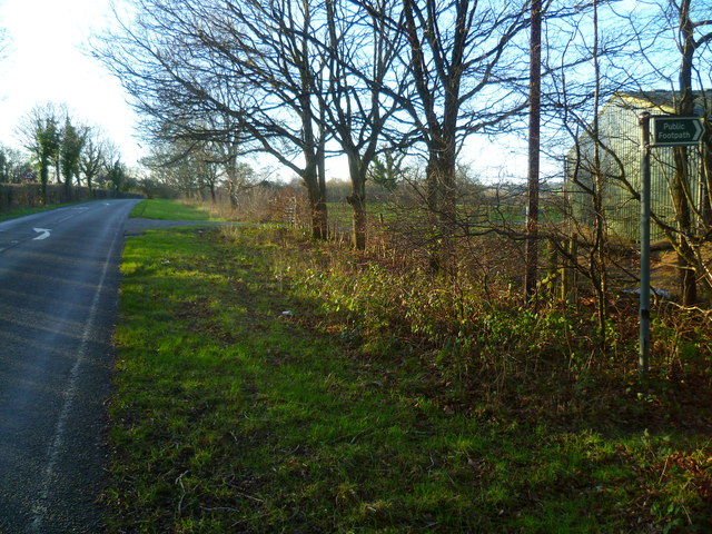
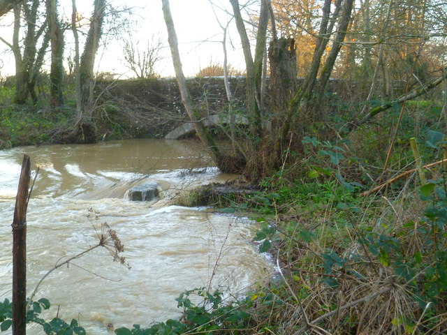
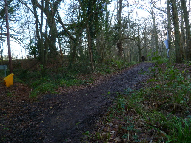
The woodland is crisscrossed by a network of well-maintained footpaths, allowing visitors to explore its natural beauty at their leisure. These paths wind their way through the copse, leading to hidden clearings, babbling brooks, and peaceful glades, making it a favorite destination for nature enthusiasts and hikers alike.

Beasleys Copse is not only visually appealing but also serves as an important ecological site. The woodland provides a sanctuary for numerous bird species, including woodpeckers, owls, and several songbirds. Additionally, it is home to a variety of mammals, such as deer, foxes, badgers, and squirrels, which can often be spotted roaming the forest floor.

Throughout the year, Beasleys Copse showcases the changing seasons in all their splendor. In spring, the woodland comes alive with vibrant bluebells carpeting the forest floor, creating a breathtaking sight. During the summer months, the canopy offers welcome shade and shelter, while in autumn, the copse is transformed into a kaleidoscope of red, orange, and gold as the leaves change color. Even in winter, the copse retains its charm, with frost-covered branches and the occasional dusting of snow adding to its ethereal beauty.

Overall, Beasleys Copse is a captivating woodland, rich in natural beauty and biodiversity, offering visitors a tranquil escape from the hustle and bustle of everyday life.

If you have any feedback on the listing, please let us know in the comments section below.

Beasleys Copse Images

Images are sourced within 2km of 51.095365/-0.36767783 or Grid Reference TQ1434. Thanks to Geograph Open Source API. All images are credited.

Bridleway past Pear Tree Farm The bridleway is up to 15 metres wide between long-established hedge banks and ditches, and must be ancient in origin, probably an old cart road. Pear Tree Farm, on the south side of the track, is quite recent, but Maltmayes, at the eastern end, is C14 in origin, and the track surely is much older still. Fortunately, this western end is no longer used by vehicles, perhaps because the junction with the Bognor Road (A29) is less than satisfactory (and distinctly hazardous if approaching from the opposite direction).
Bridleway past Pear Tree Farm
The bridleway is up to 15 metres wide between long-established hedge banks and ditches, and must be ancient in origin, probably an old cart road. Pear Tree Farm, on the south side of the track, is quite recent, but Maltmayes, at the eastern end, is C14 in origin, and the track surely is much older still. Fortunately, this western end is no longer used by vehicles, perhaps because the junction with the Bognor Road (A29) is less than satisfactory (and distinctly hazardous if approaching from the opposite direction).
New bridleway off Bell Lane The footpath leading south-east off Bell Lane to the old Dorking Road (now sequestered by the A24 dual carriageway) has recently been upgraded to bridleway, no. 3647_1.
New bridleway off Bell Lane
The footpath leading south-east off Bell Lane to the old Dorking Road (now sequestered by the A24 dual carriageway) has recently been upgraded to bridleway, no. 3647_1.
School Hill, Warnham School Hill in the village of Warnham, in West Sussex
School Hill, Warnham
School Hill in the village of Warnham, in West Sussex
Timber-framed outbuilding at Bailing Hill Farm - with antler trophies Bailing Hill (on the Warnham Park estate) is currently run as a deer farm - hence the antler trophies.  Apart from the smallish trophies fixed to the first-floor frame, notice the huge pair of antlers on the ground at the far end of the building.   <span class="nowrap"><a title="http://www.warnhampark.com/" rel="nofollow ugc noopener" href="http://www.warnhampark.com/">Link</a><img style="margin-left:2px;" alt="External link" title="External link - shift click to open in new window" src="https://s1.geograph.org.uk/img/external.png" width="10" height="10"/></span>
Timber-framed outbuilding at Bailing Hill Farm - with antler trophies
Bailing Hill (on the Warnham Park estate) is currently run as a deer farm - hence the antler trophies. Apart from the smallish trophies fixed to the first-floor frame, notice the huge pair of antlers on the ground at the far end of the building. LinkExternal link
Former school, by Warnham village green A Victorian school building, overlooking the village green from the east.
Former school, by Warnham village green
A Victorian school building, overlooking the village green from the east.
Mid-18th century tombstone, Warnham churchyard The name is JOHN AGATE (if I've read it correctly) and the date July 1748.  The jawless skull is pretty typical of the rather heartless imagery to be found on 18th century tombstones.
Mid-18th century tombstone, Warnham churchyard
The name is JOHN AGATE (if I've read it correctly) and the date July 1748. The jawless skull is pretty typical of the rather heartless imagery to be found on 18th century tombstones.
Stonefarm Gill and tributary
Looking west along Marches Road at footpath junction
Field edge path at Winterfold
Entrance to Mayes Park House
Road junction at Pound Corner For another view see <a title="https://www.geograph.org.uk/photo/1852989" href="https://www.geograph.org.uk/photo/1852989">Link</a>.
Road junction at Pound Corner
For another view see Link.
Junction at Pound Corner with pillar box For a better view of the post box see <a title="https://www.geograph.org.uk/photo/1853267" href="https://www.geograph.org.uk/photo/1853267">Link</a>.
Junction at Pound Corner with pillar box
For a better view of the post box see Link.
Dwellings on Northlands Road
Looking west along the edge of Mount Wood
Turbulence beneath the A29
Bridleway goes south from Northlands Road through Benland Wood
Bend on Northlands Road with bridleway junction
Towers on Northlands Road Shame about all the cables.  For another view and some information see <a title="https://www.geograph.org.uk/photo/4043481" href="https://www.geograph.org.uk/photo/4043481">Link</a>.
Towers on Northlands Road
Shame about all the cables. For another view and some information see Link.
Show me another place!

Beasleys Copse is located at Grid Ref: TQ1434 (Lat: 51.095365, Lng: -0.36767783)

Administrative County: West Sussex

District: Horsham

Police Authority: Sussex

What 3 Words

///spoils.polo.reflected. Near Warnham, West Sussex

Related Wikis

Warnham & Rusper (electoral division)

Warnham & Rusper is an electoral division of West Sussex in the United Kingdom and returns one member to sit on West Sussex County Council. The current...

Warnham

Warnham is a village and civil parish in the Horsham district of West Sussex, England. The village is centred 2 miles (3.2 km) north-northwest of Horsham...

Field Place, Warnham

Field Place is a Grade I listed house in Warnham, West Sussex, England. It is the birthplace of the poet Percy Bysshe Shelley, born there in 1792. The...

E. Tredcroft's Ground

E. Tredcroft's Ground was a cricket ground at the Warnham Court estate, located at Horsham, Sussex. The first recorded match on the ground was in 1851...

Stane Street (Chichester)

Stane Street is the modern name of the 91 km-long (57 mi) Roman road in southern England that linked Londinium (London) to Noviomagus Reginorum (Chichester...

Warnham railway station

Warnham railway station serves the village of Warnham in West Sussex, England. It is 33 miles 46 chains (54.0 km) measured from London Waterloo (although...

Broadbridge Heath

Broadbridge Heath is a village and civil parish in the Horsham district of West Sussex, England. It is about two miles (3 km) west from the historic centre...

Warnham LNR

Warnham LNR is a 38.4-hectare (95-acre) Local Nature Reserve in Horsham in West Sussex. It is owned and managed by Horsham District Council.The principal...

Nearby Amenities

Located within 500m of 51.095365,-0.36767783
The data included in this document is from www.openstreetmap.org. The data is made available under ODbL.

Have you been to Beasleys Copse?

Leave your review of Beasleys Copse below (or comments, questions and feedback).