Collin's Grove

Wood, Forest in Bedfordshire

England

Collin's Grove

Road (B658) near to Stanford Farm Looking south-westward.
Road (B658) near to Stanford Farm Credit: Peter Wood

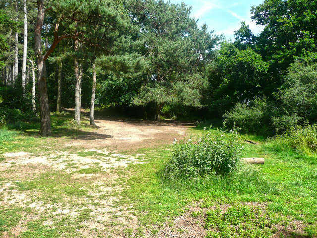
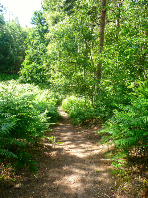
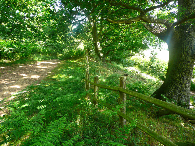
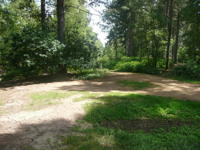
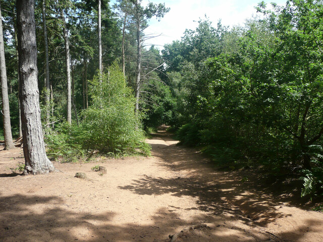
Collin's Grove is a picturesque woodland located in Bedfordshire, England. Situated in the heart of the county, it is known for its dense forest and stunning natural beauty. Covering an area of approximately 100 acres, it offers a peaceful escape from the hustle and bustle of nearby towns and cities.

The woodland is characterized by a diverse range of tree species, including oak, beech, and birch, which create a rich and vibrant canopy overhead. The forest floor is adorned with a plethora of wildflowers, creating a colorful tapestry during the spring and summer months. Moreover, the Grove is home to an array of wildlife, including deer, foxes, and various bird species, making it a delight for nature enthusiasts.

Collin's Grove offers several well-maintained walking trails and paths that wind their way through the forest, providing visitors with an opportunity to explore its natural wonders. These trails cater to different levels of difficulty, making them suitable for both leisurely strolls and more adventurous hikes. Additionally, there are picnic areas and resting spots strategically placed throughout the woodland, allowing visitors to relax and enjoy the tranquil surroundings.

The Grove is managed by the local council, who ensure the preservation of its natural habitat and the safety of its visitors. Regular maintenance and conservation efforts, such as tree planting and trail upkeep, contribute to the sustainable management of this beautiful woodland.

Overall, Collin's Grove in Bedfordshire is a haven for nature lovers and offers a serene and captivating experience for everyone who visits.

If you have any feedback on the listing, please let us know in the comments section below.

Collin's Grove Images

Images are sourced within 2km of 52.046774/-0.33684186 or Grid Reference TL1440. Thanks to Geograph Open Source API. All images are credited.

Road (B658) near to Stanford Farm Looking south-westward.
Road (B658) near to Stanford Farm
Looking south-westward.
Pedley Lane, Clifton Looking south-westward.
Pedley Lane, Clifton
Looking south-westward.
Dalchini Spice, Shefford An award winning Indian restaurant
Dalchini Spice, Shefford
An award winning Indian restaurant
Roundabout on  Ivel Road, Shefford Oak Manor care home is on the right
Roundabout on Ivel Road, Shefford
Oak Manor care home is on the right
Hitchin Road at the corner of Ivel Road
Stanford Road, Shefford
The entrance to Stanford Bury
Trailer by Stanford Road, Shefford
Track to Stanford Bury Farm
Part of the car park for Rowney Warren Wood, Southill The car park is also a picnic area.
Part of the car park for Rowney Warren Wood, Southill
The car park is also a picnic area.
Track in Rowney Warren Wood, Southill This track is along the southern edge of the wood.
Track in Rowney Warren Wood, Southill
This track is along the southern edge of the wood.
Path in Rowney Warren Wood, Southill It is all too easy to lose one's sense of direction in this wood, and also my GPS readings did not always indicate a position on one of the paths shown on the 1:25000 map.
Path in Rowney Warren Wood, Southill
It is all too easy to lose one's sense of direction in this wood, and also my GPS readings did not always indicate a position on one of the paths shown on the 1:25000 map.
Track in Rowney Warren Wood, Southill This track goes along the southern edge of the wood, and over the boundary fence at a lower level there is a bridleway, which is part of the John Bunyan Trail. Along the length of the track that I walked there was no connection between the two paths.
Track in Rowney Warren Wood, Southill
This track goes along the southern edge of the wood, and over the boundary fence at a lower level there is a bridleway, which is part of the John Bunyan Trail. Along the length of the track that I walked there was no connection between the two paths.
The John Bunyan Trail at the A600, Shefford The roundabout is at the junction with the B658 Sandy road.
The John Bunyan Trail at the A600, Shefford
The roundabout is at the junction with the B658 Sandy road.
Track junction in Rowney Warren Wood, Southill I am not certain about the grid reference.
Track junction in Rowney Warren Wood, Southill
I am not certain about the grid reference.
Track in Rowney Warren Wood, Southill Position uncertain.
Track in Rowney Warren Wood, Southill
Position uncertain.
Disused railway bridge This 3 arch bridge (No. HIB18) takes the Southill road over the old Bedford to Hitchin line of the Midland Railway.  Before St. Pancras Station and the line from Bedford to London was built, Midland Railway trains accessed the GNR's Kings Cross station via Hitchin.  After the new line was built, the line became a backwater, and was closed to passengers in 1961 and to freight in 1964.
Disused railway bridge
This 3 arch bridge (No. HIB18) takes the Southill road over the old Bedford to Hitchin line of the Midland Railway. Before St. Pancras Station and the line from Bedford to London was built, Midland Railway trains accessed the GNR's Kings Cross station via Hitchin. After the new line was built, the line became a backwater, and was closed to passengers in 1961 and to freight in 1964.
Farmland, Shefford, Beds View N from the Bedford Road.
Farmland, Shefford, Beds
View N from the Bedford Road.
Show me another place!

Collin's Grove is located at Grid Ref: TL1440 (Lat: 52.046774, Lng: -0.33684186)

Unitary Authority: Central Bedfordshire

Police Authority: Bedfordshire

What 3 Words

///february.librarian.manly. Near Shefford, Bedfordshire

Related Wikis

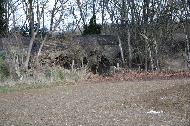
Shefford railway station

Shefford was a railway station on the Bedford to Hitchin Line which served the town of Shefford in Bedfordshire, England. Opened in 1857, it gave more...

St Francis' Boy's Home

St Francis' Boy's Home in Shefford, Bedfordshire was the longest serving children's home in England. Founded in 1868, it played a vital role in providing...

Shefford, Bedfordshire

Shefford is a town and civil parish in the Central Bedfordshire district of Bedfordshire, England. At the 2021 census it had a population of 7,311. It...

River Flit

The River Flit is a short river in Bedfordshire, England. Its name is not ancient, but rather a back formation from Flitton which originally meant that...

Camps End

Camps End is a hamlet near Castle Camps in Cambridgeshire, England. == References ==

Campton and Chicksands

Campton and Chicksands is a civil parish in the Central Bedfordshire district, in the ceremonial county of Bedfordshire, England. Its main settlements...

HMS Ferret (1982 shore establishment)

HMS Ferret is a training unit of the Royal Naval Reserve based at MOD Chicksands in Bedfordshire. == History == HMS Ferret was initially established at...
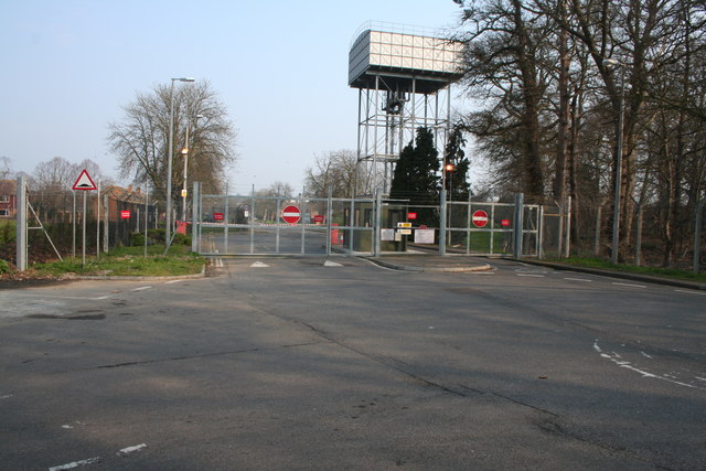
RAF Chicksands

Royal Air Force Chicksands or more simply RAF Chicksands, was a Royal Air Force station located 7.7 miles (12.4 km) south east of Bedford, Bedfordshire...

Nearby Amenities

Located within 500m of 52.046774,-0.33684186
Cockshoot Hill
Place: locality
Source: OS 1:25k
Lat/Long: 52.0452166/-0.3319713
Turning Circle
Turning Circle: knuckle
Lat/Long: 52.0426274/-0.3369108
Turning Circle
Turning Circle: circle
Lat/Long: 52.0429147/-0.336529
Direction: 200
Generator Method: photovoltaic
Generator Output Electricity: yes
Generator Solar Modules: 14
Generator Source: solar
Generator Type: solar_photovoltaic_panel
Location: roof
Power: generator
Lat/Long: 52.0427646/-0.3366244
The data included in this document is from www.openstreetmap.org. The data is made available under ODbL.

Have you been to Collin's Grove?

Leave your review of Collin's Grove below (or comments, questions and feedback).